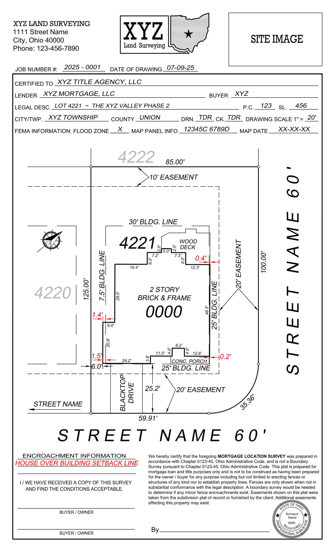
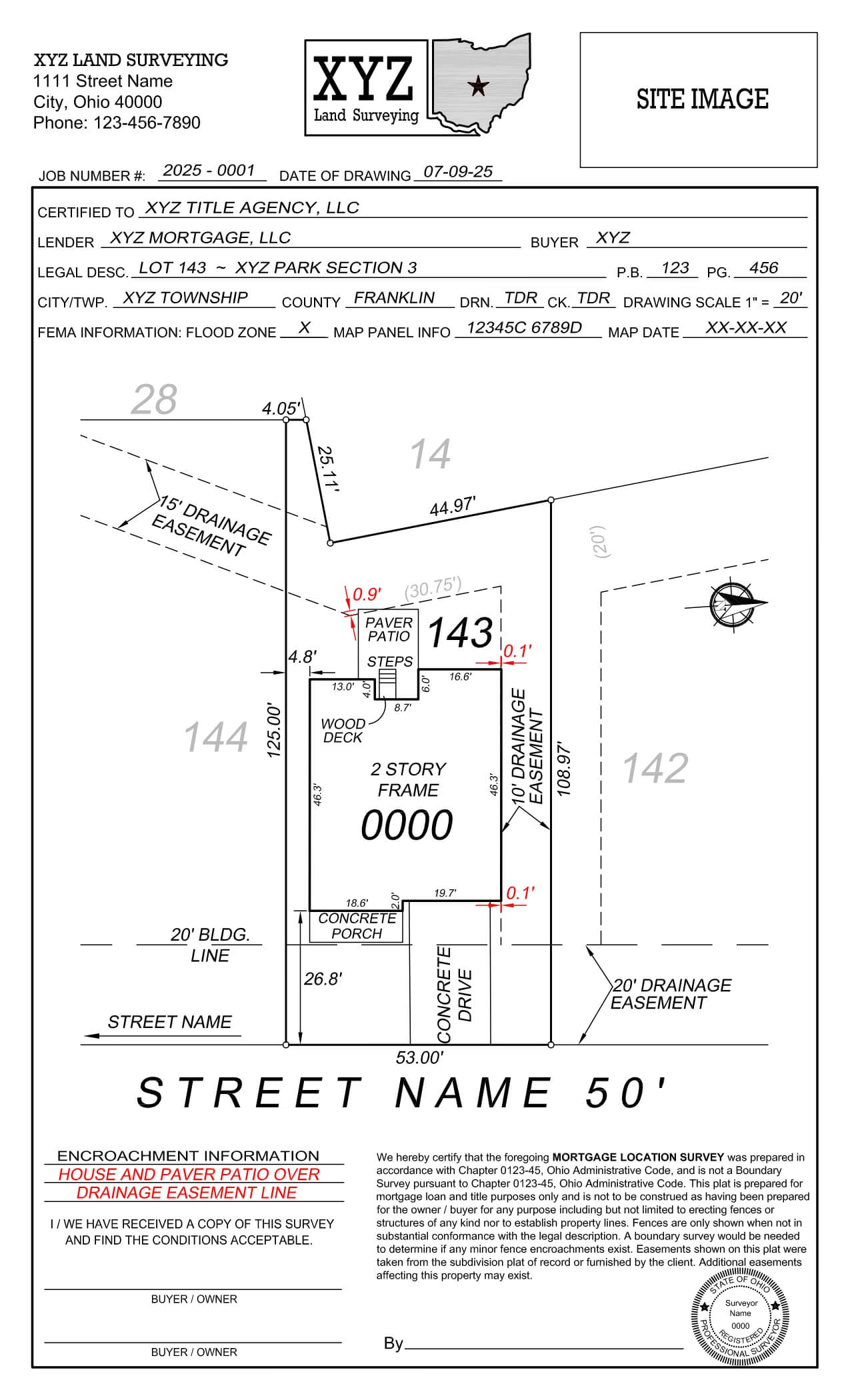
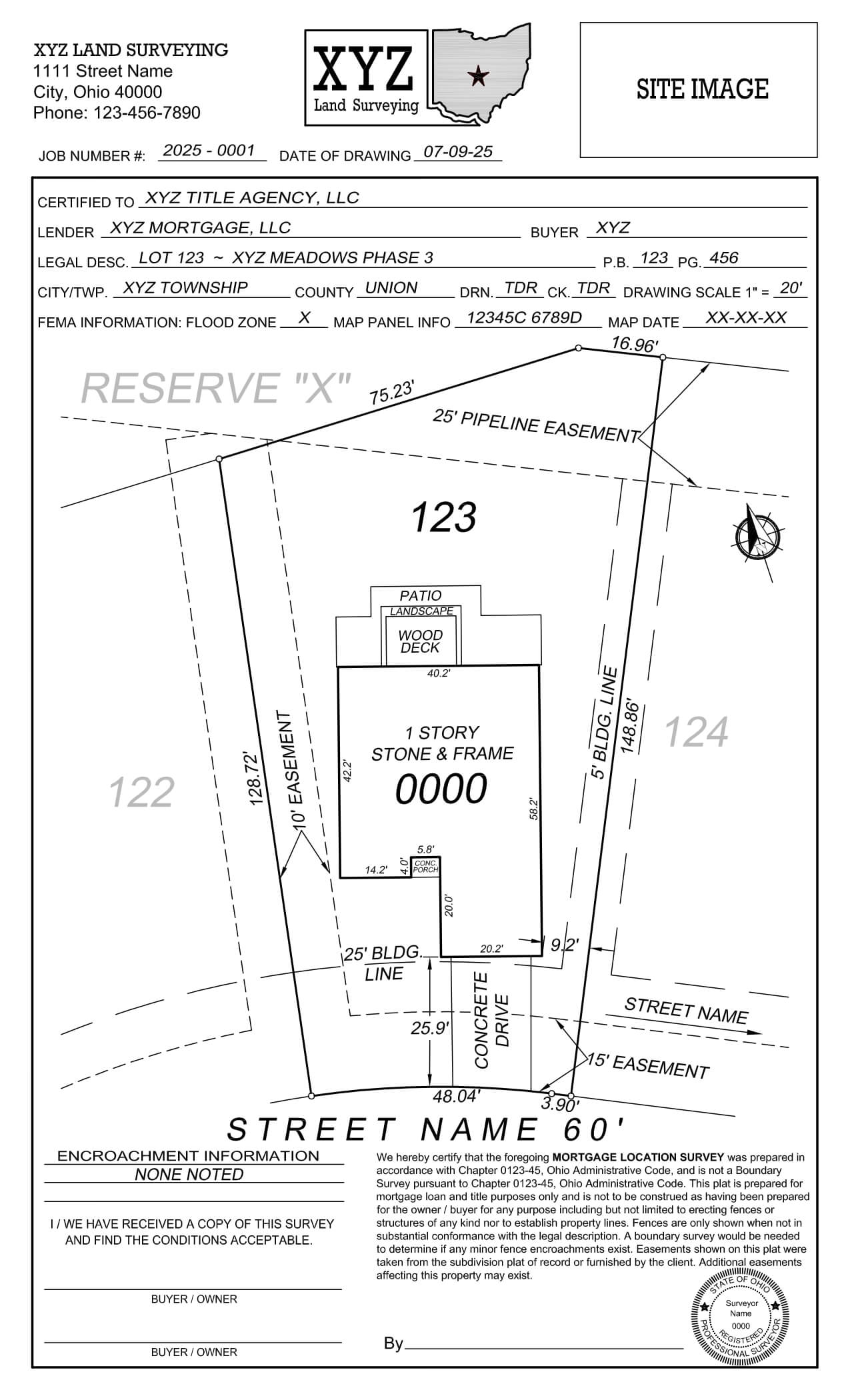
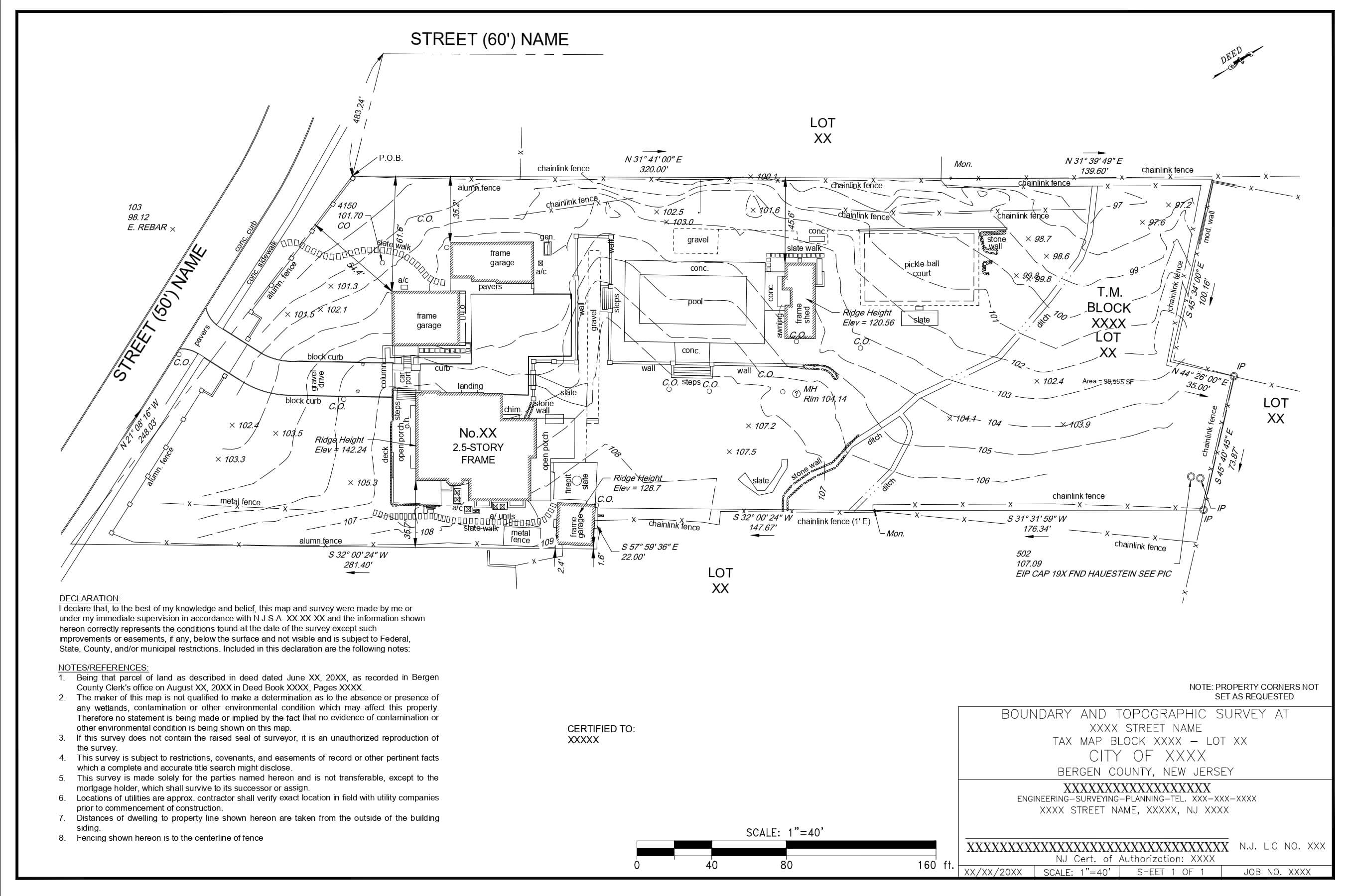
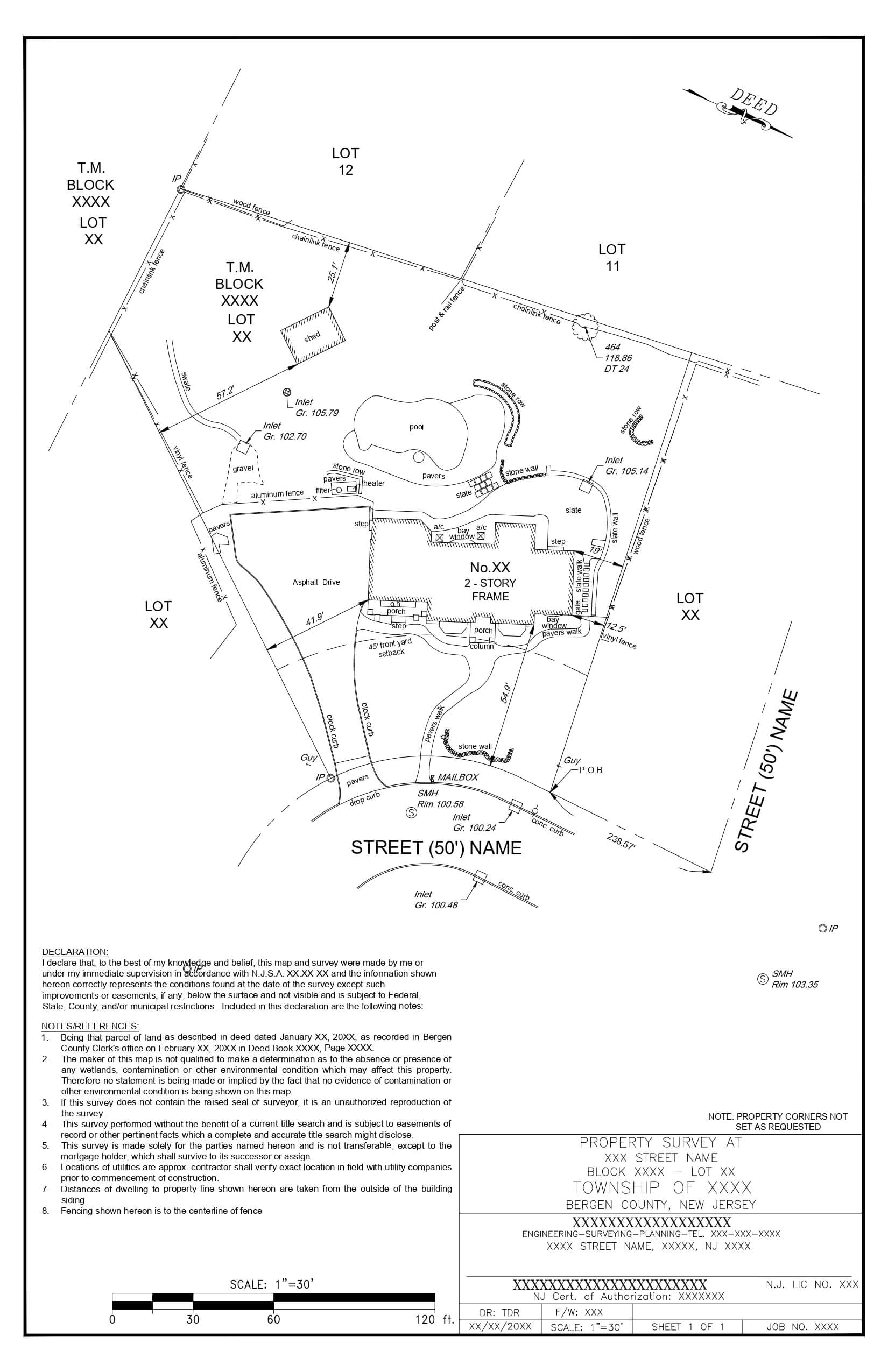
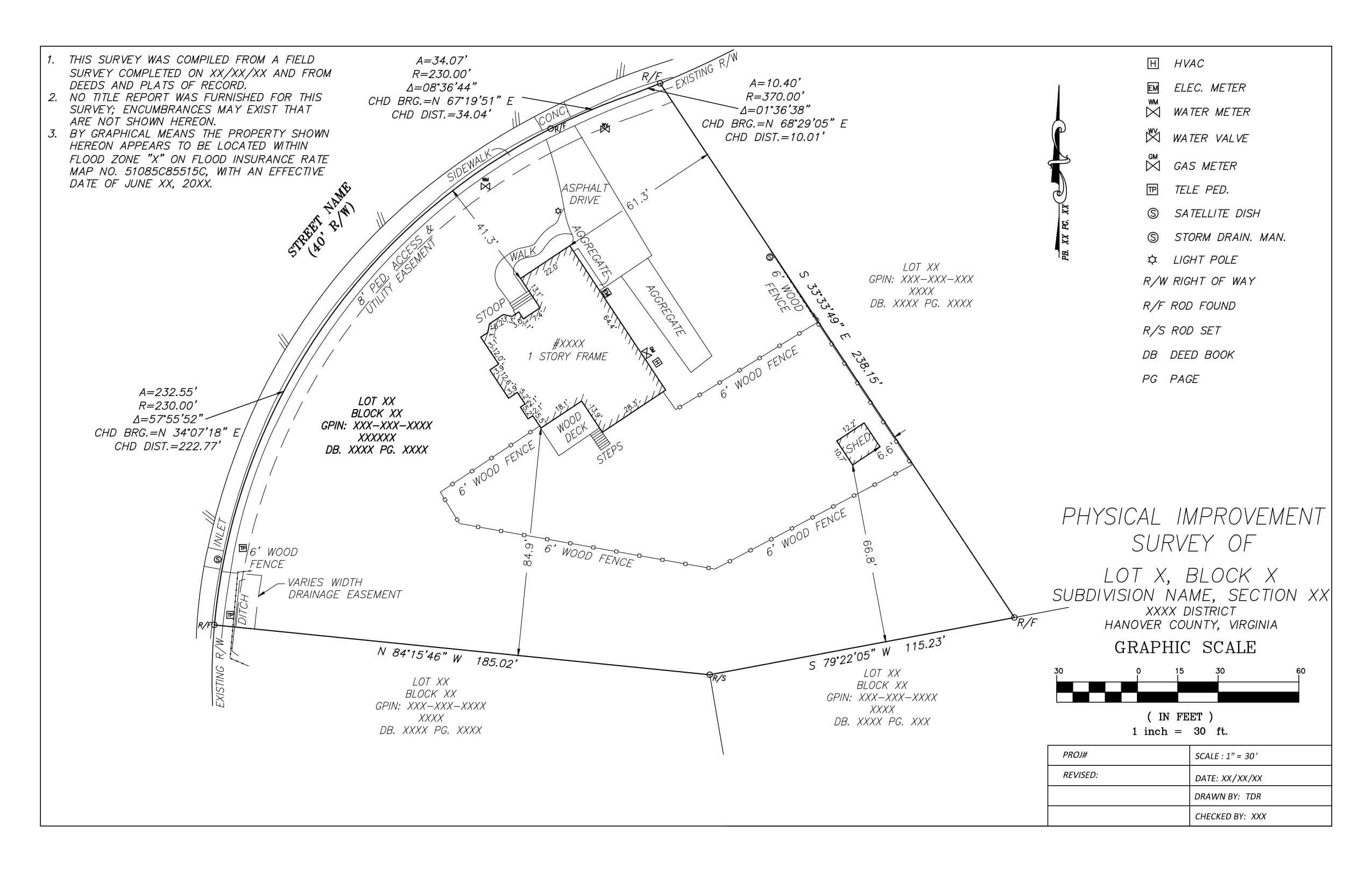
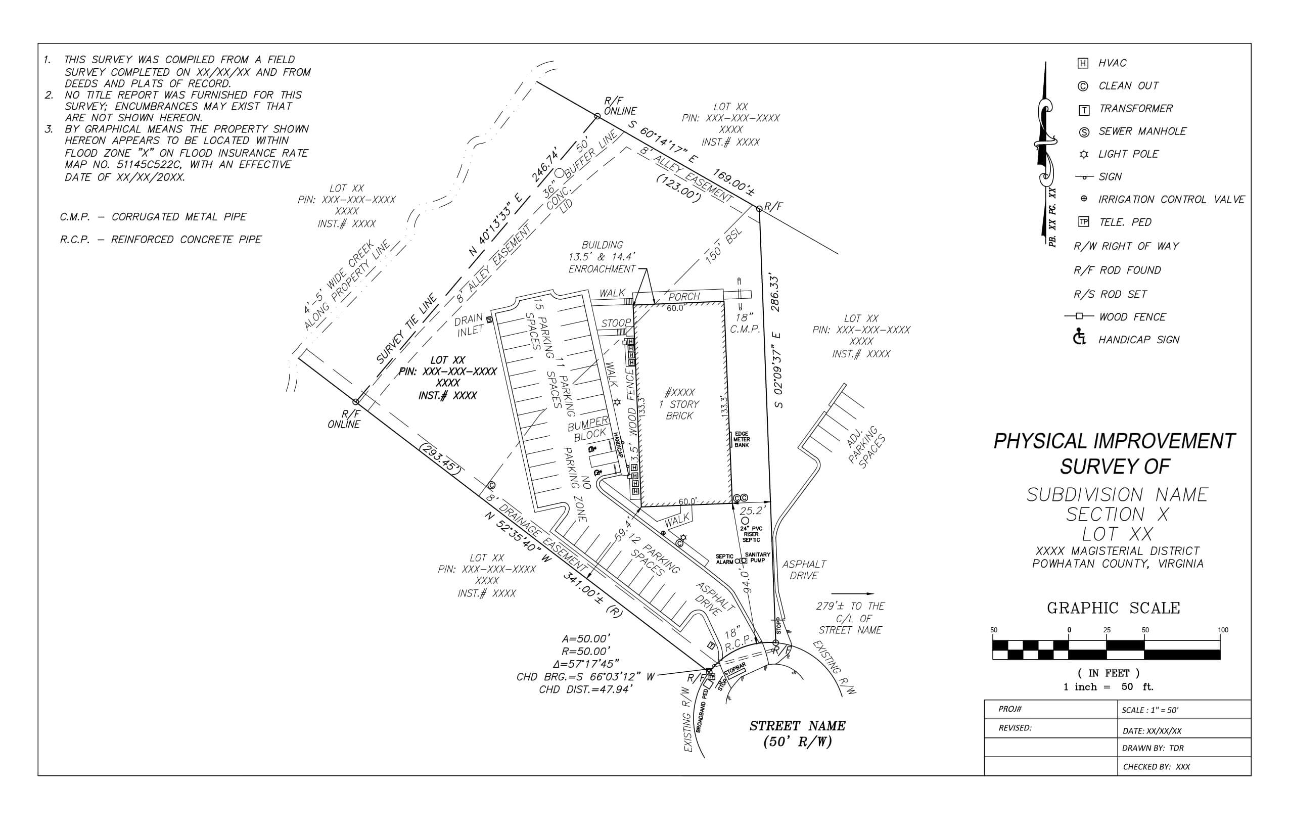
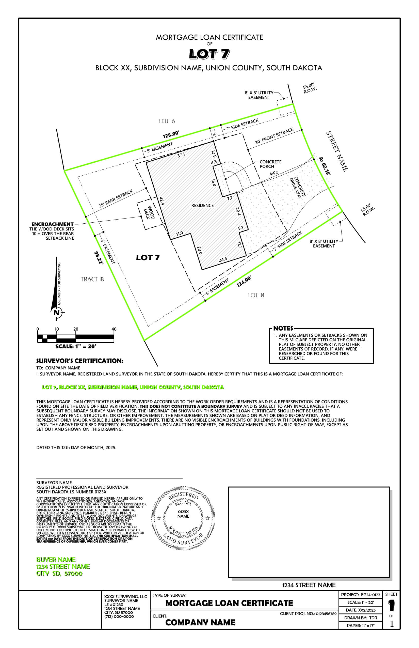
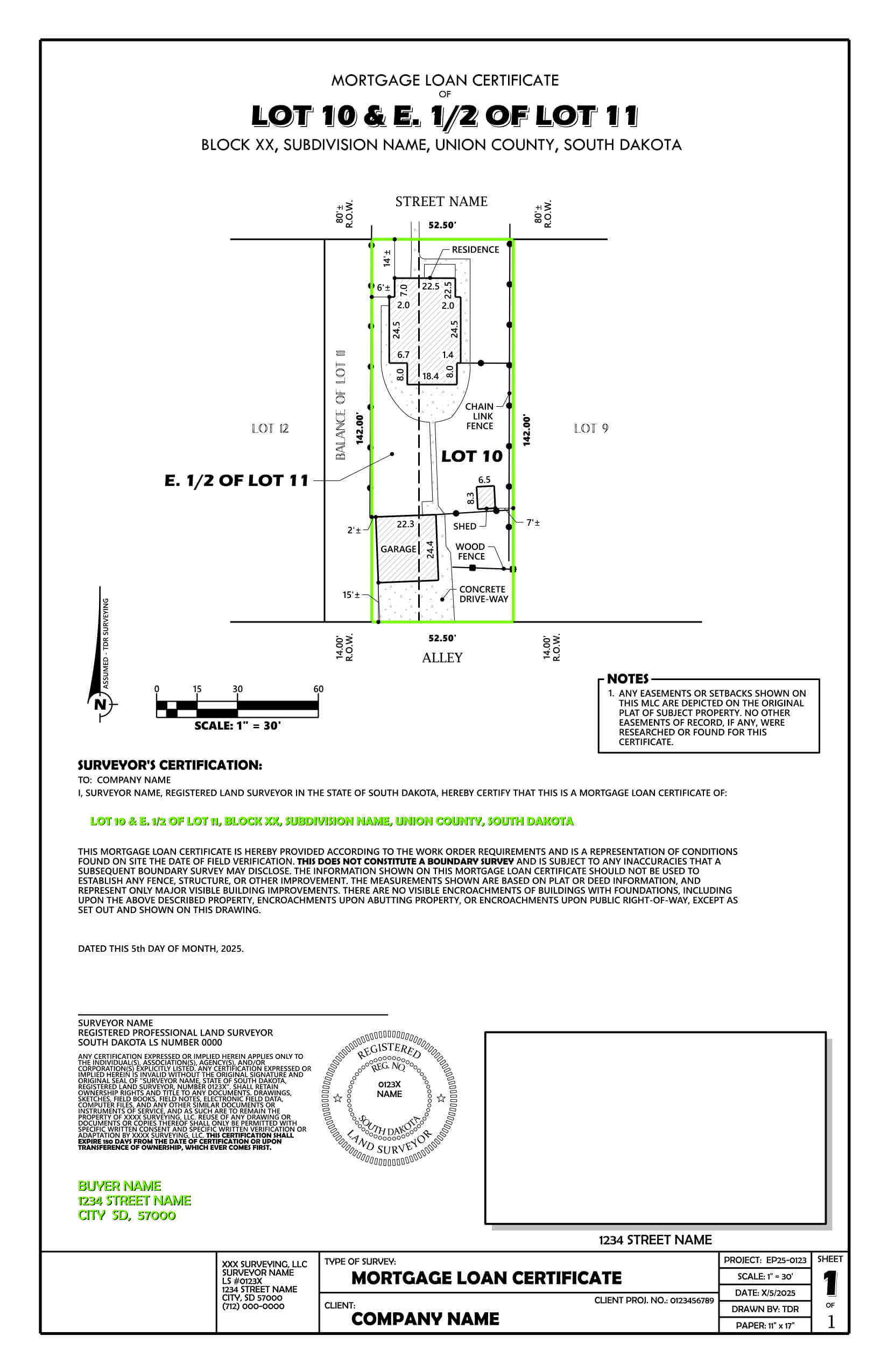
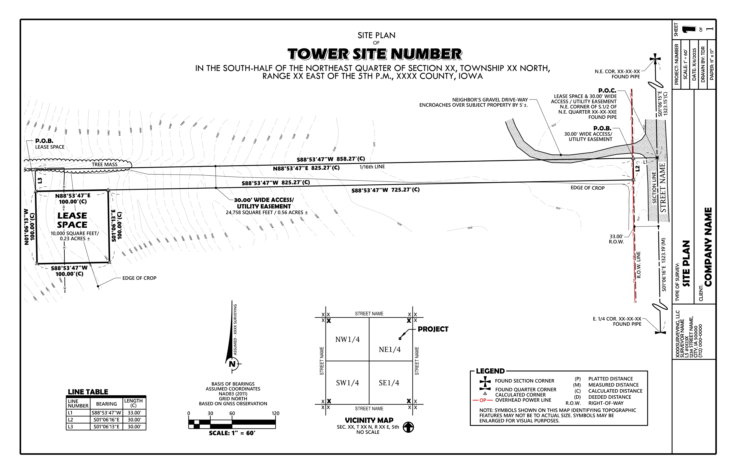
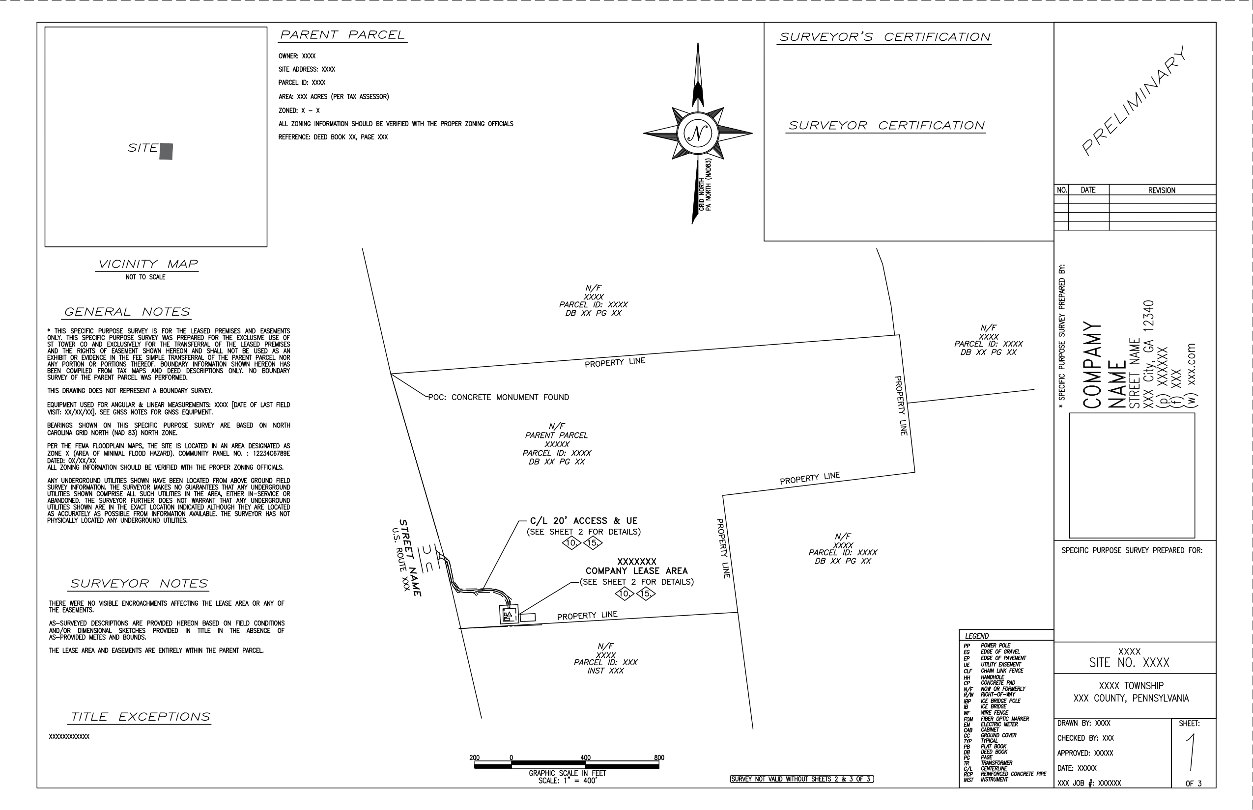
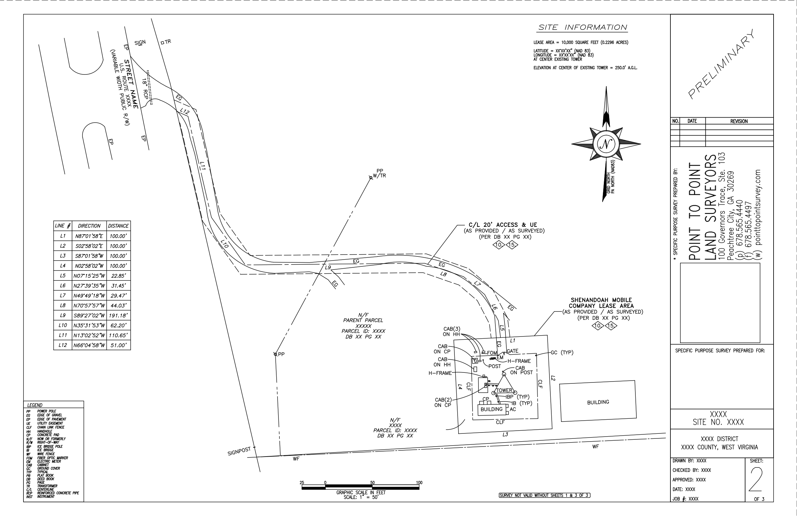
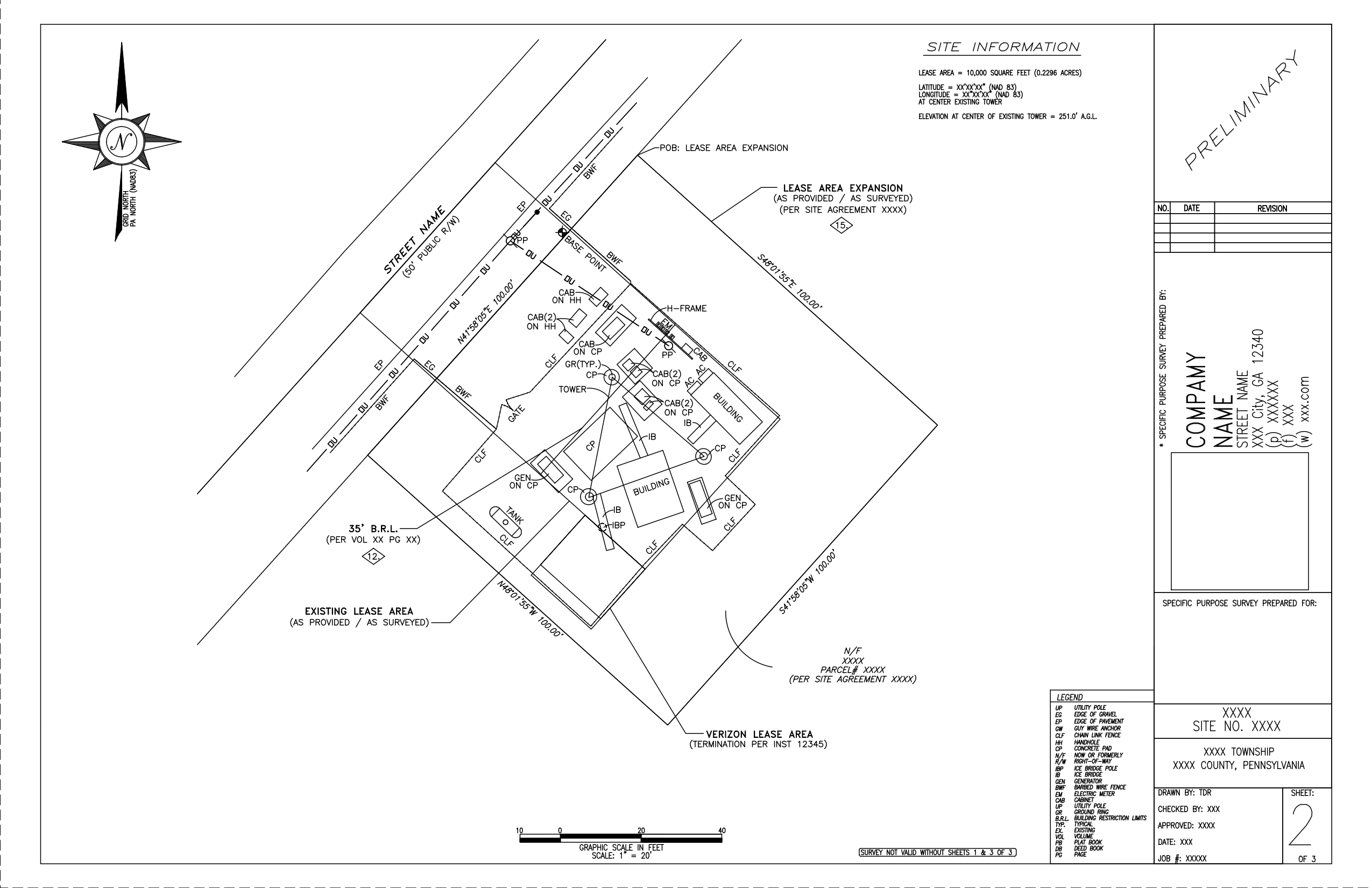
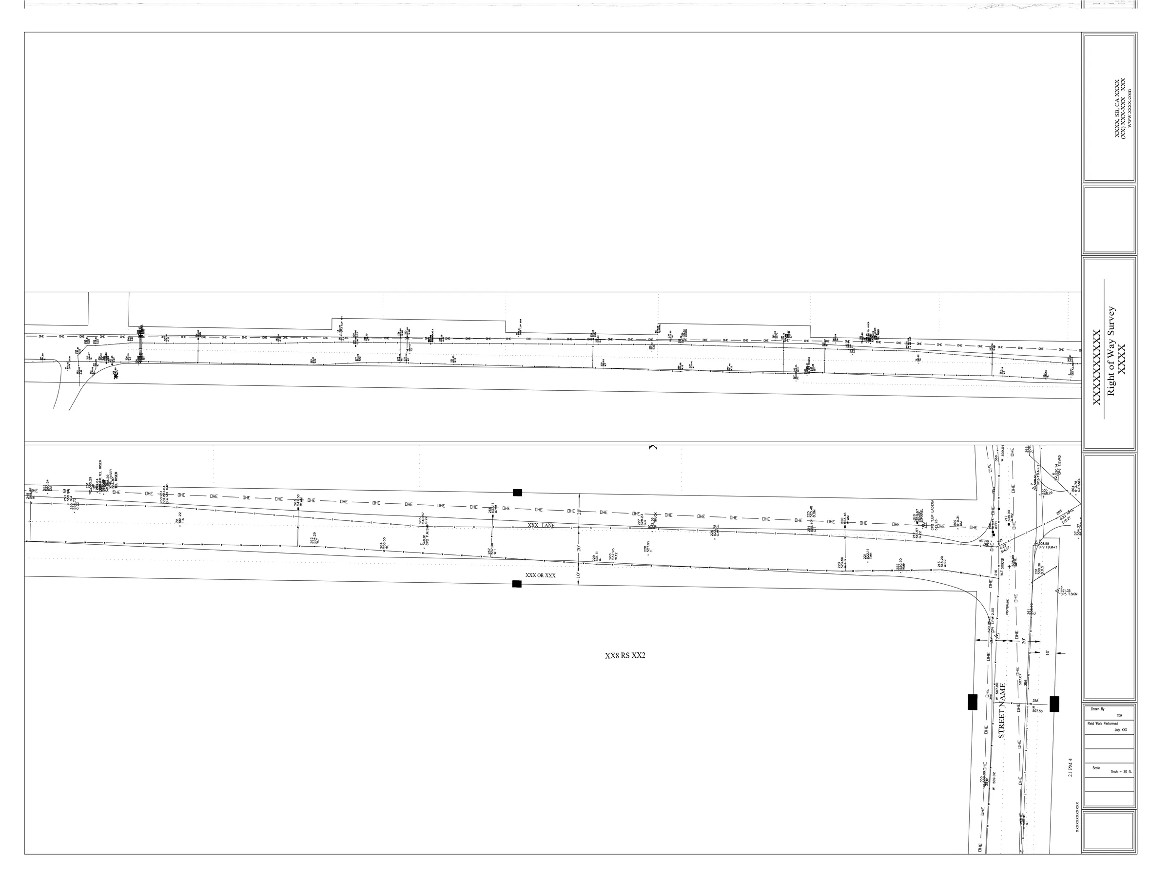
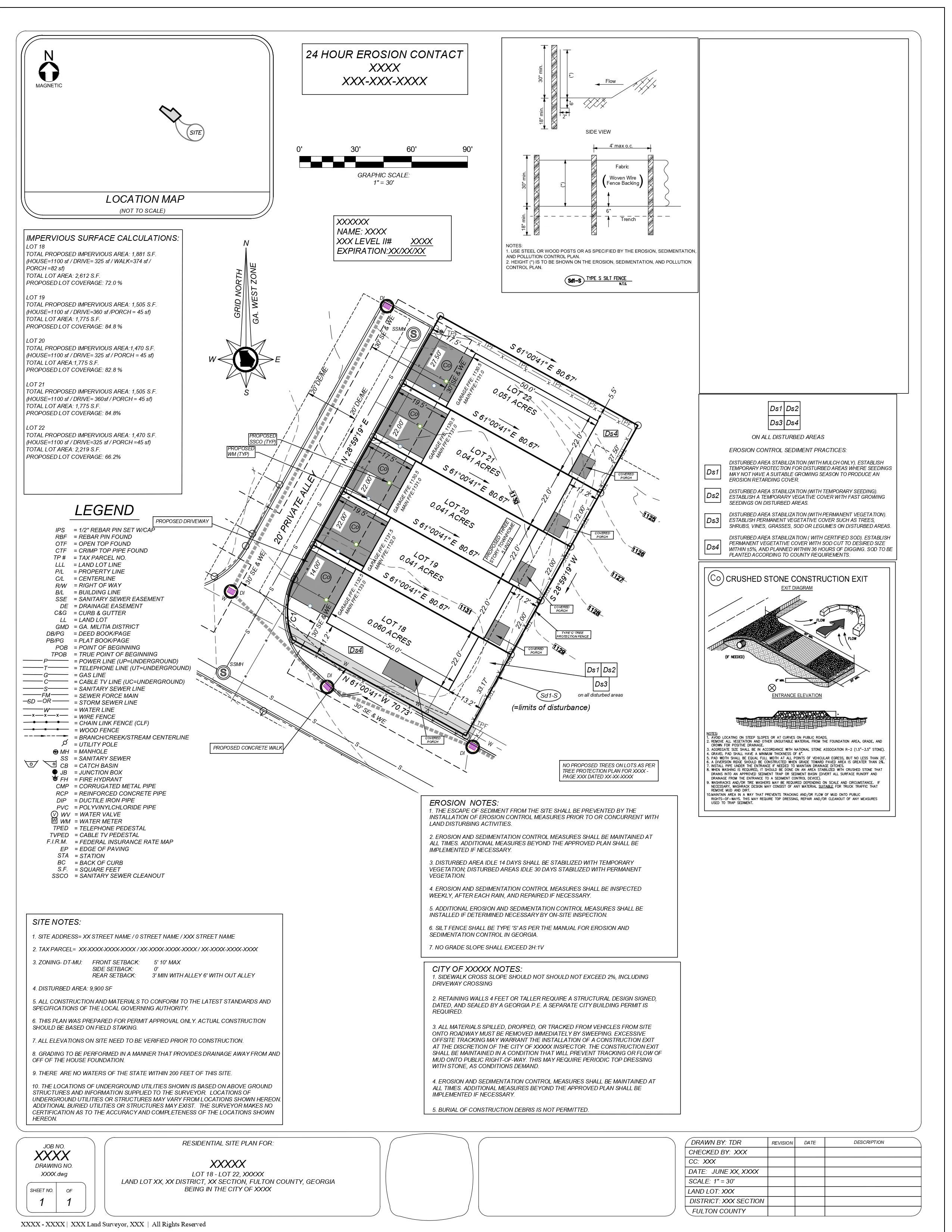
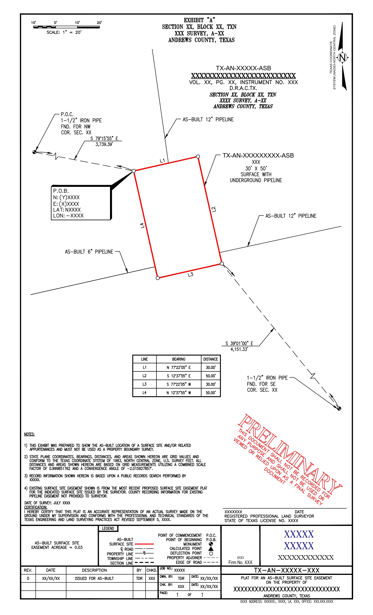
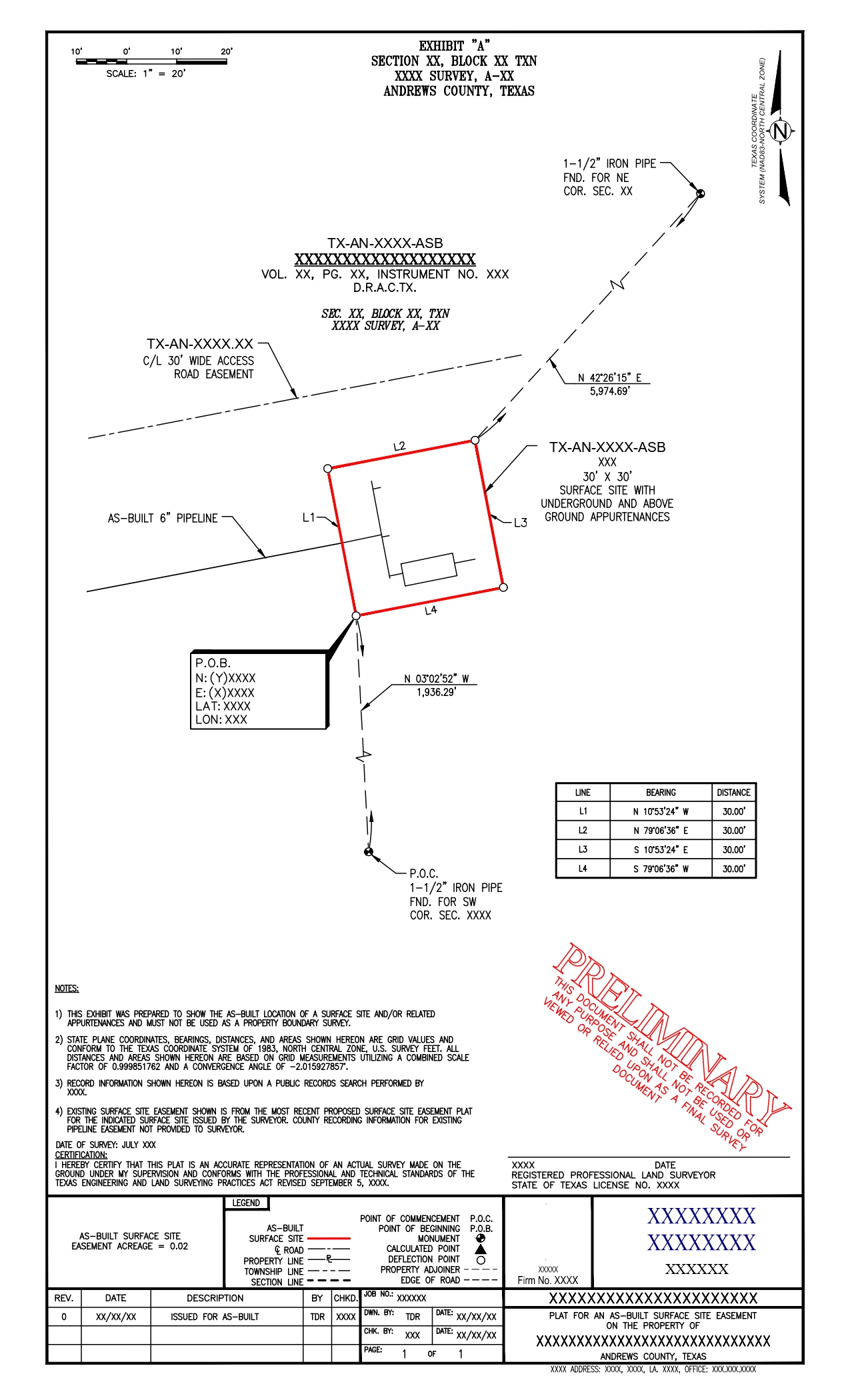
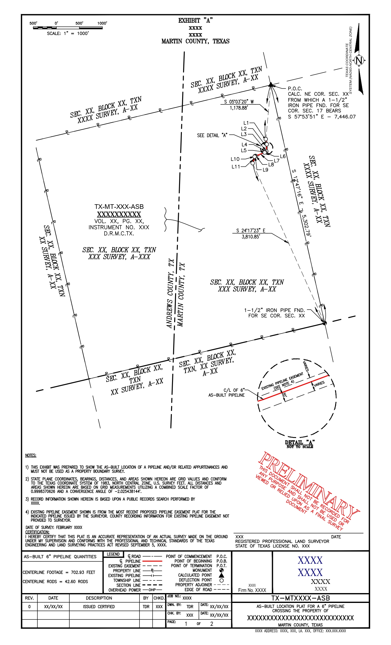
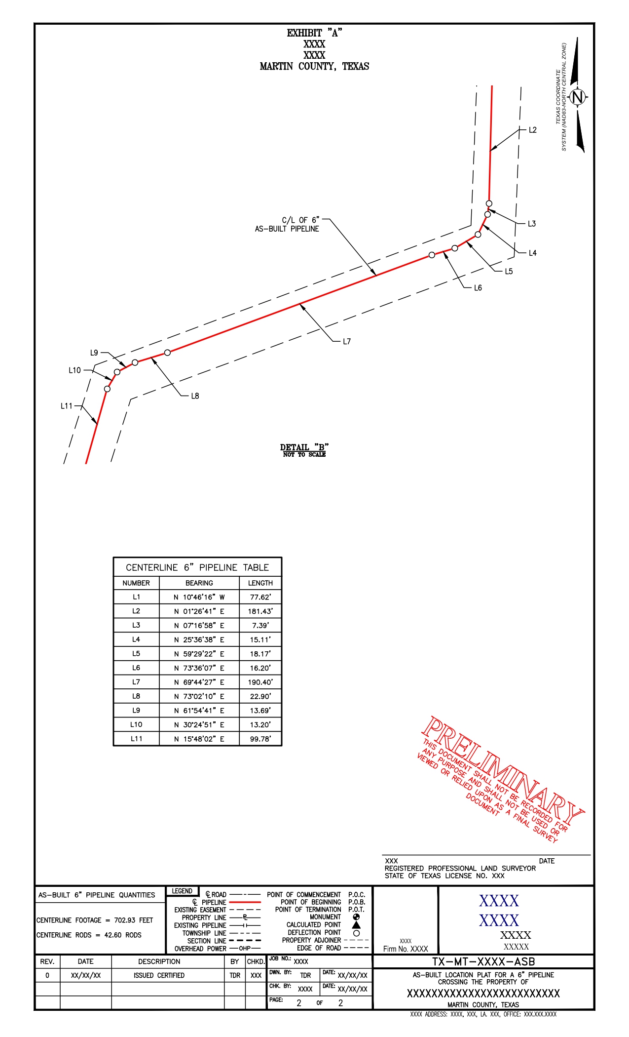
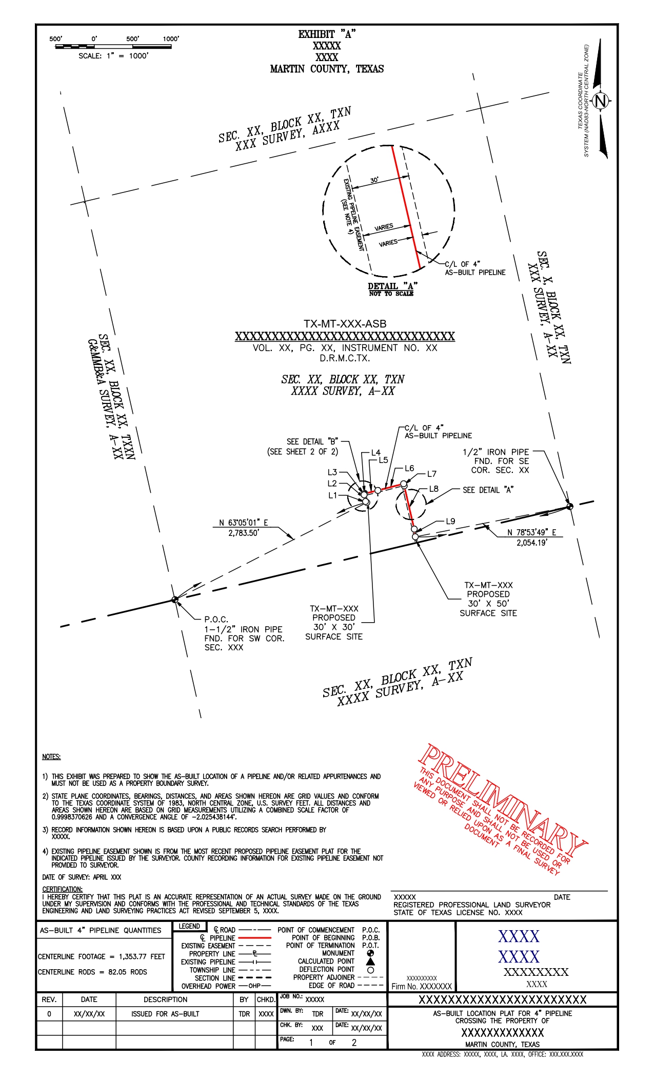
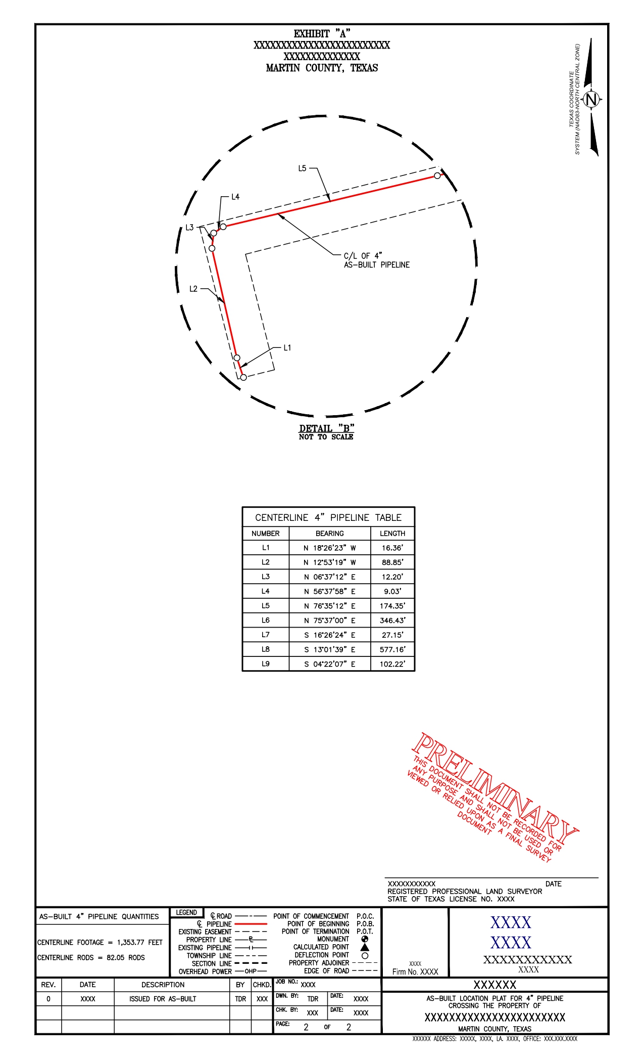
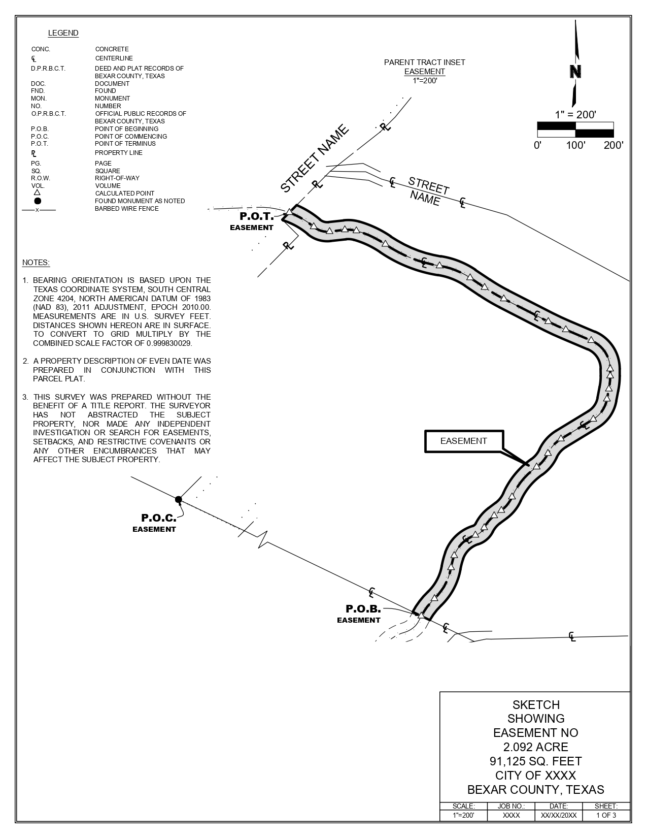
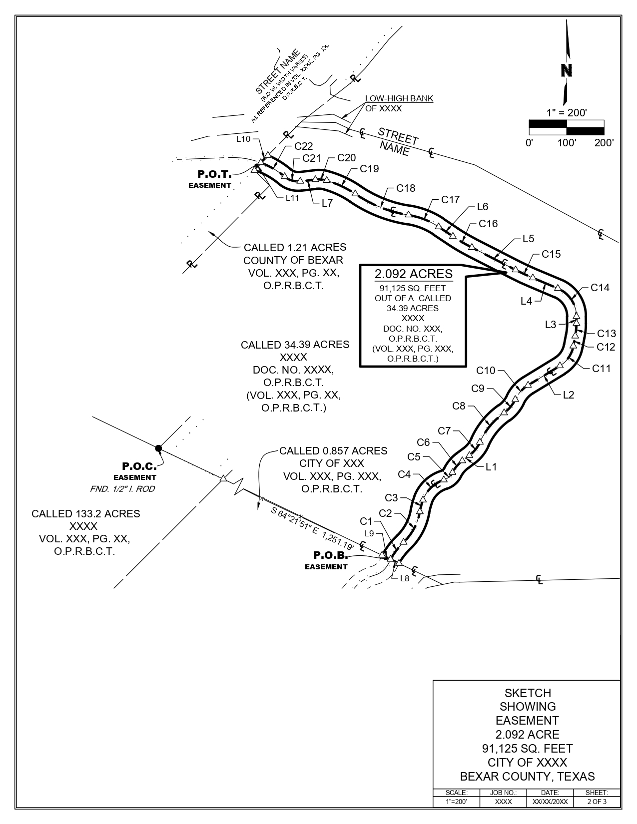
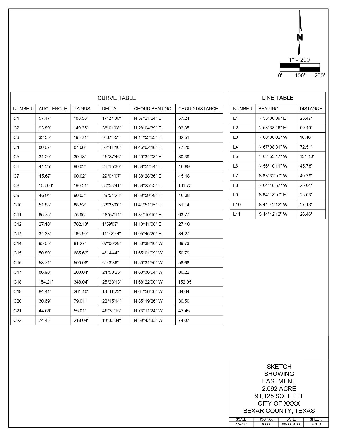
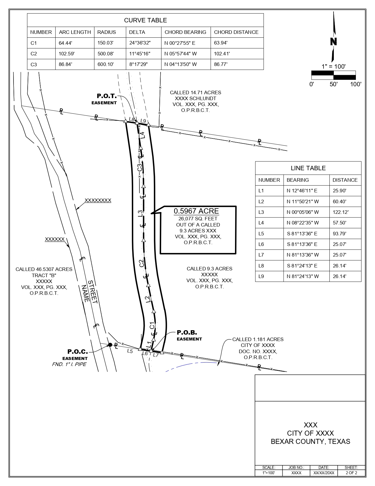
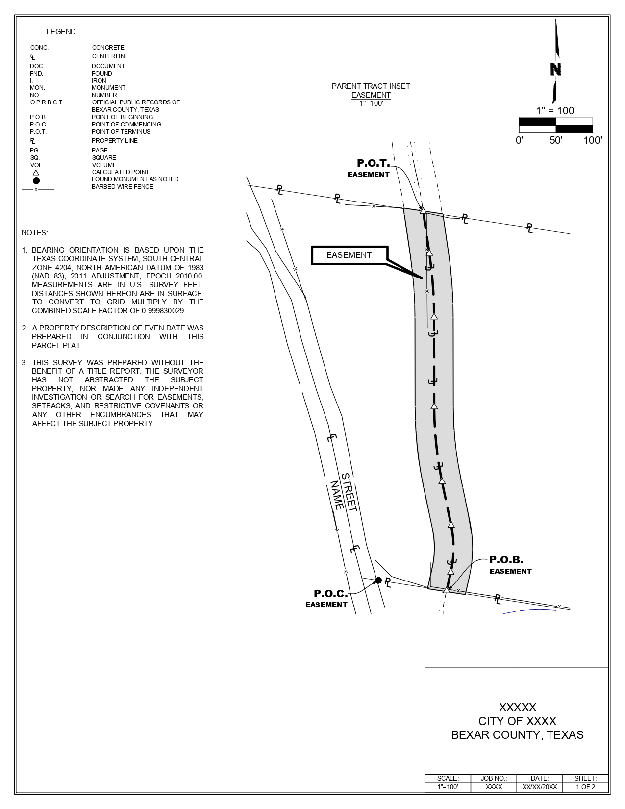
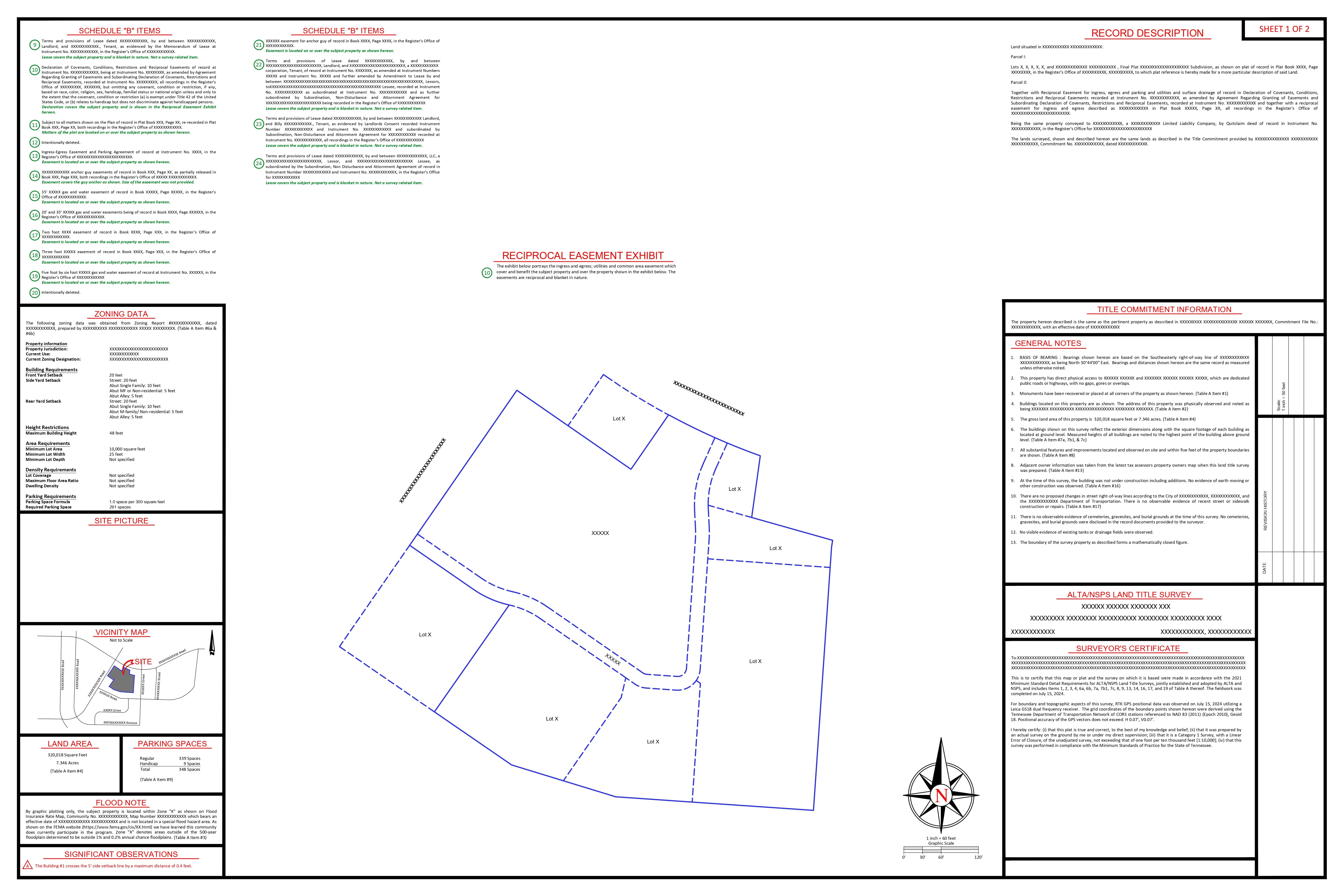
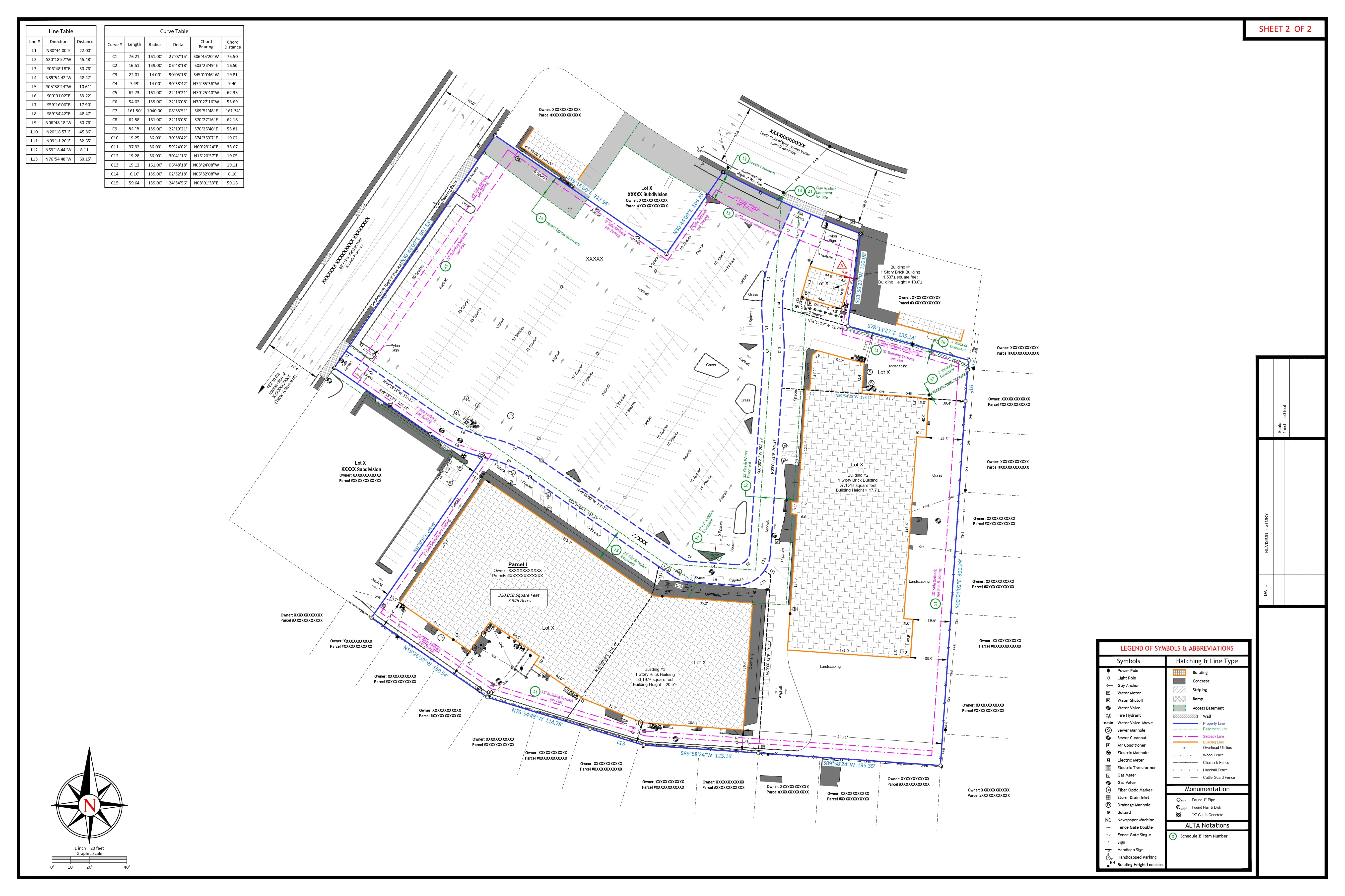
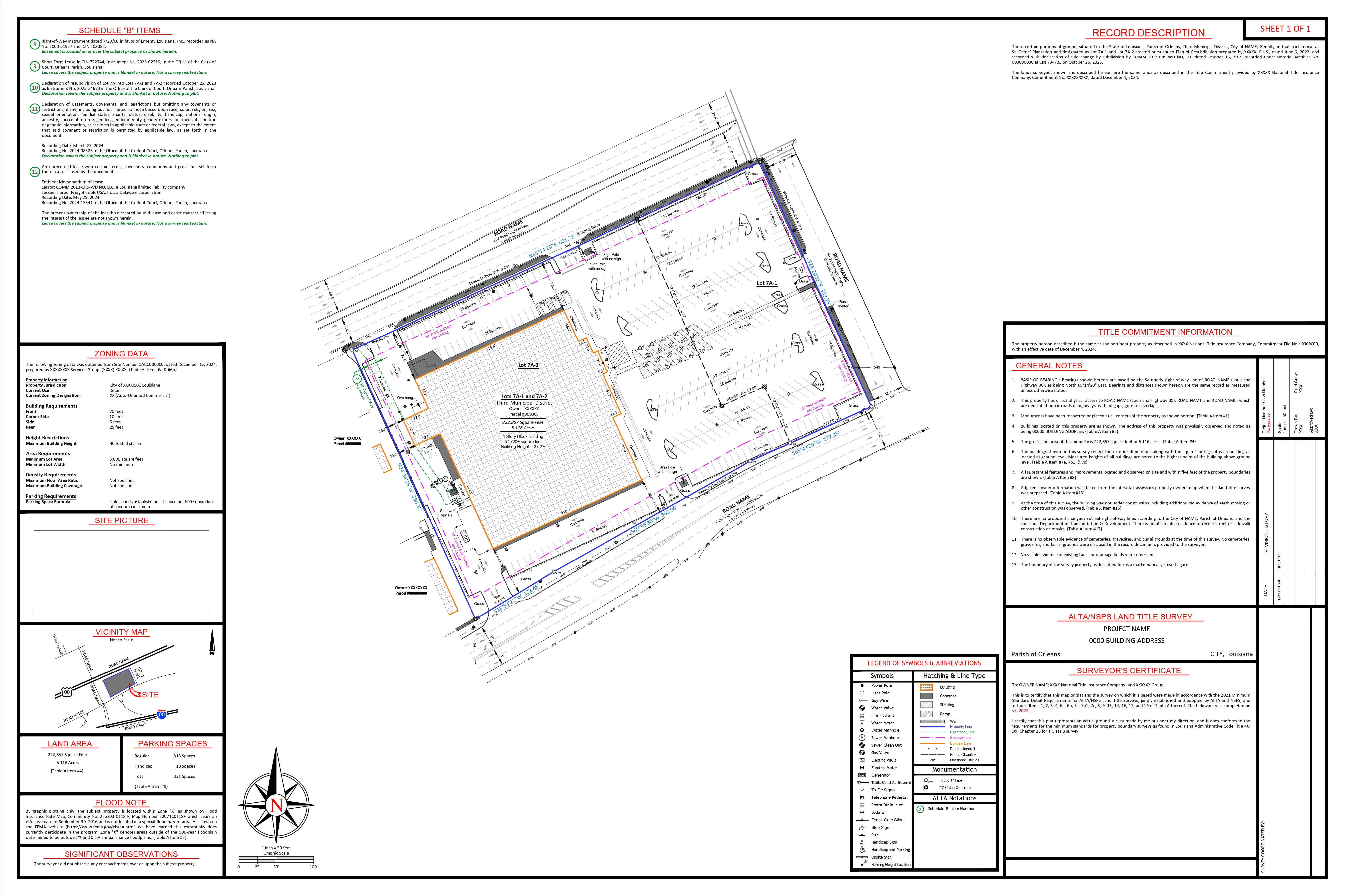
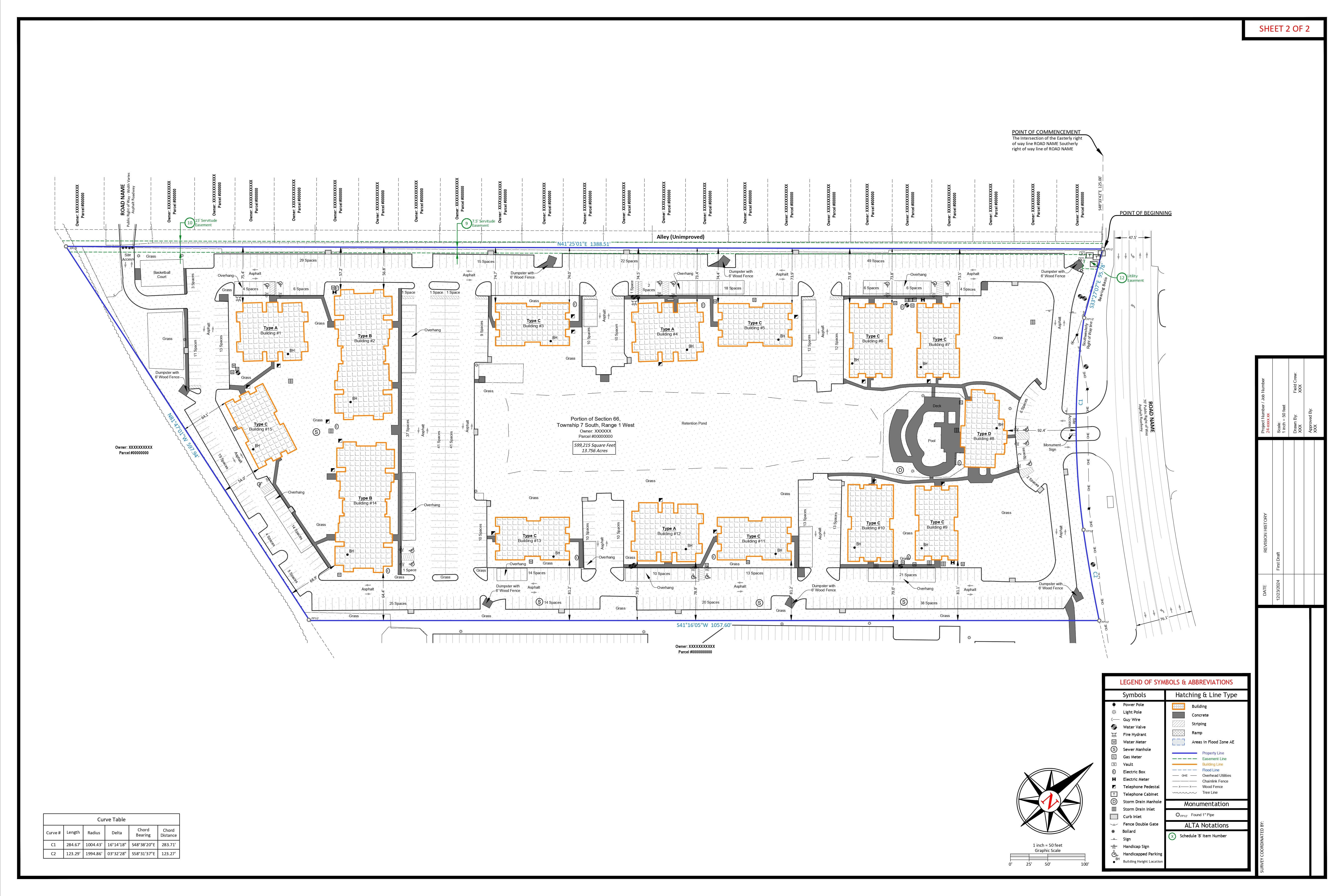
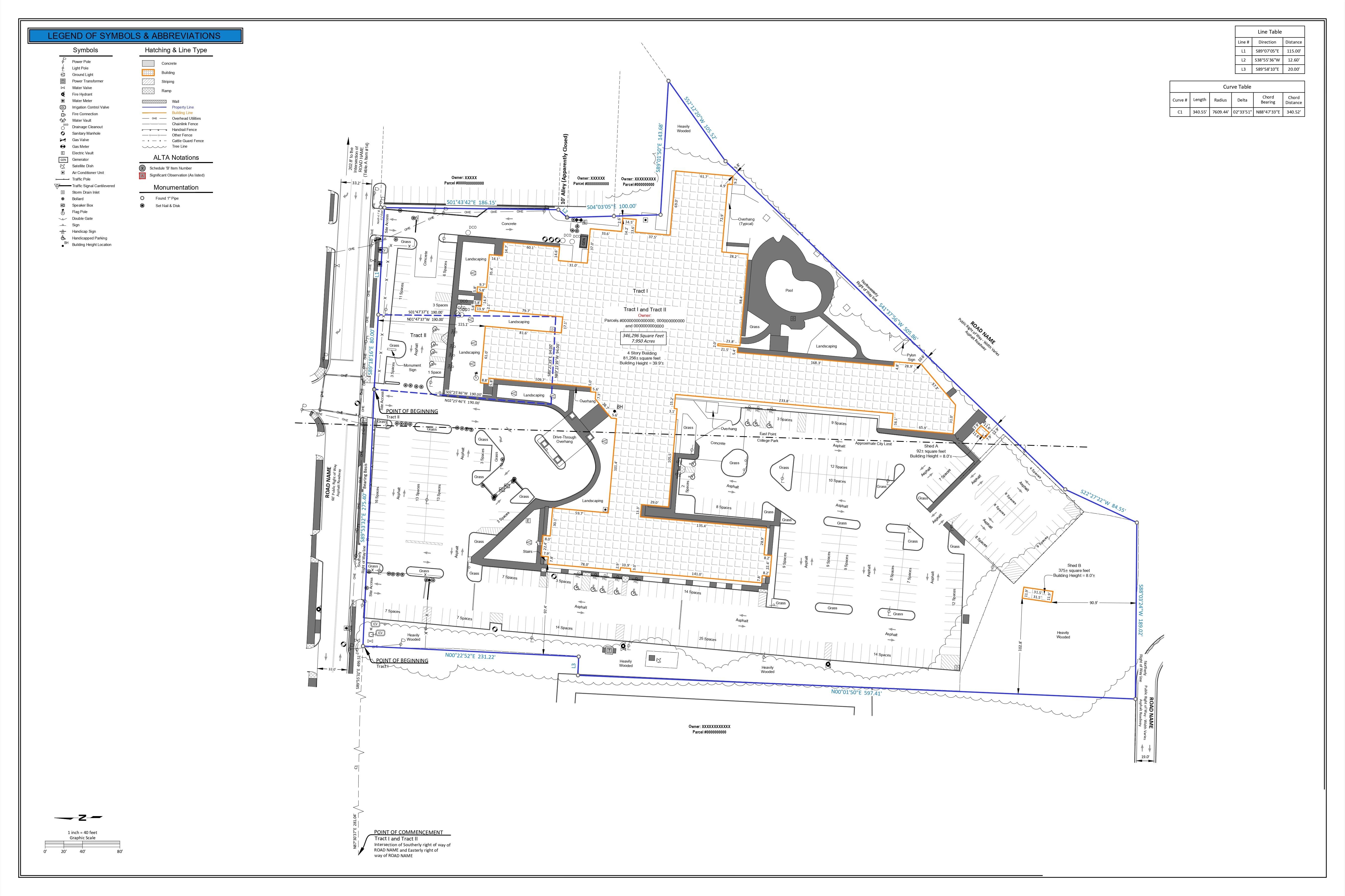
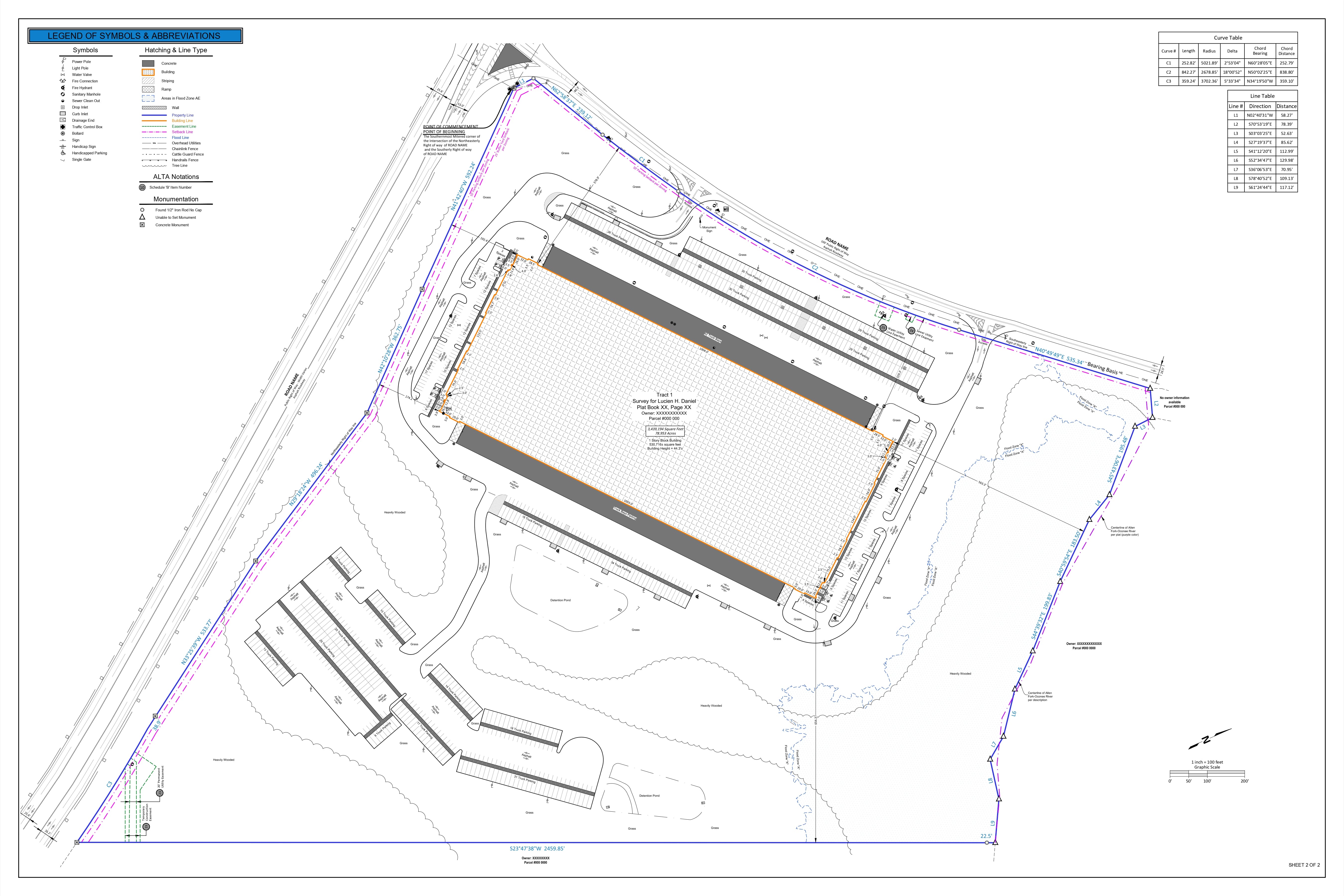
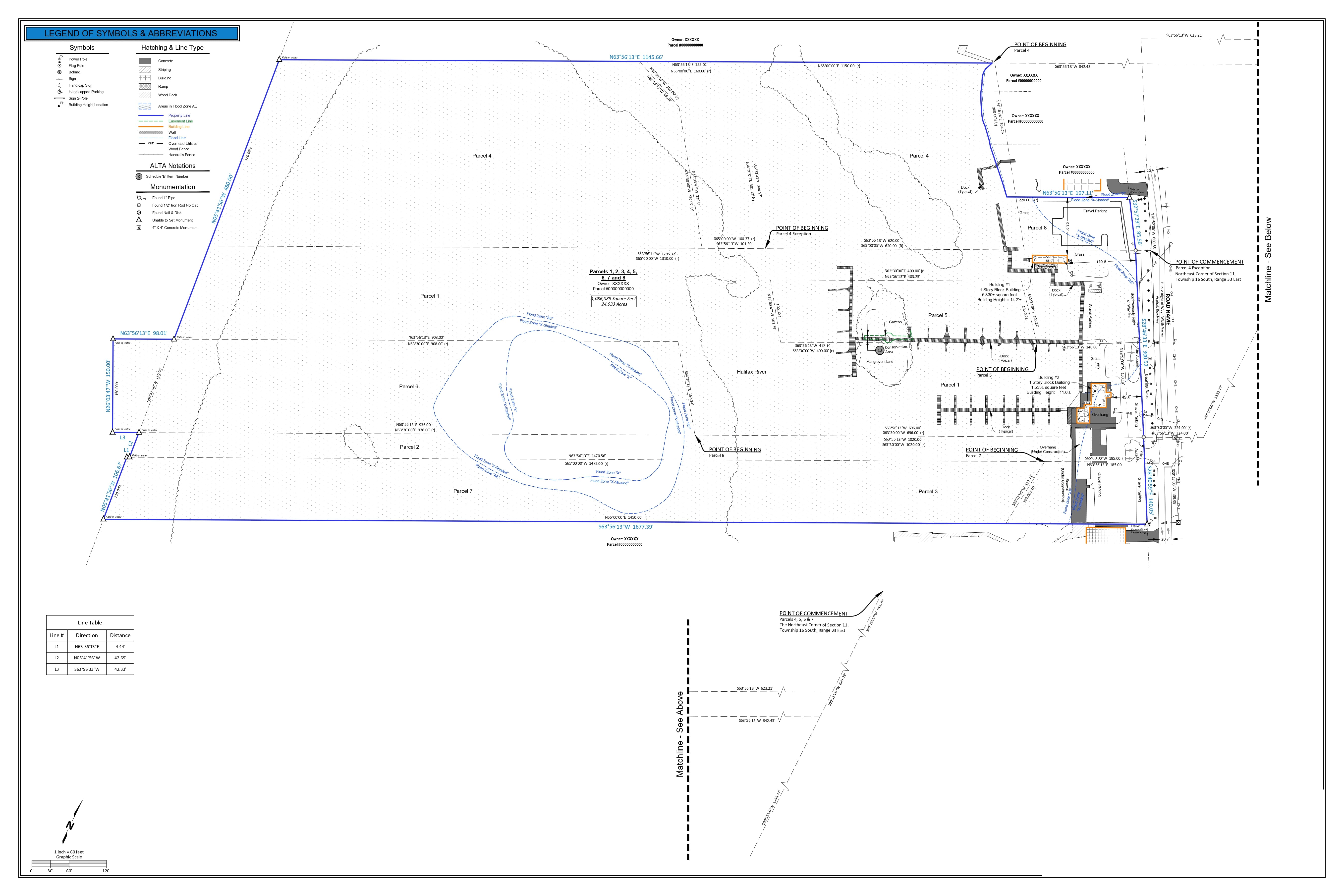
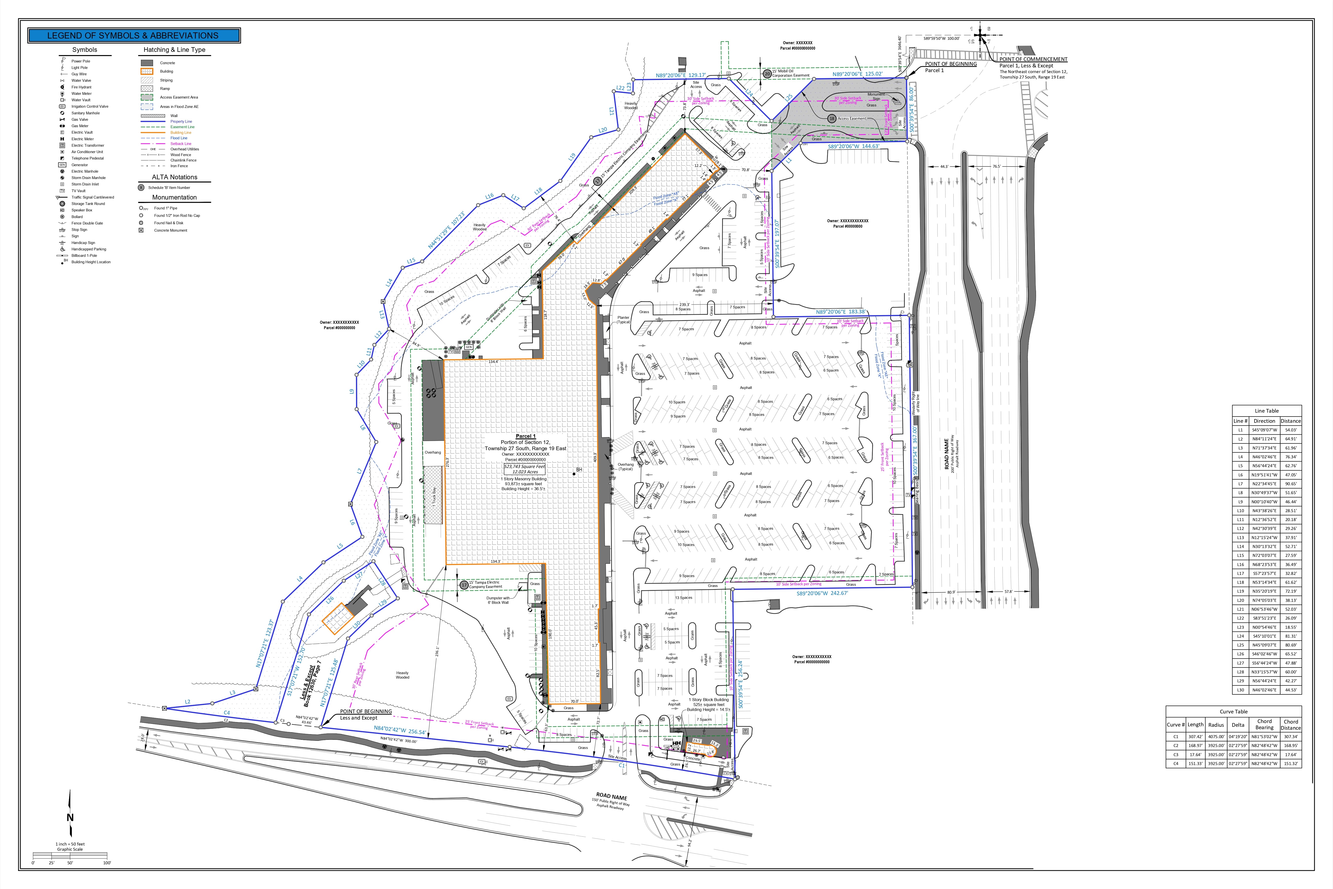
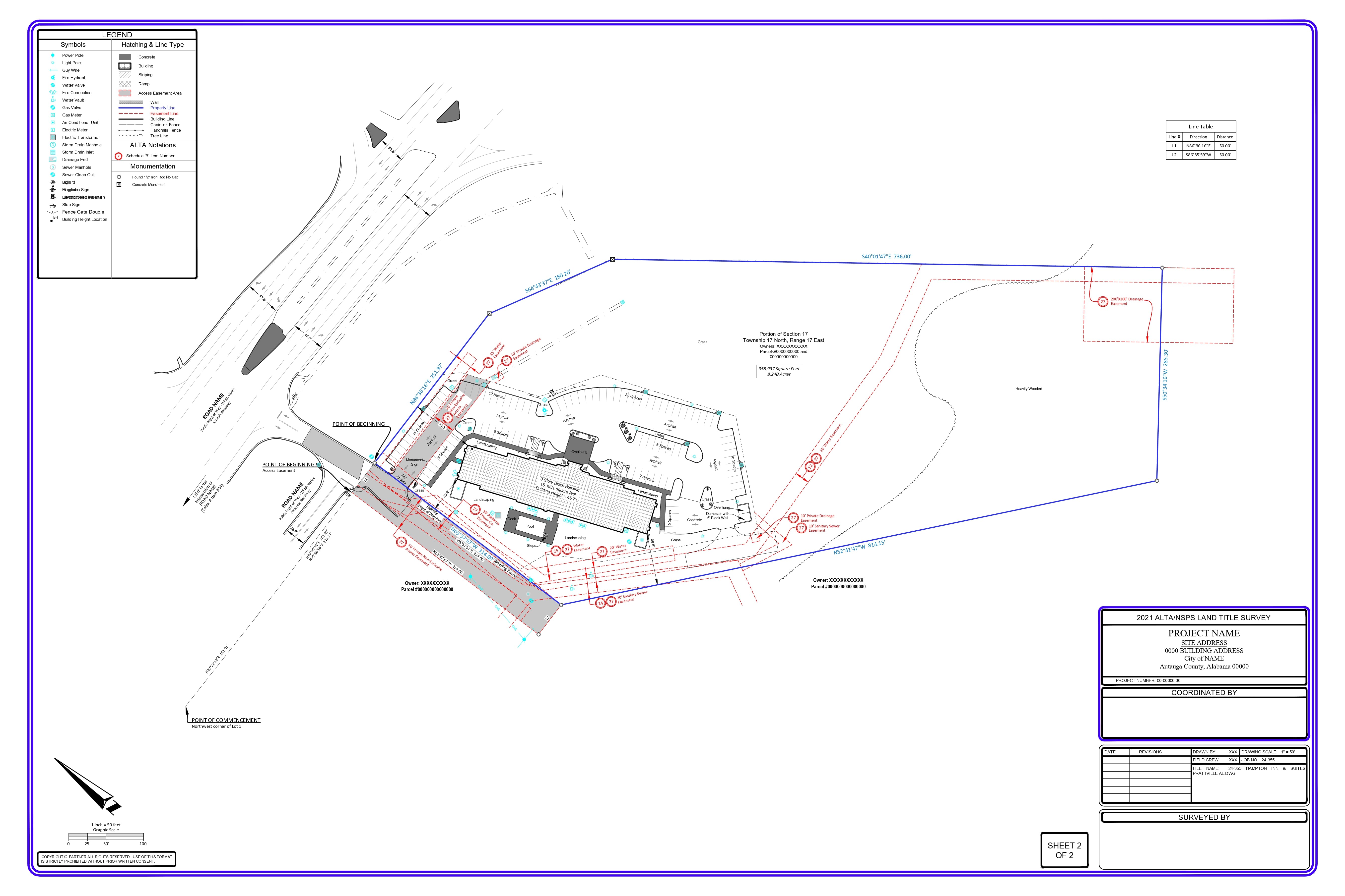
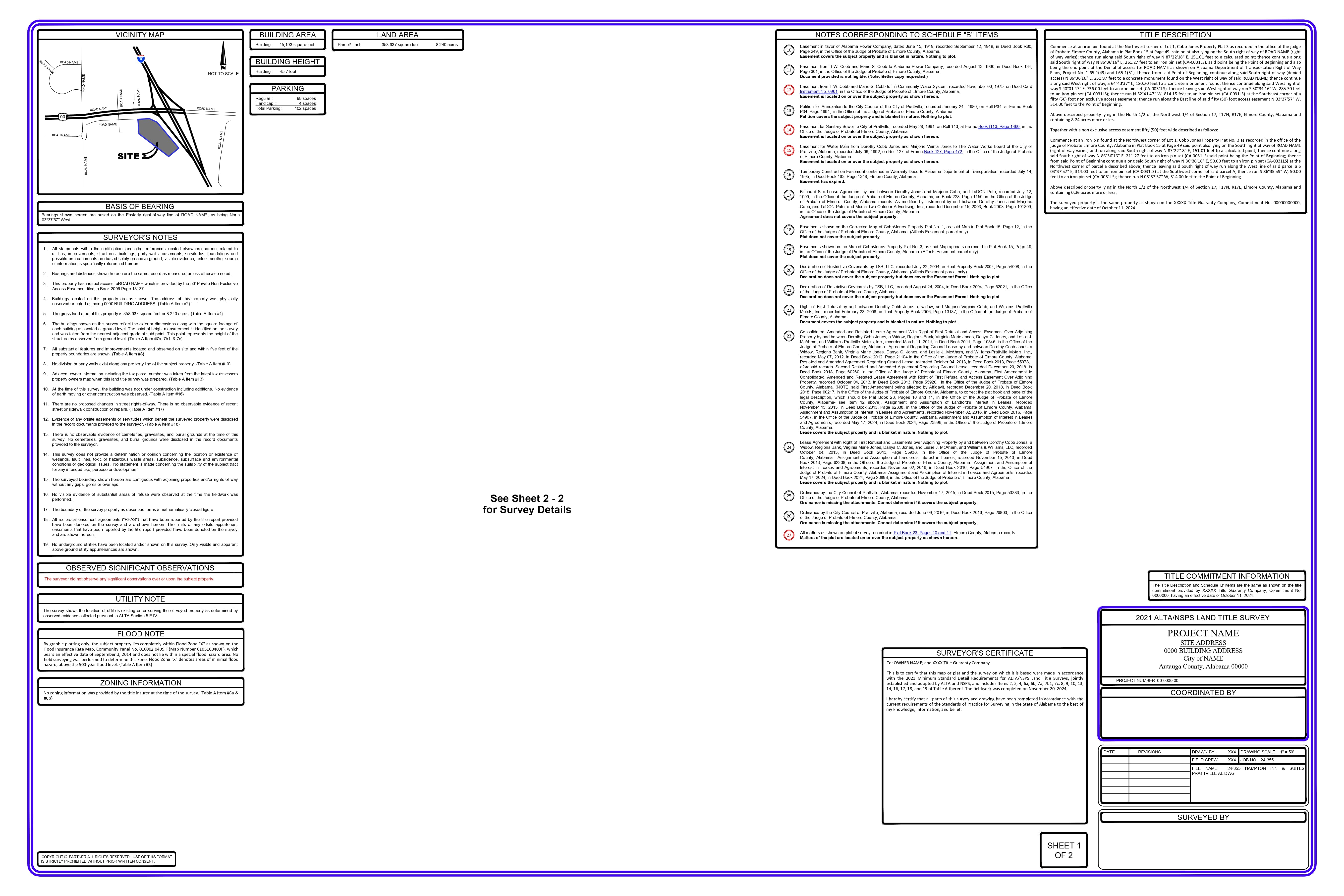
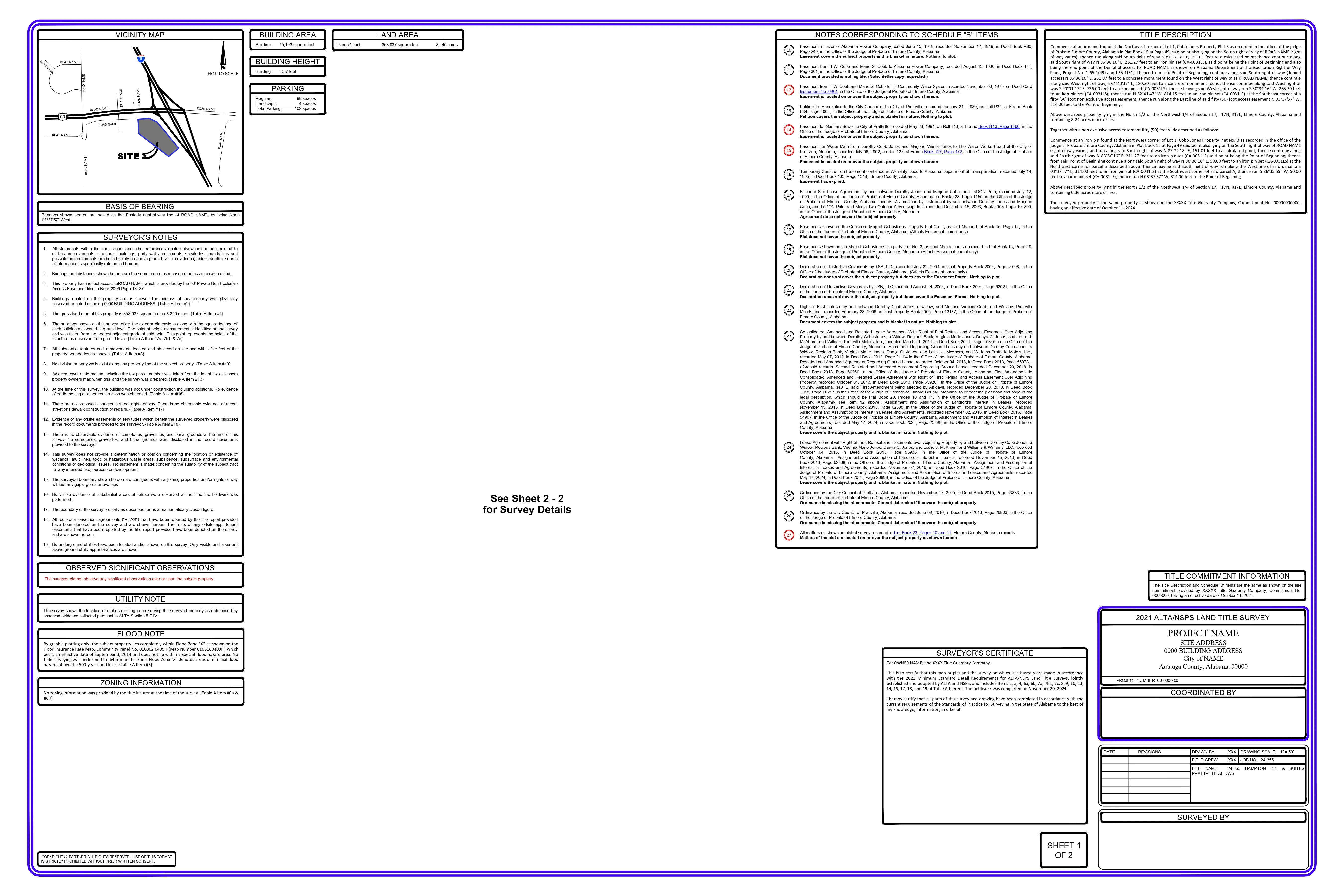
We are provided with the base setup drawing, COGO points with the geolocation and property corners established, to begin the new parcel creation as part of the record of survey.
The property line is drawn based on the COGO points and instructions, with cross-verification of the existing property lines against the plat map, where available.
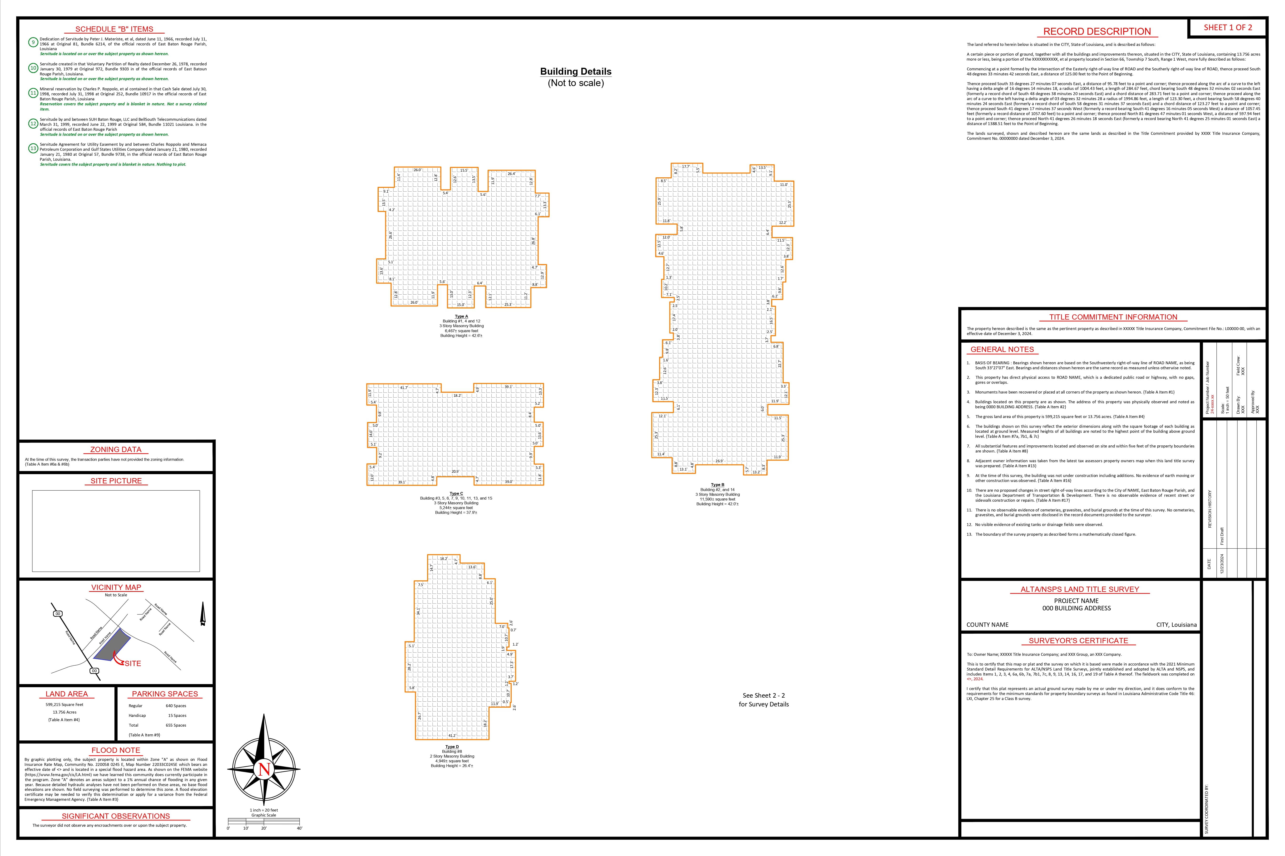
All lines are labeled with platted and measured bearings and distances, along with the corresponding “crow’s feet” notation to differentiate the lines.
All found, set, and calculated monuments are shown and labeled as required, and all necessary information is included in the drawing.