Property Maintenance

Burbank Outdoor Living
Aerial Imaging With their ability to capture data from above, drones are able to perform land surveys, photogrammetry, 3D mapping, topographic surveying, and more, with increased efficiency. The Benefits of Drone Mapping Using drones for surveying offers the following advantages: Speed – Drones can scan acres of land in a fraction of the time it …

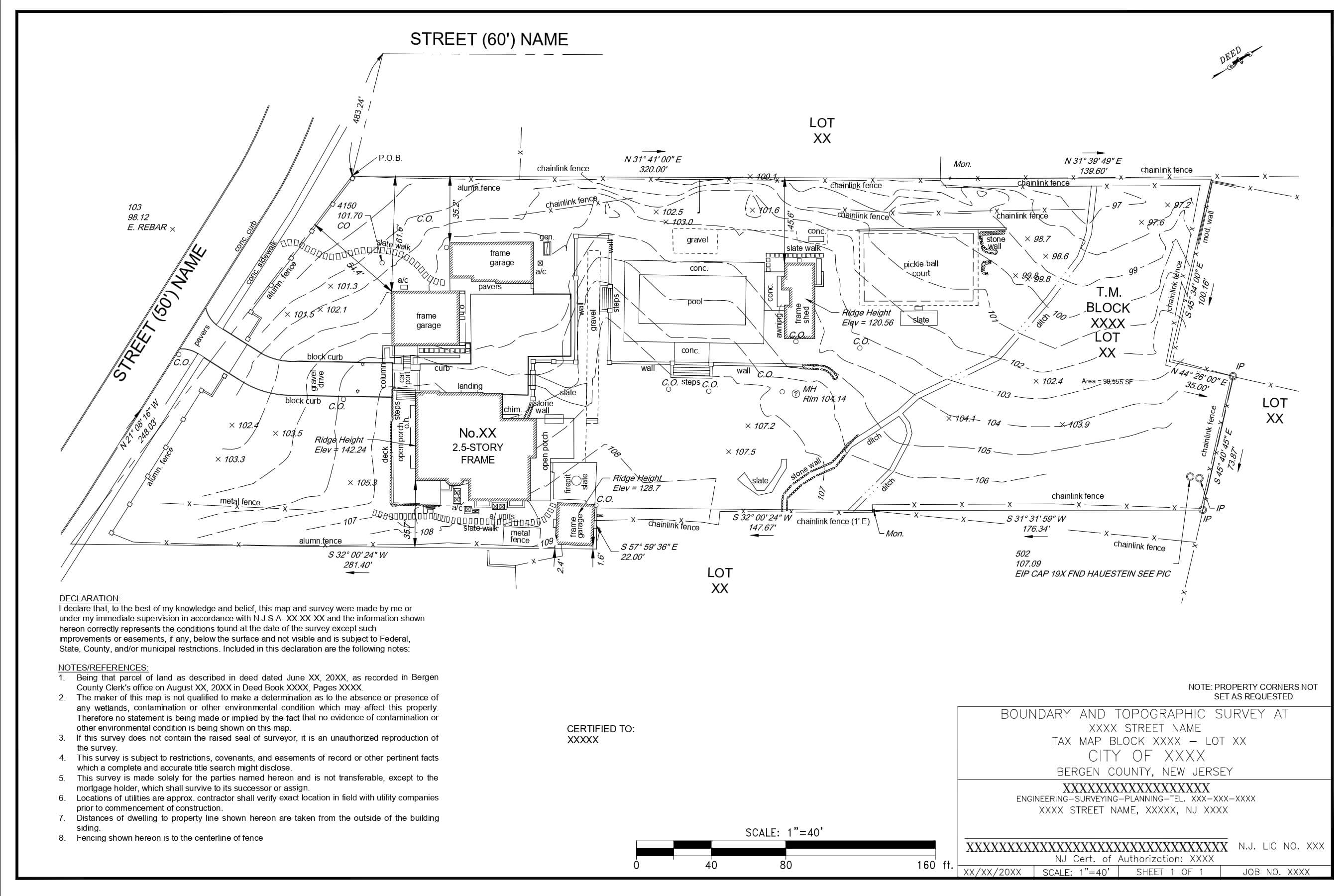
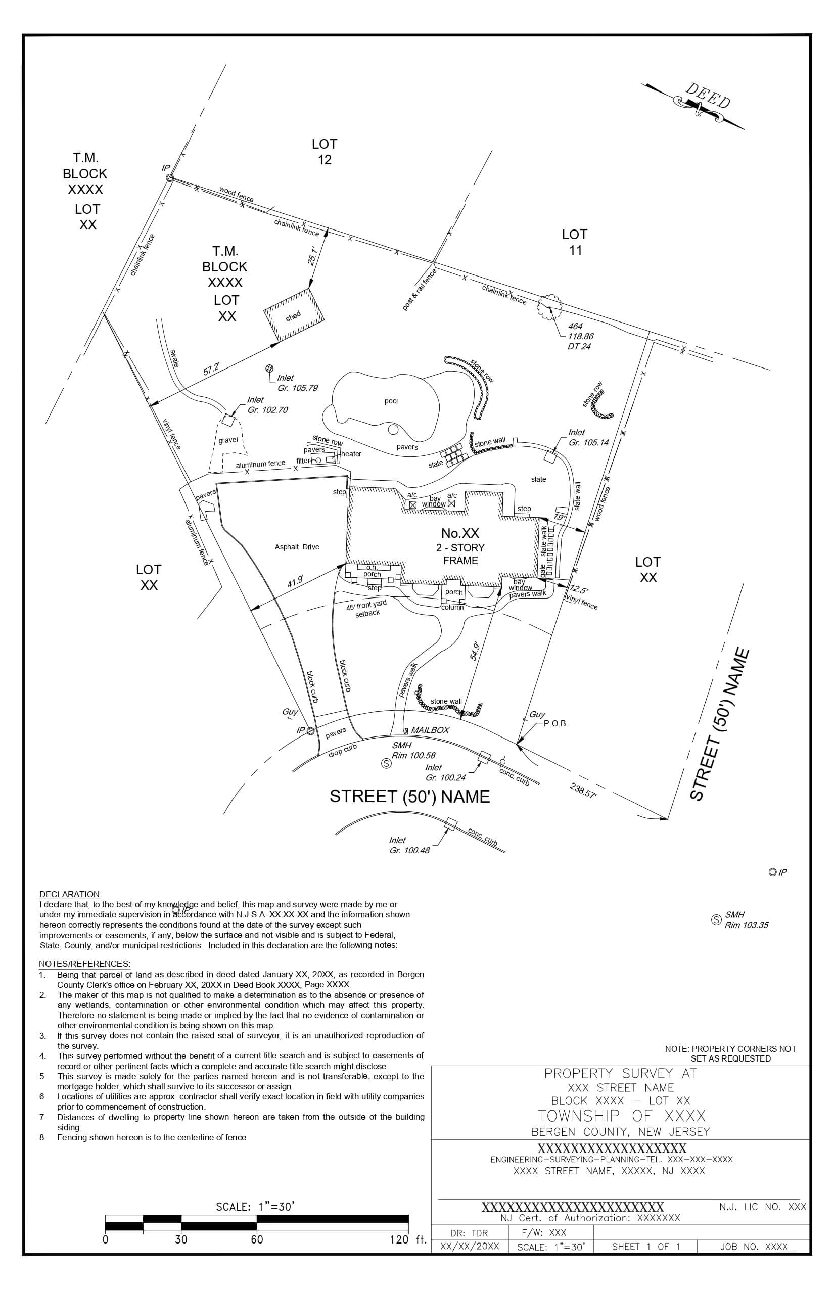
Villanova Residence
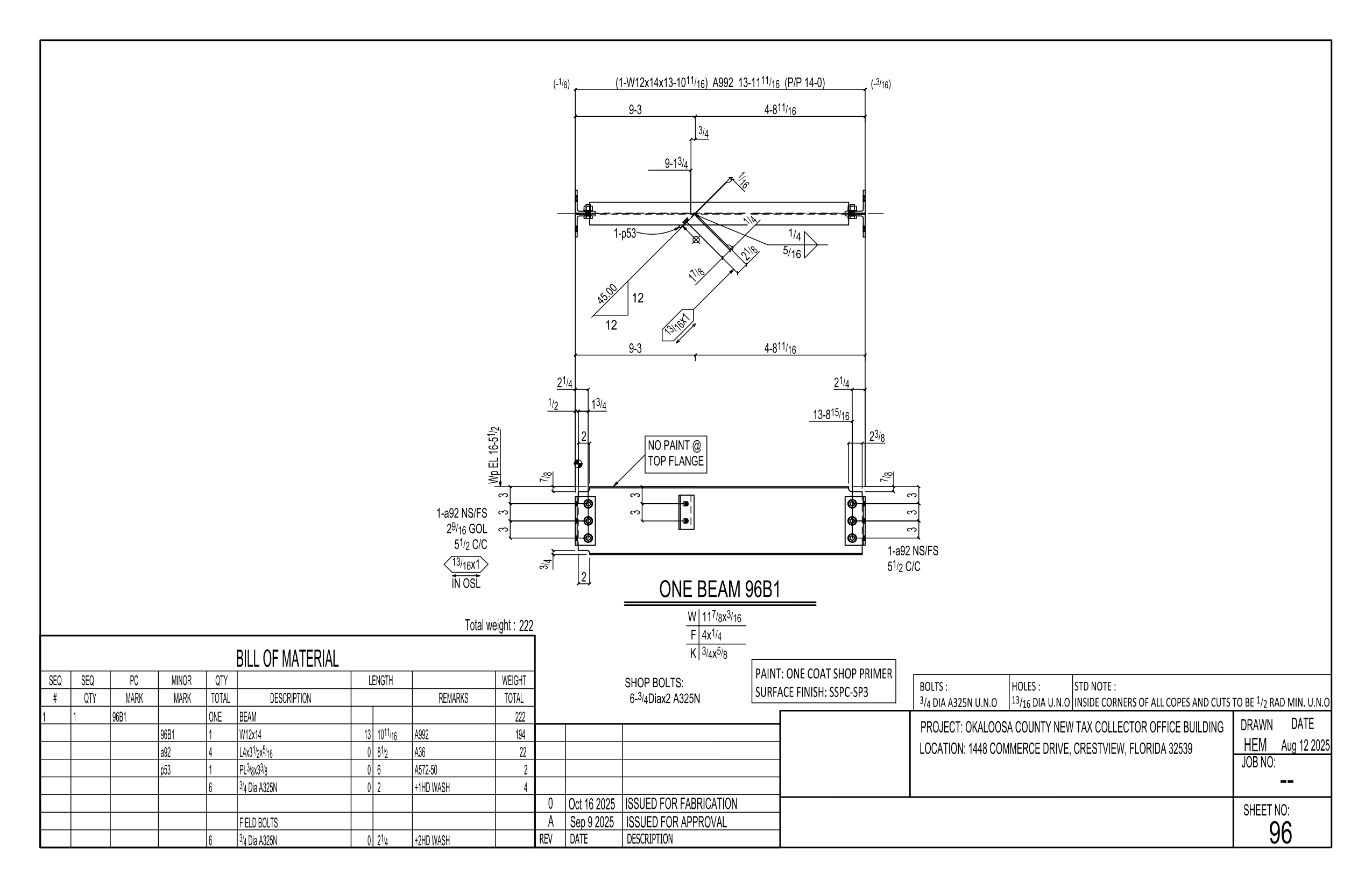
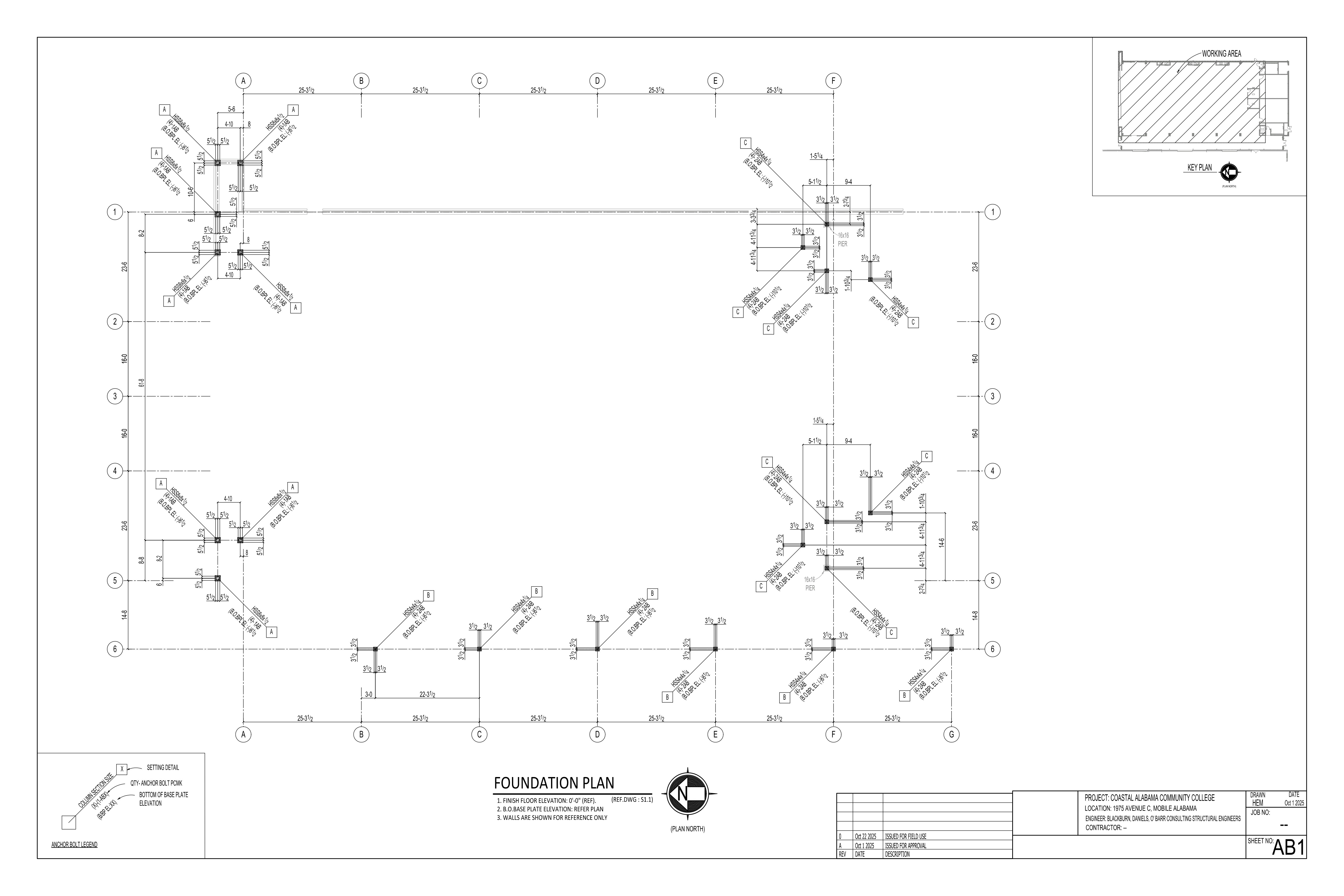
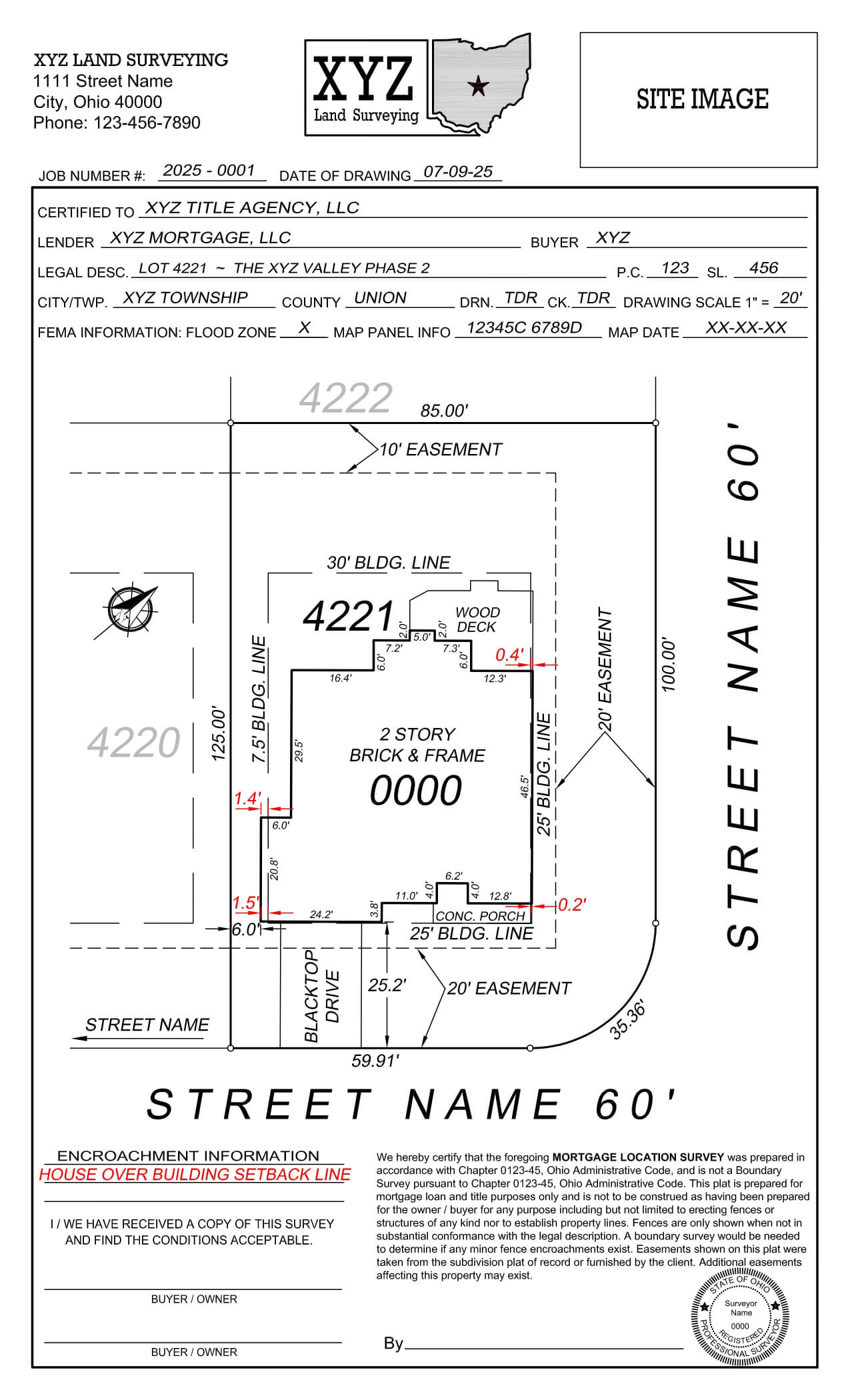
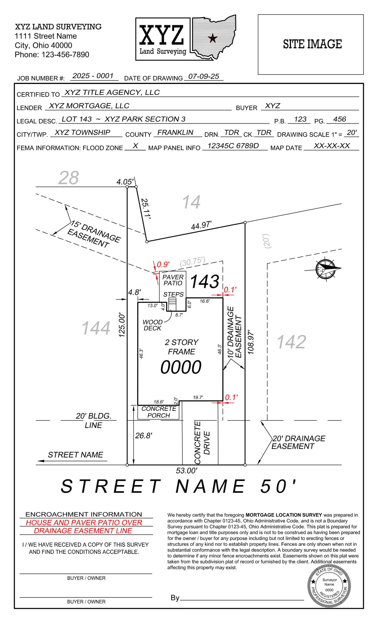
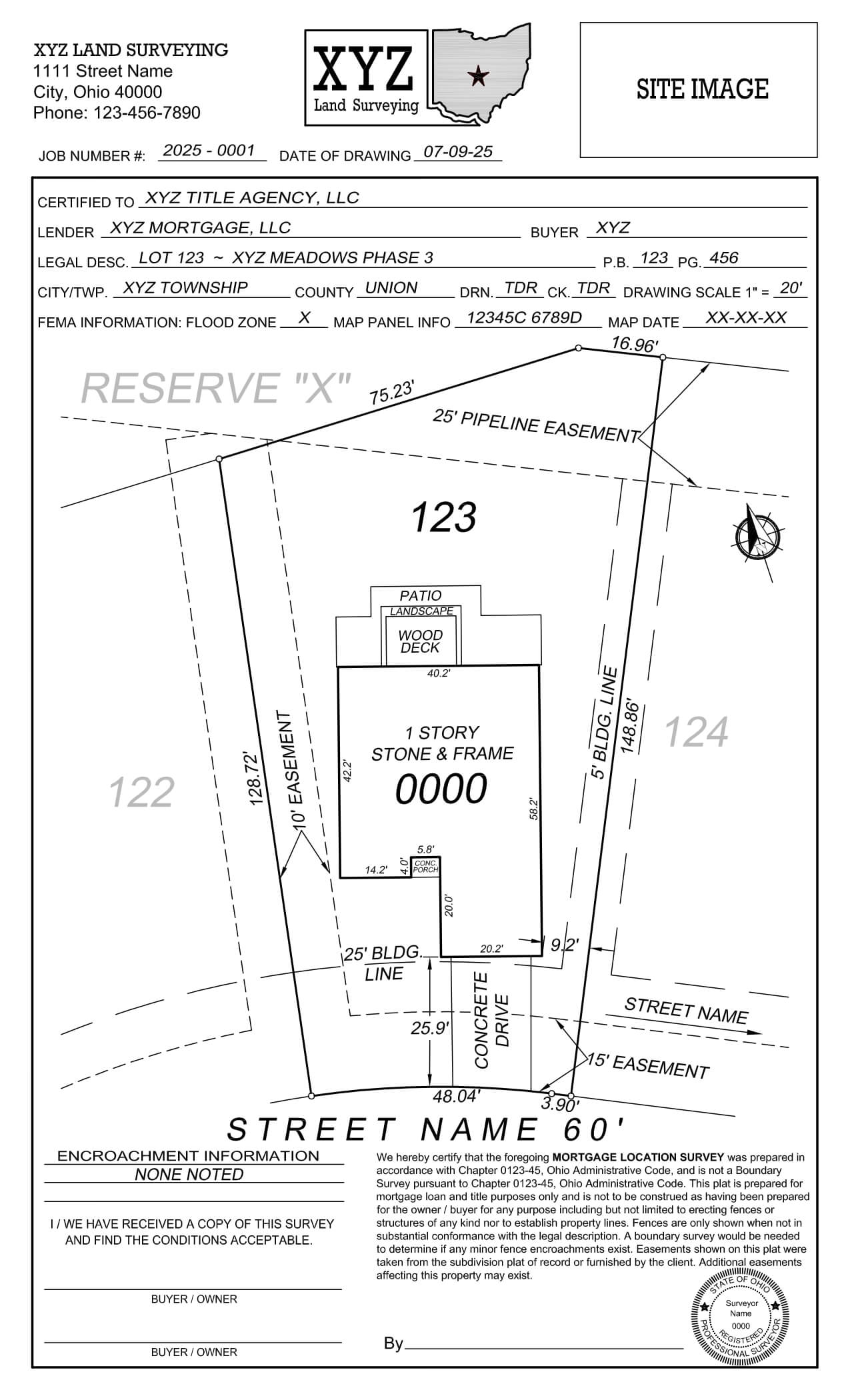
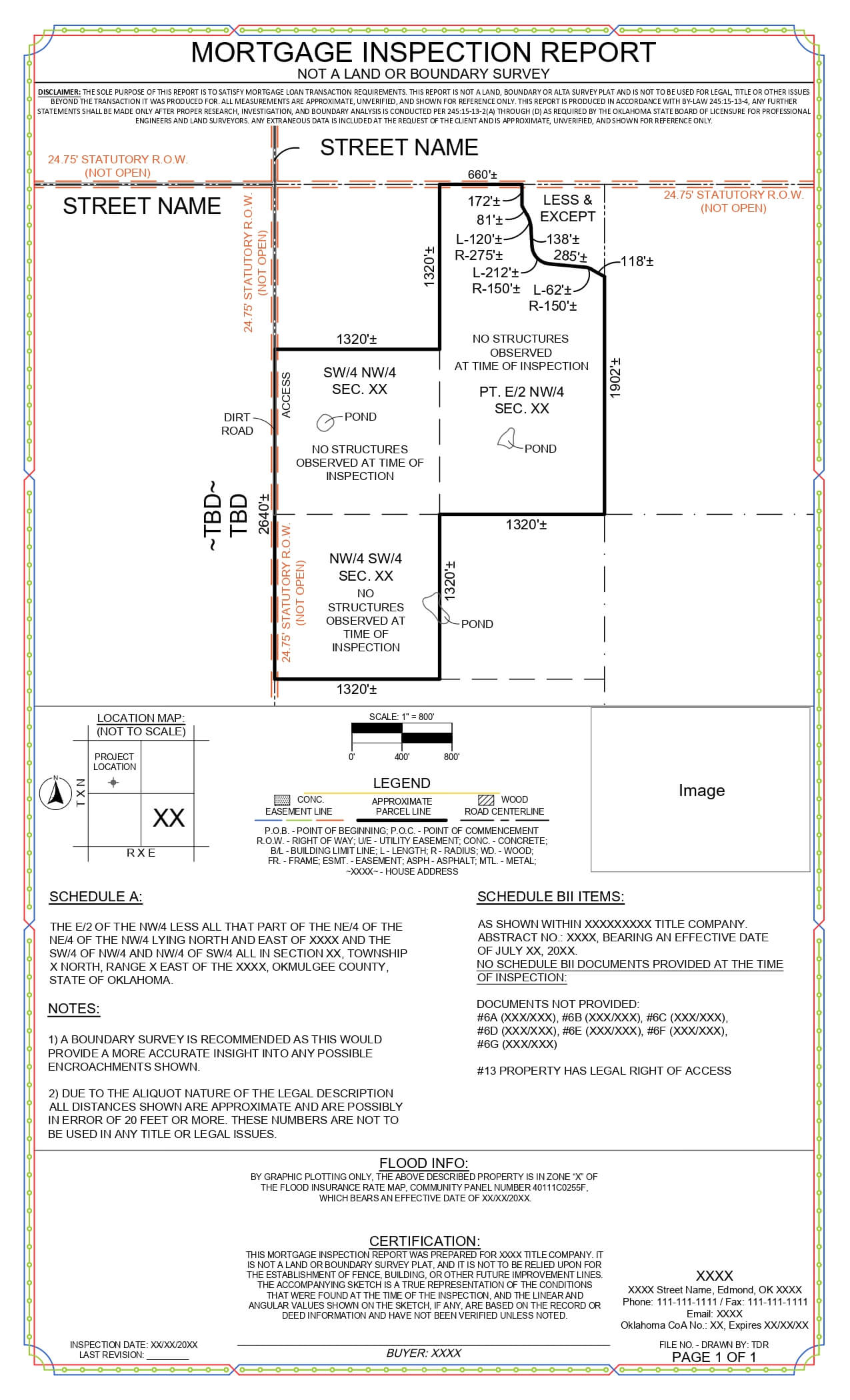
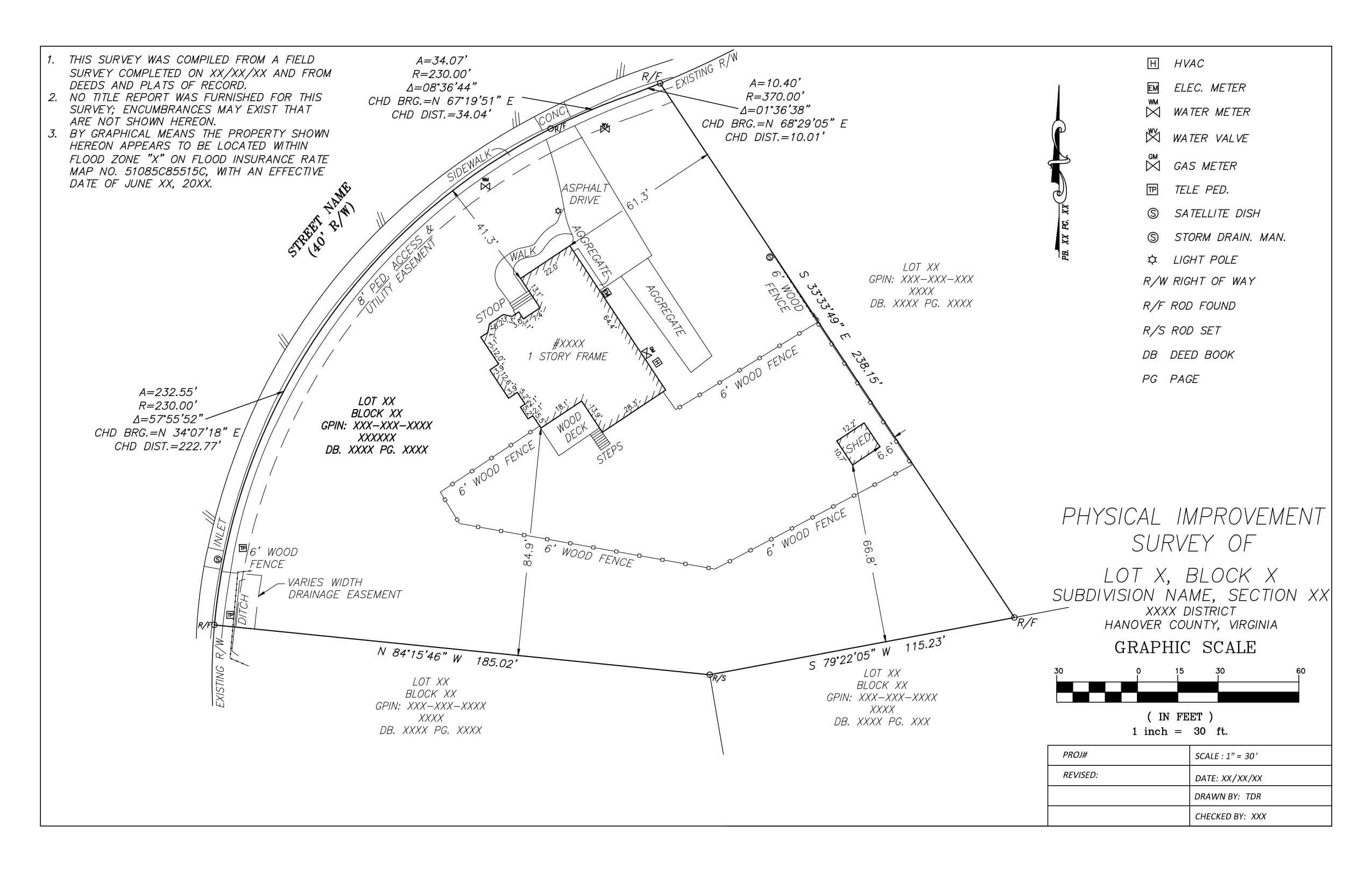
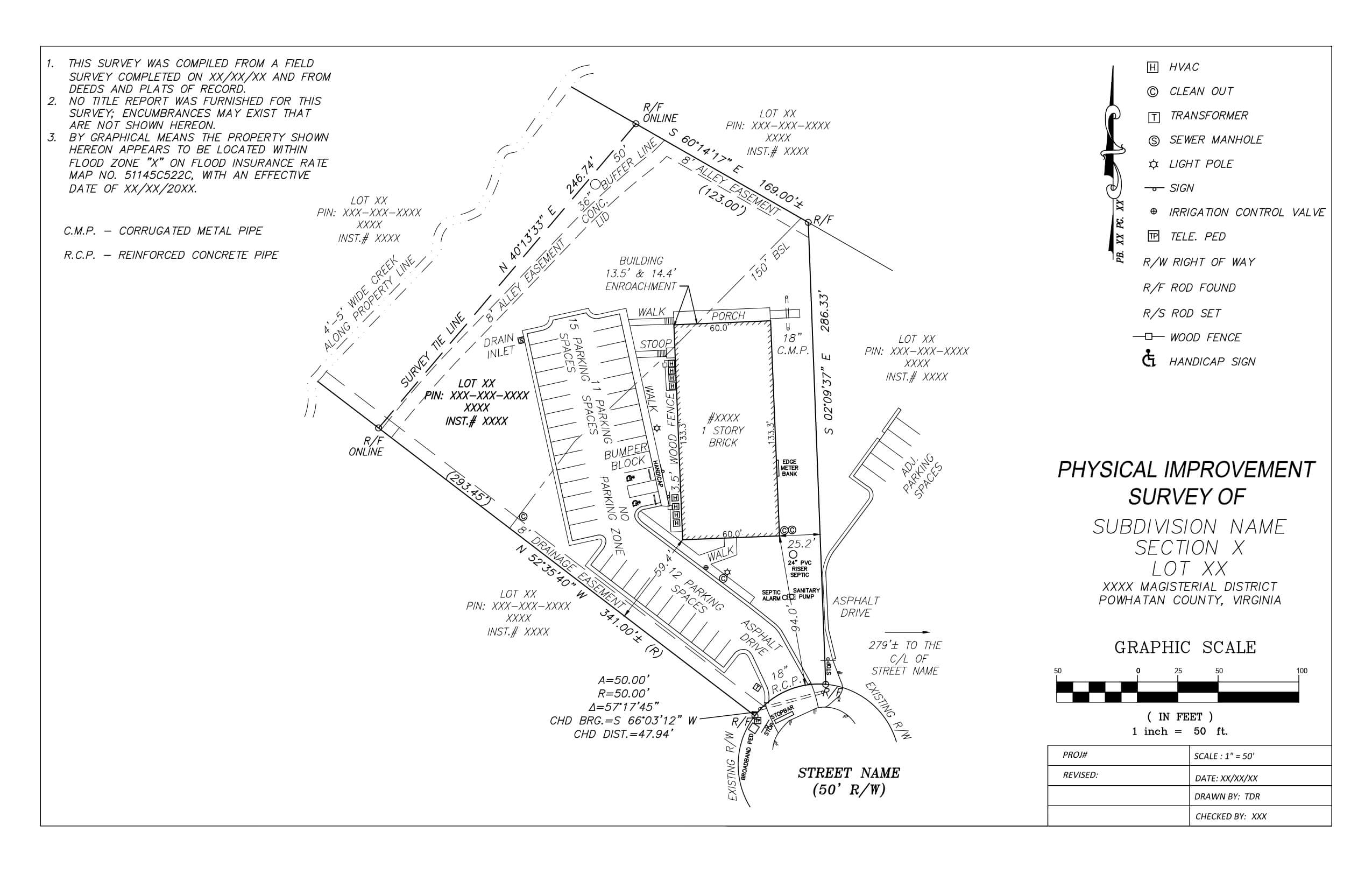
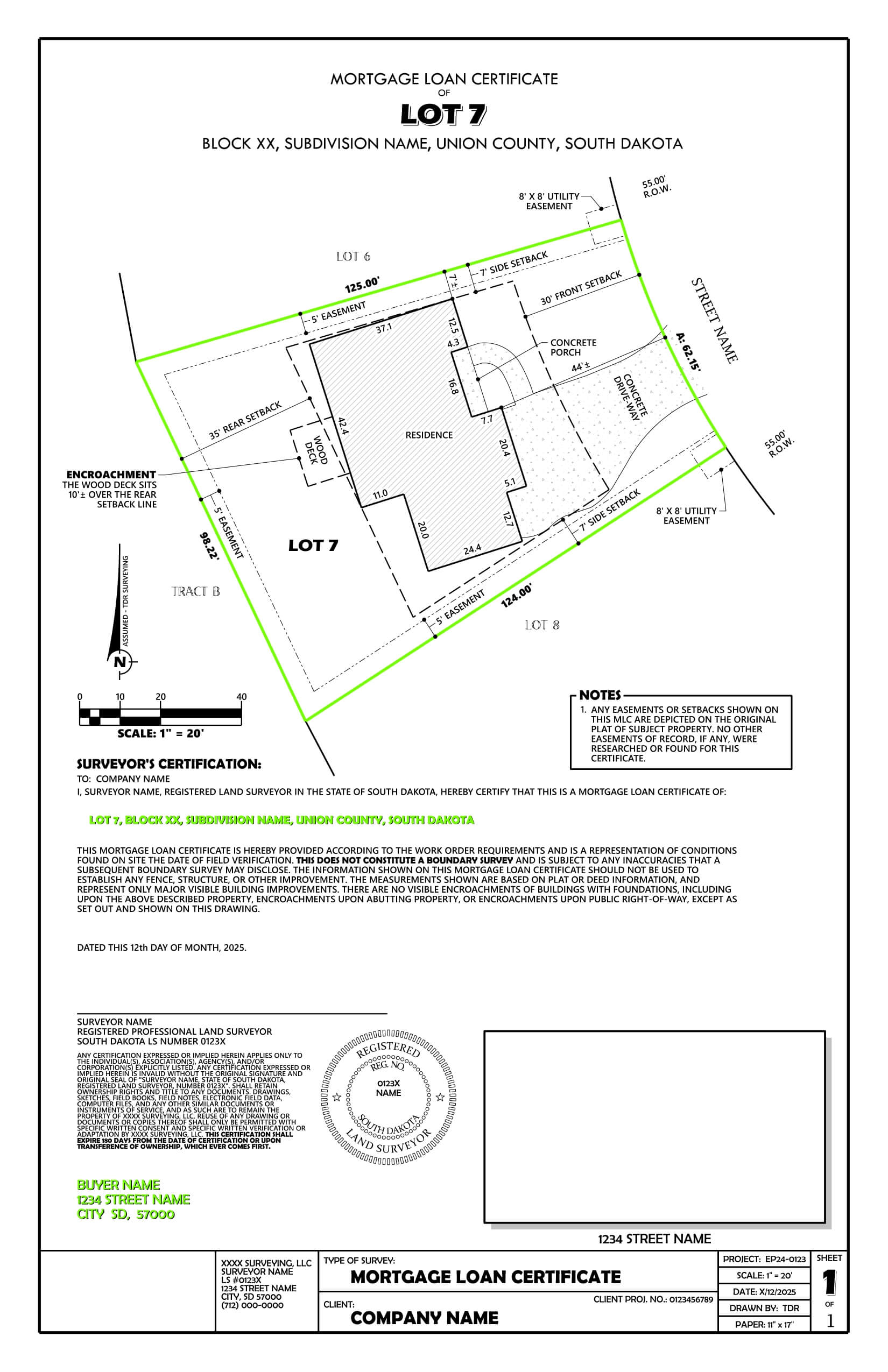
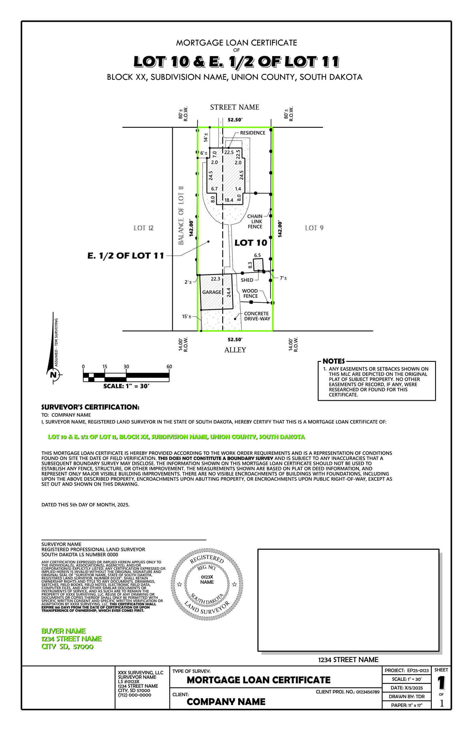
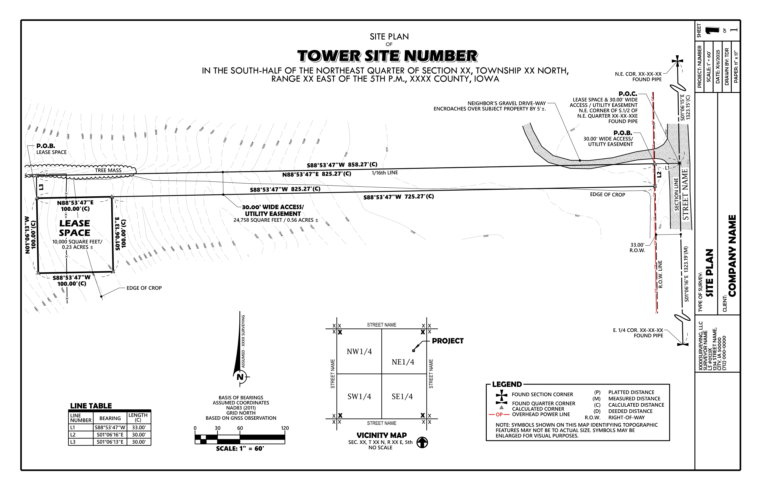
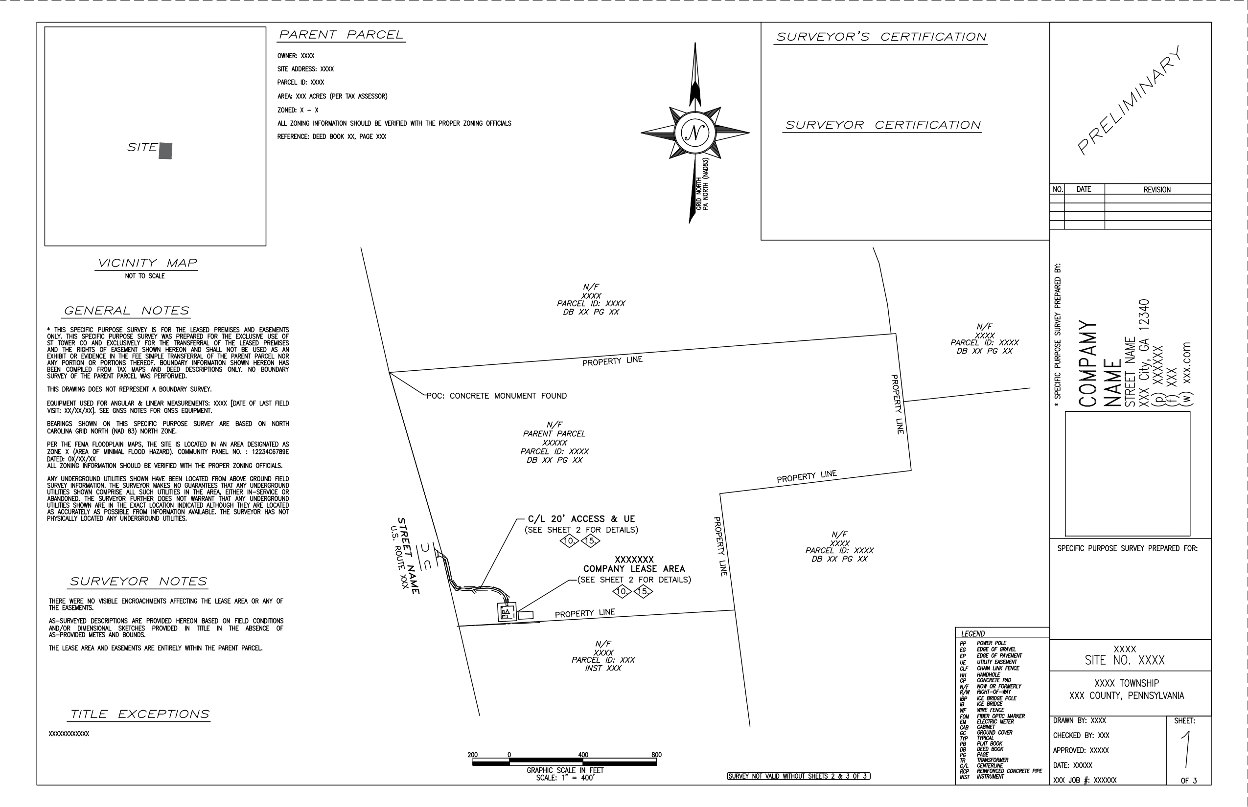
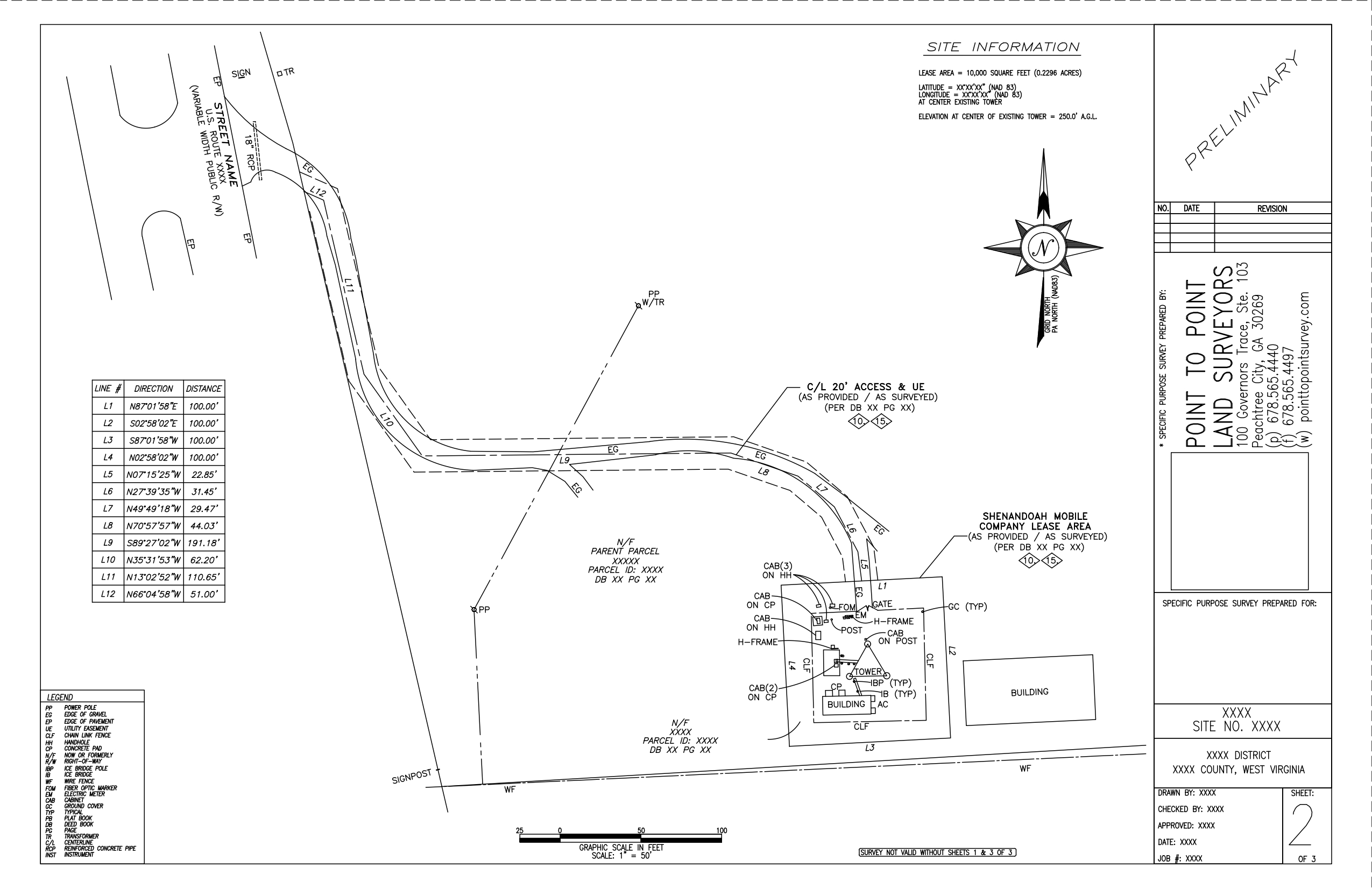
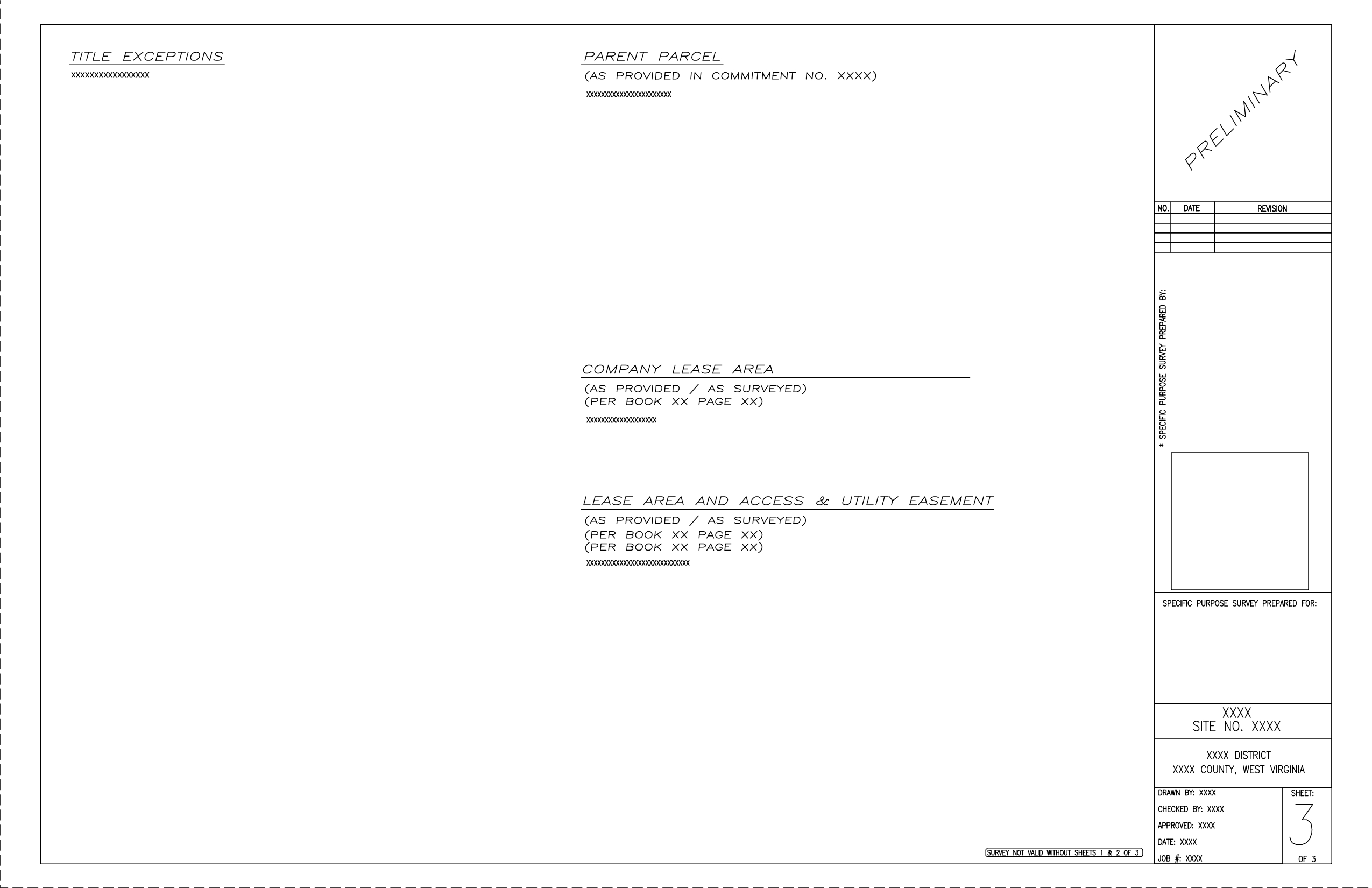
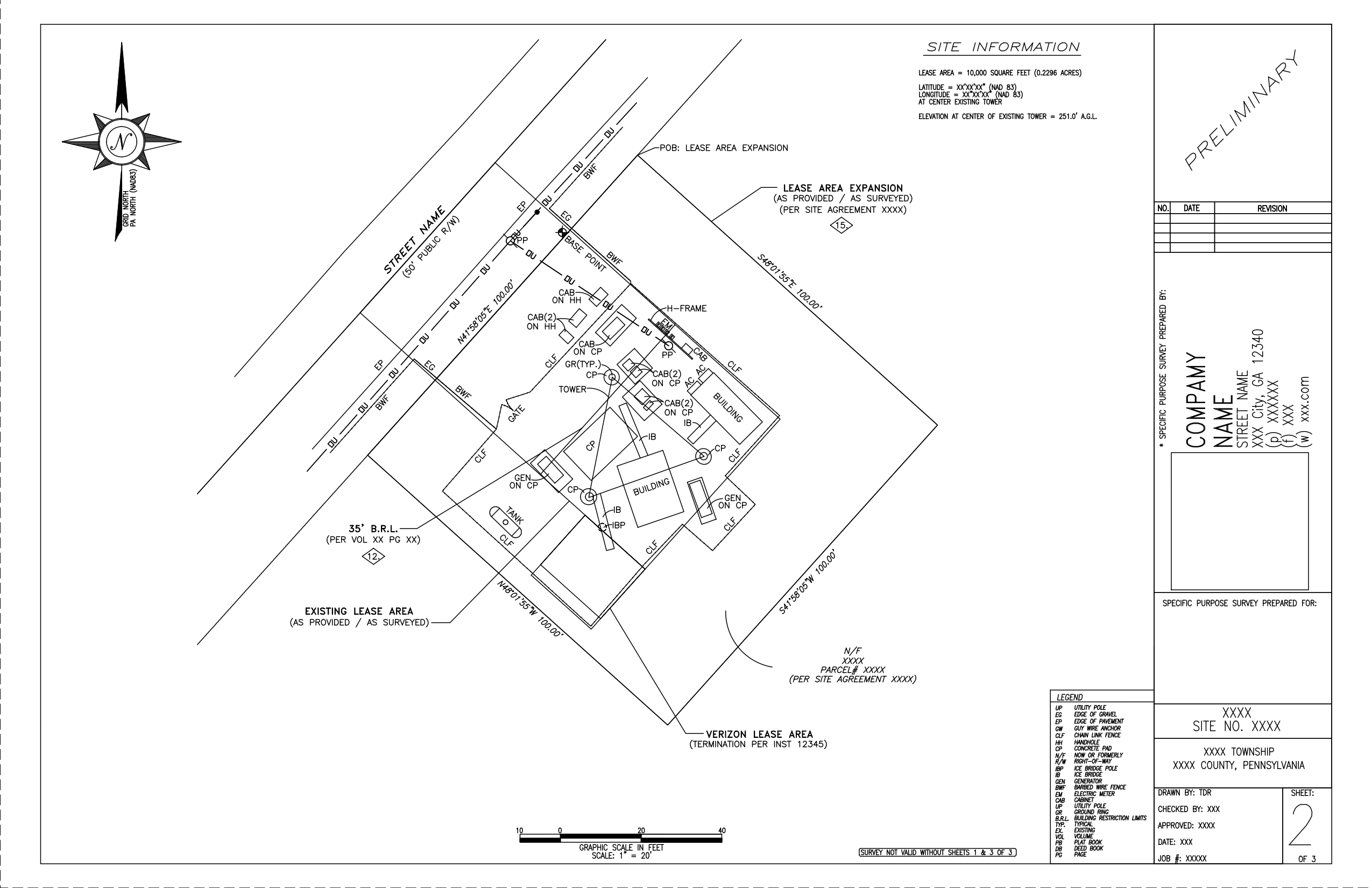
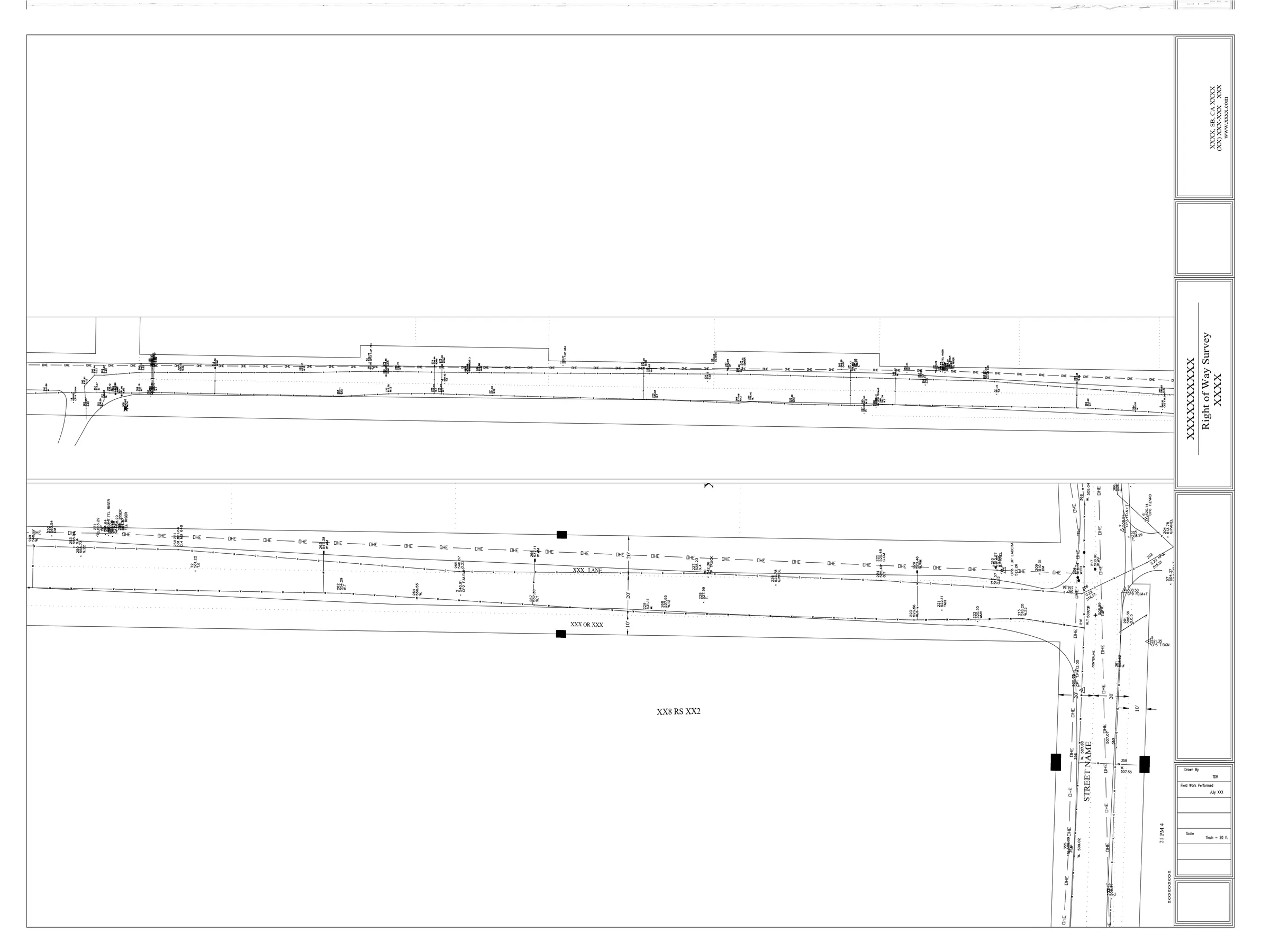
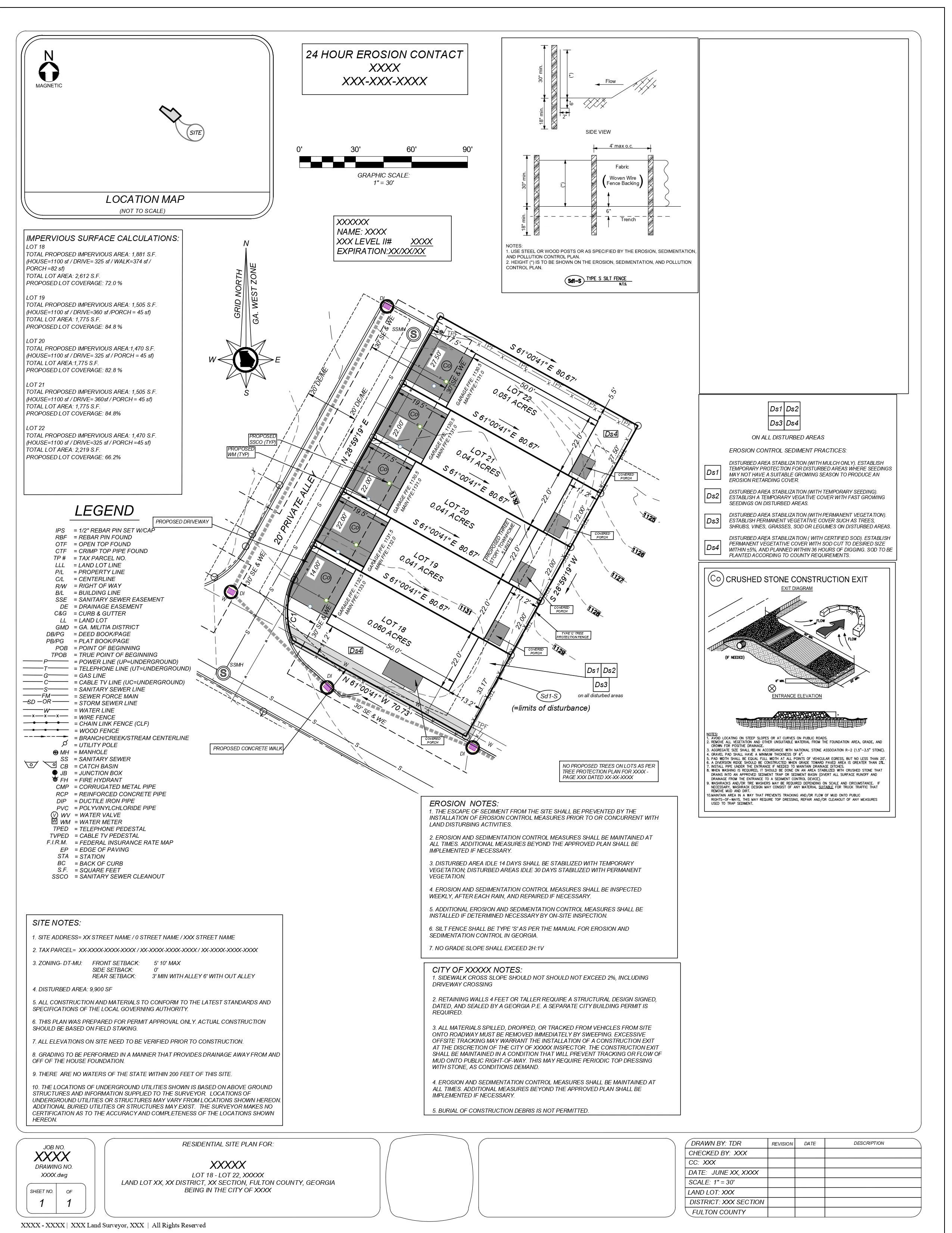
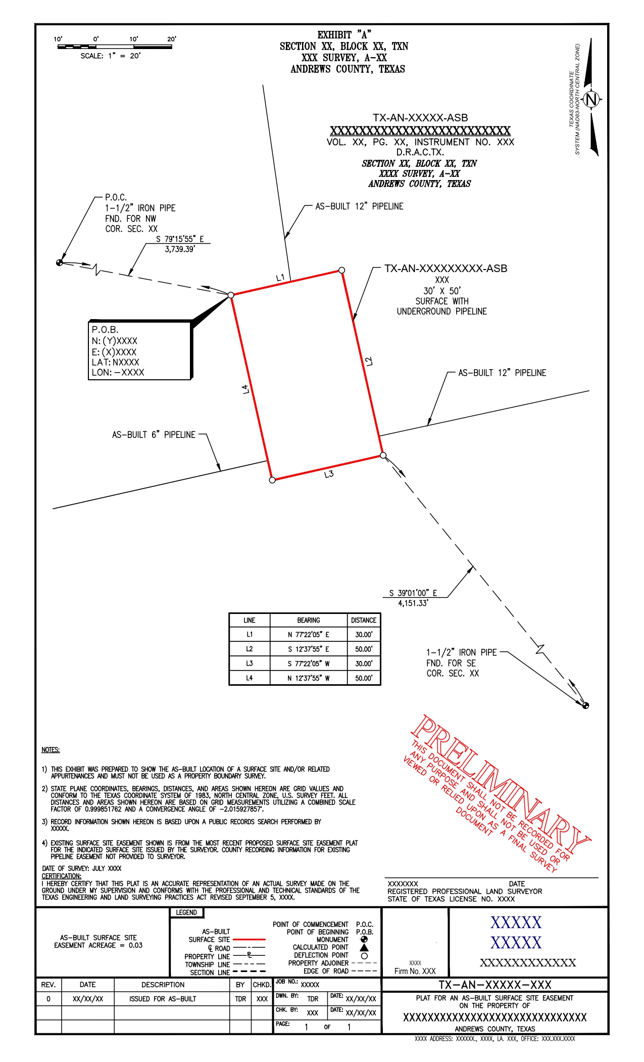
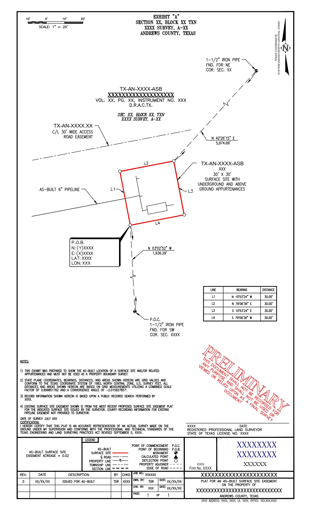
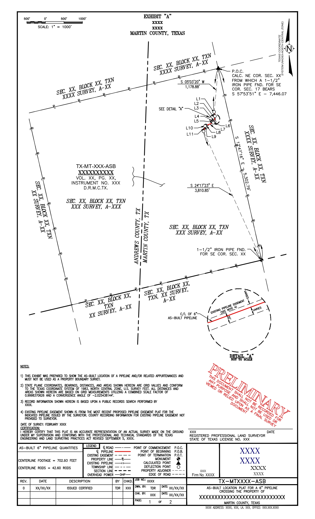
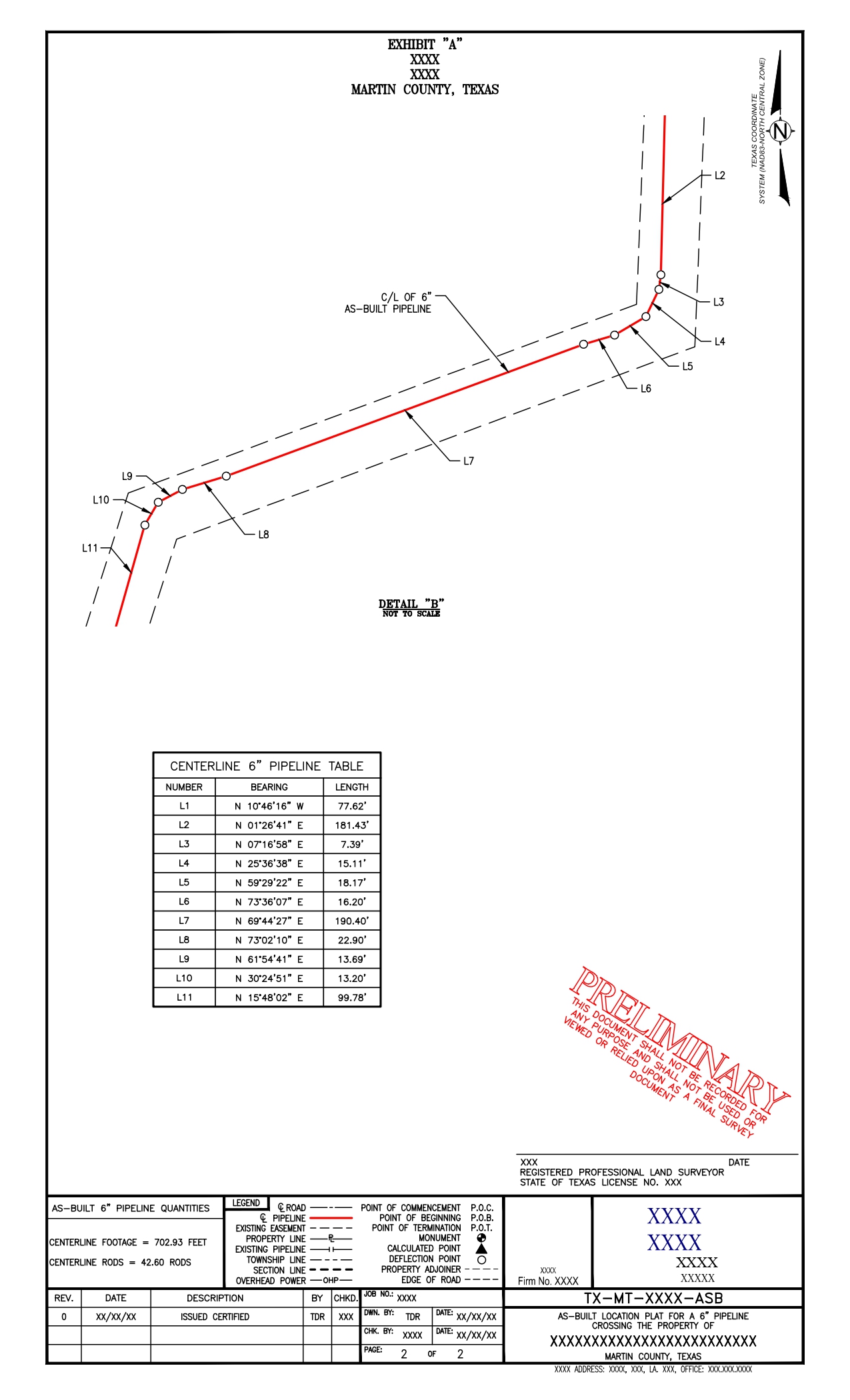
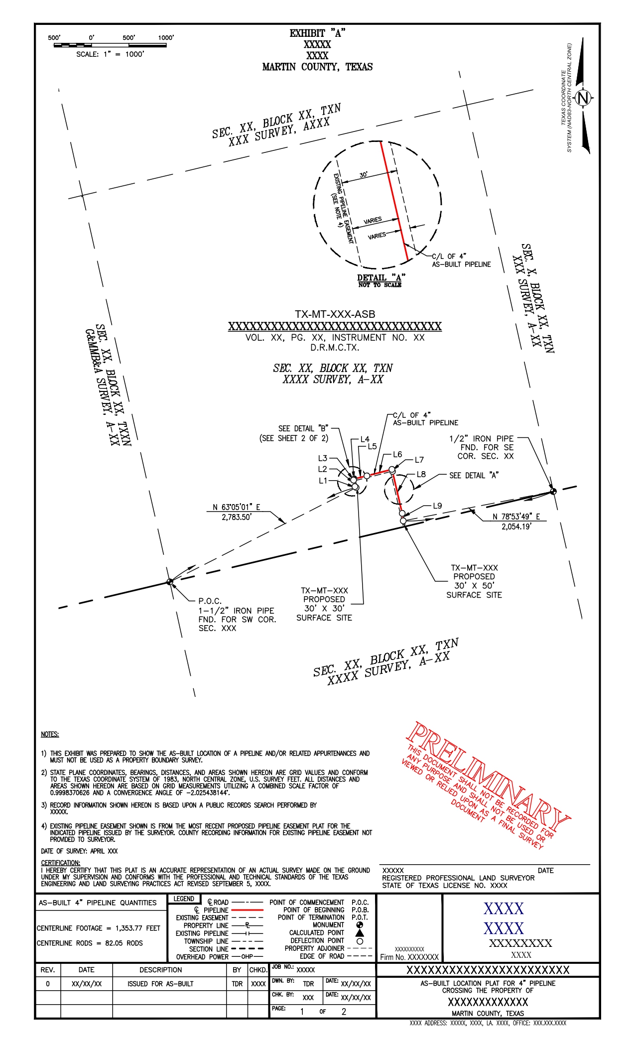
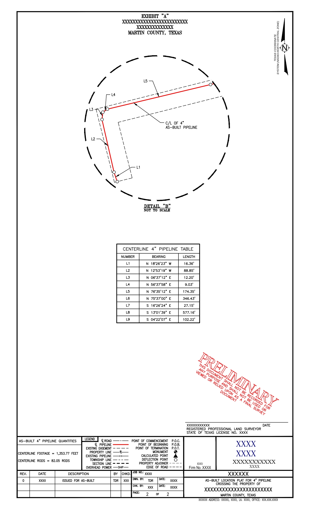
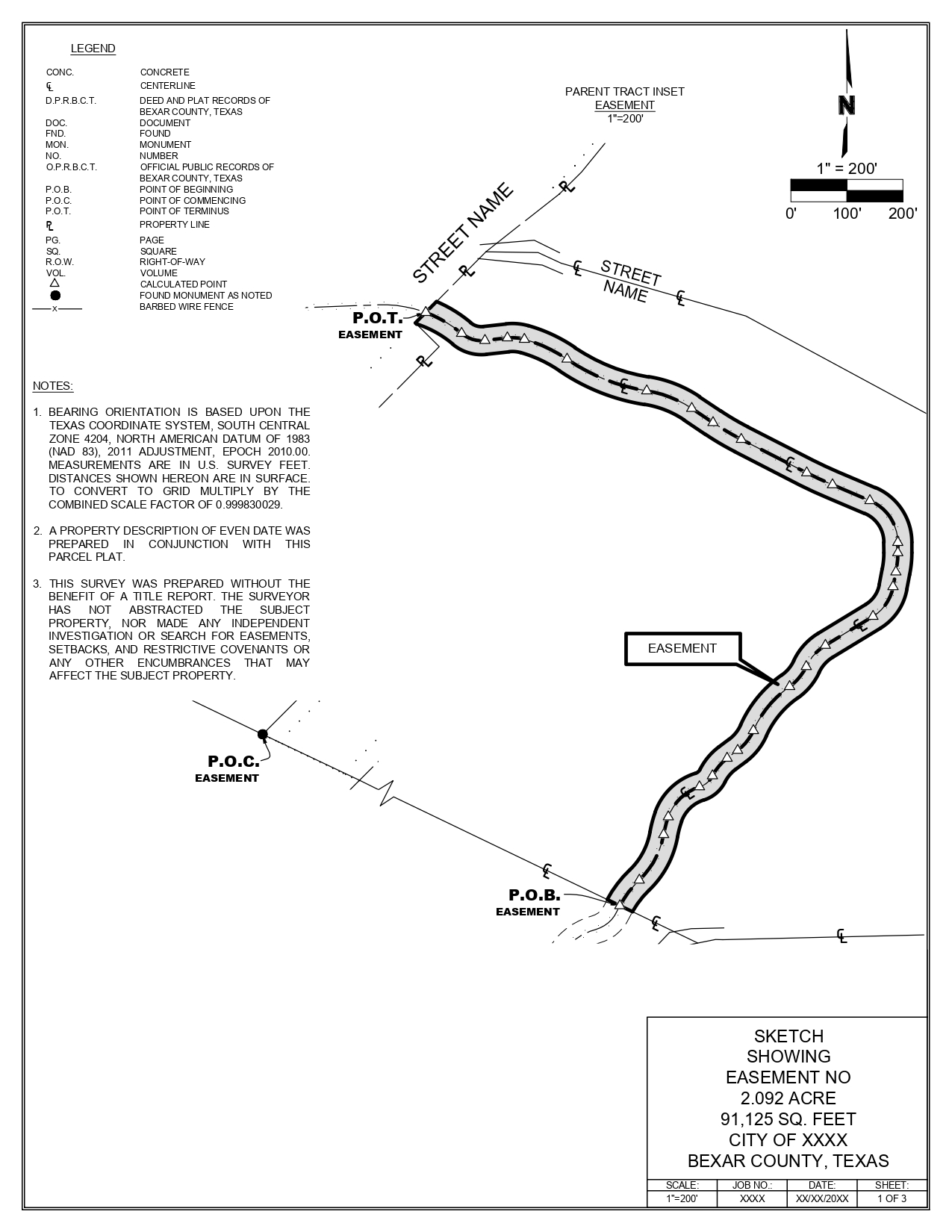
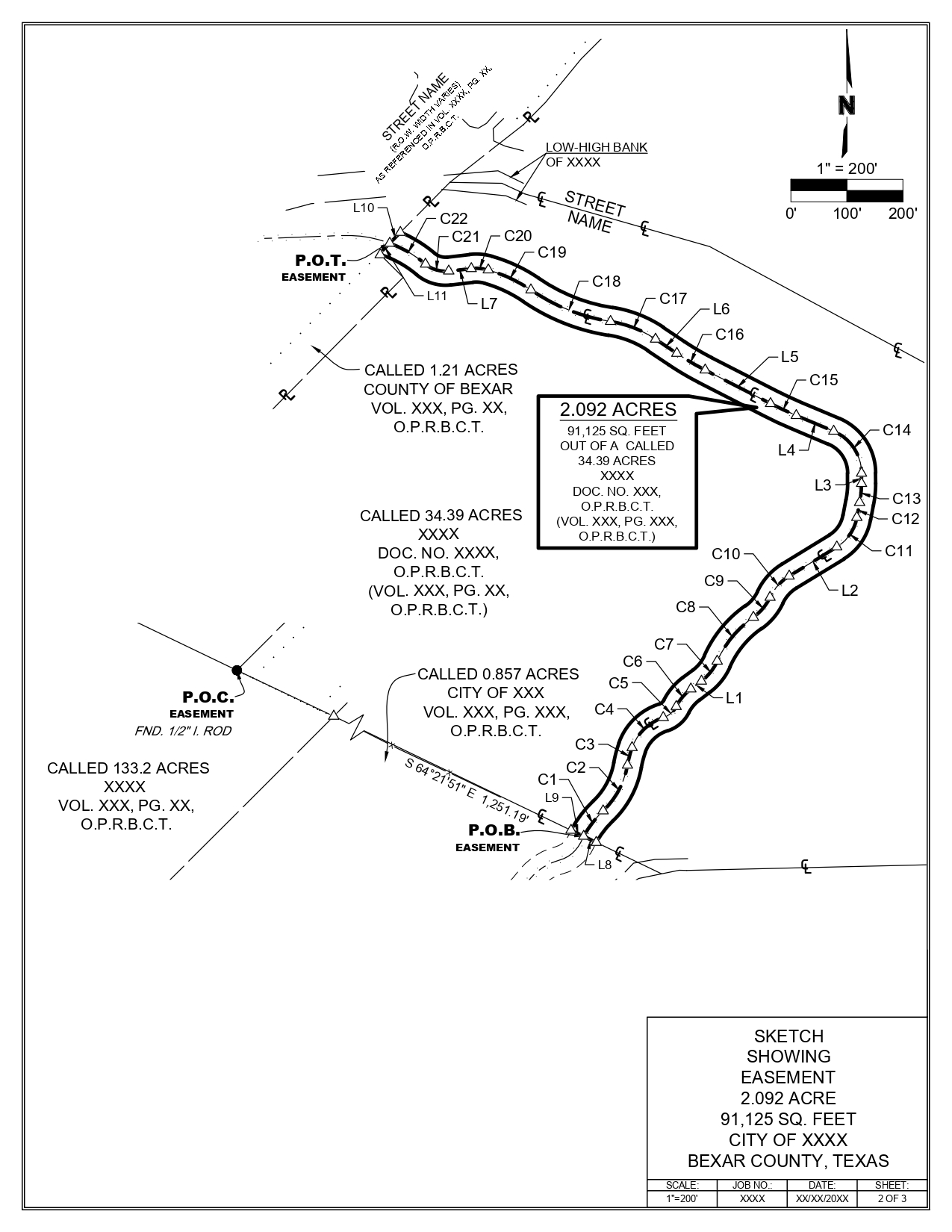
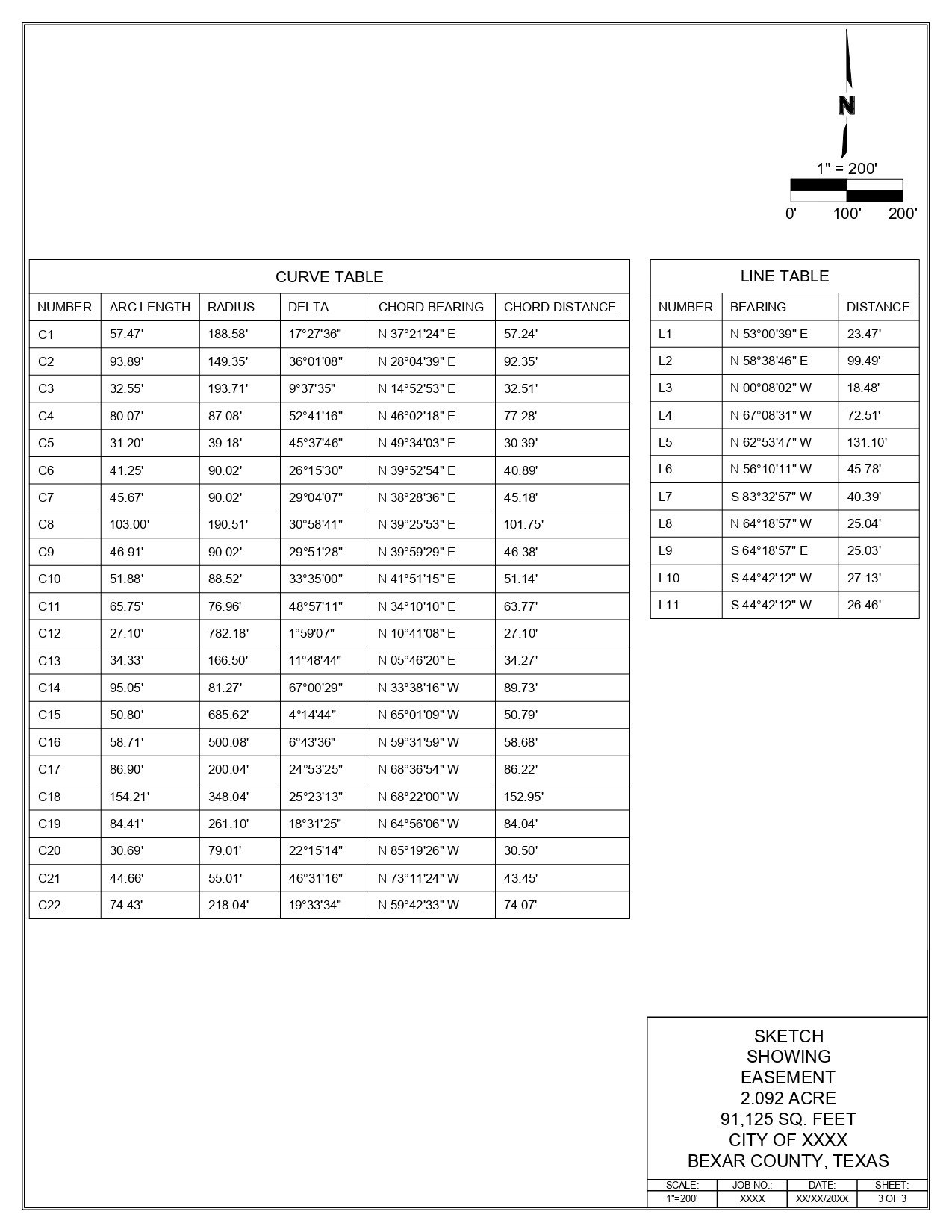
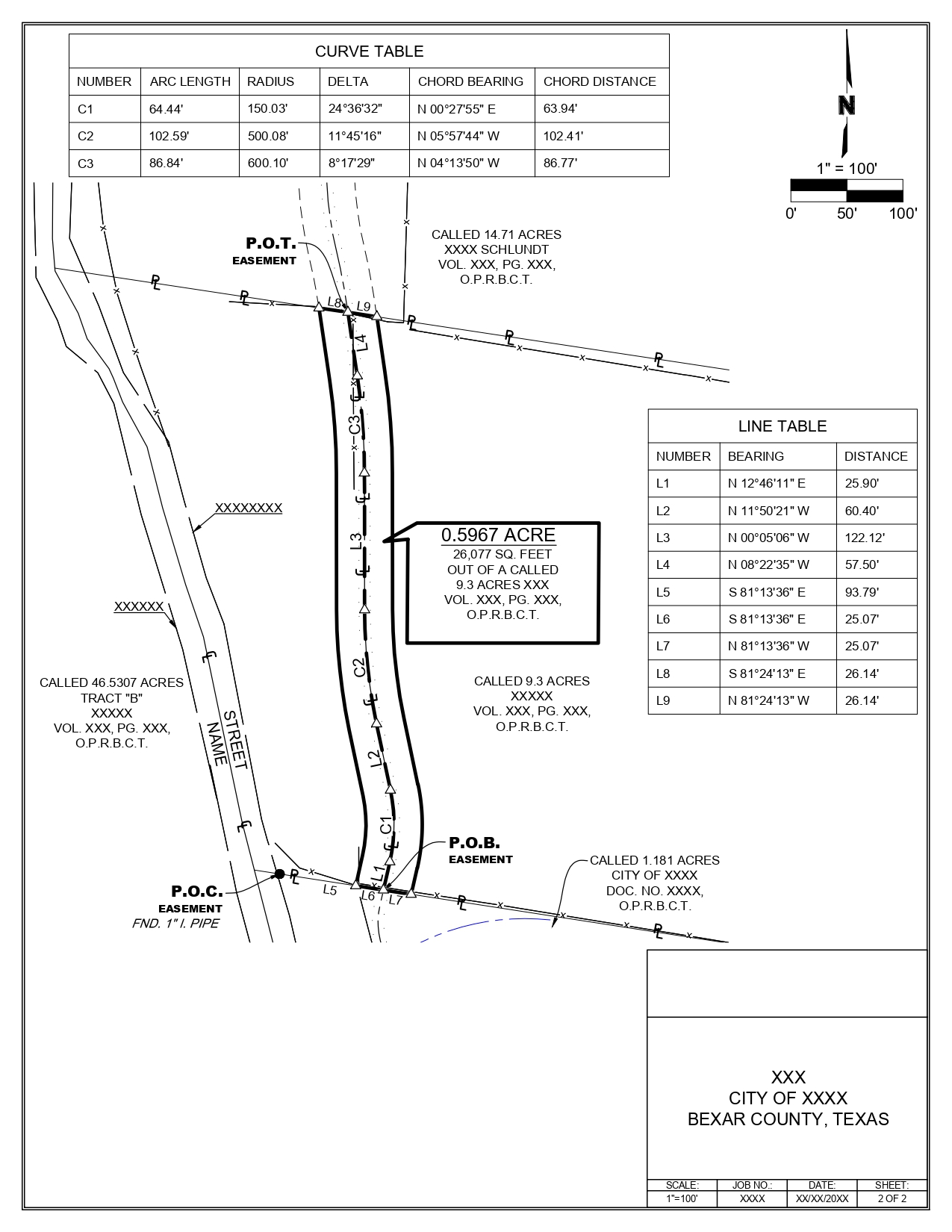
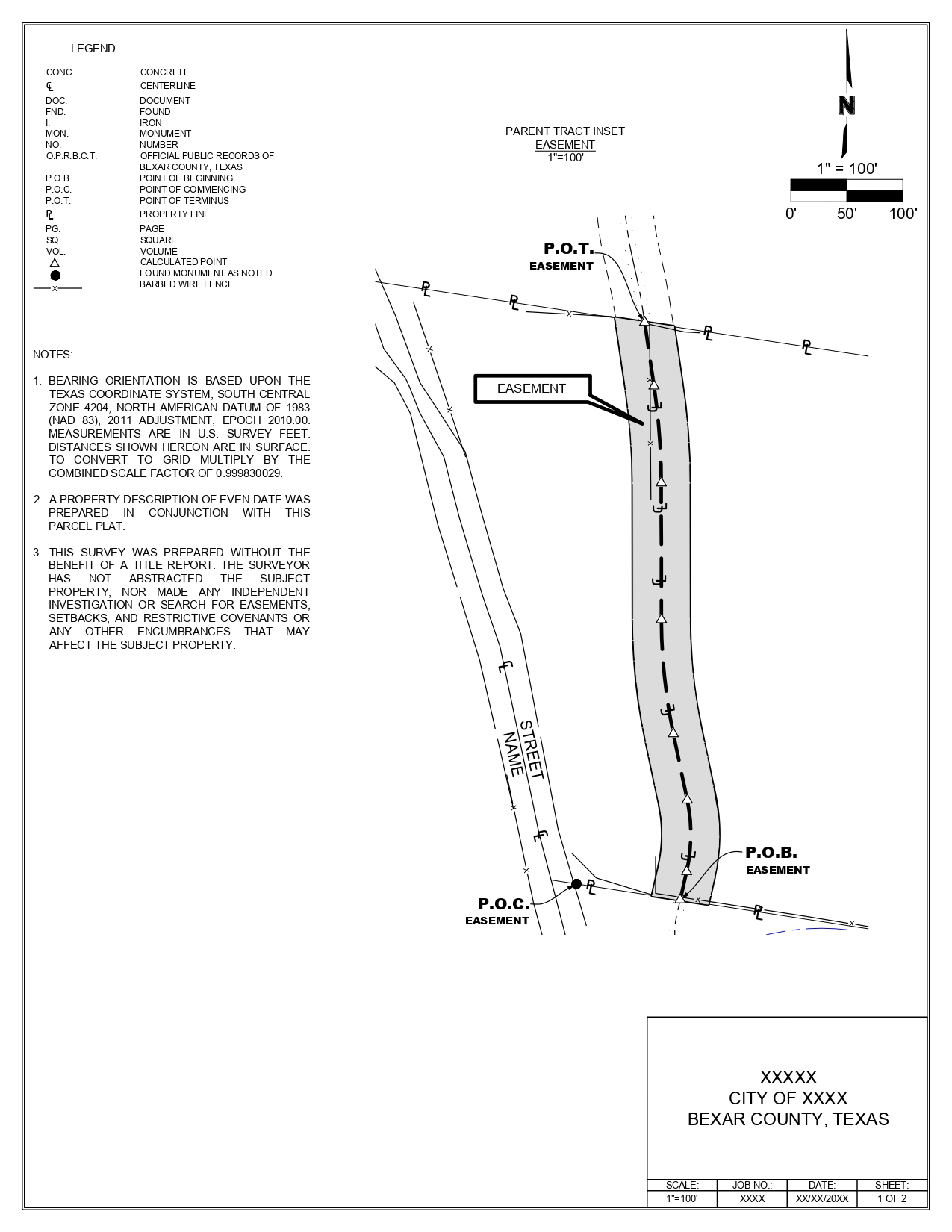
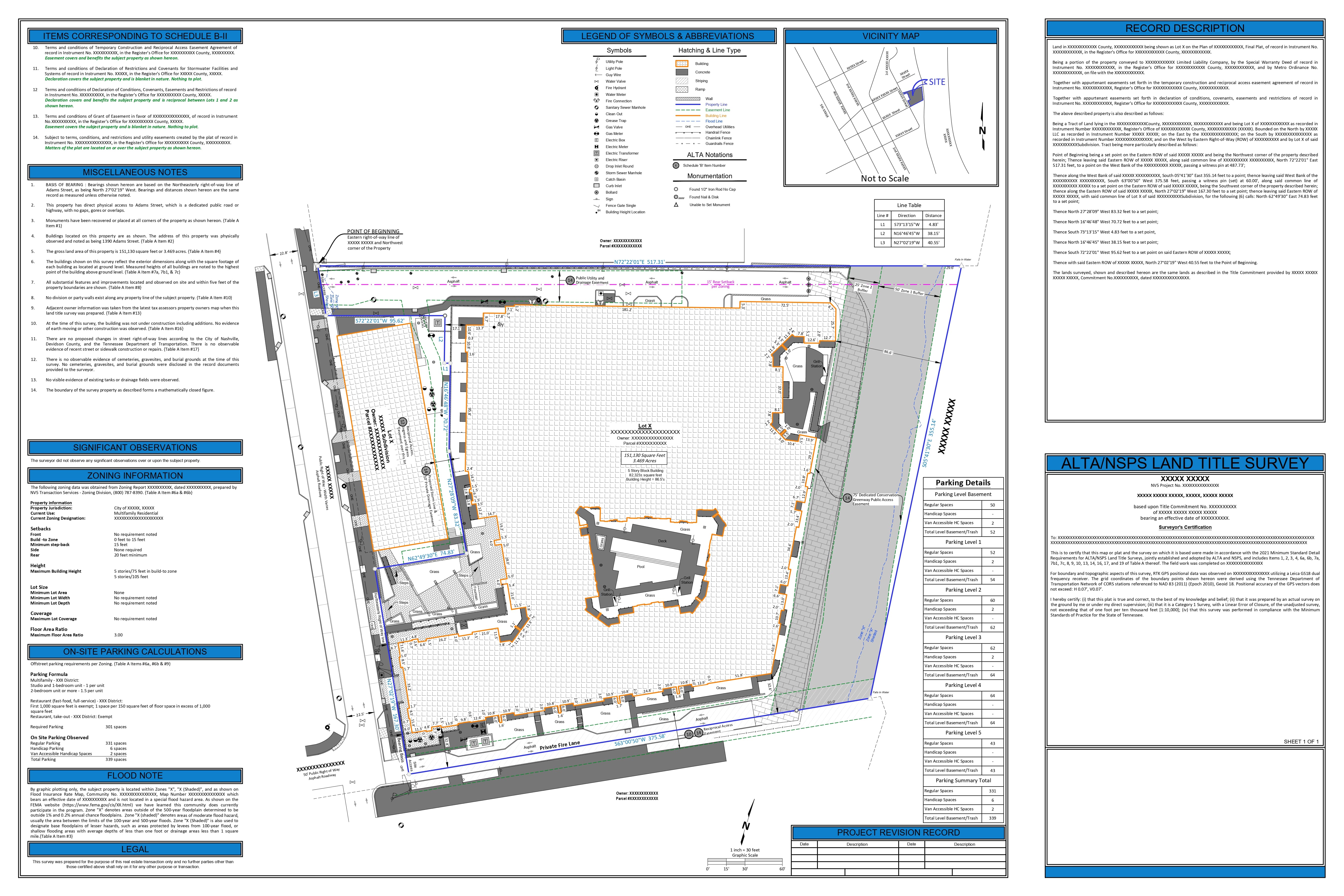
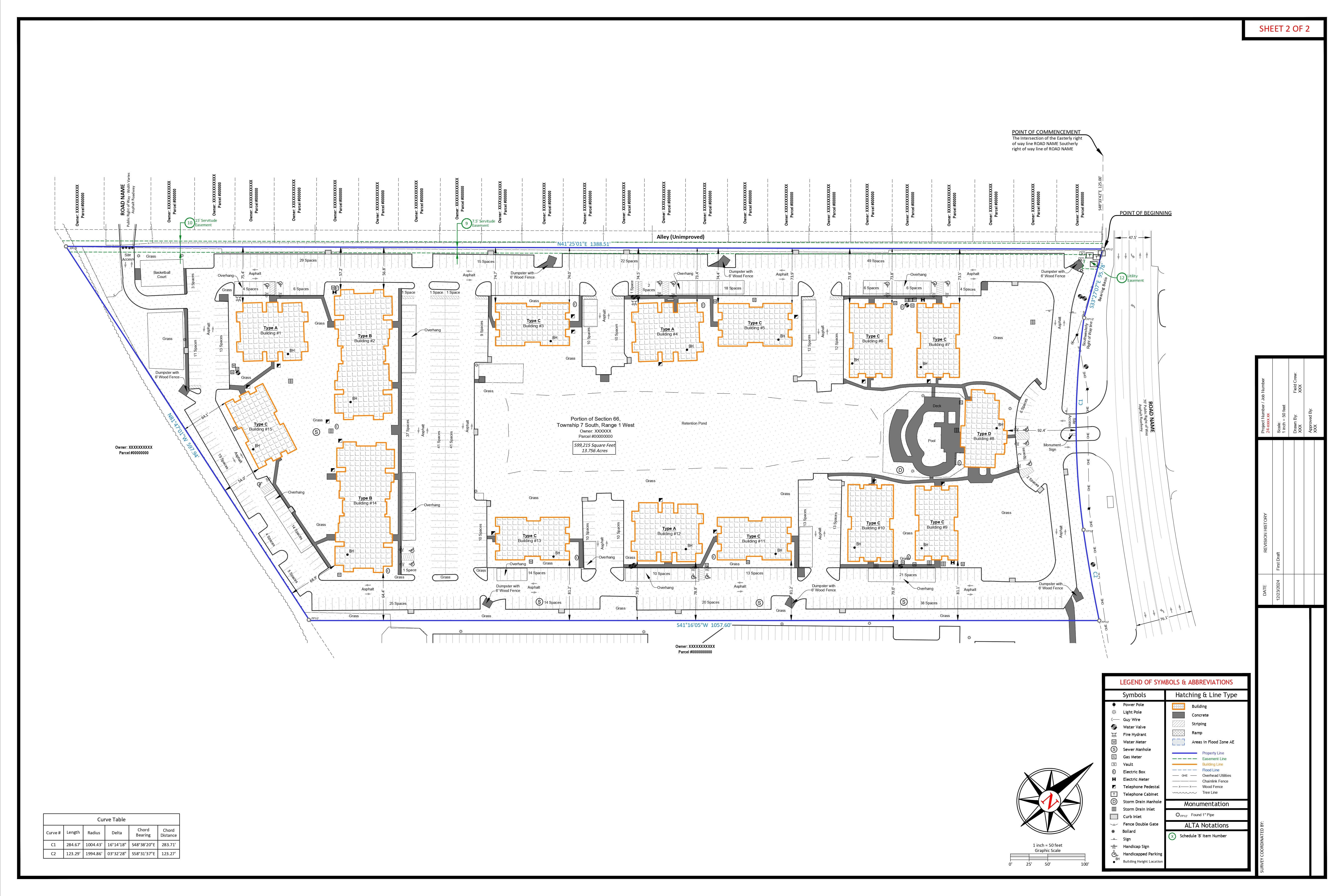
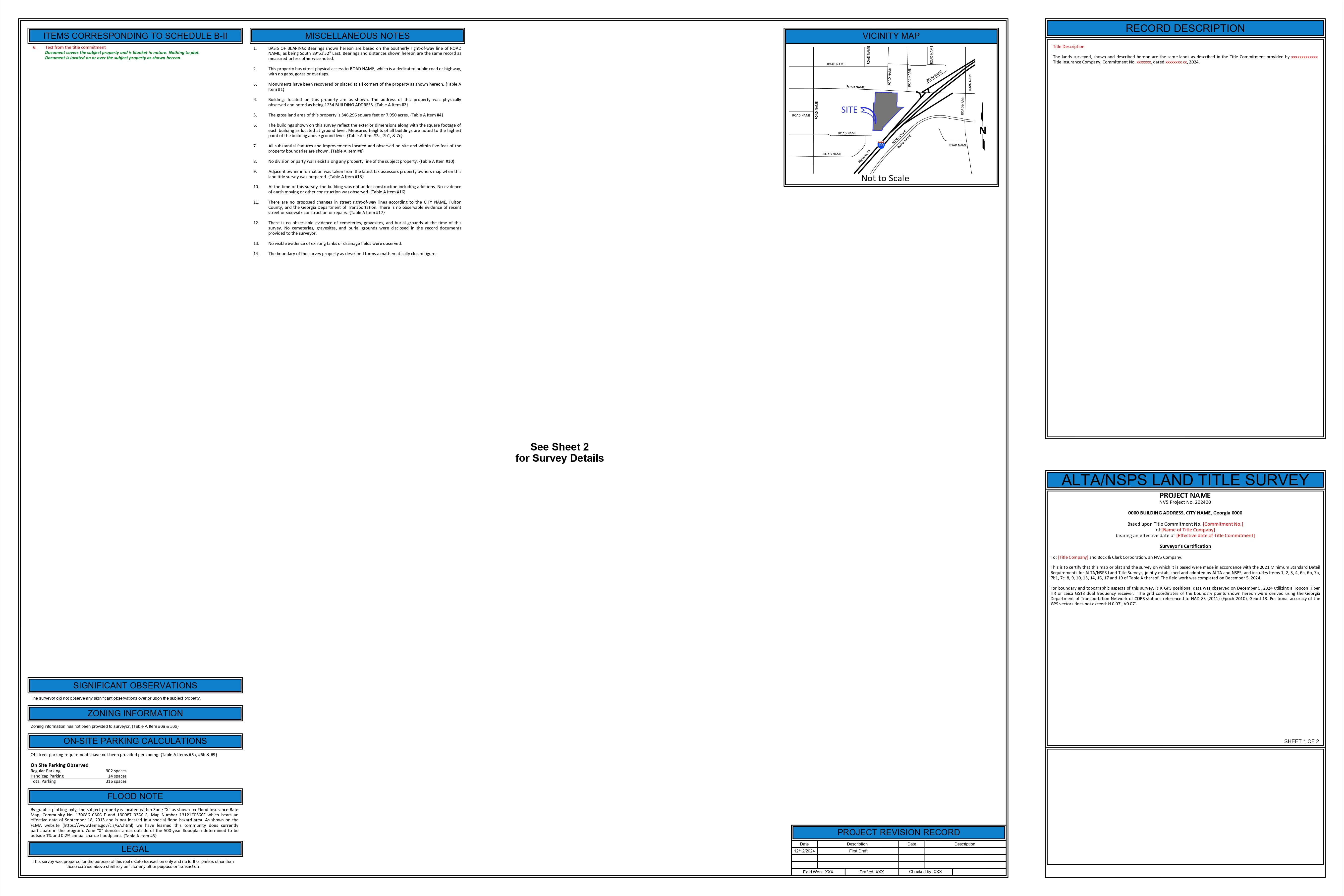
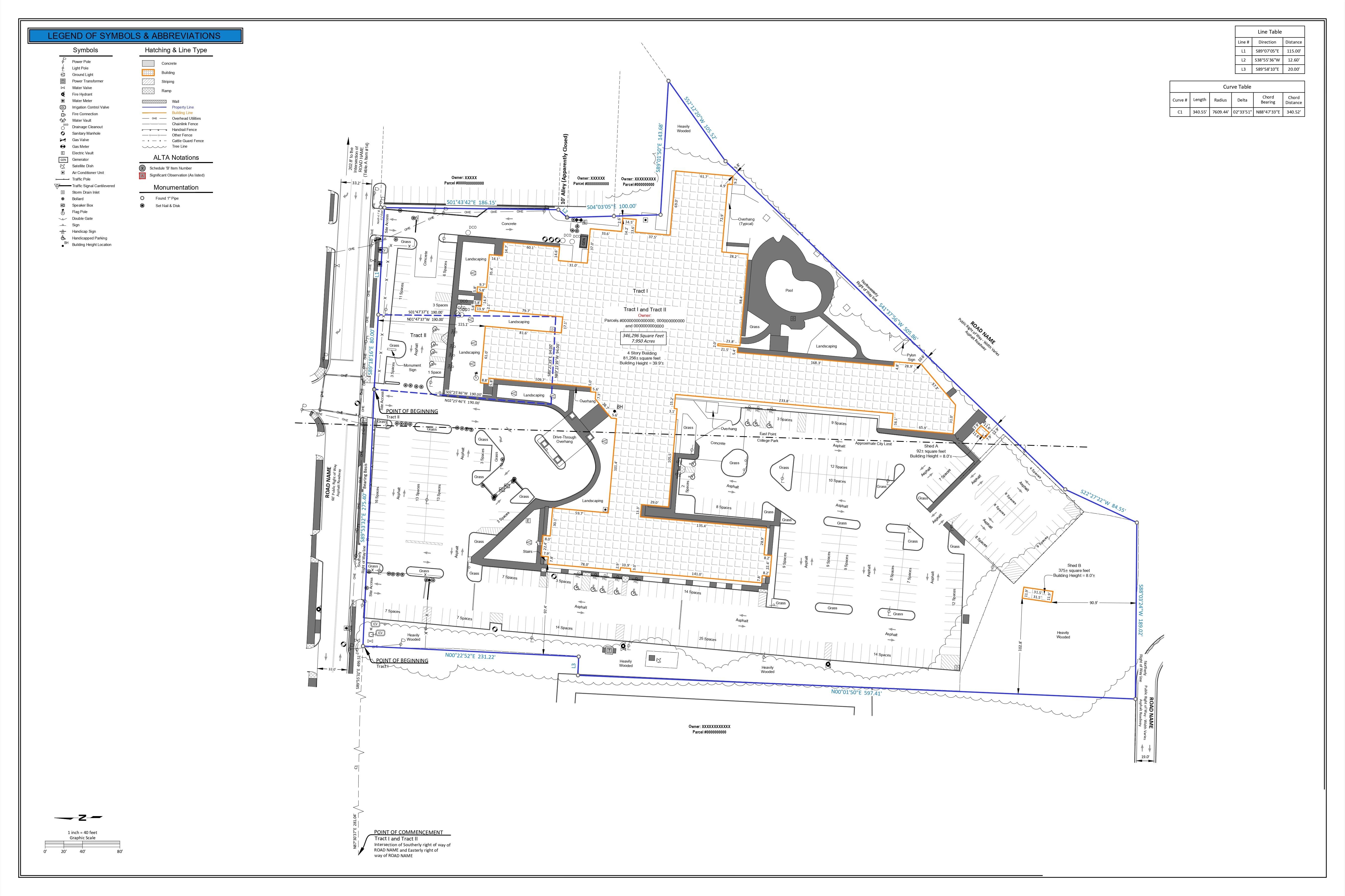
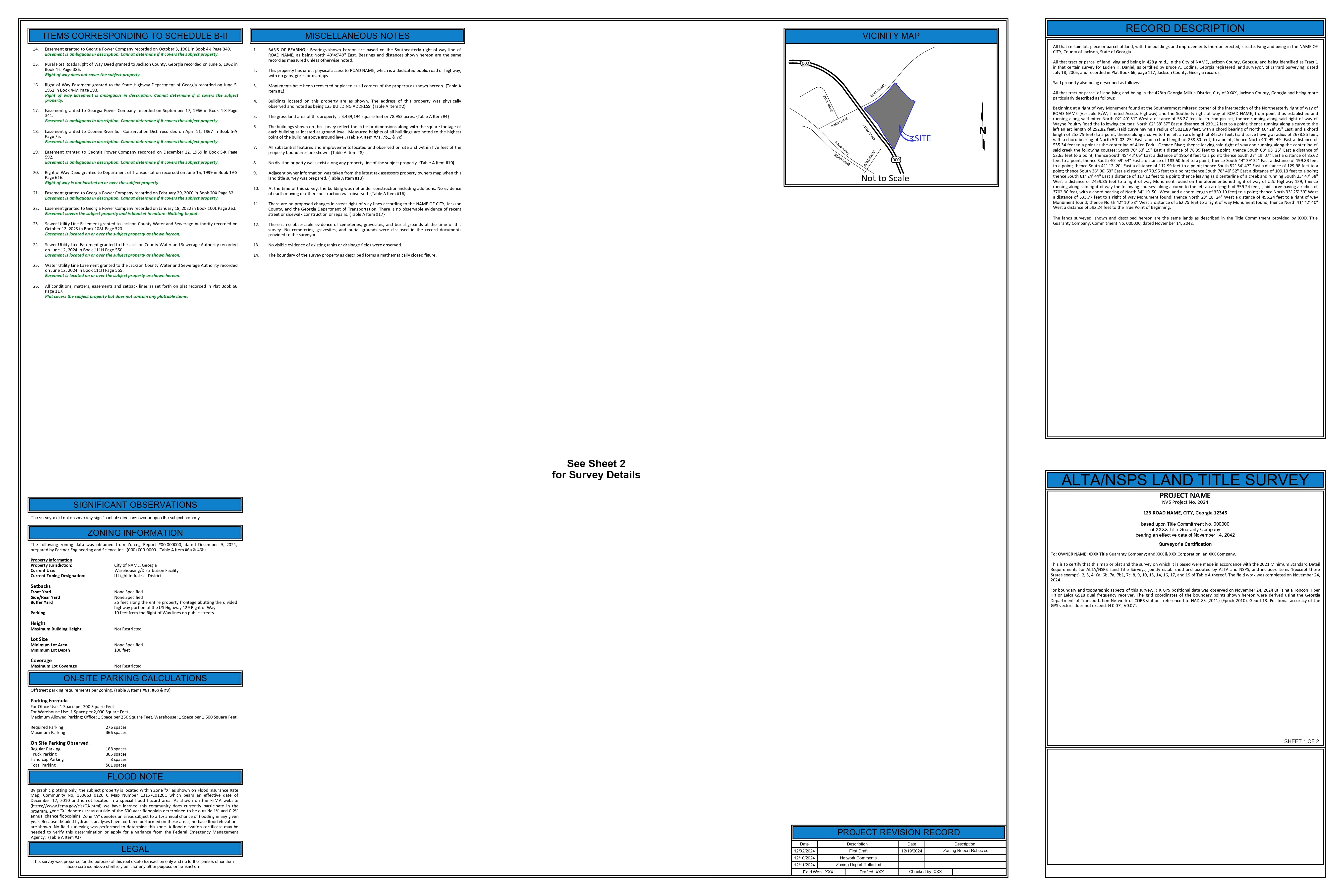
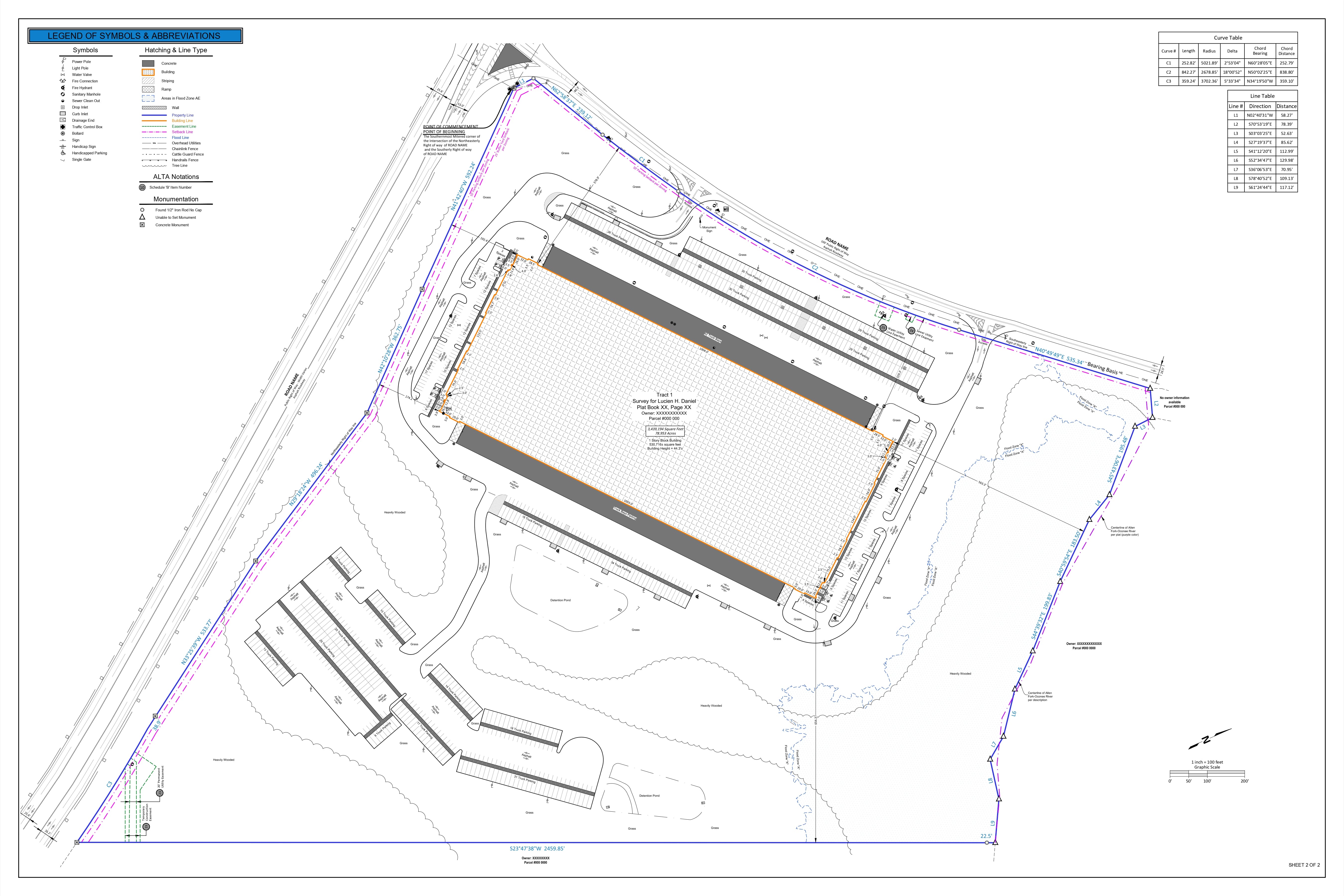
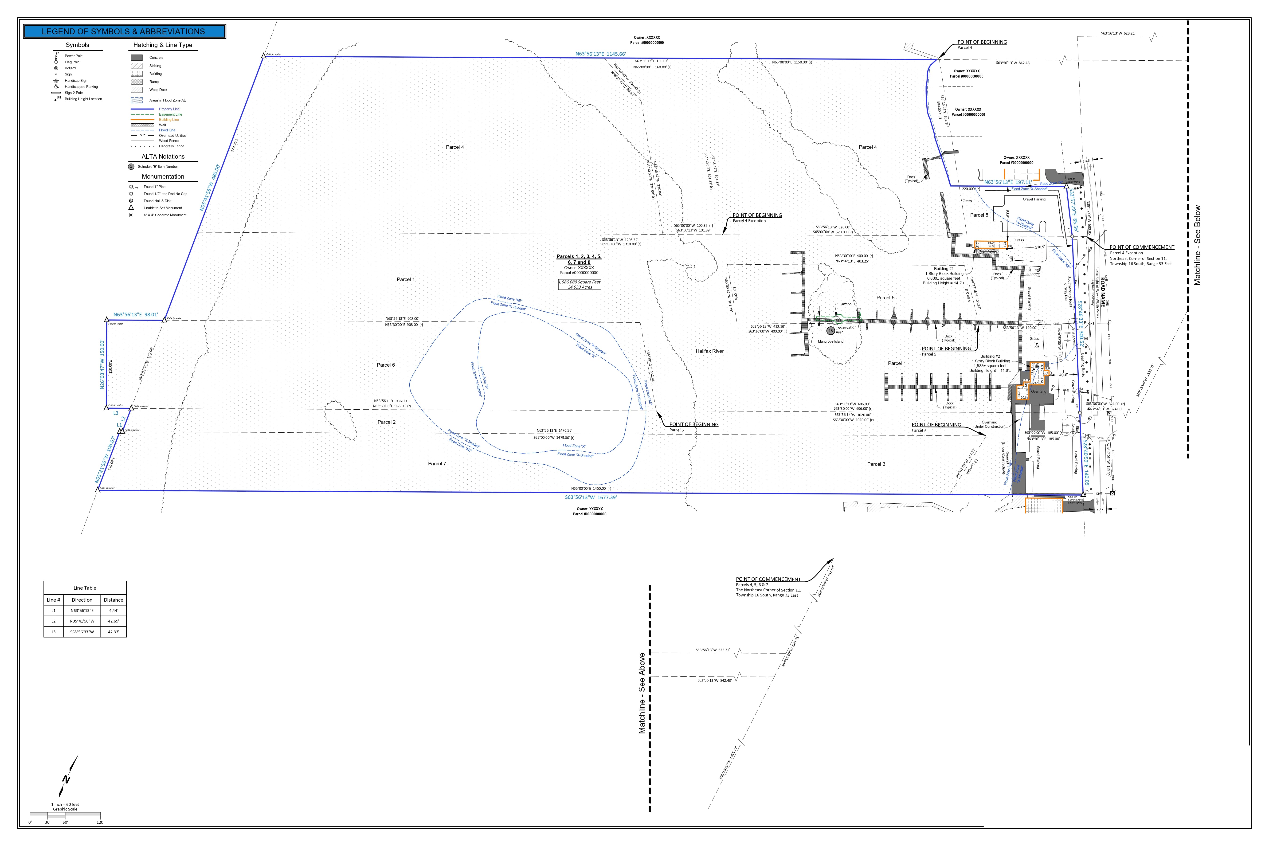
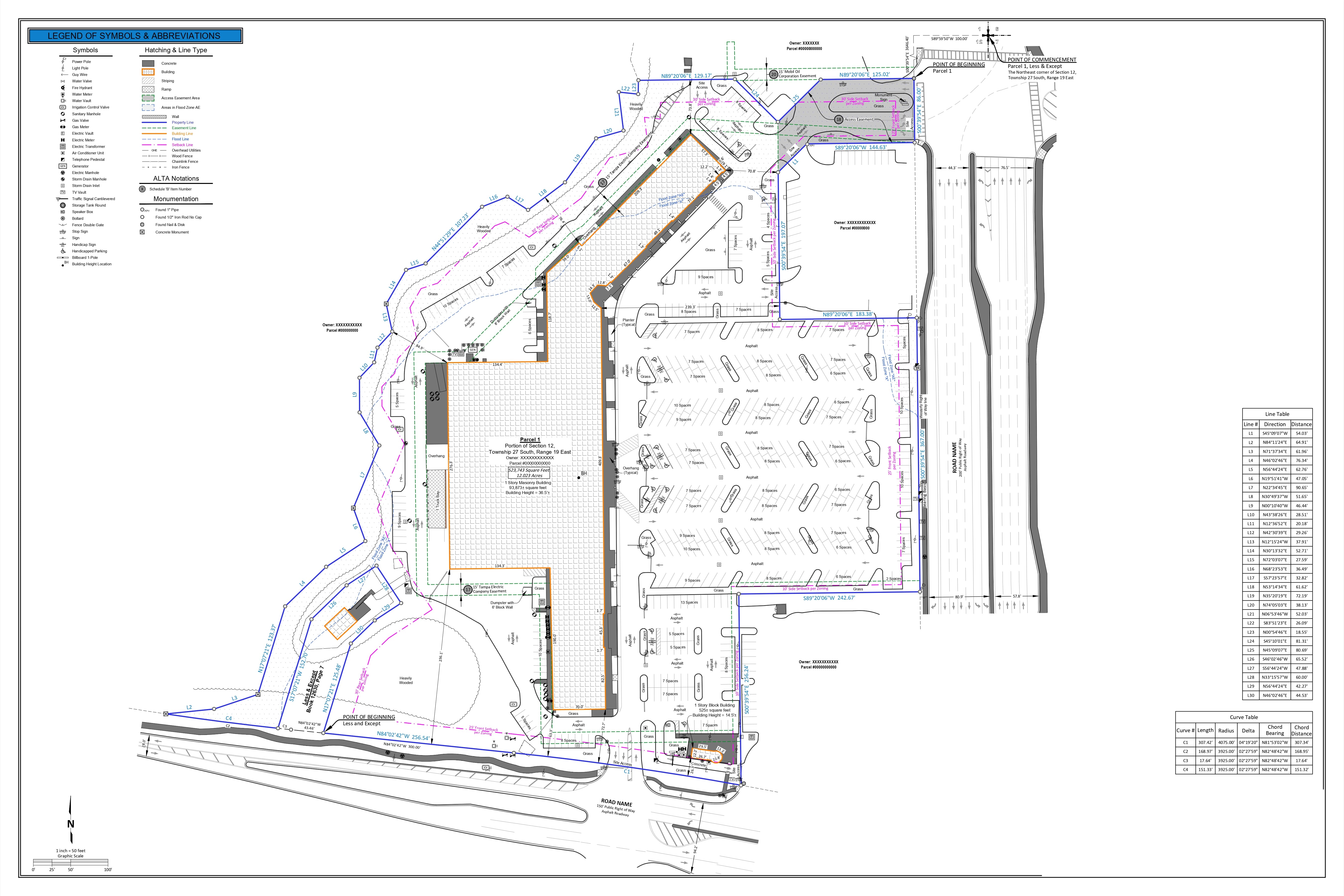
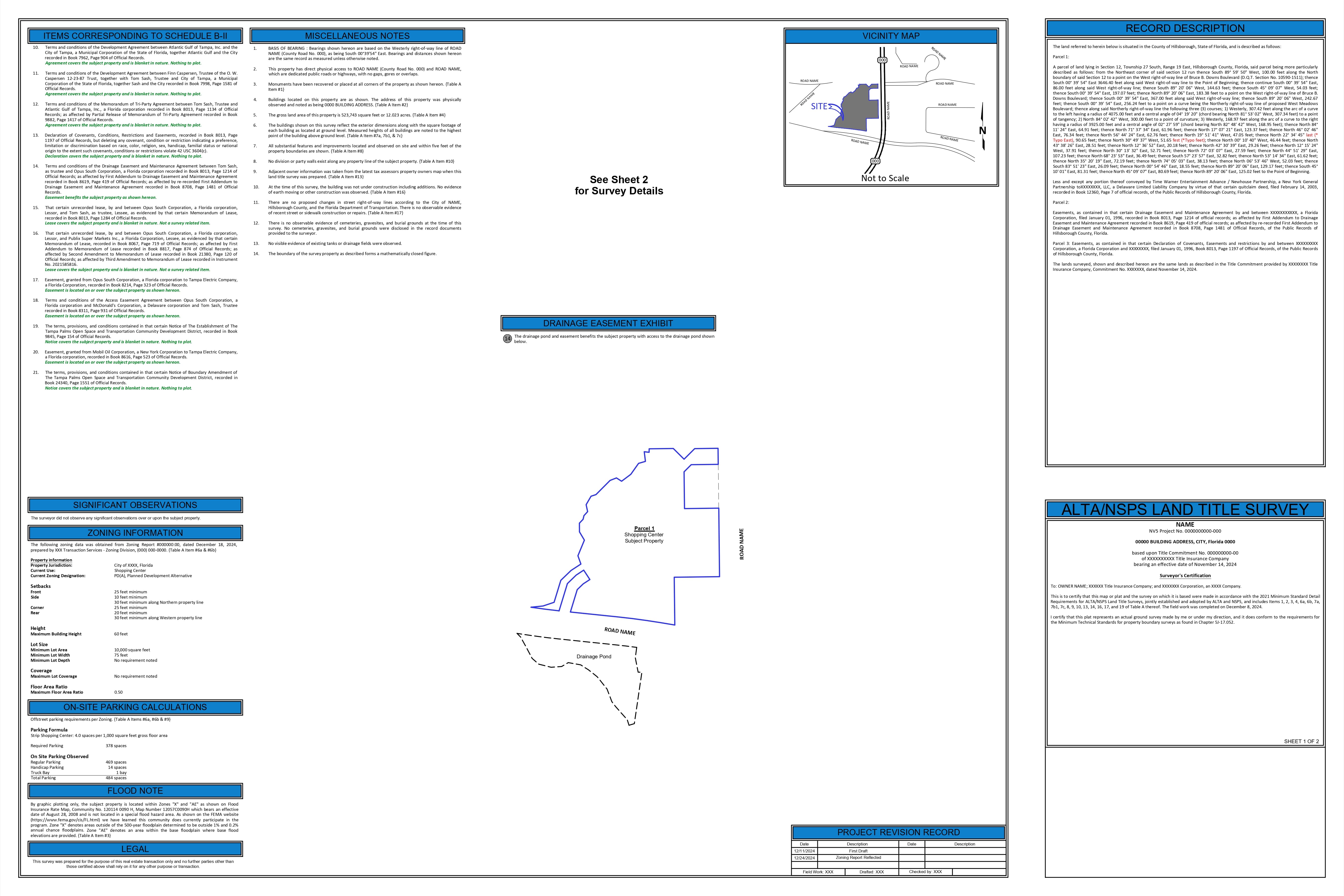
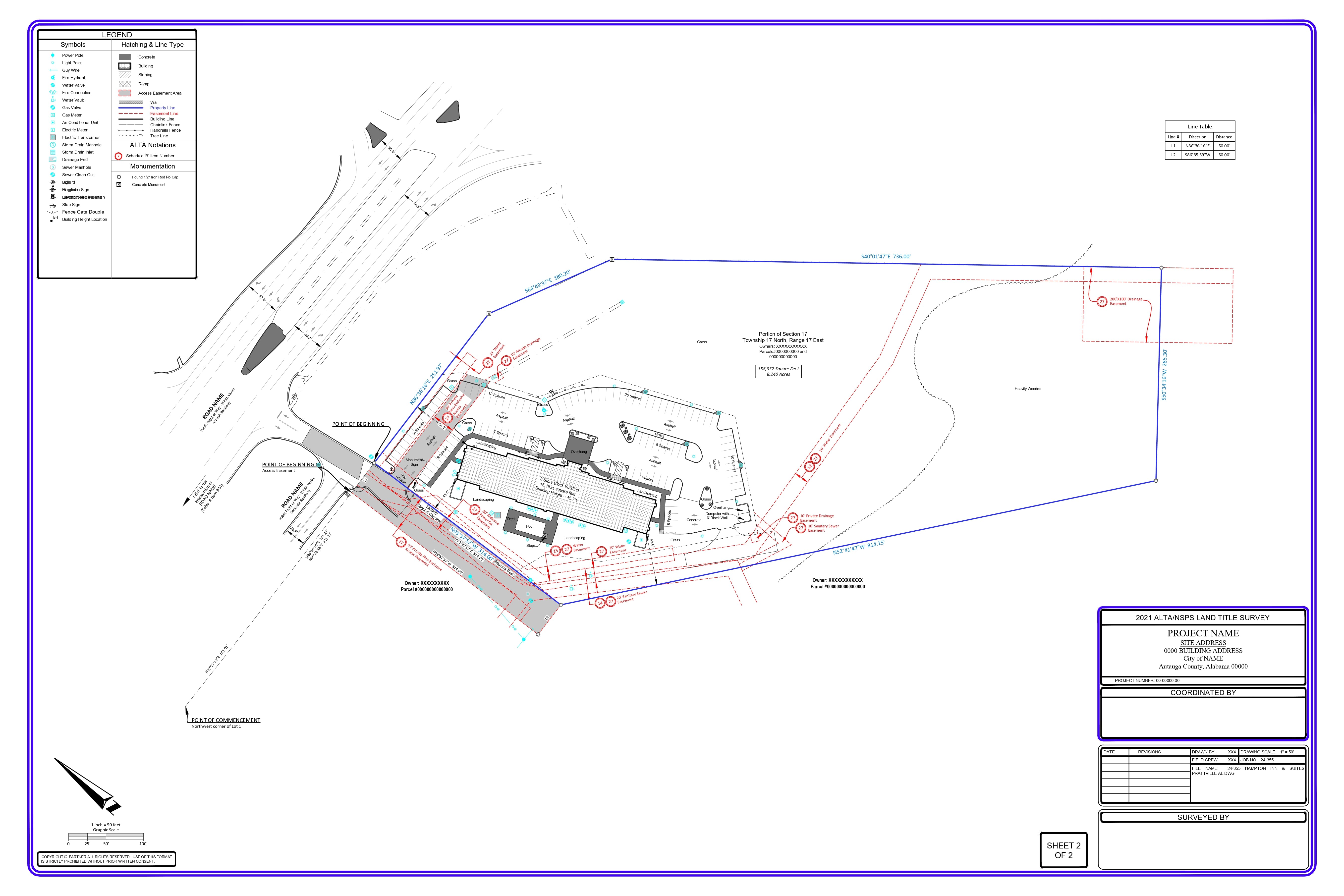
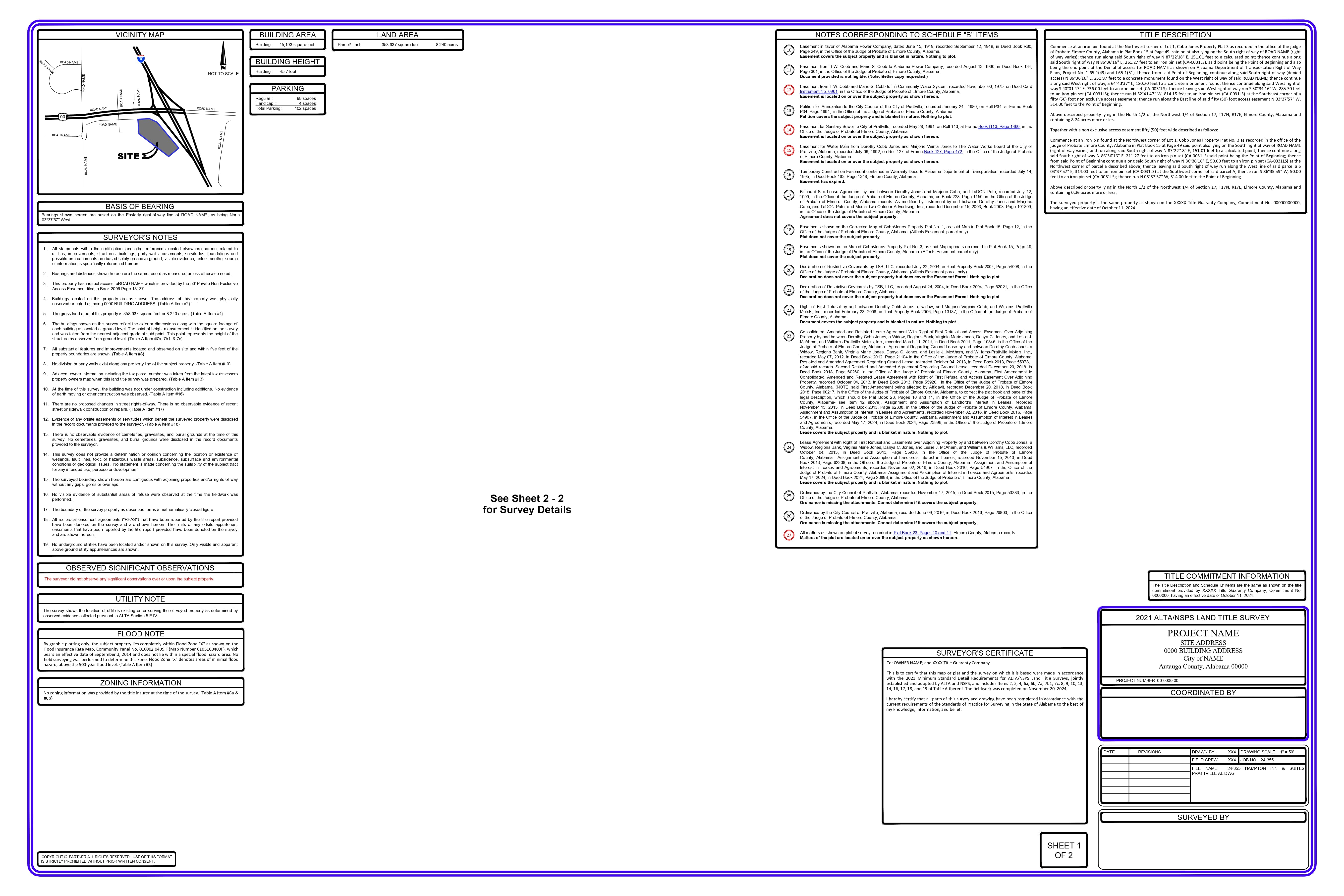
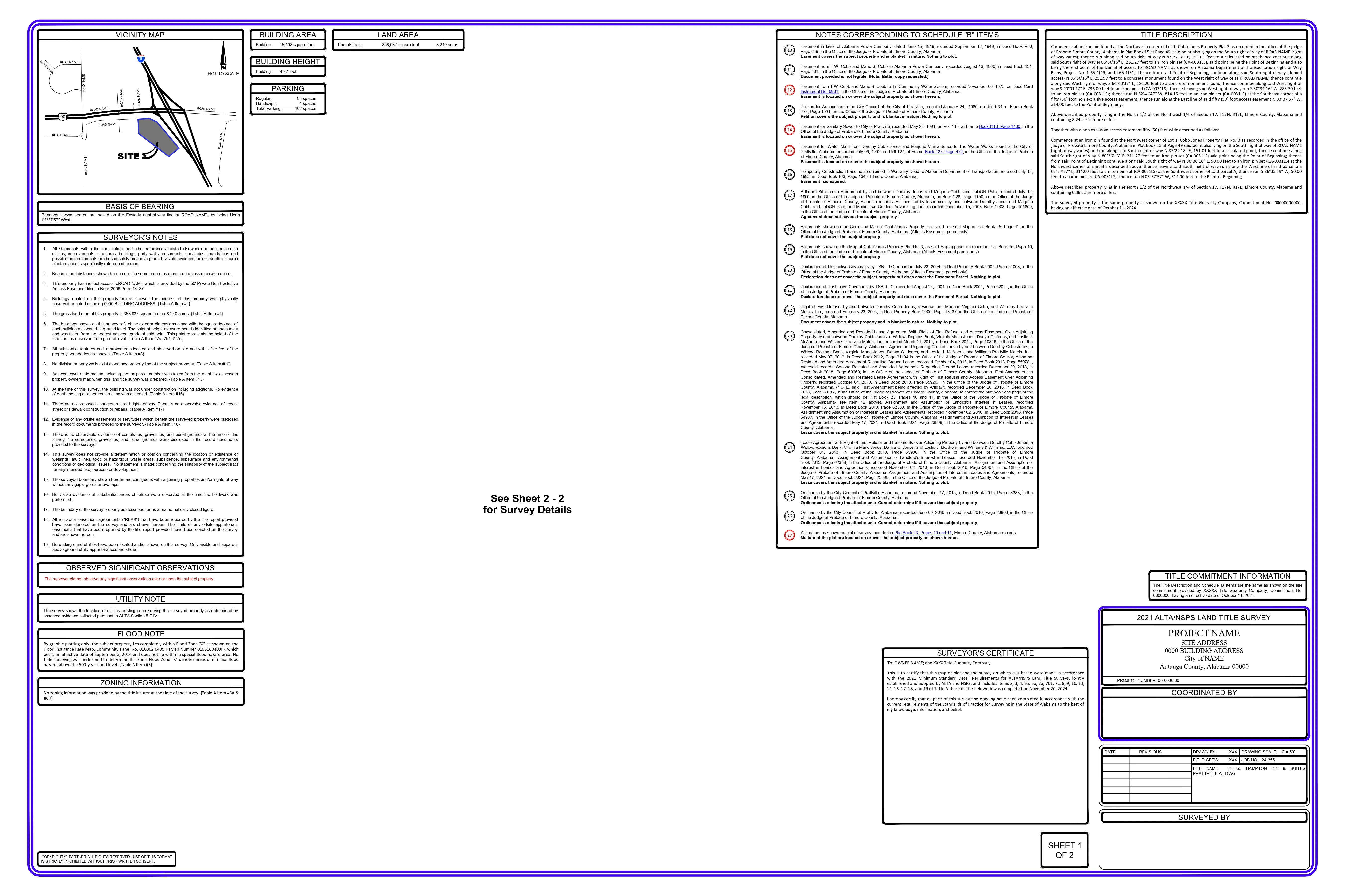
The foundation block of a cadastre is the cadastral plan (or survey plan). This is produced by a registered surveyor who measures each property.


TheDraftRack © 2025
We seek to take the expertise acquired over the years & keep working diligently to adapt ourselves to the growing demands of the ever-so-changing AEC industry. The process is to learn – replicate – learn – replicate.