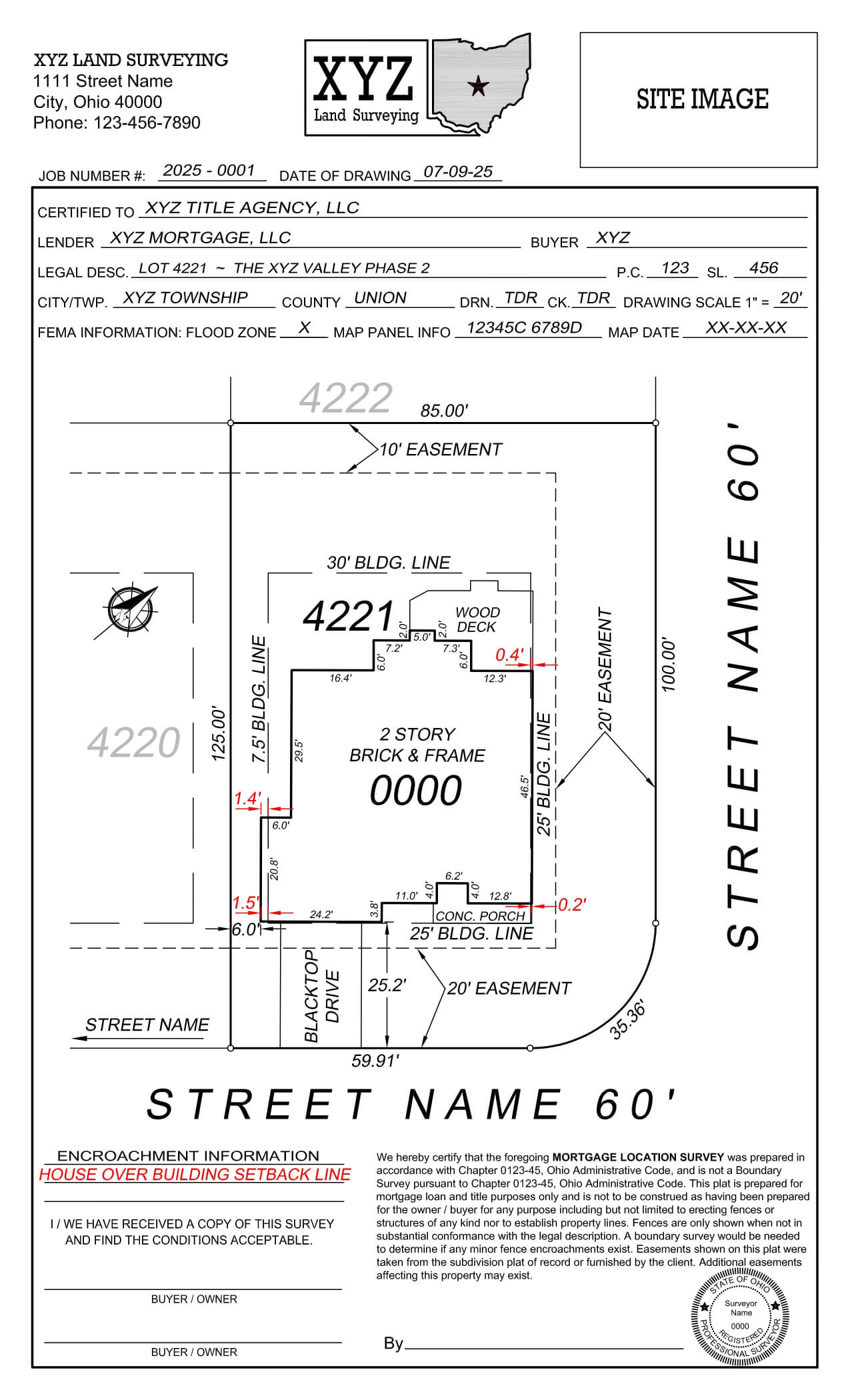
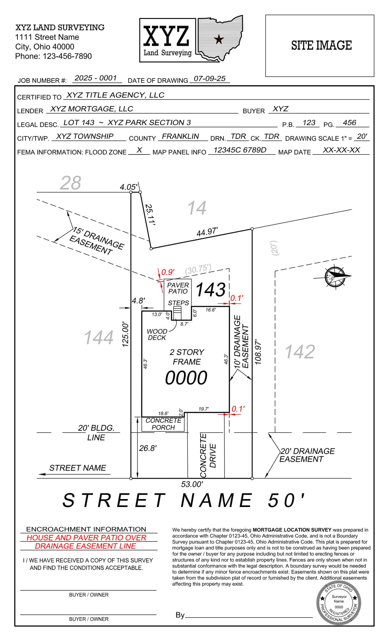
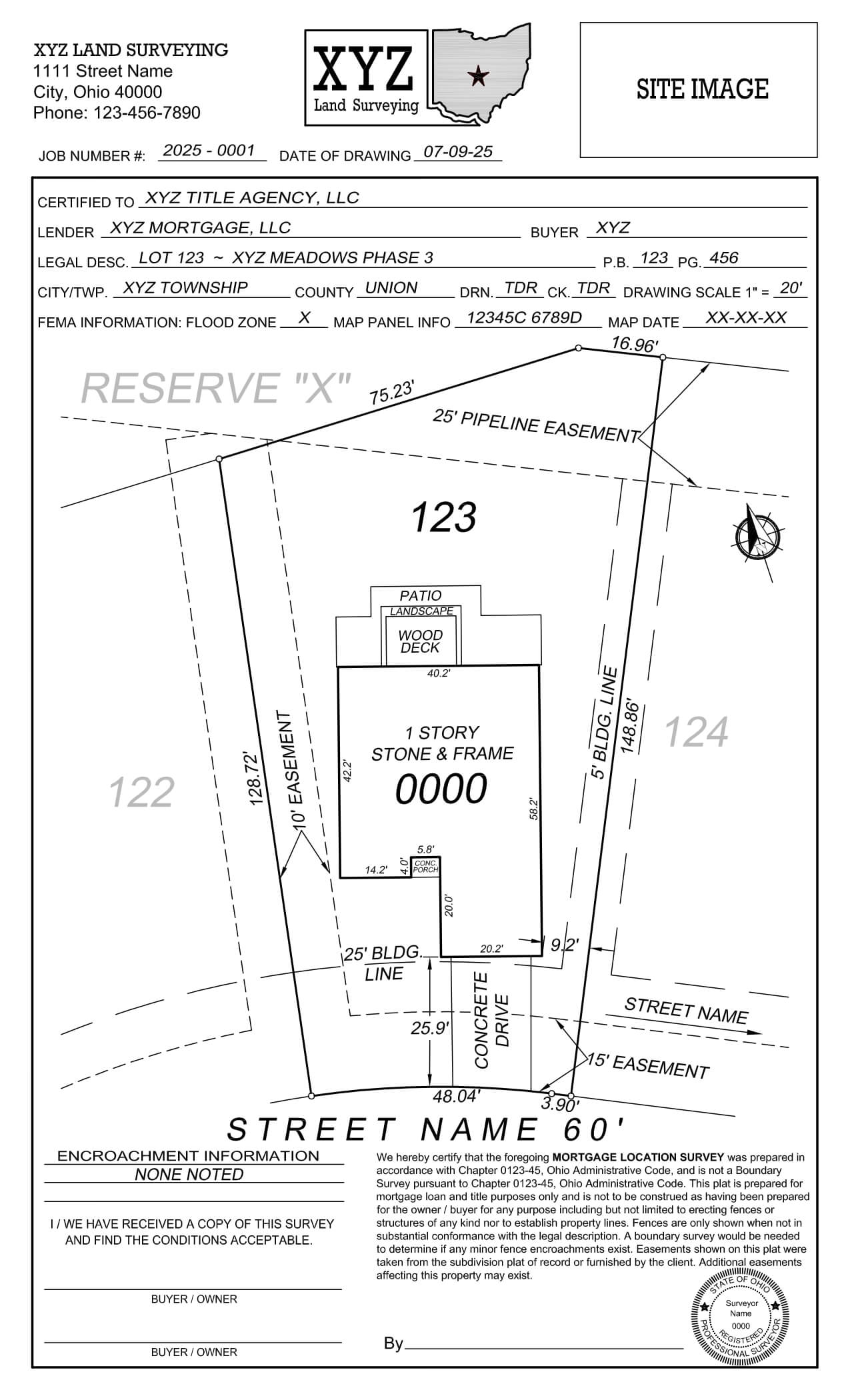
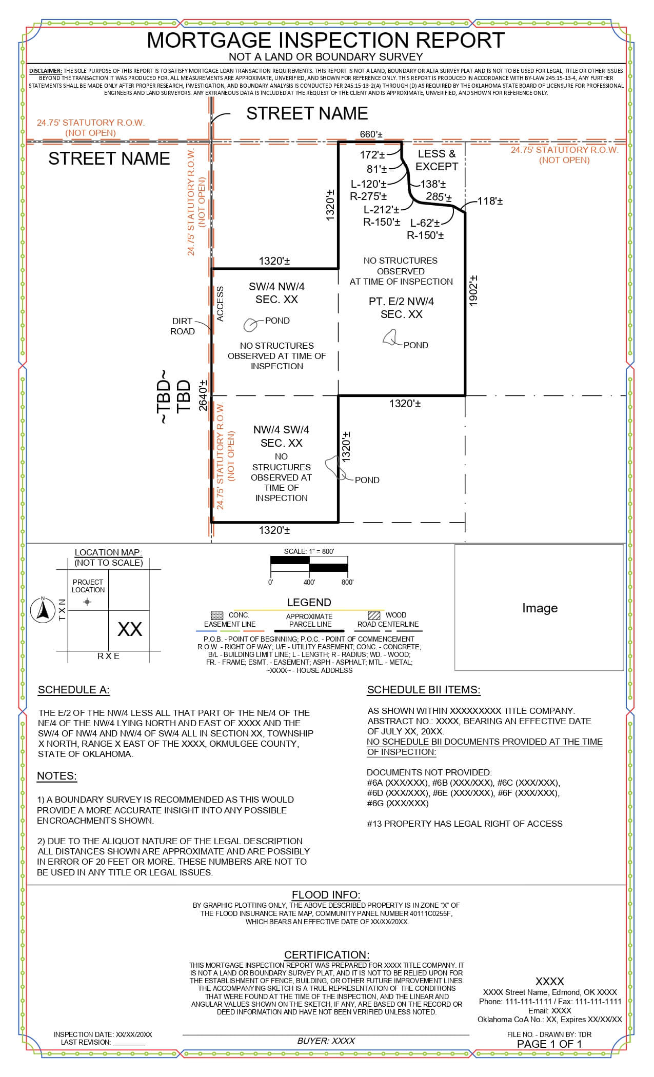
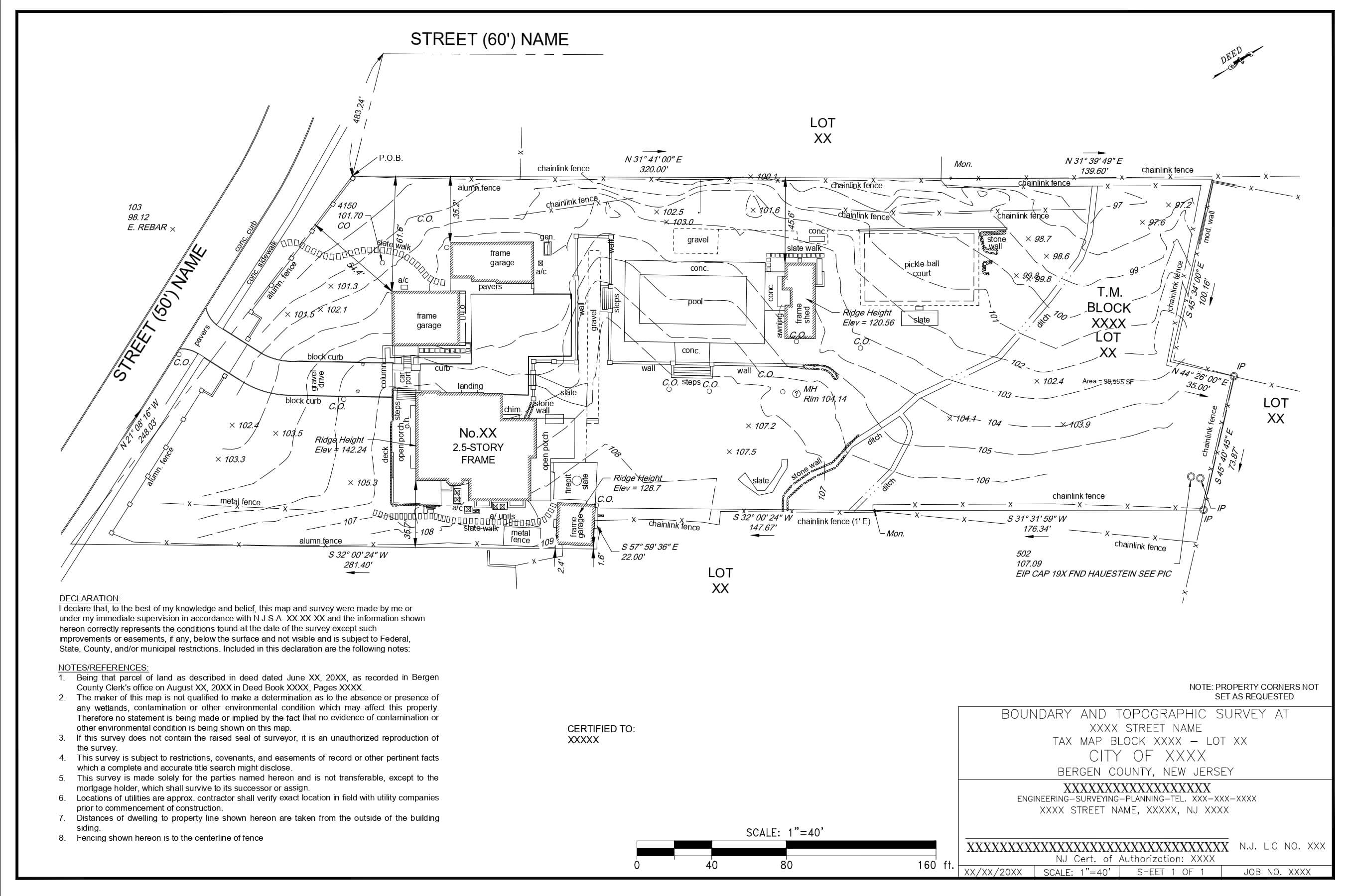
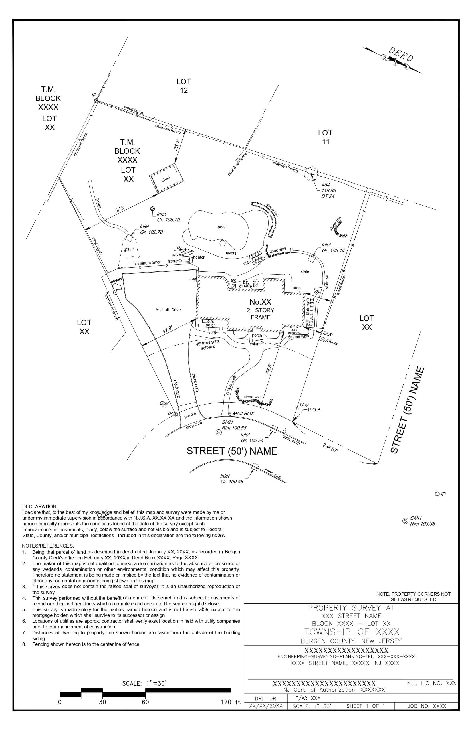
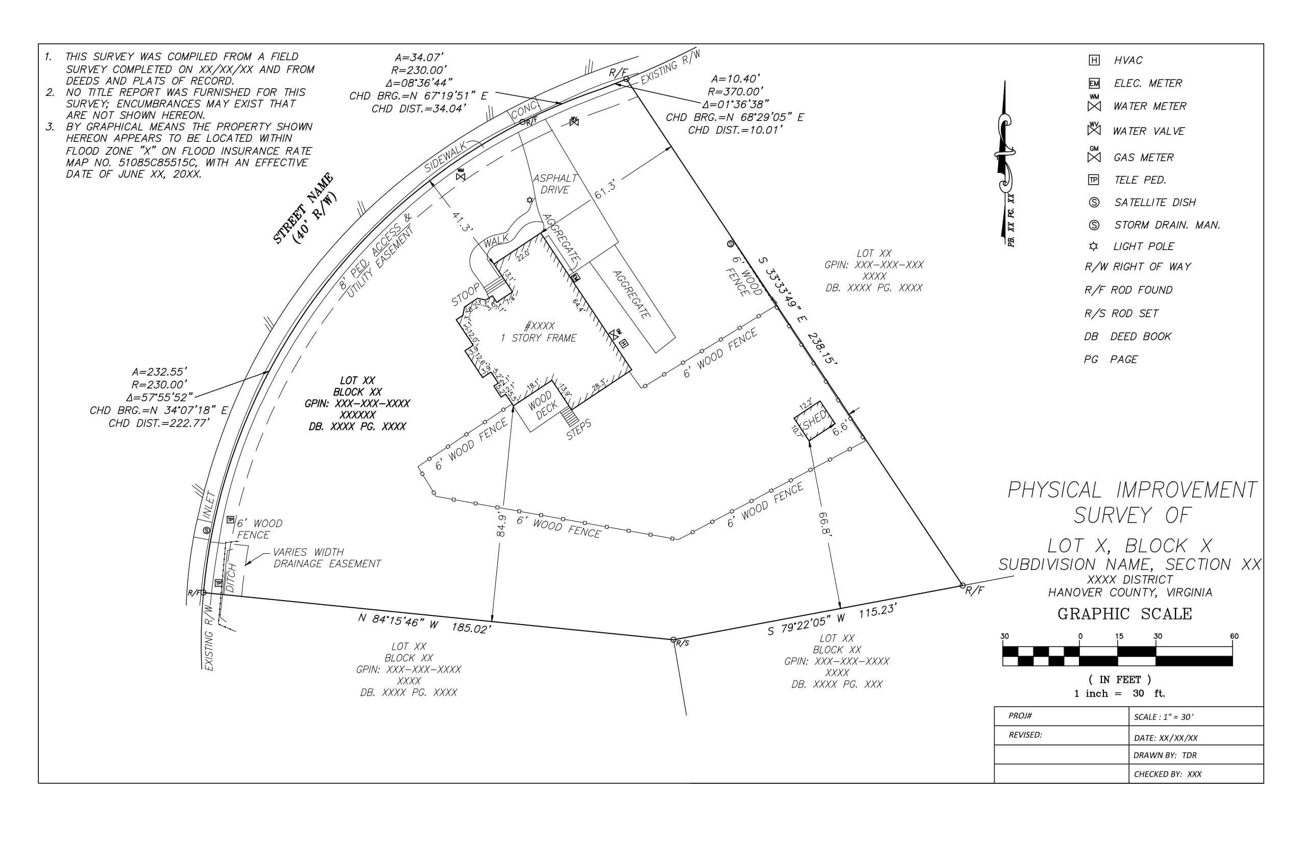
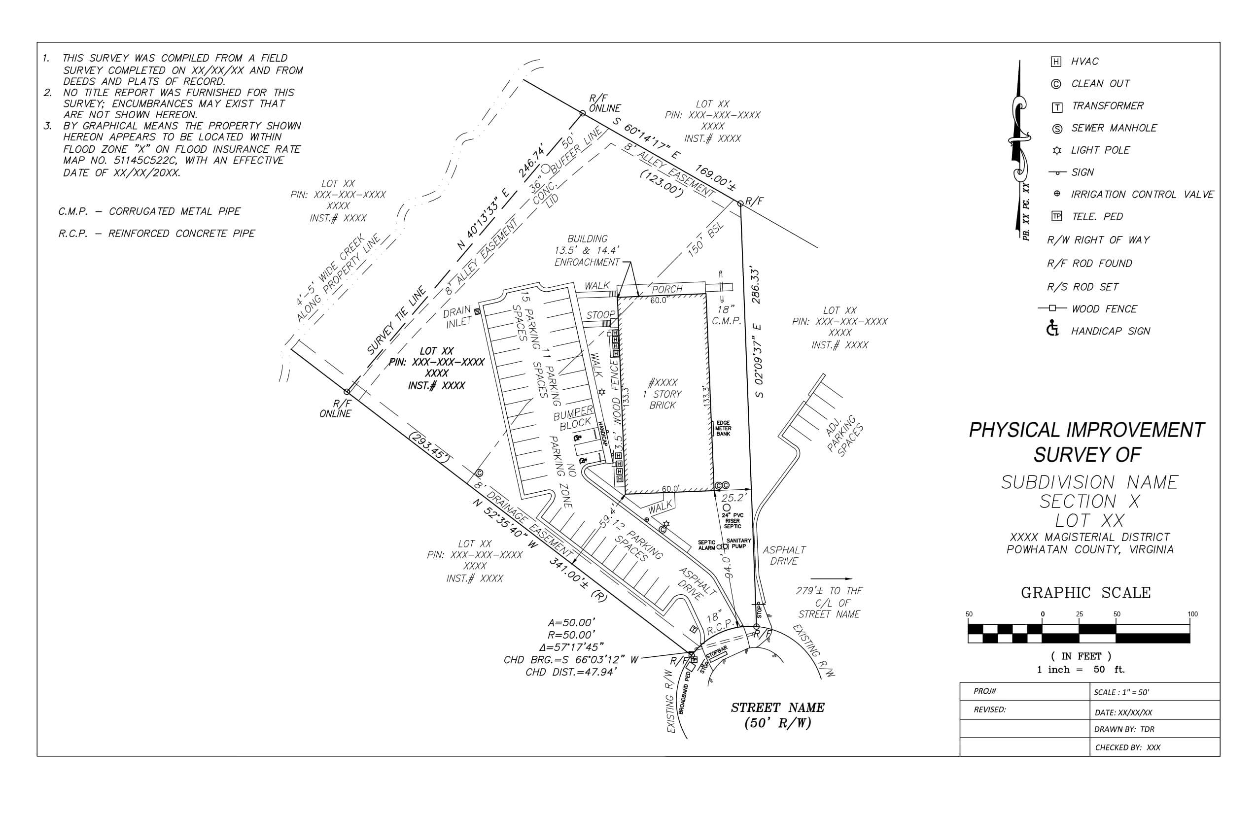
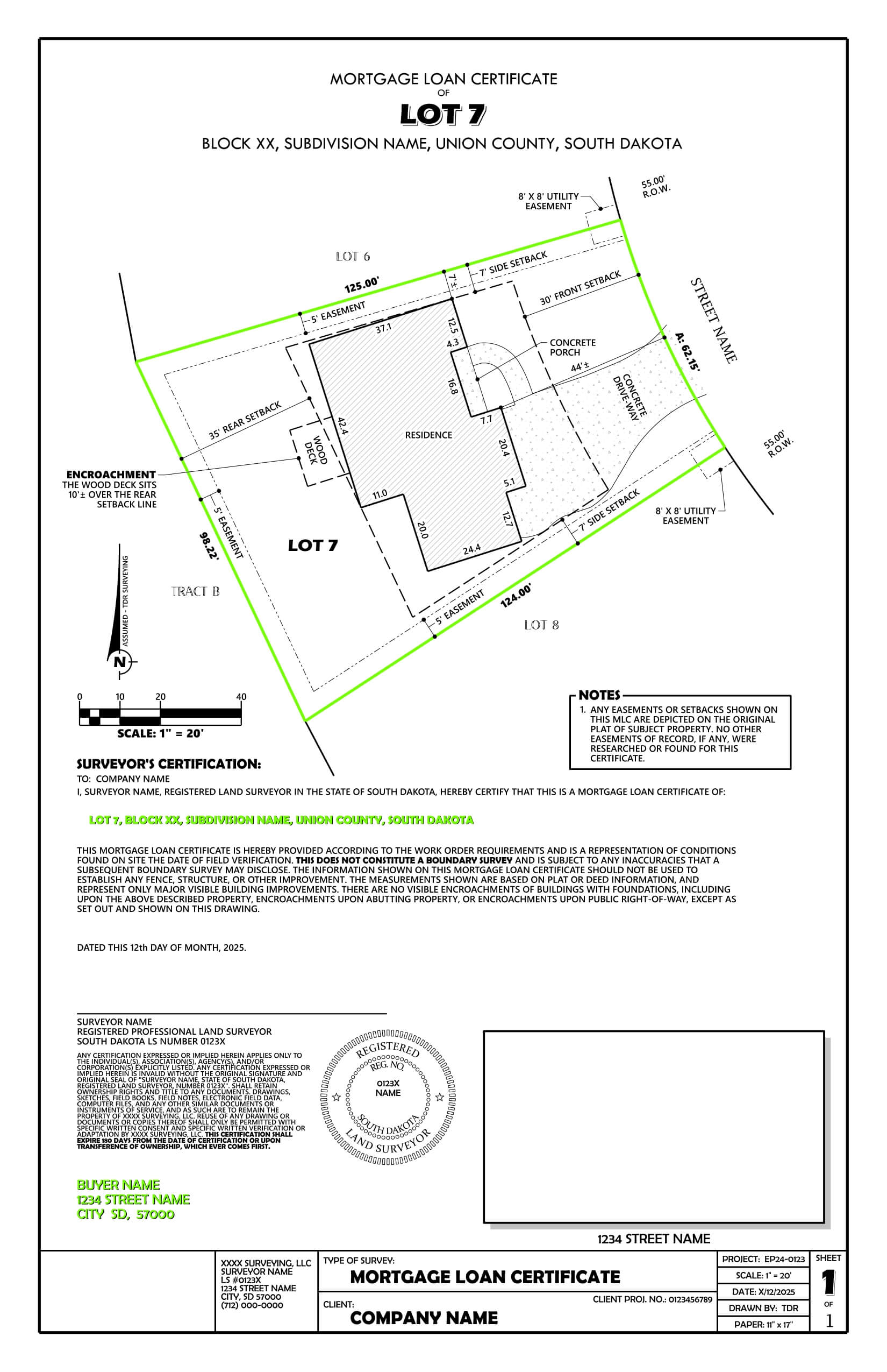
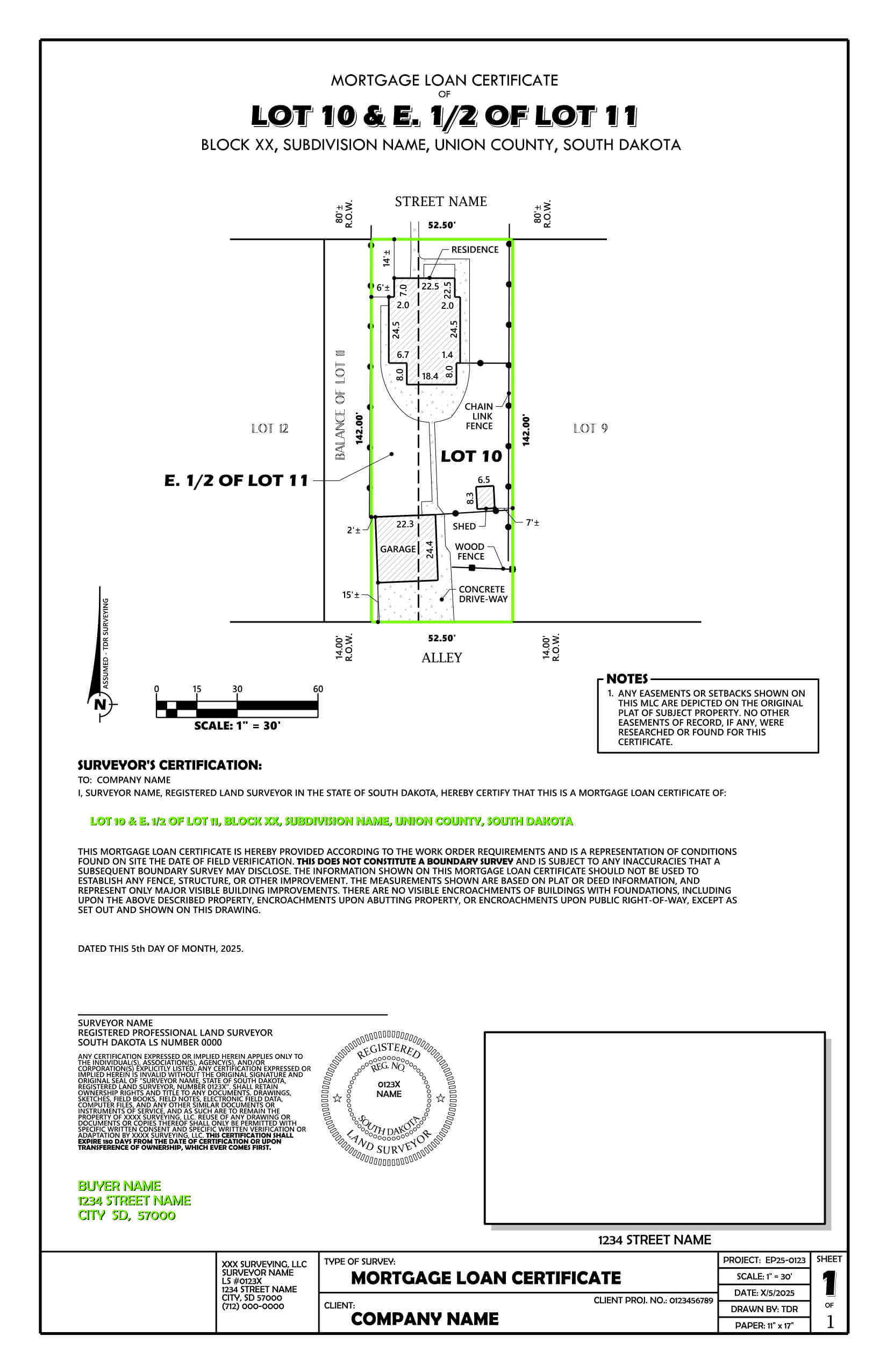
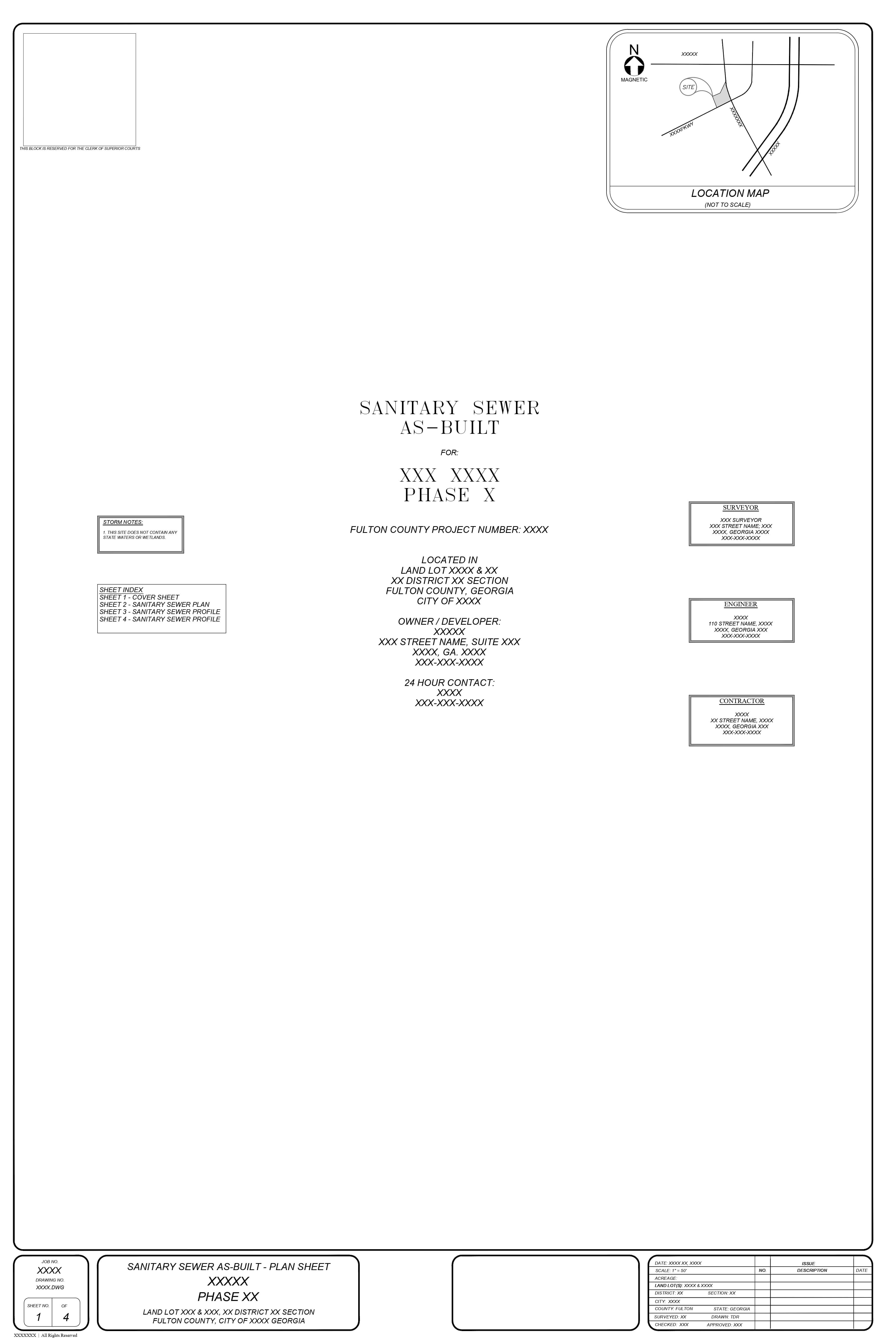
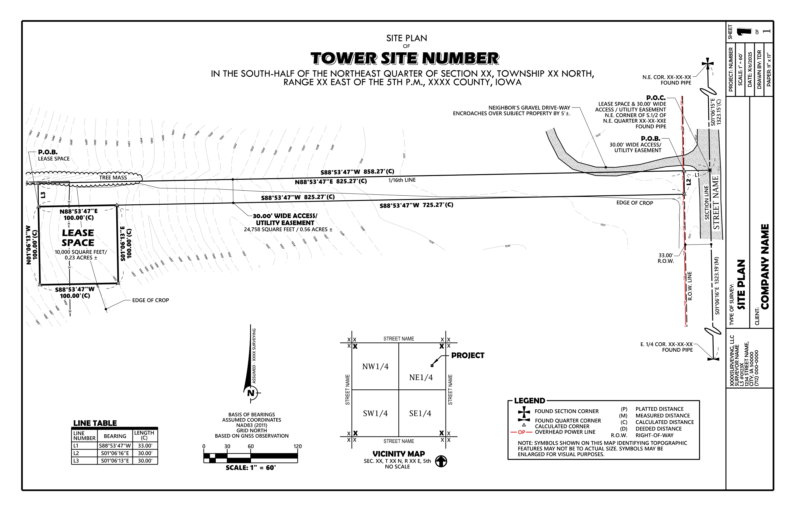
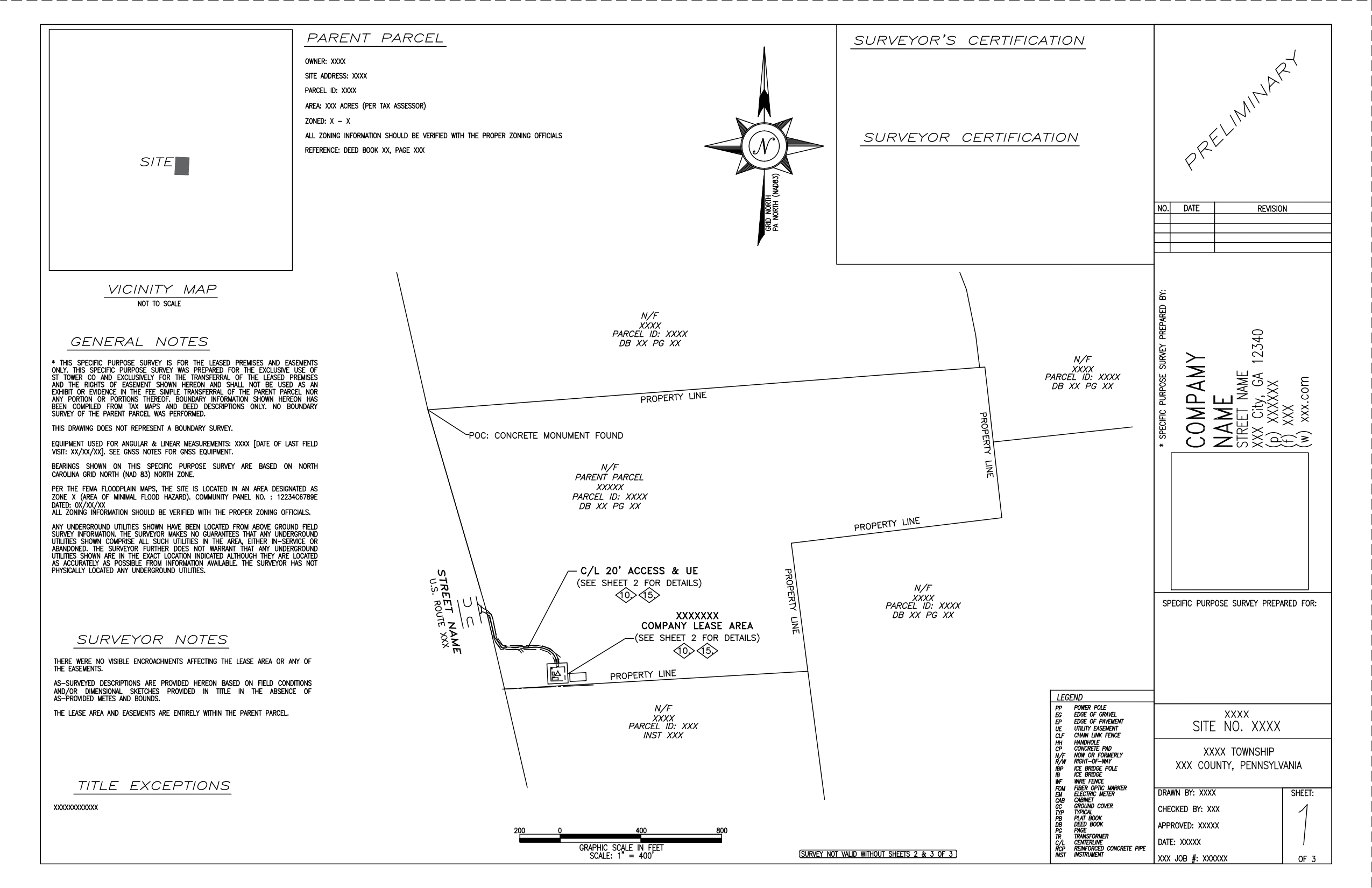
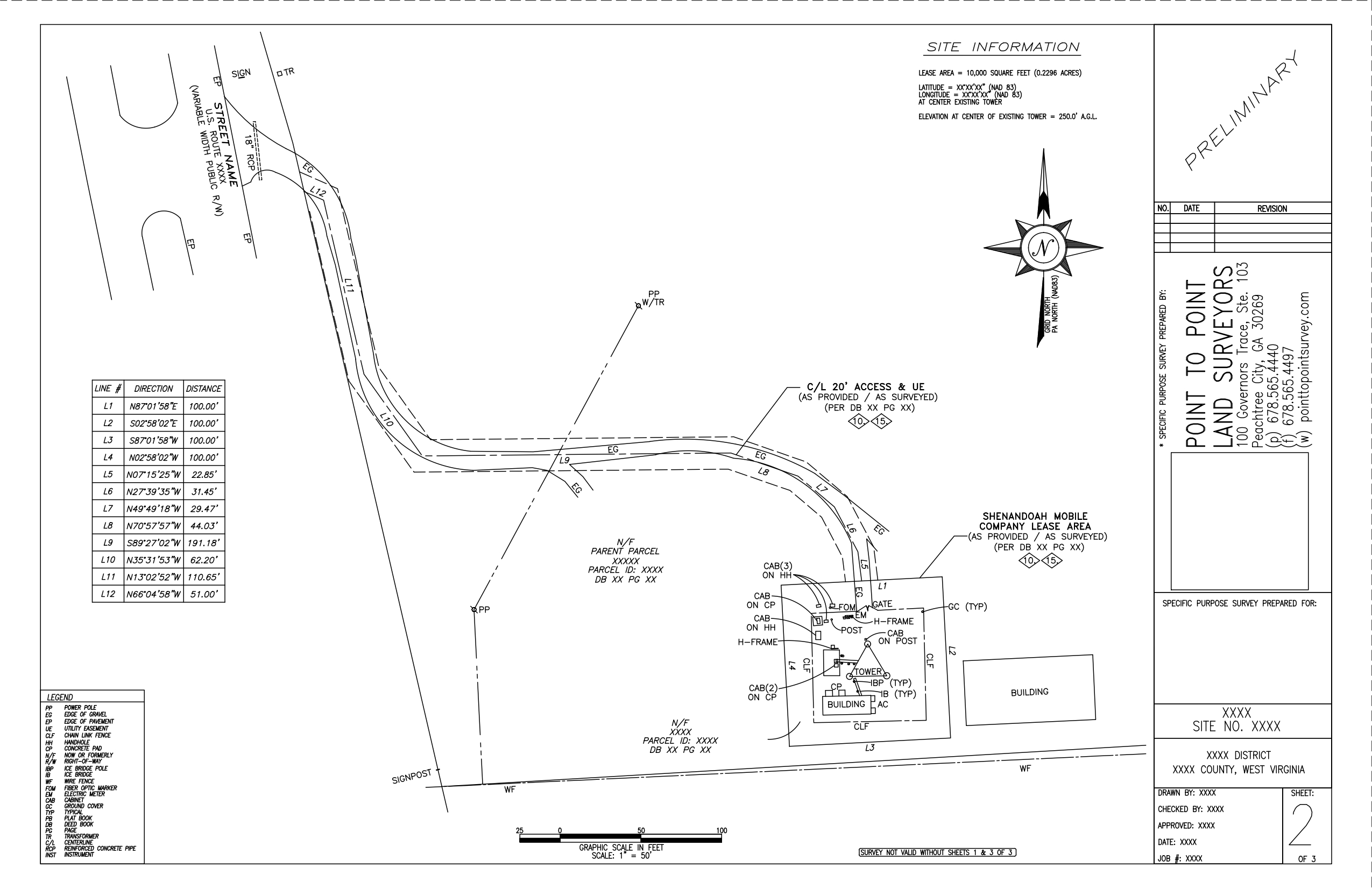
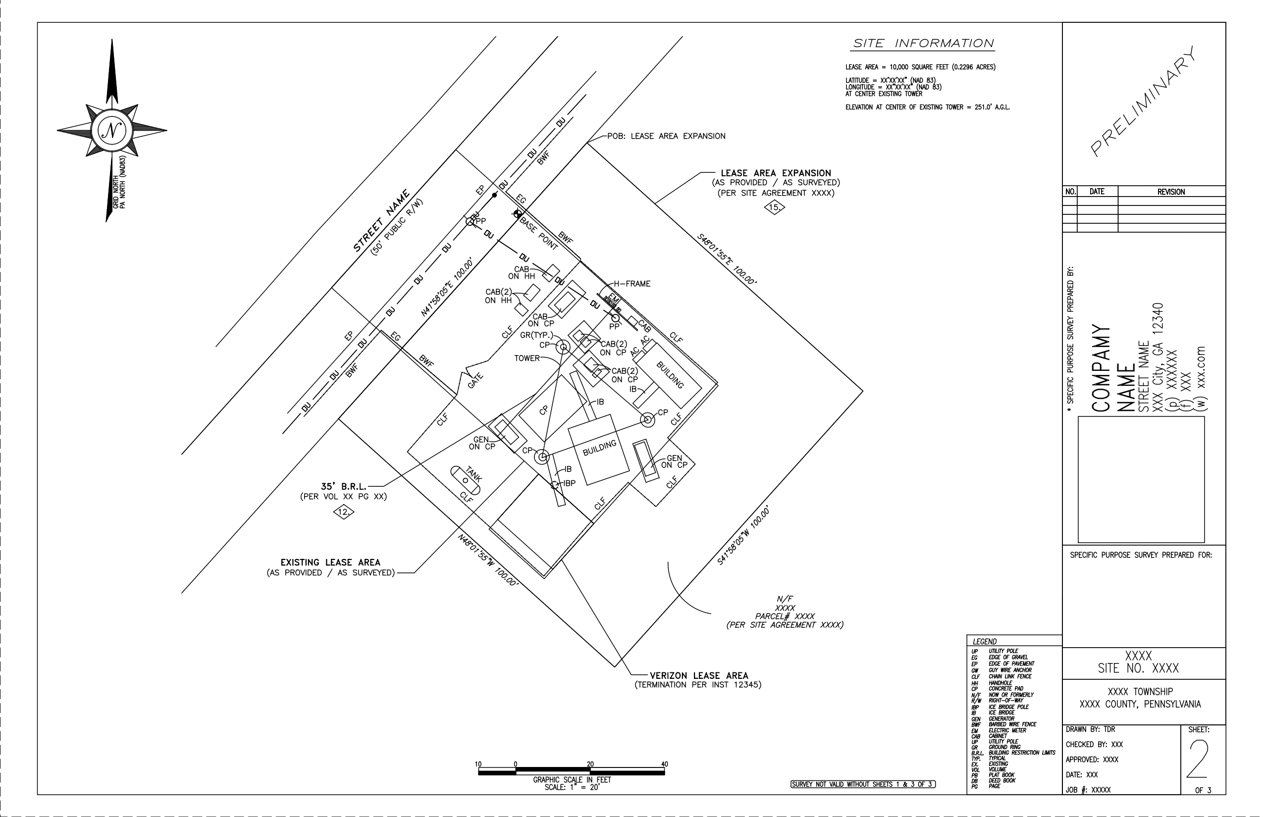
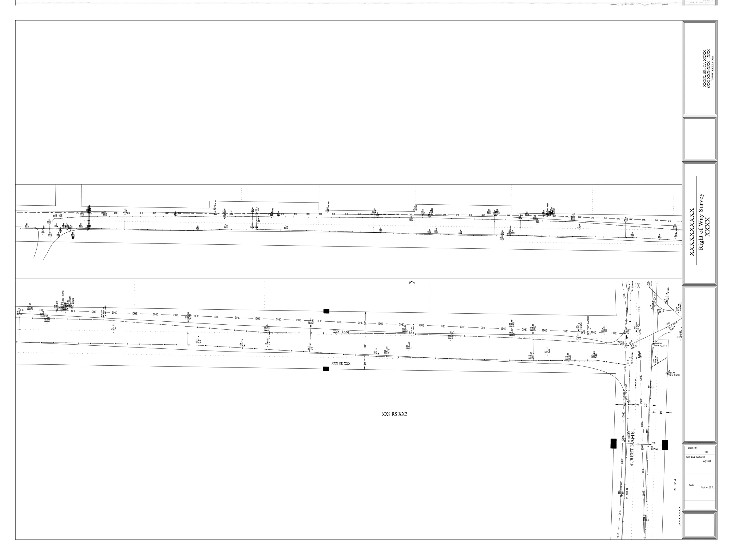
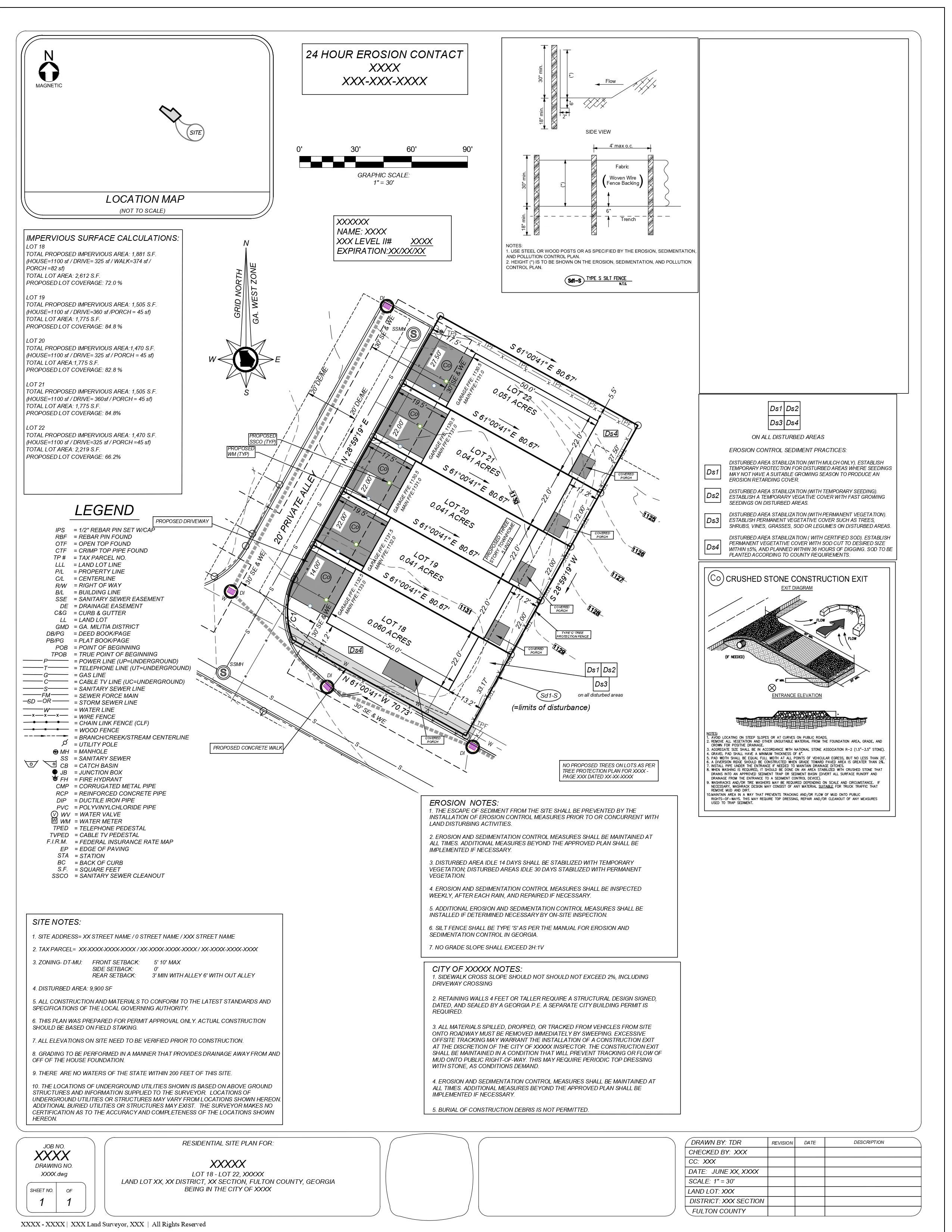
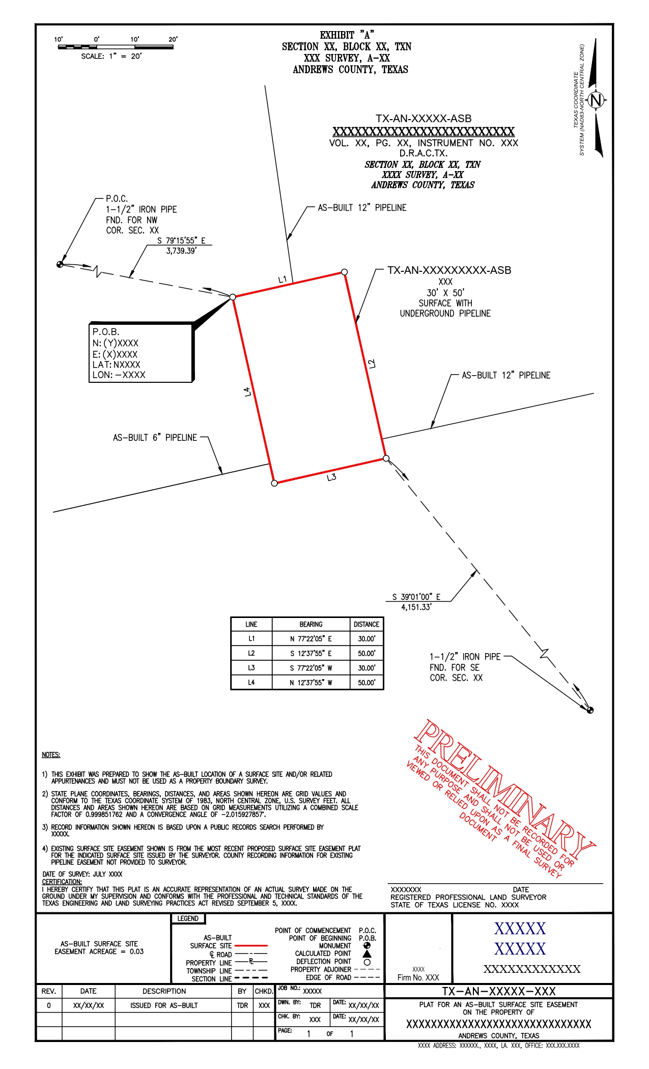
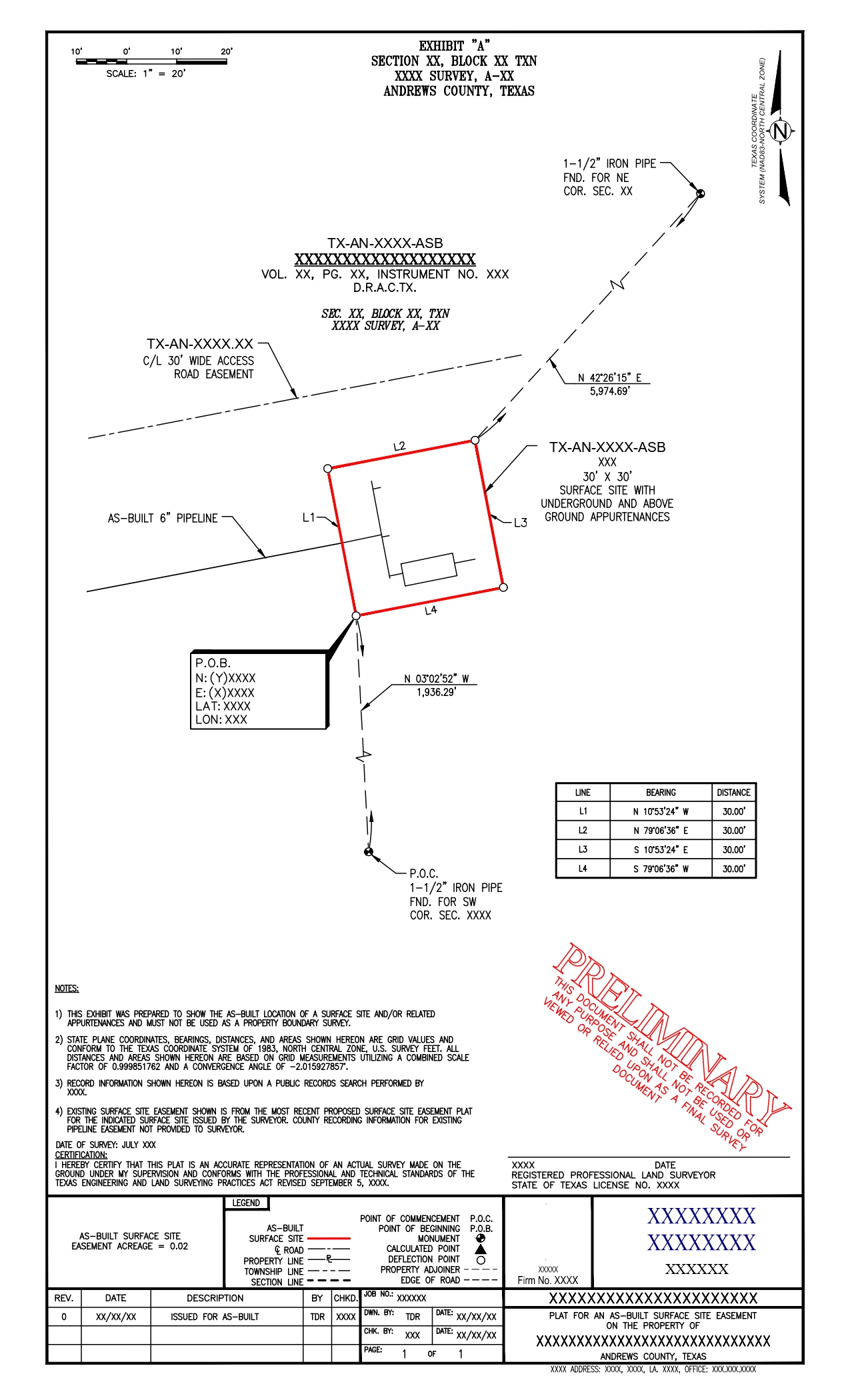
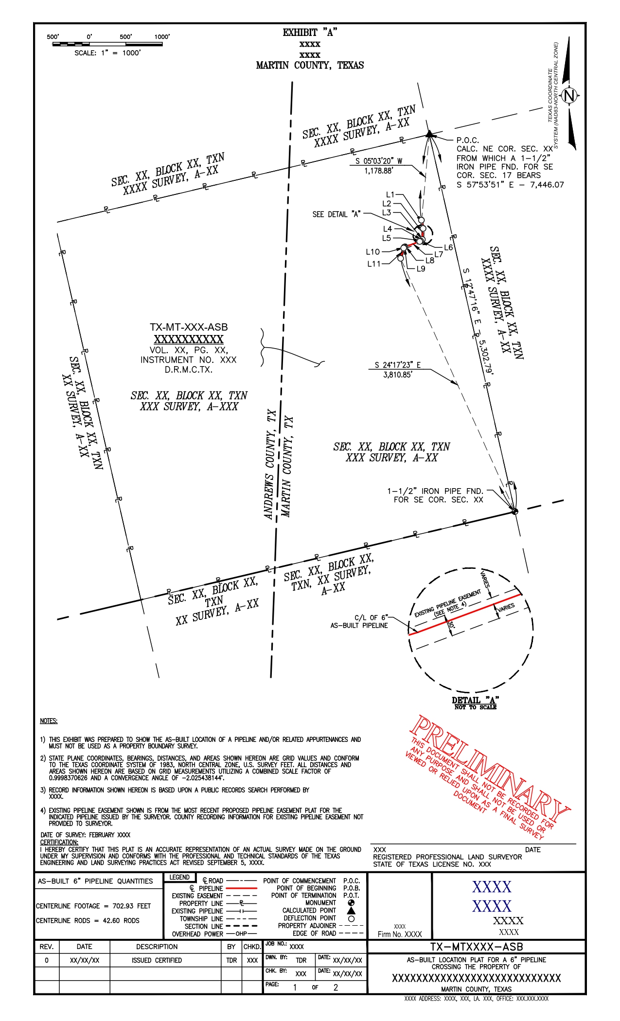
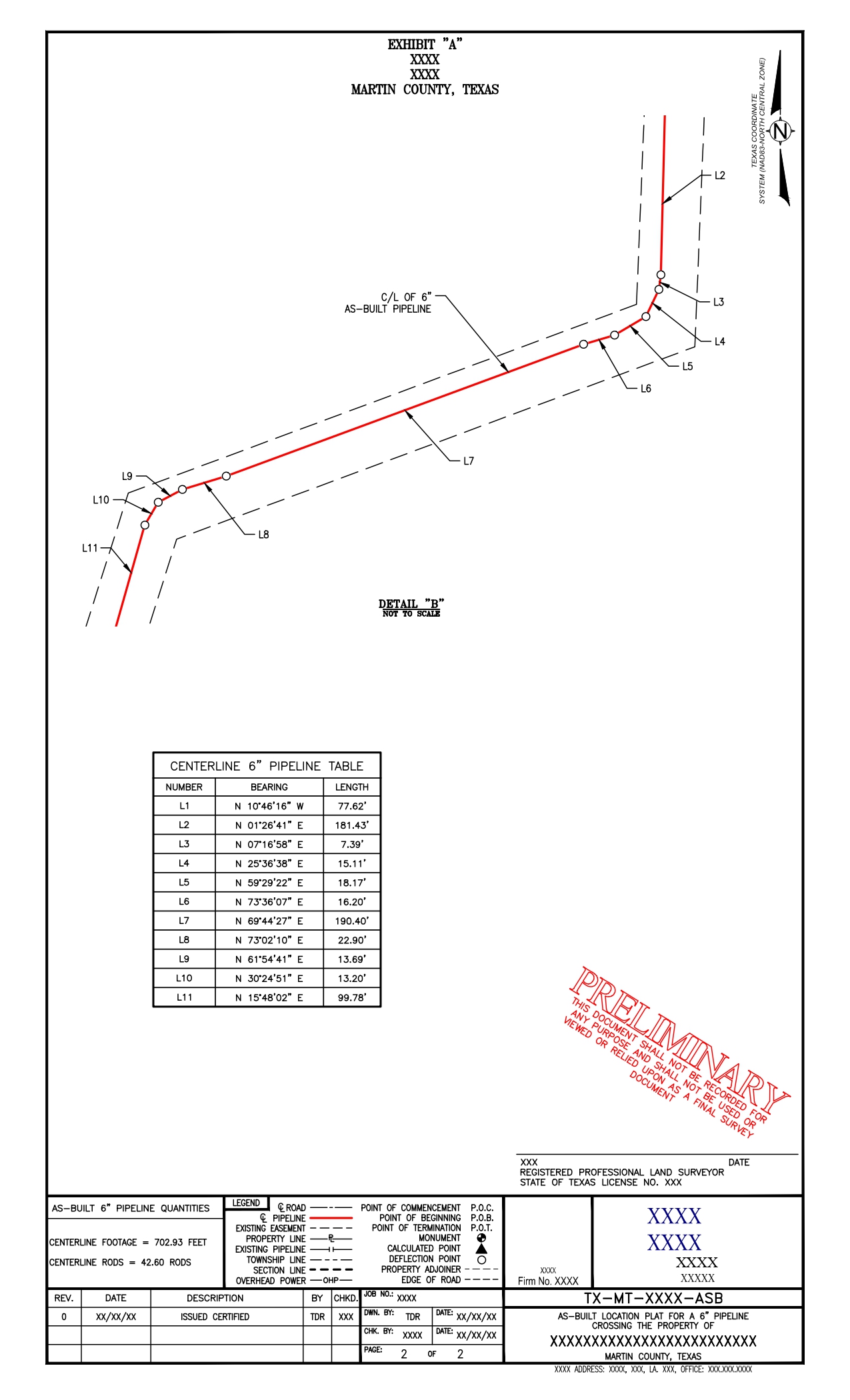
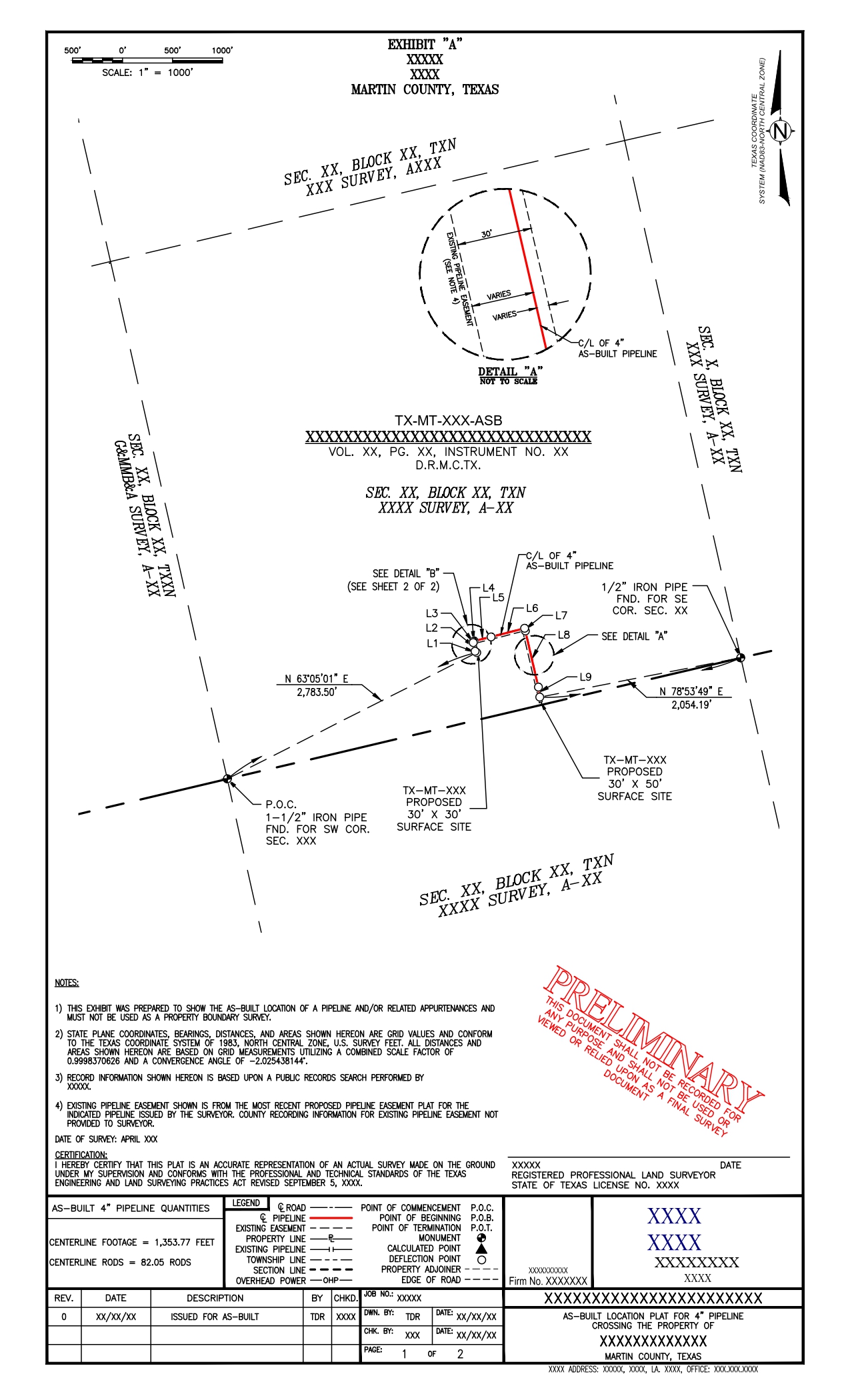
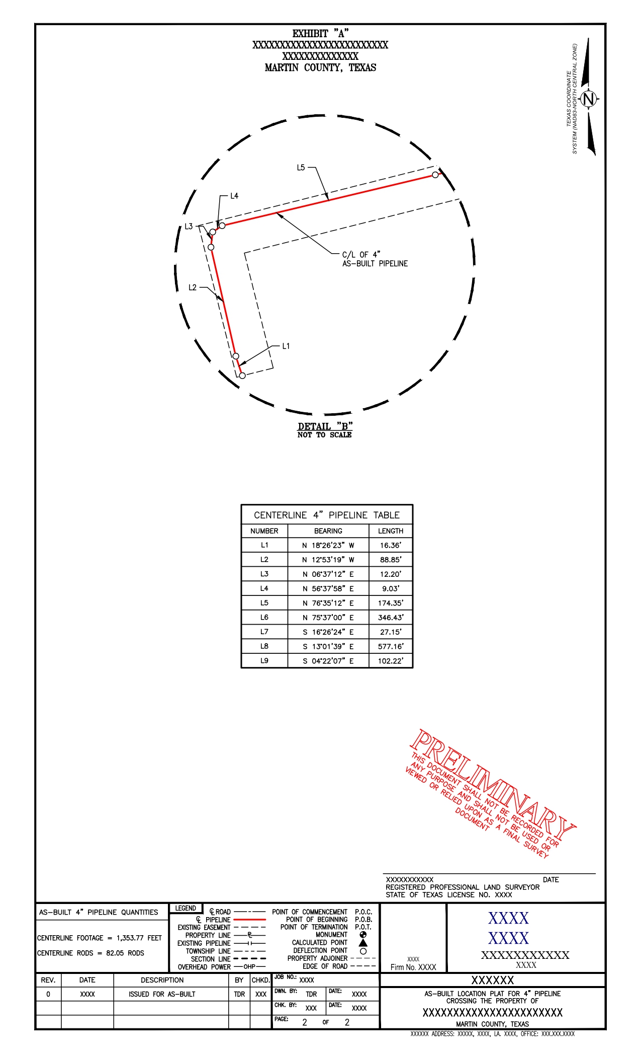
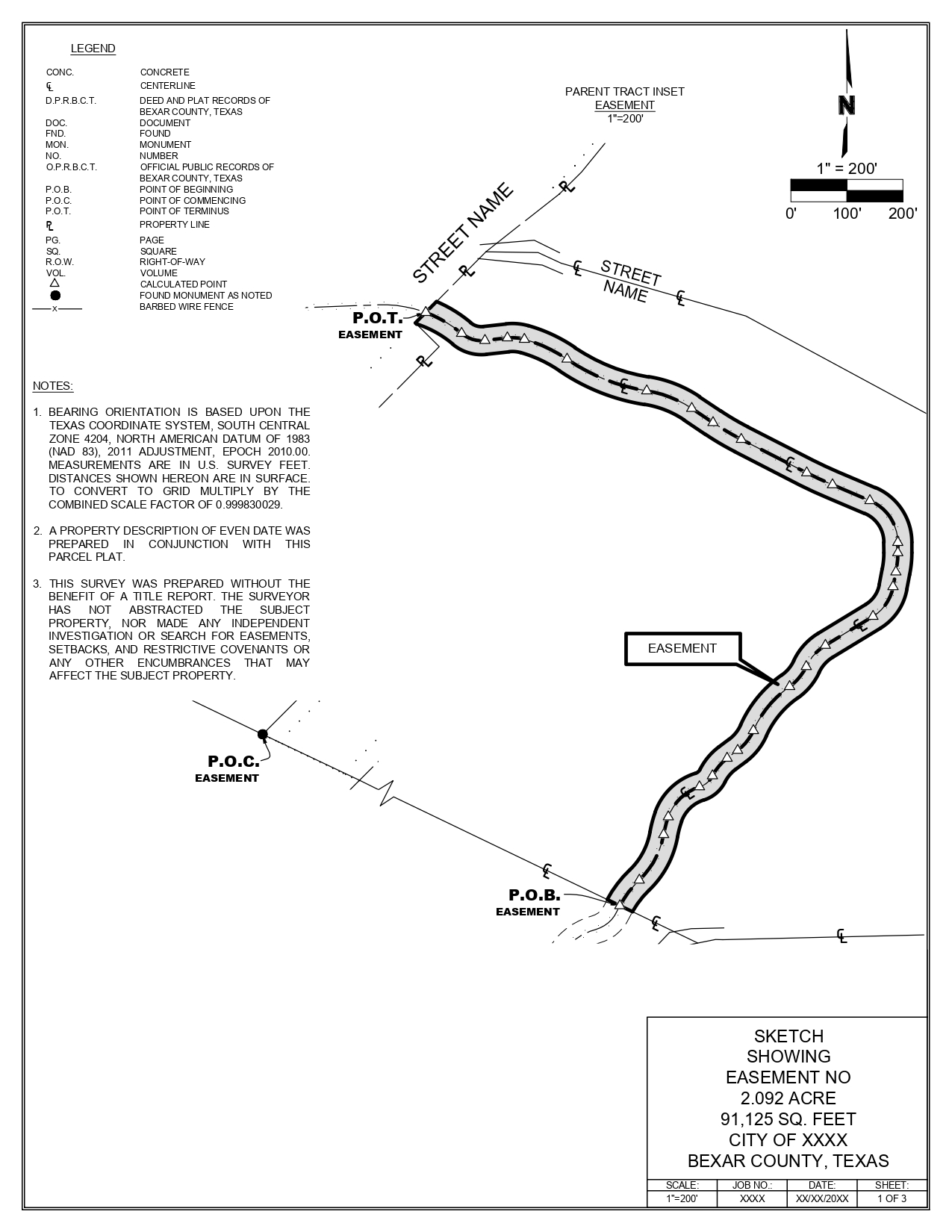
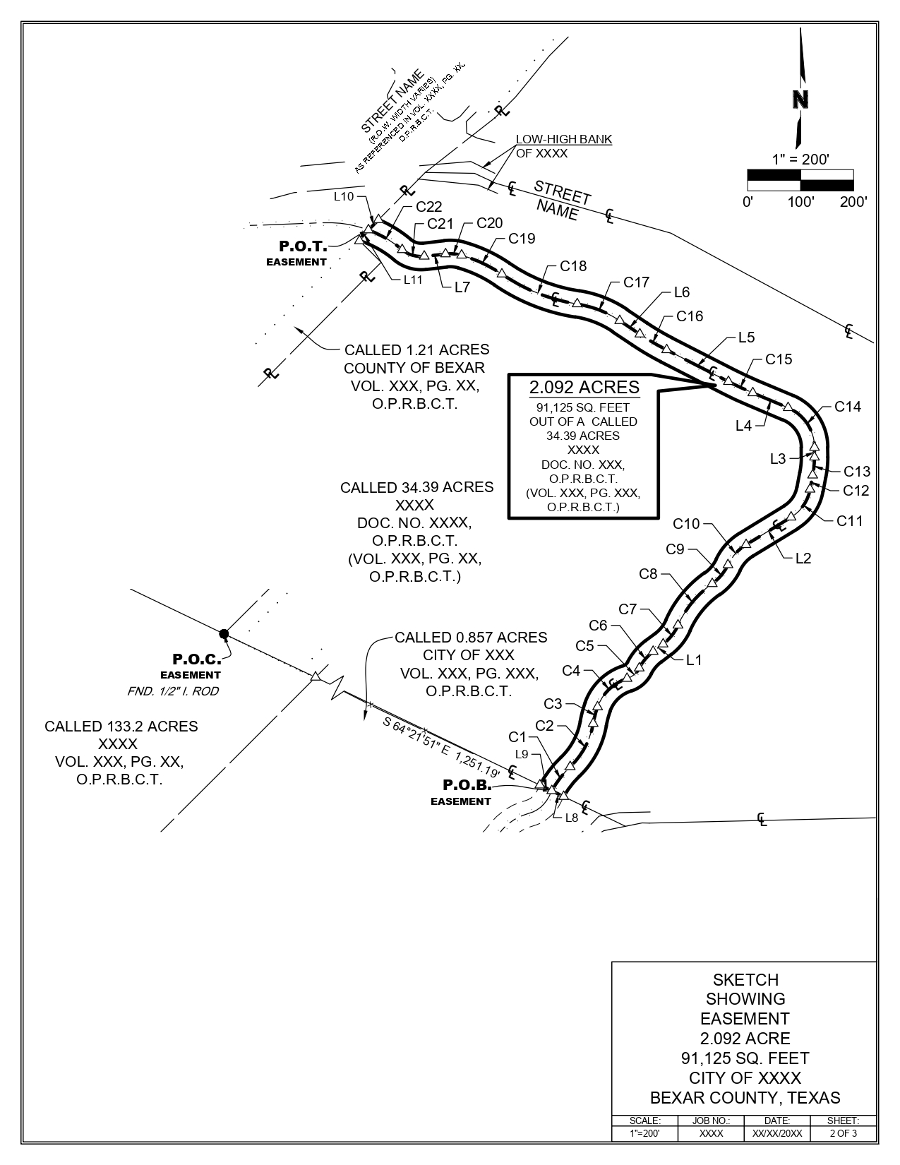
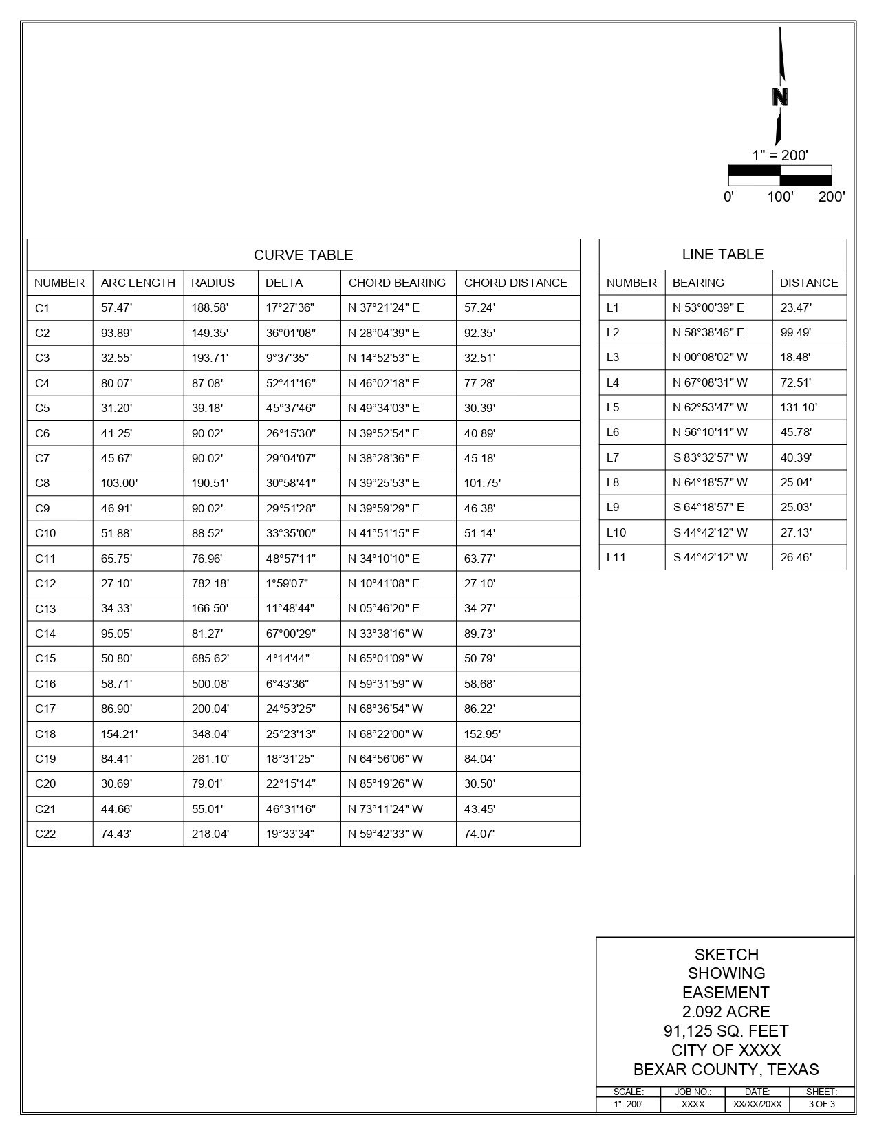
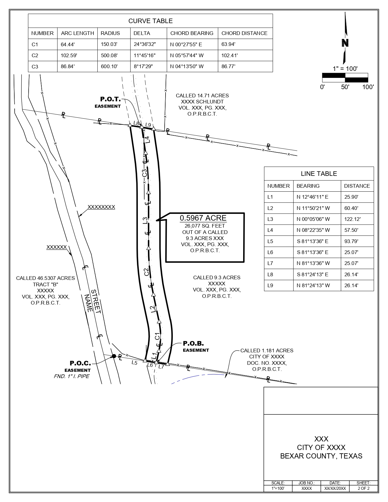
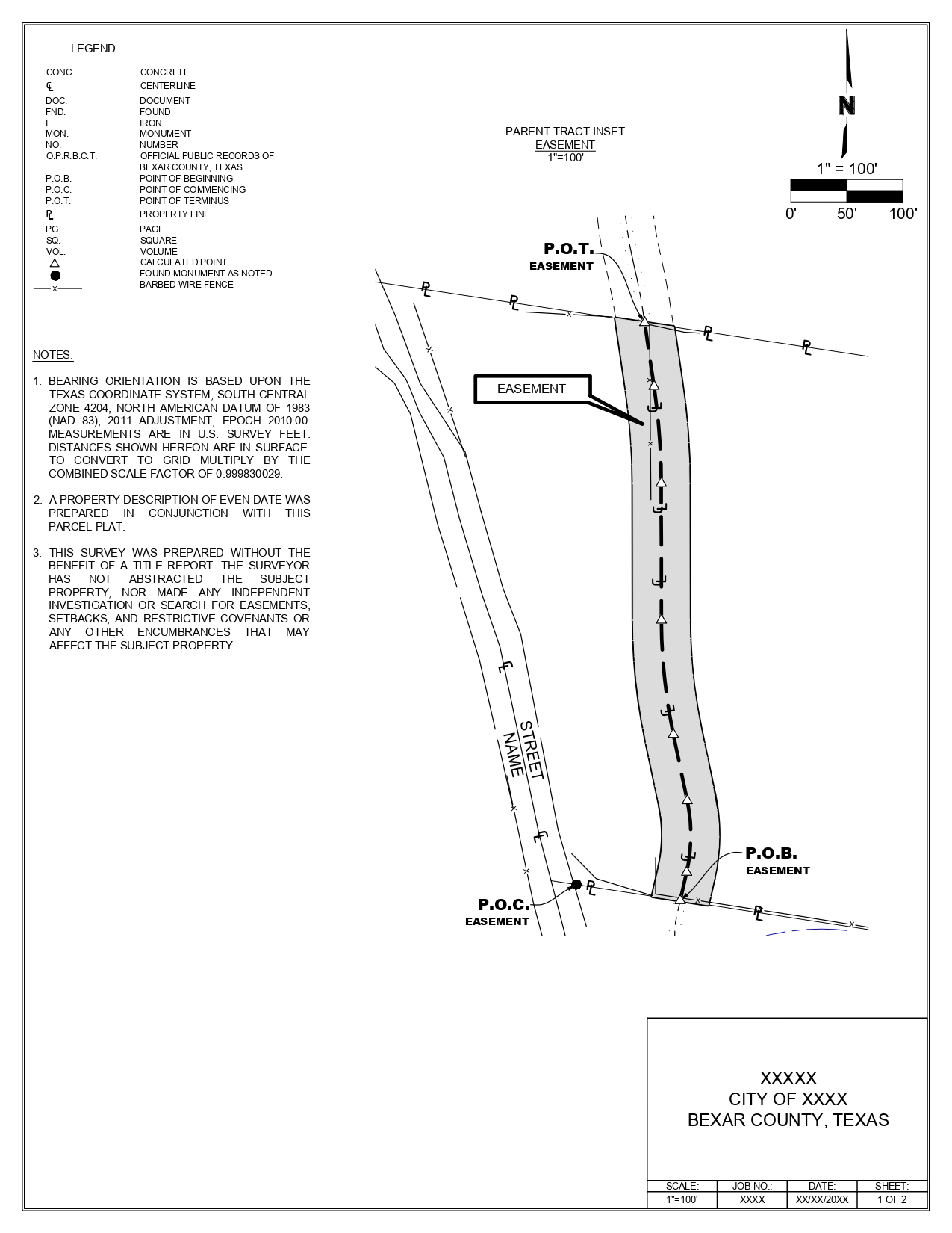
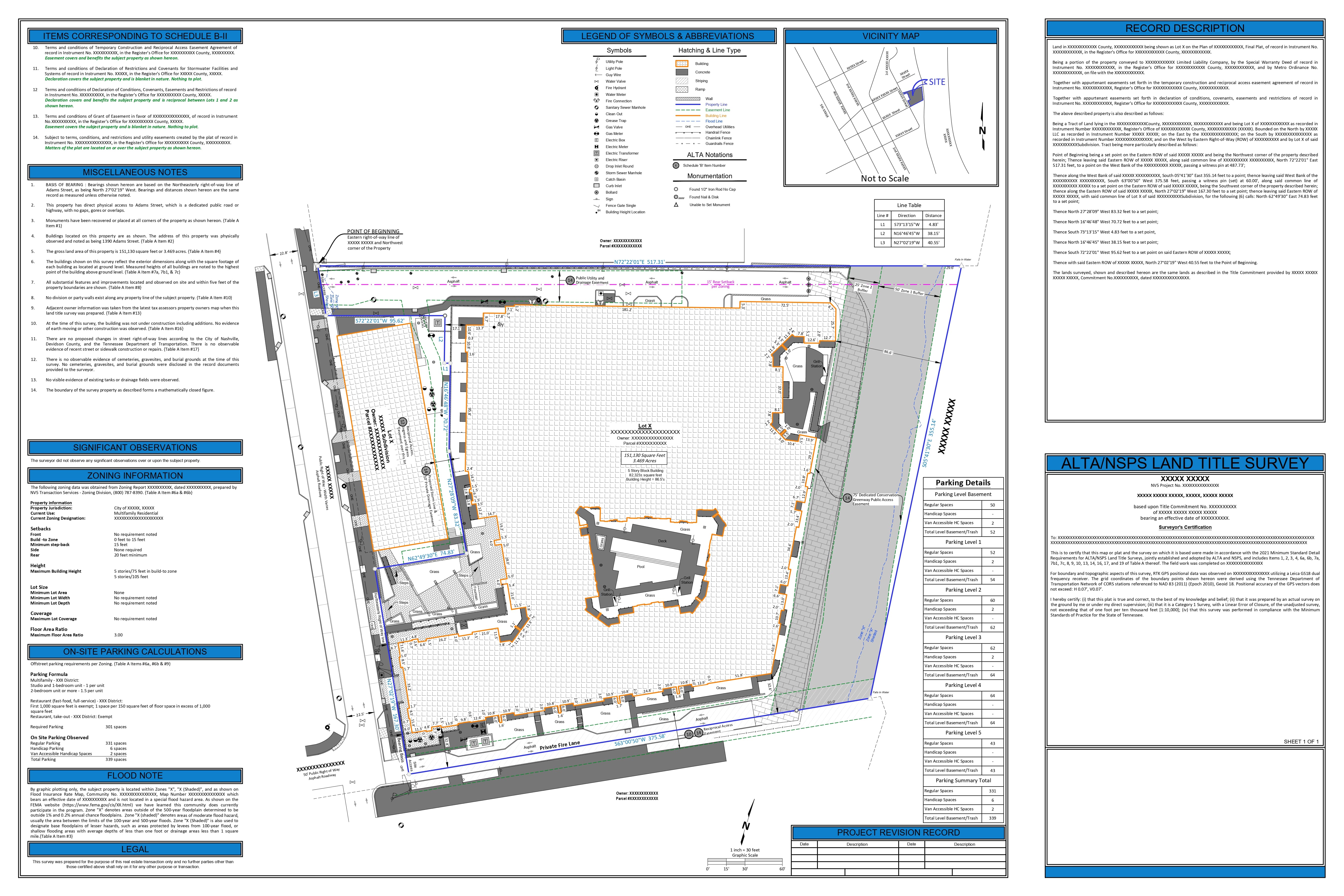
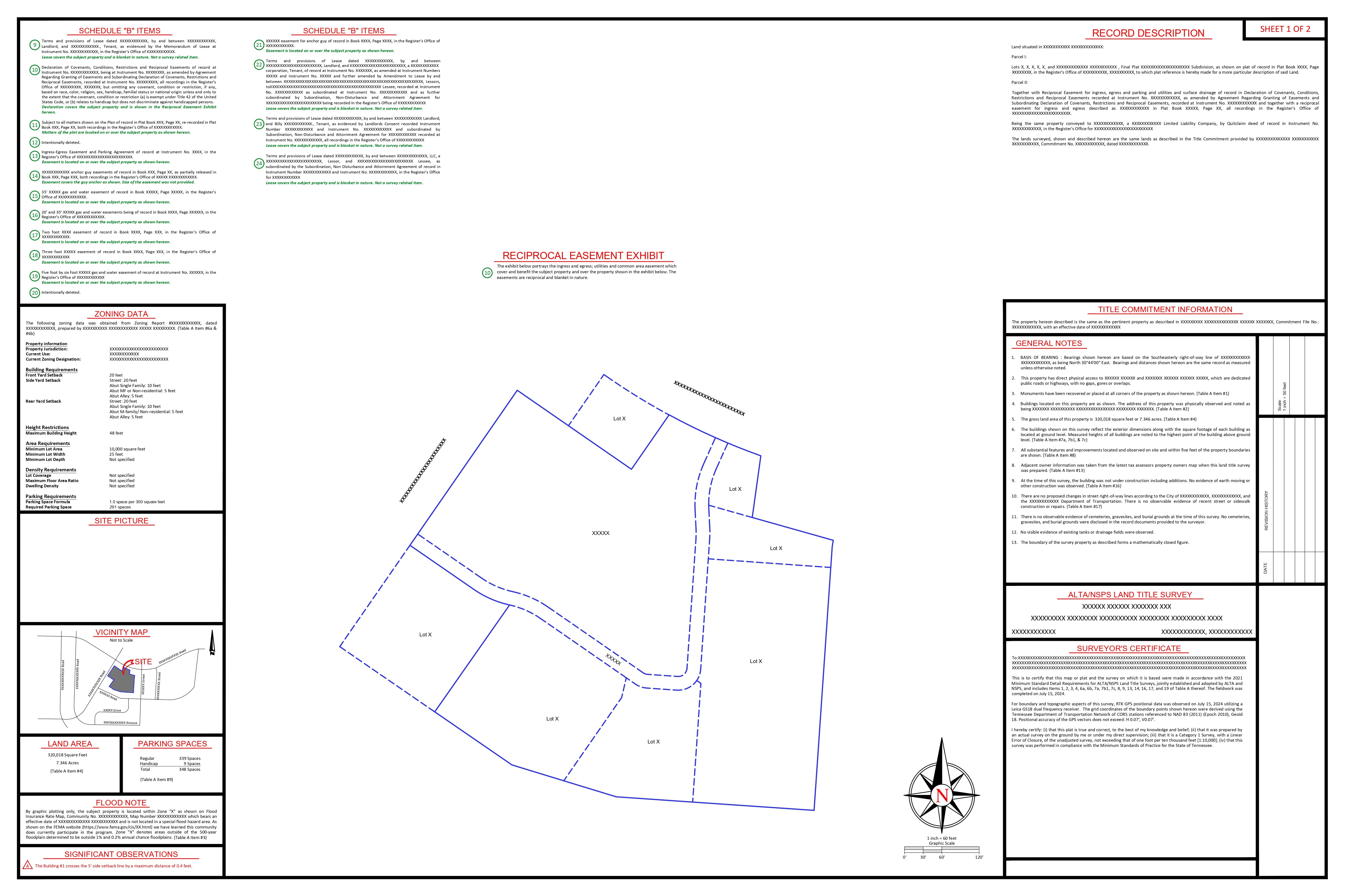
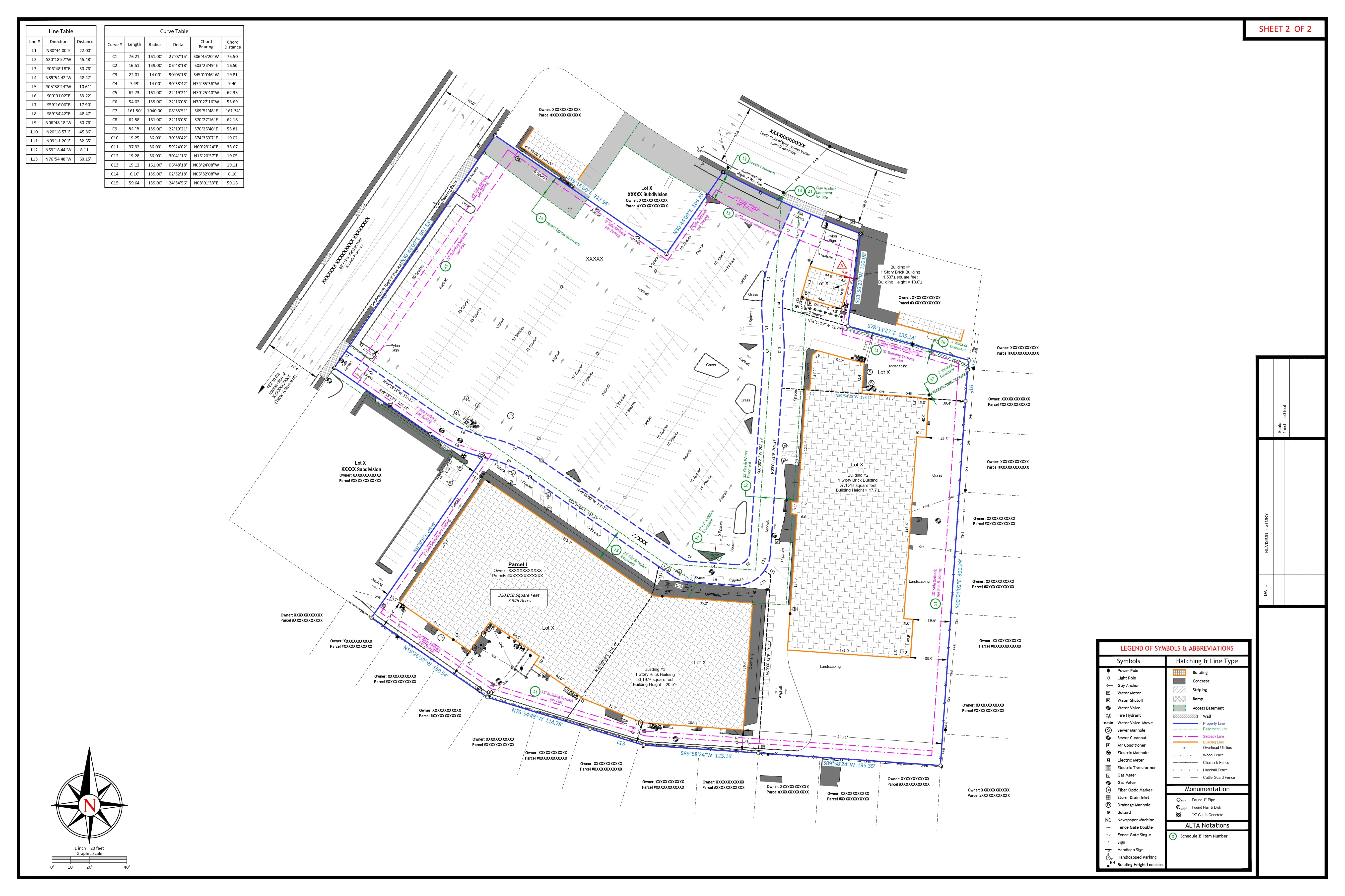
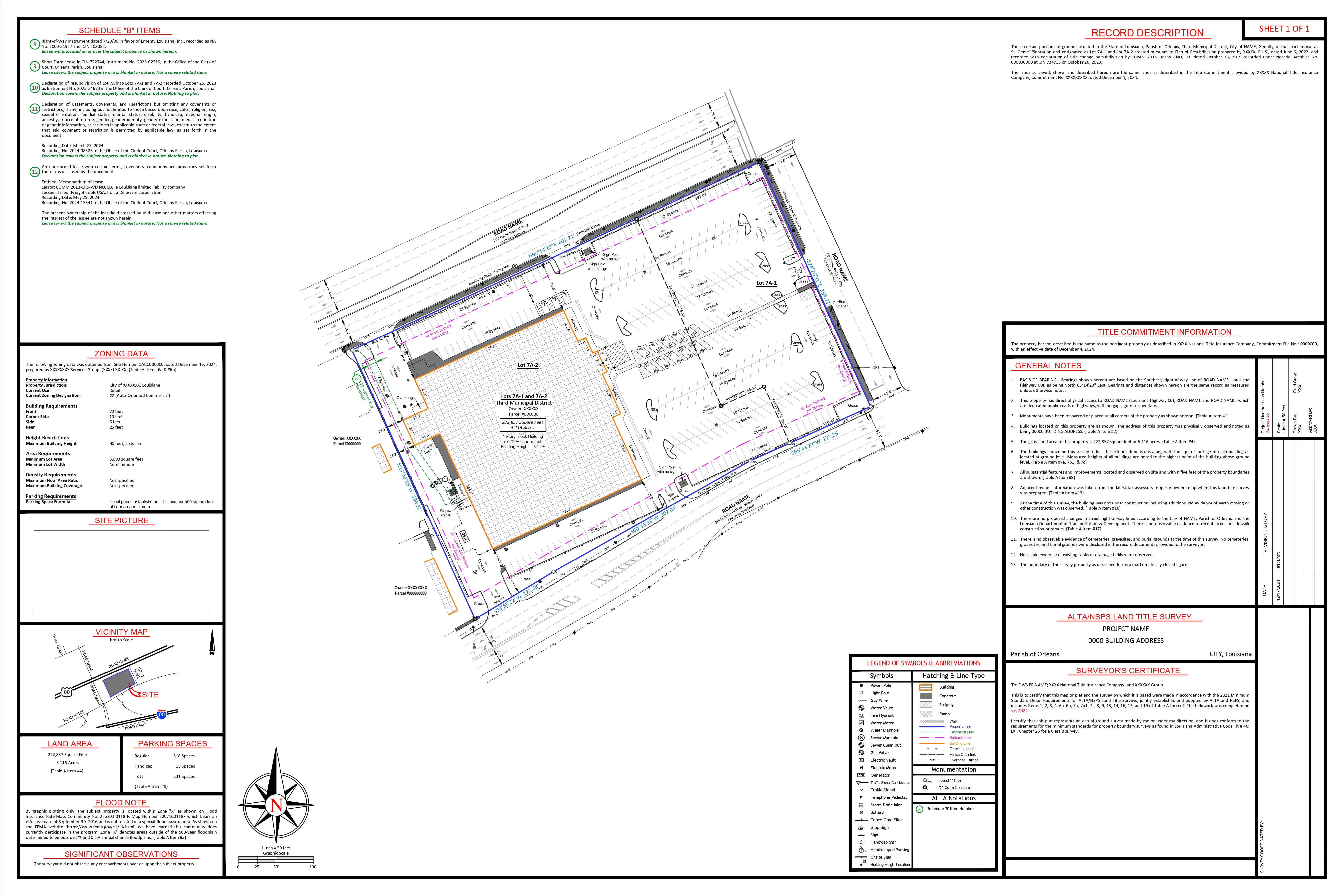
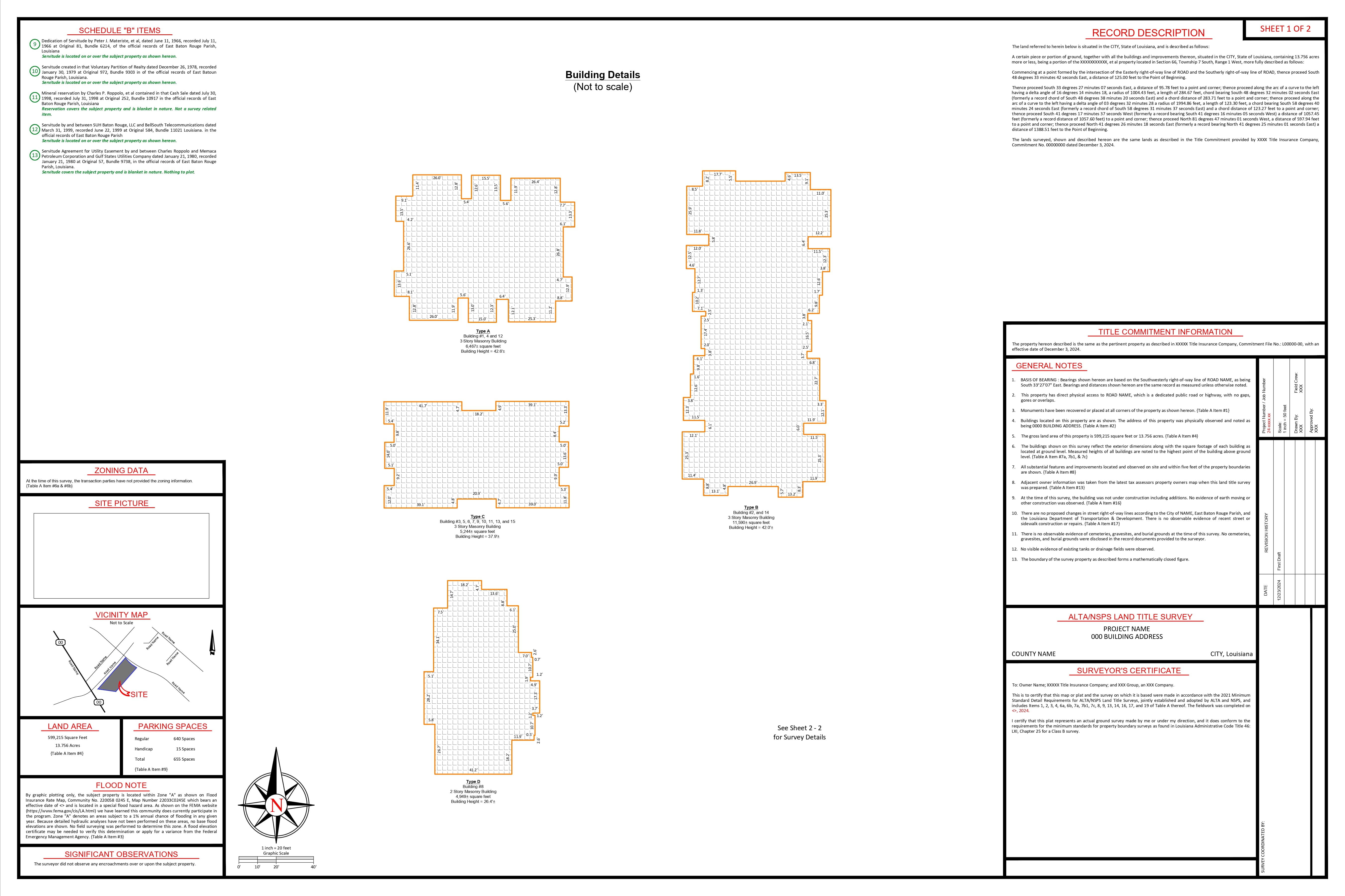
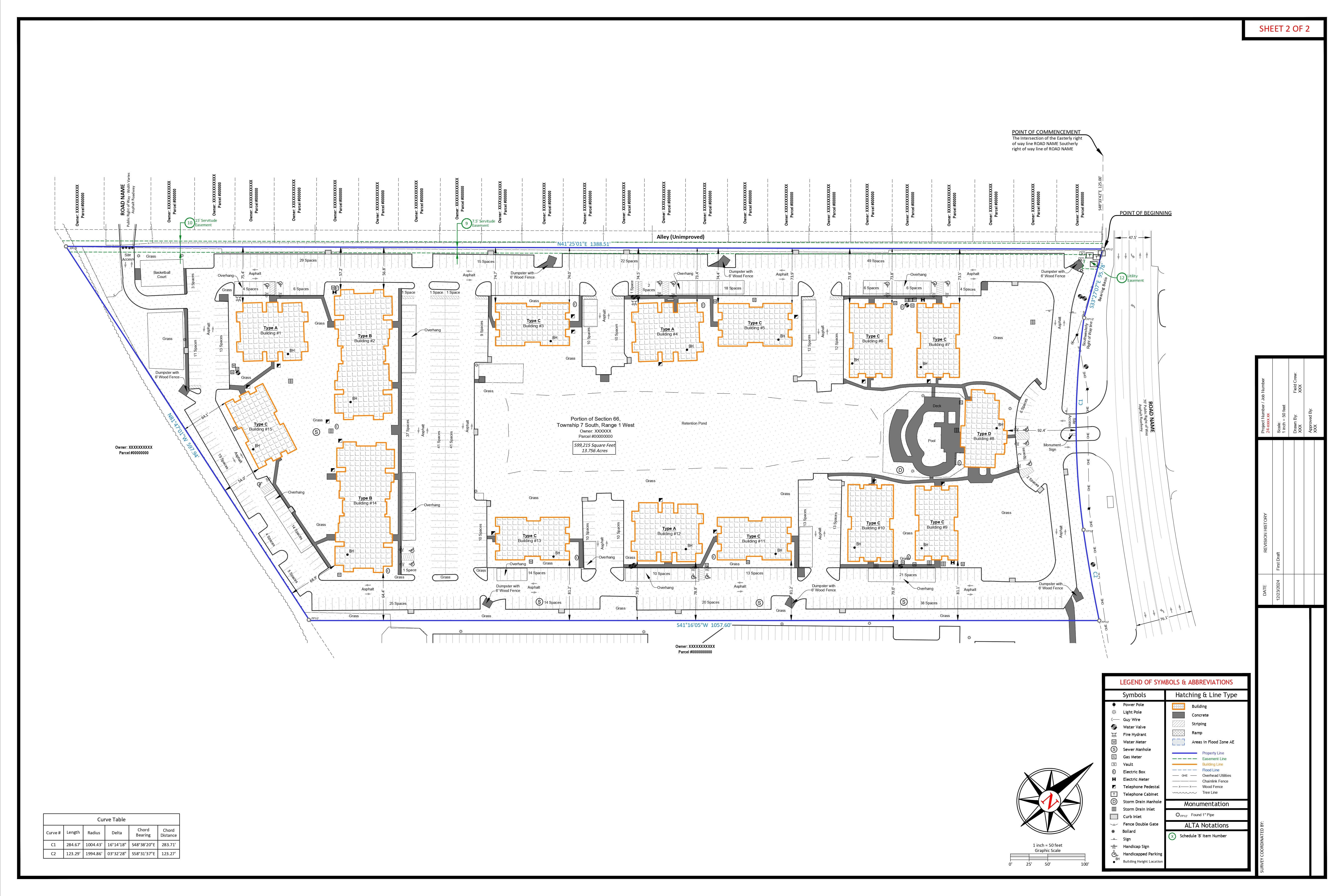
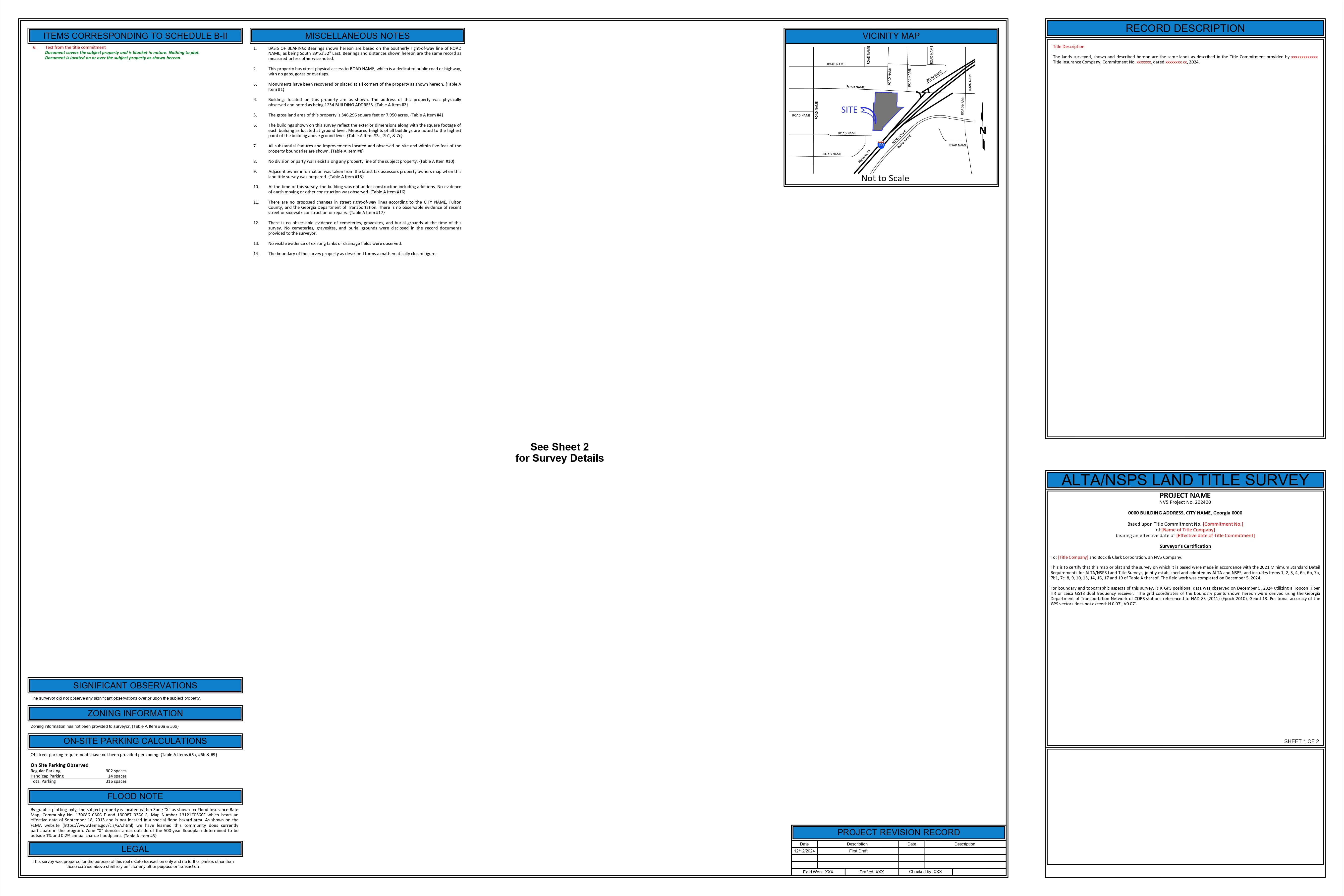
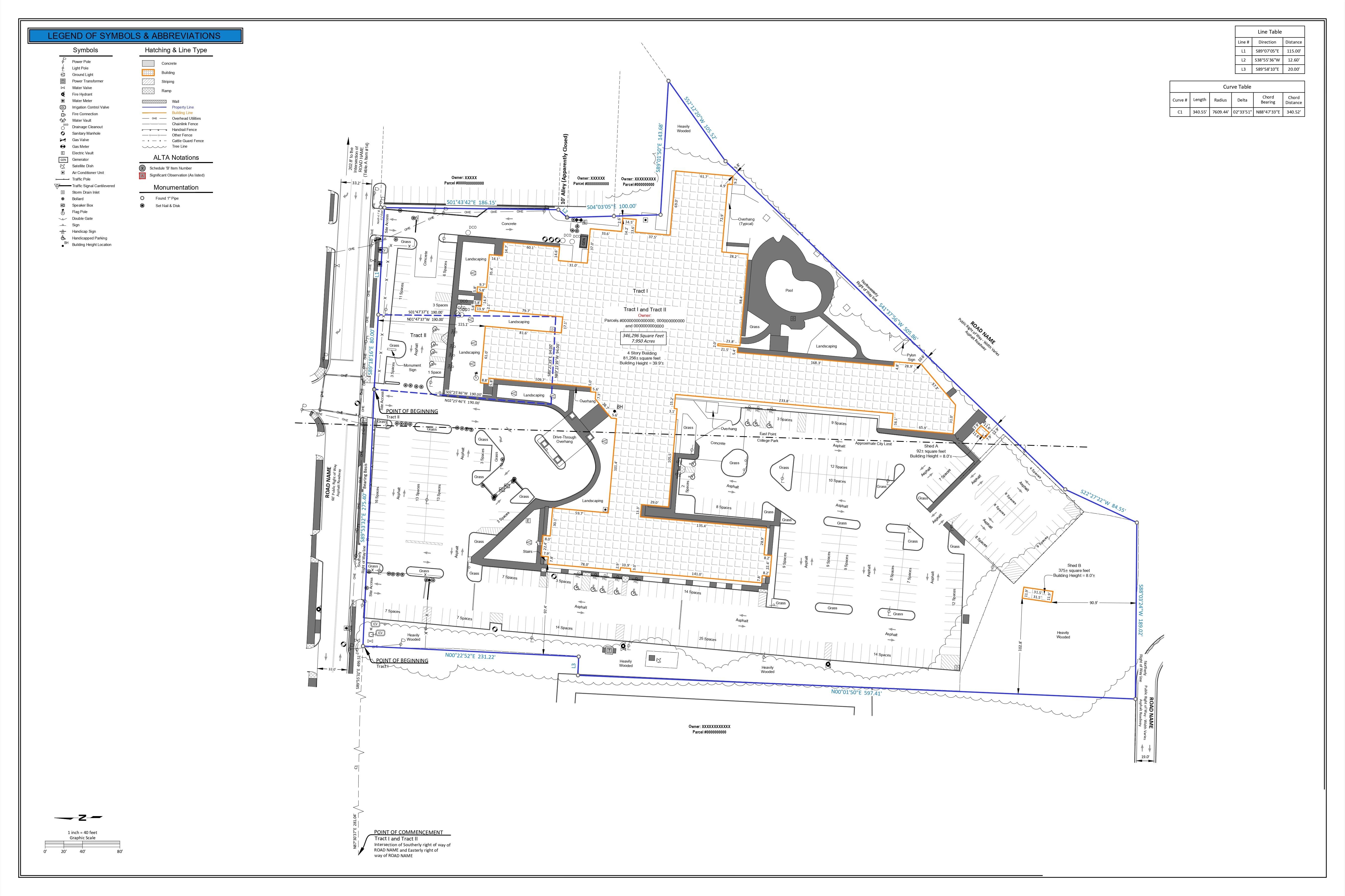
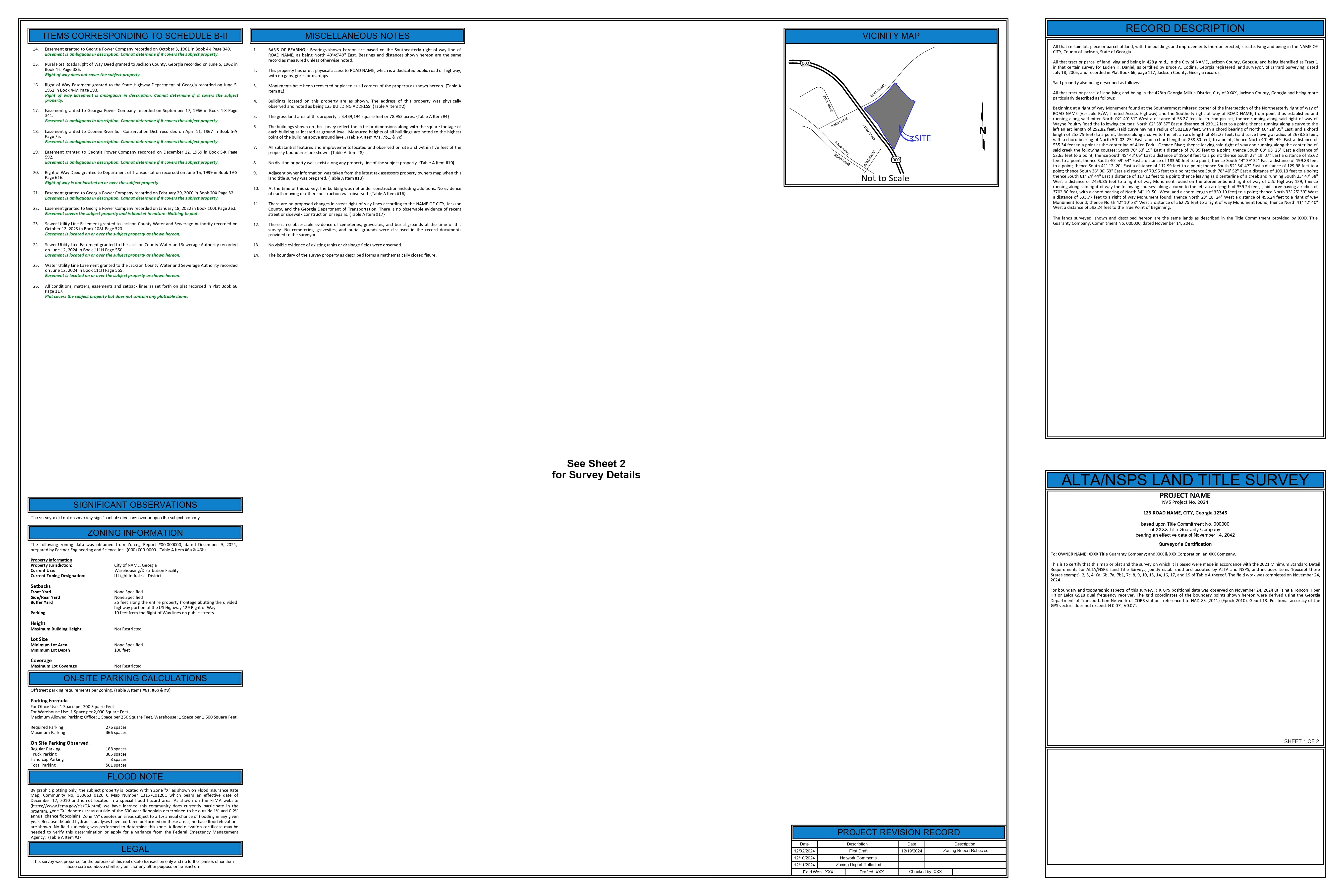
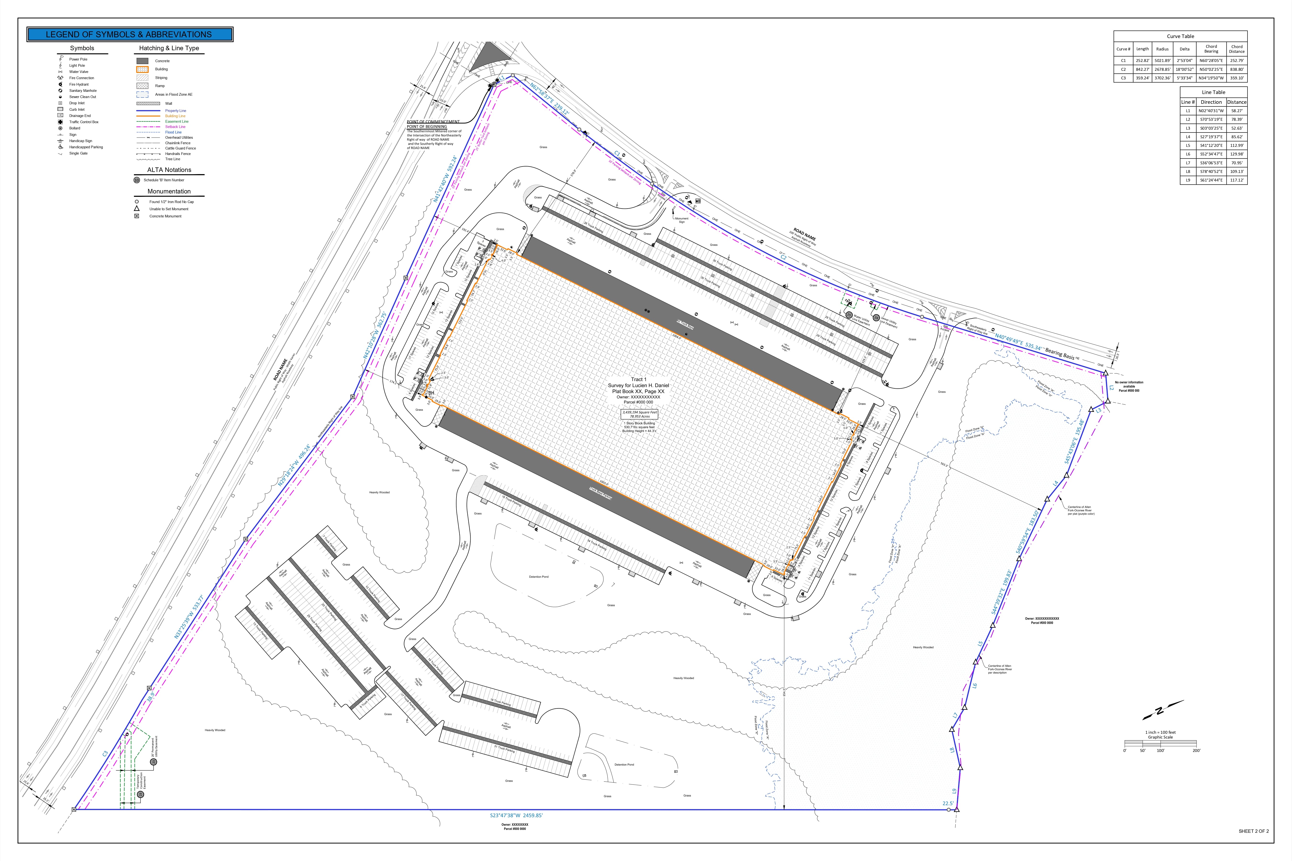
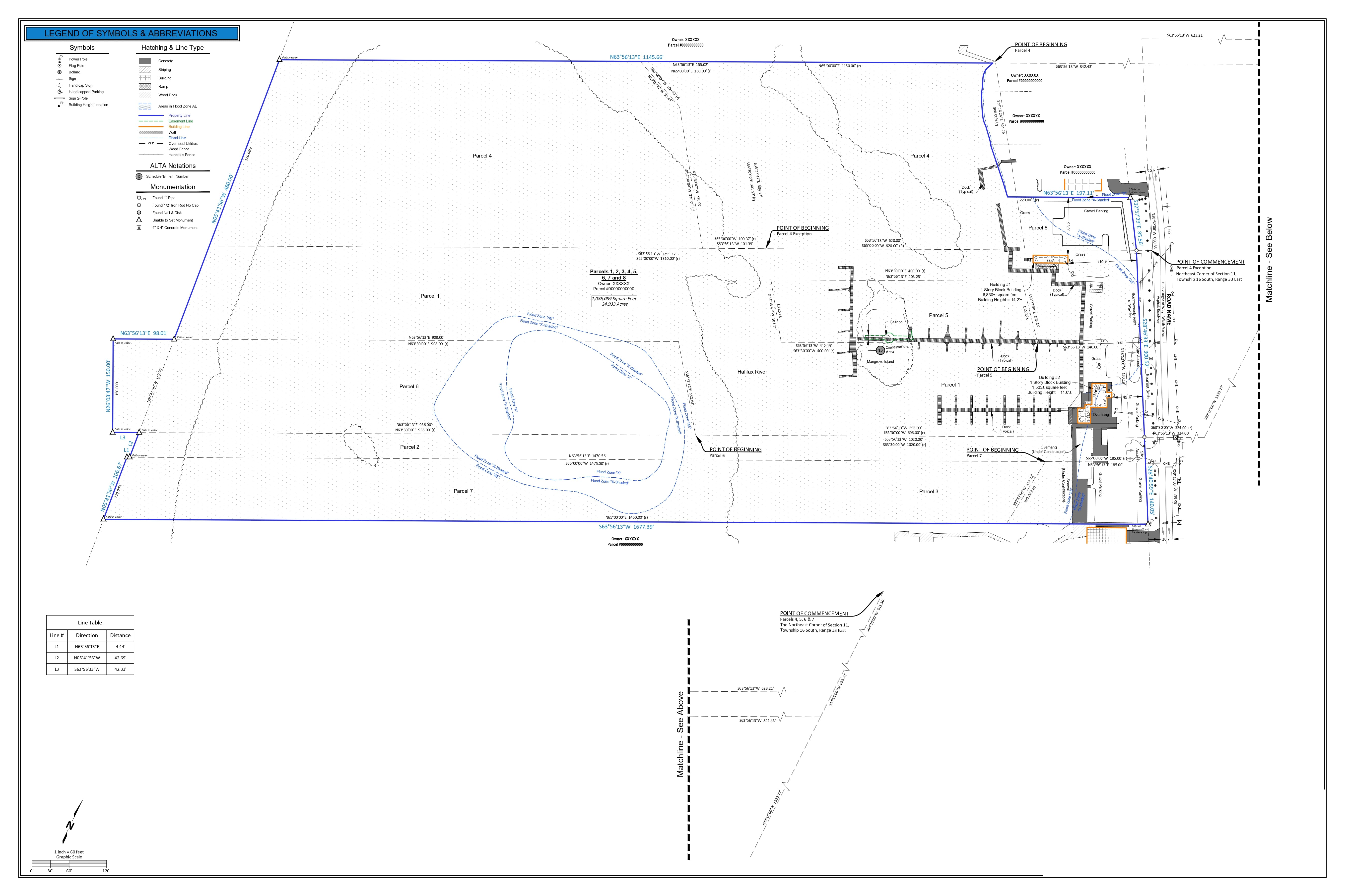
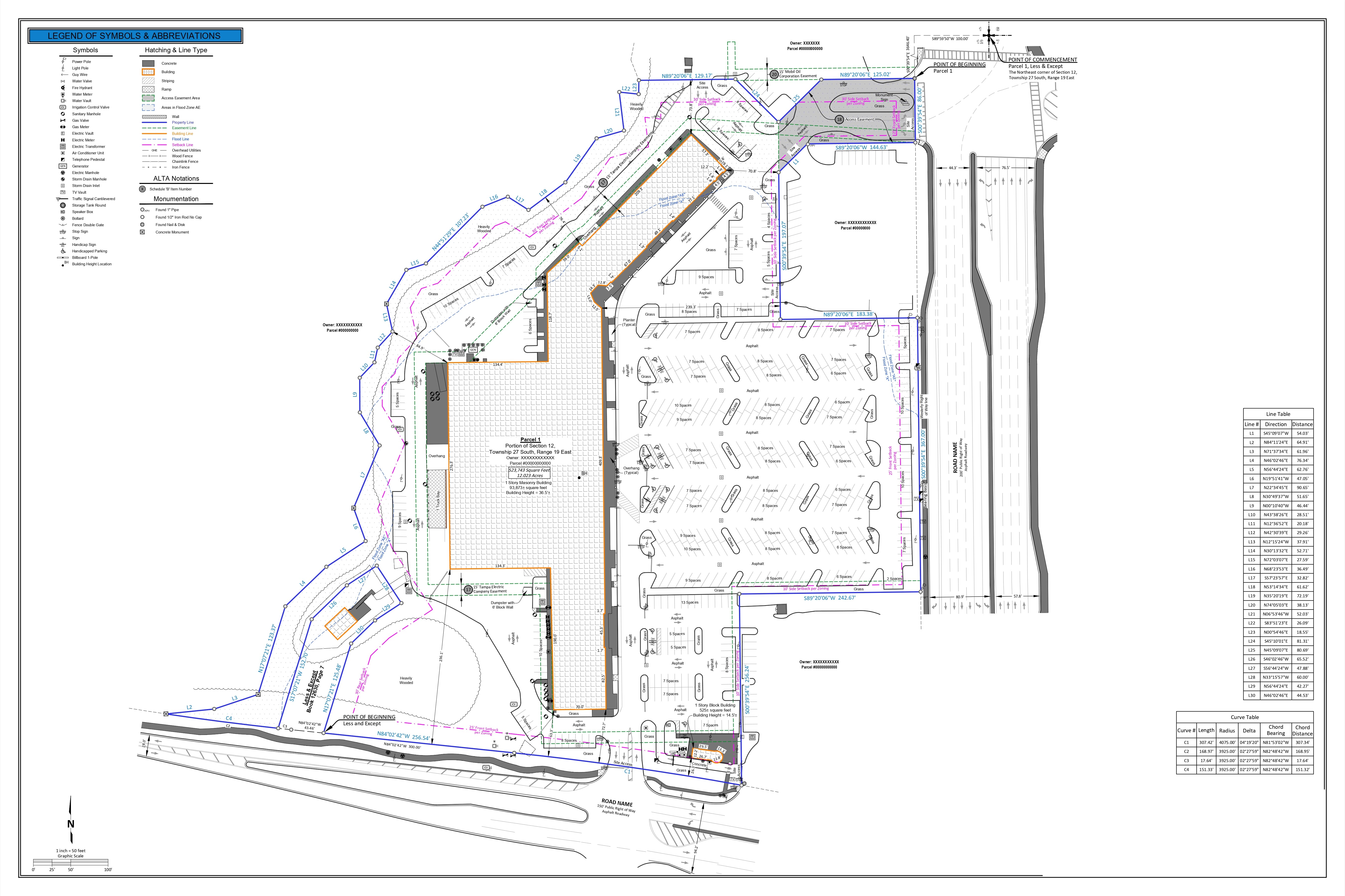
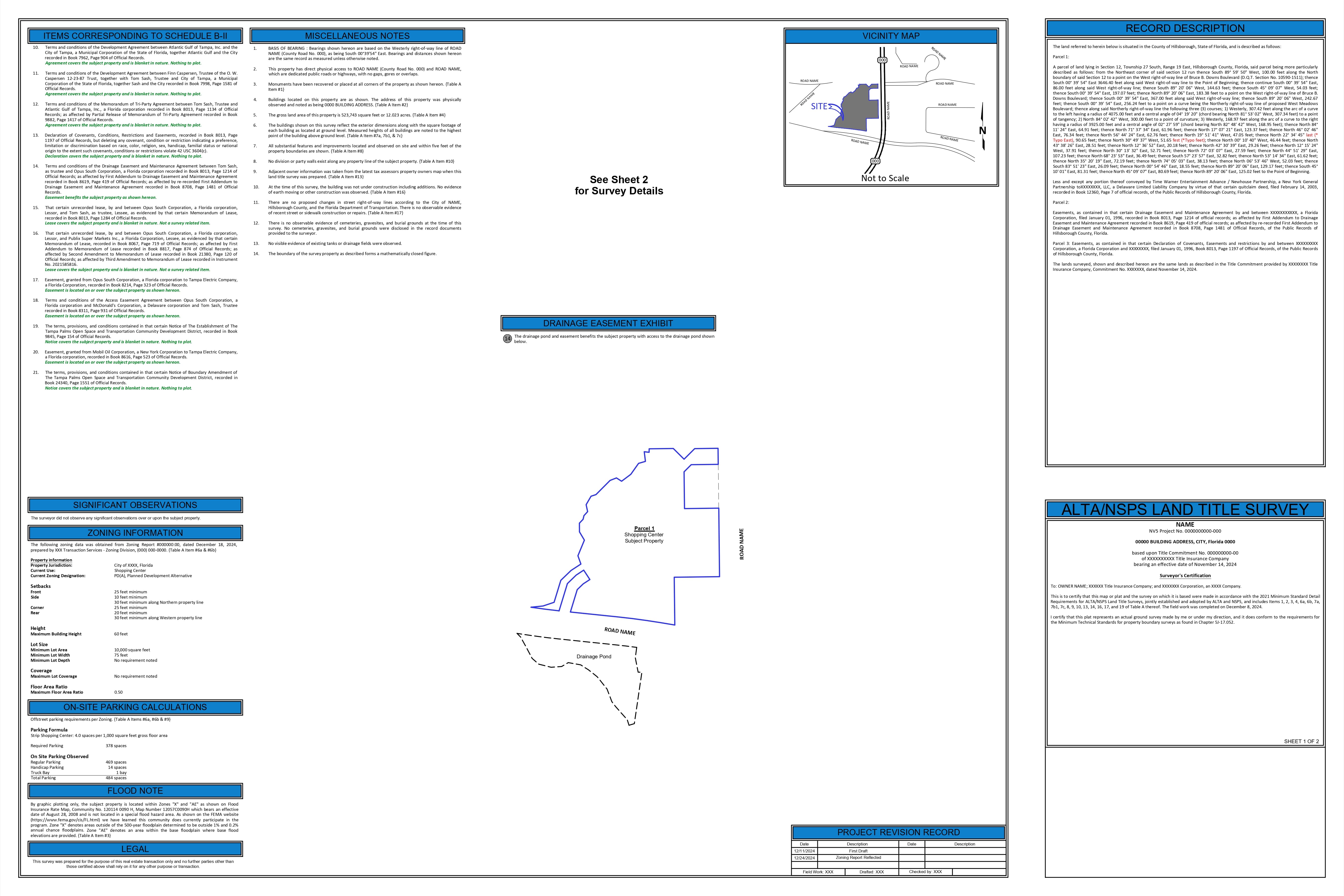
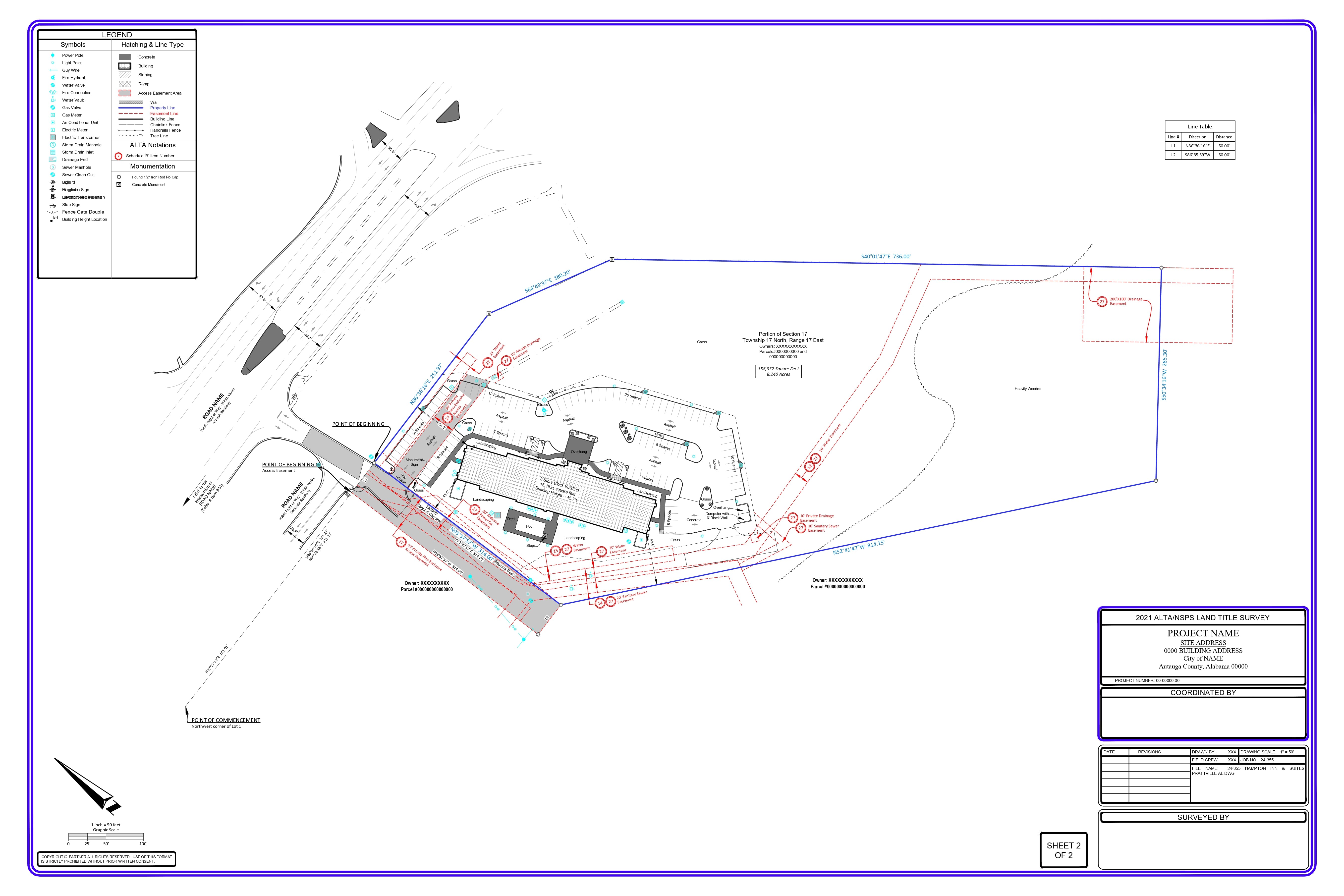
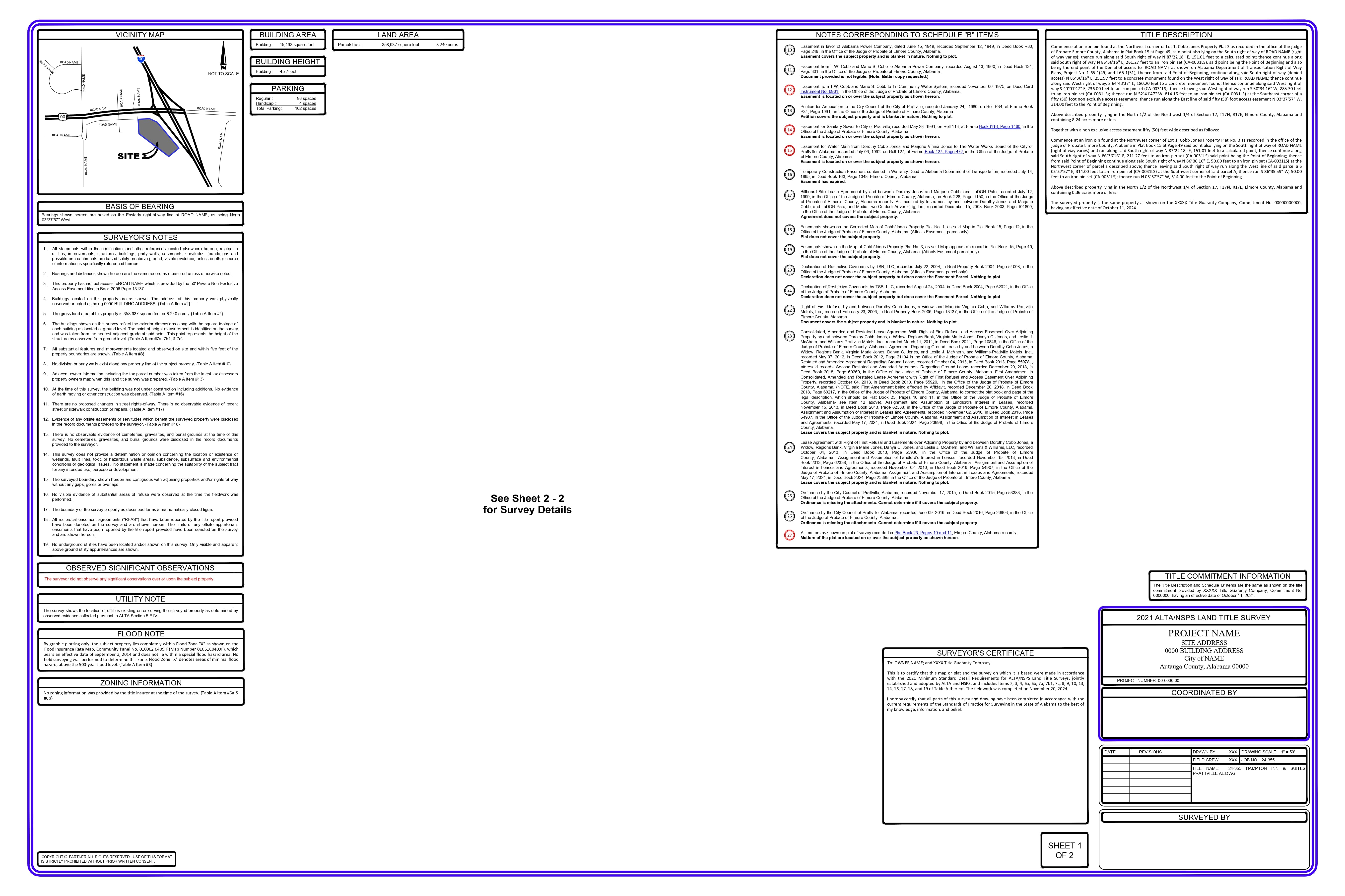
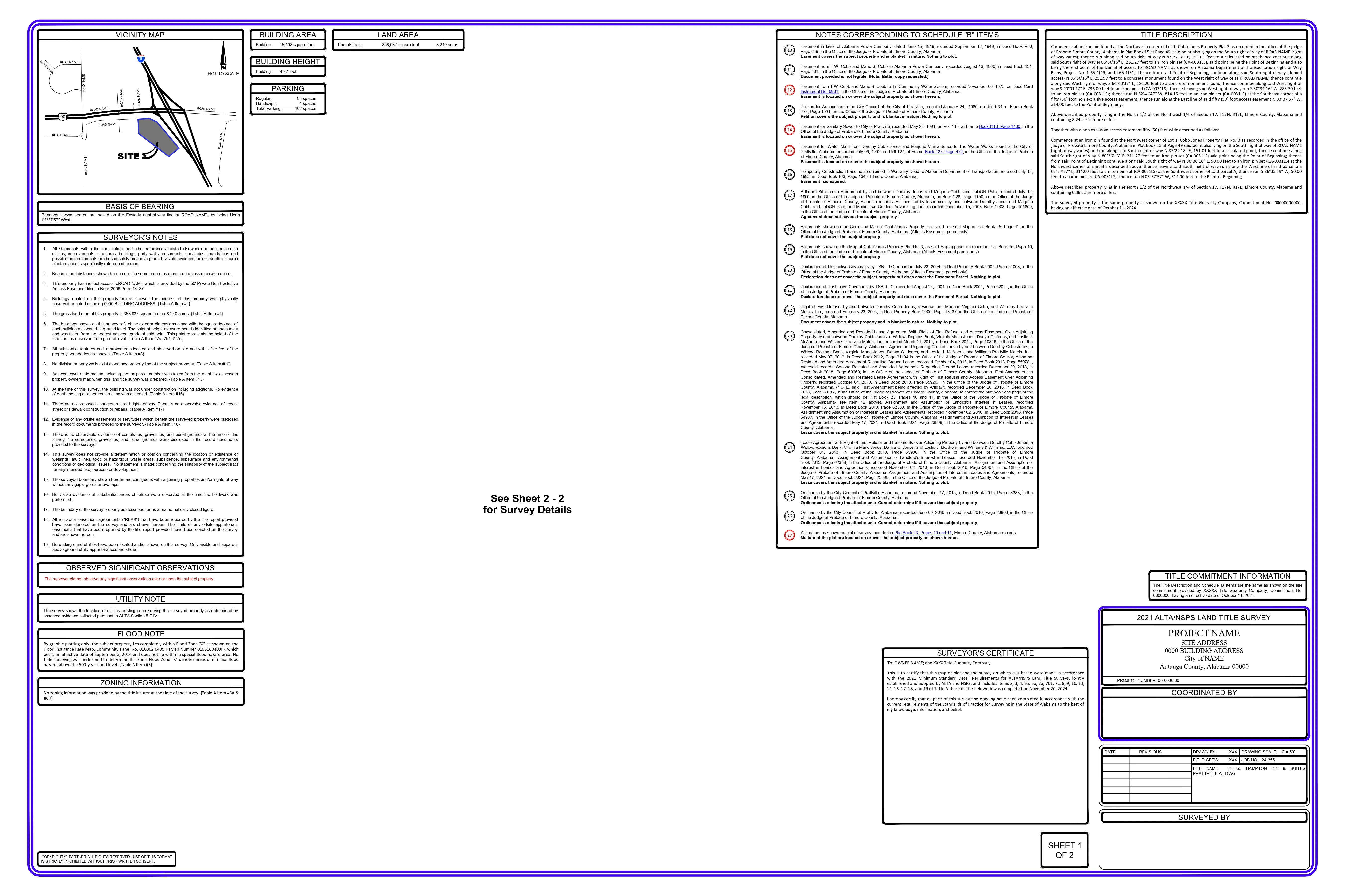
We receive the COGO points along with all the necessary county documents.
Using these documents, we create the property layout and follow the client’s priority list to establish a step-by-step procedure for COGO point rotation, identifying the best possible rotation and placing the points accordingly.
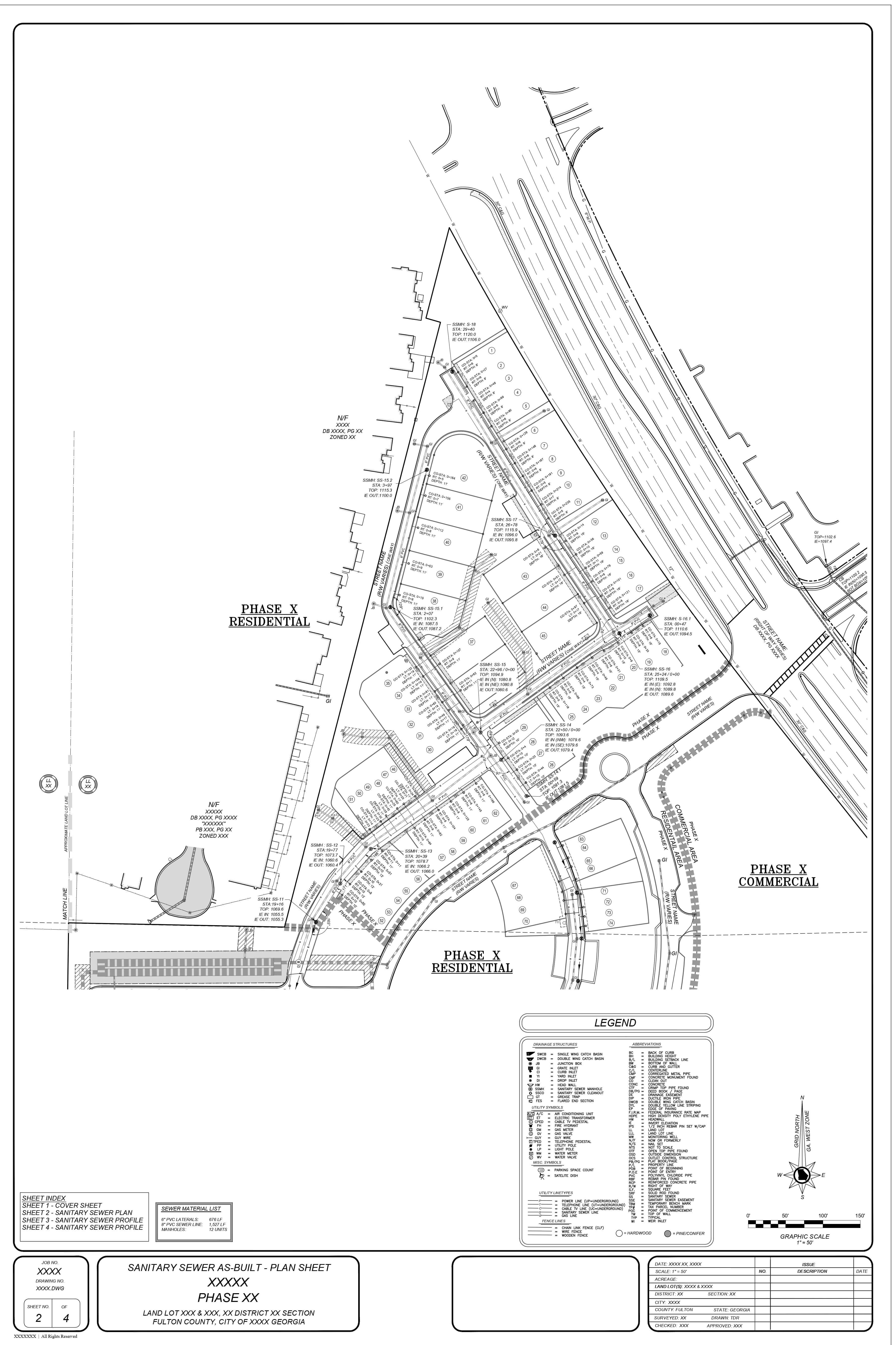
All improvements are drafted using the field sketch and COGO points and labeled in accordance with the established standards.
FEMA data, deed information, field information, legends, and templates are updated to align with the property details and specific project requirements.
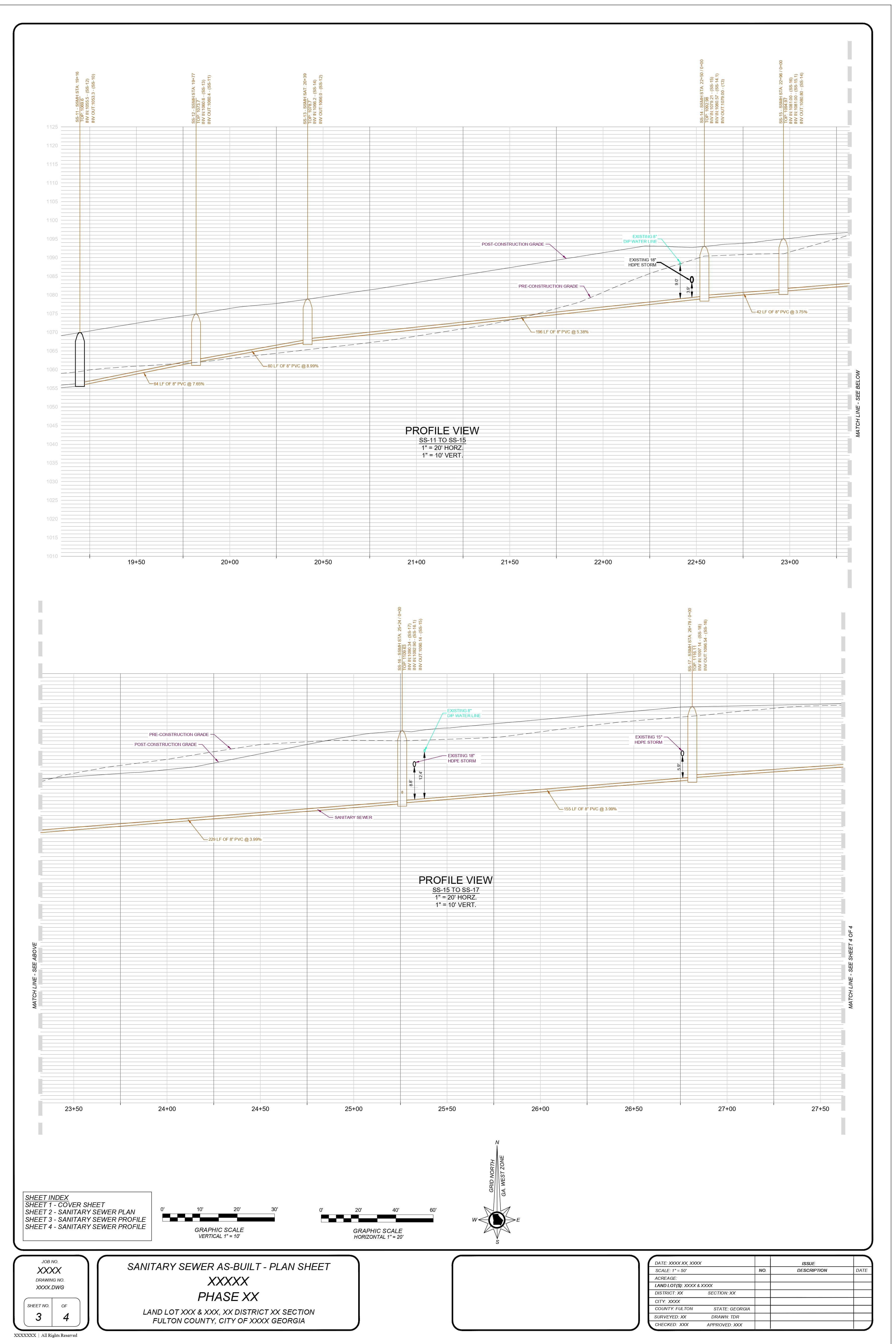
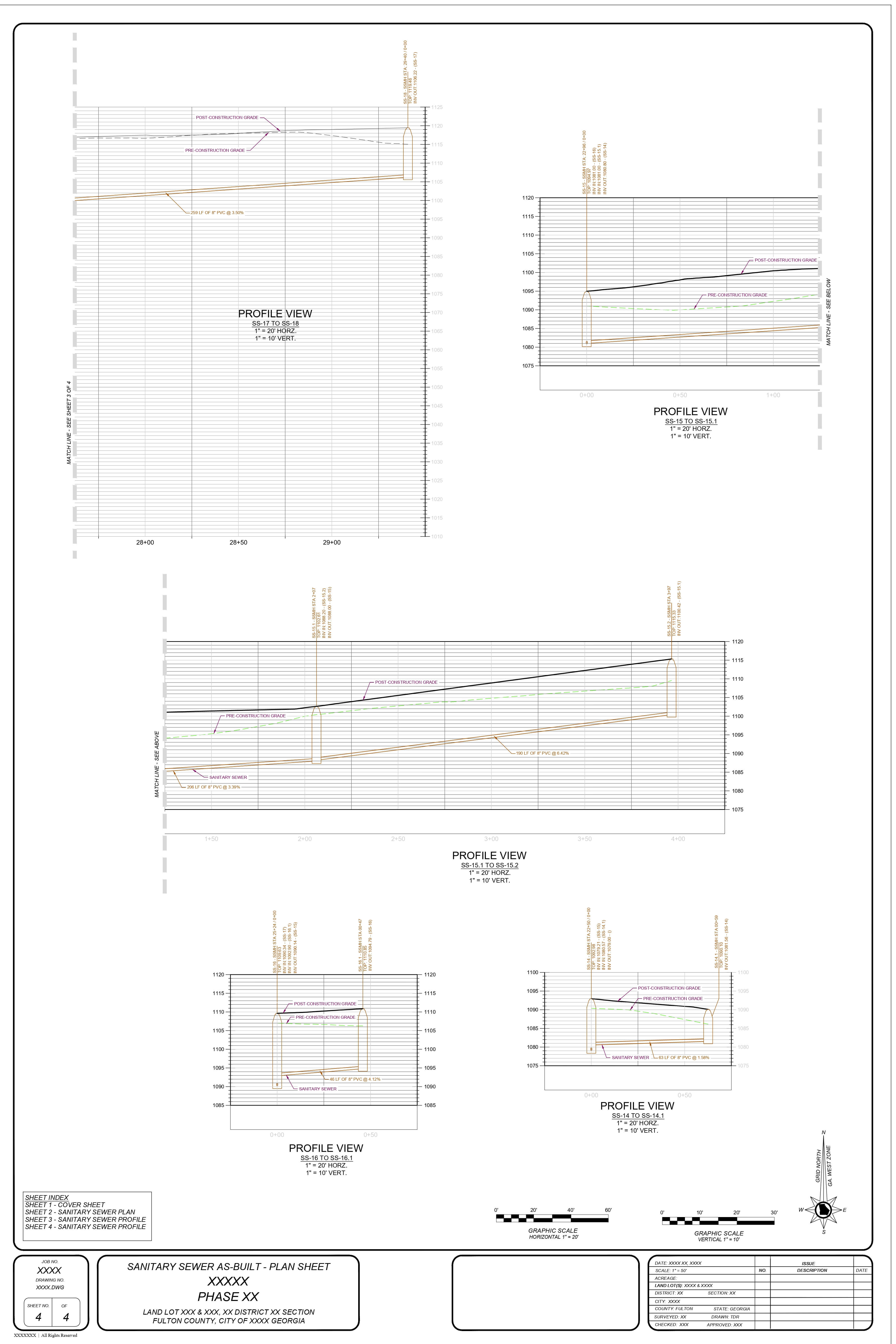
For projects which need surface contours, basis the client’s requirements we generated the contours with the established standards of our client.
Boundary Commercial Survey-1_Virginia
Boundary Residencial Survey-2_Virginia
Boundary Residencial Topographic Survey-3_New Jersey