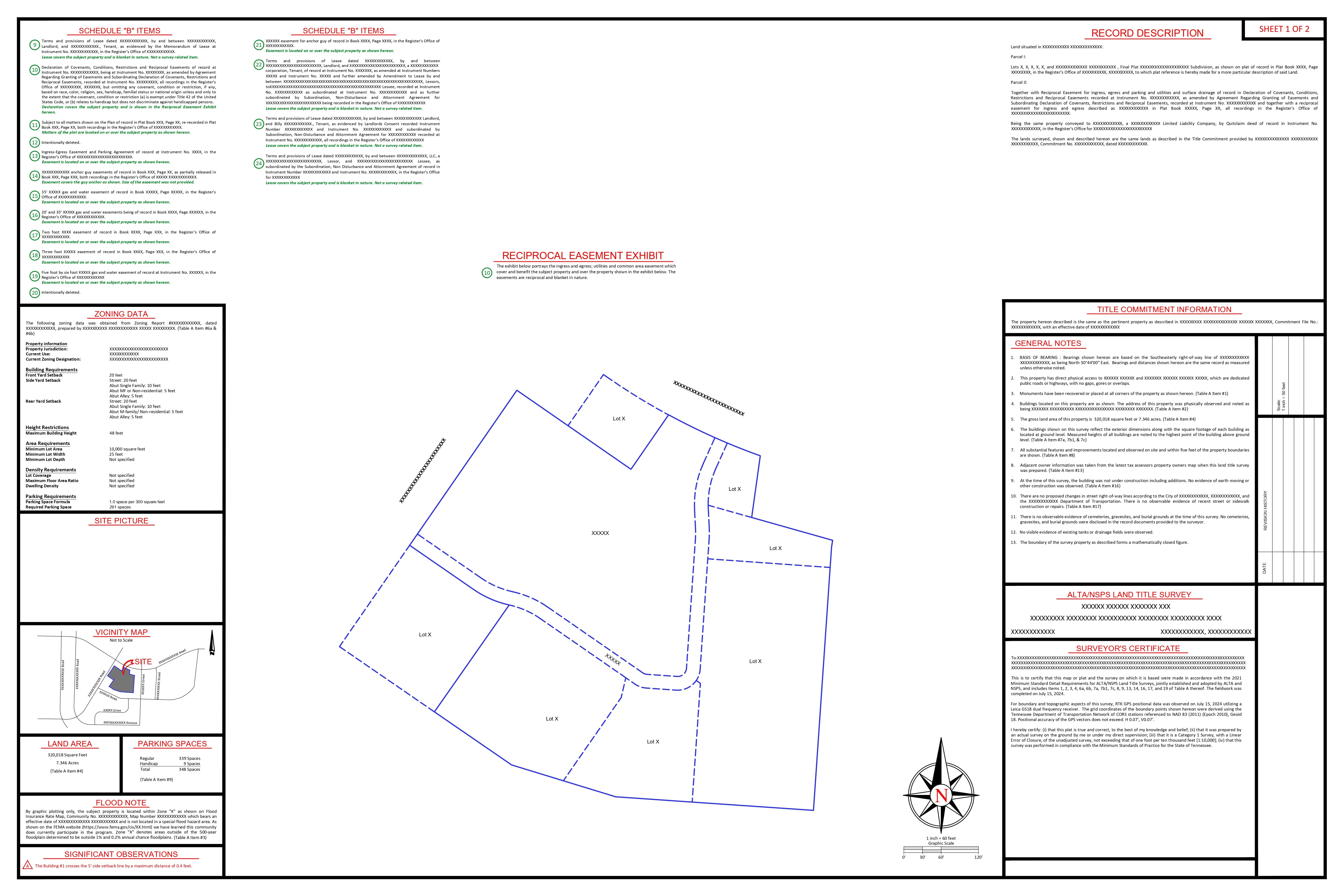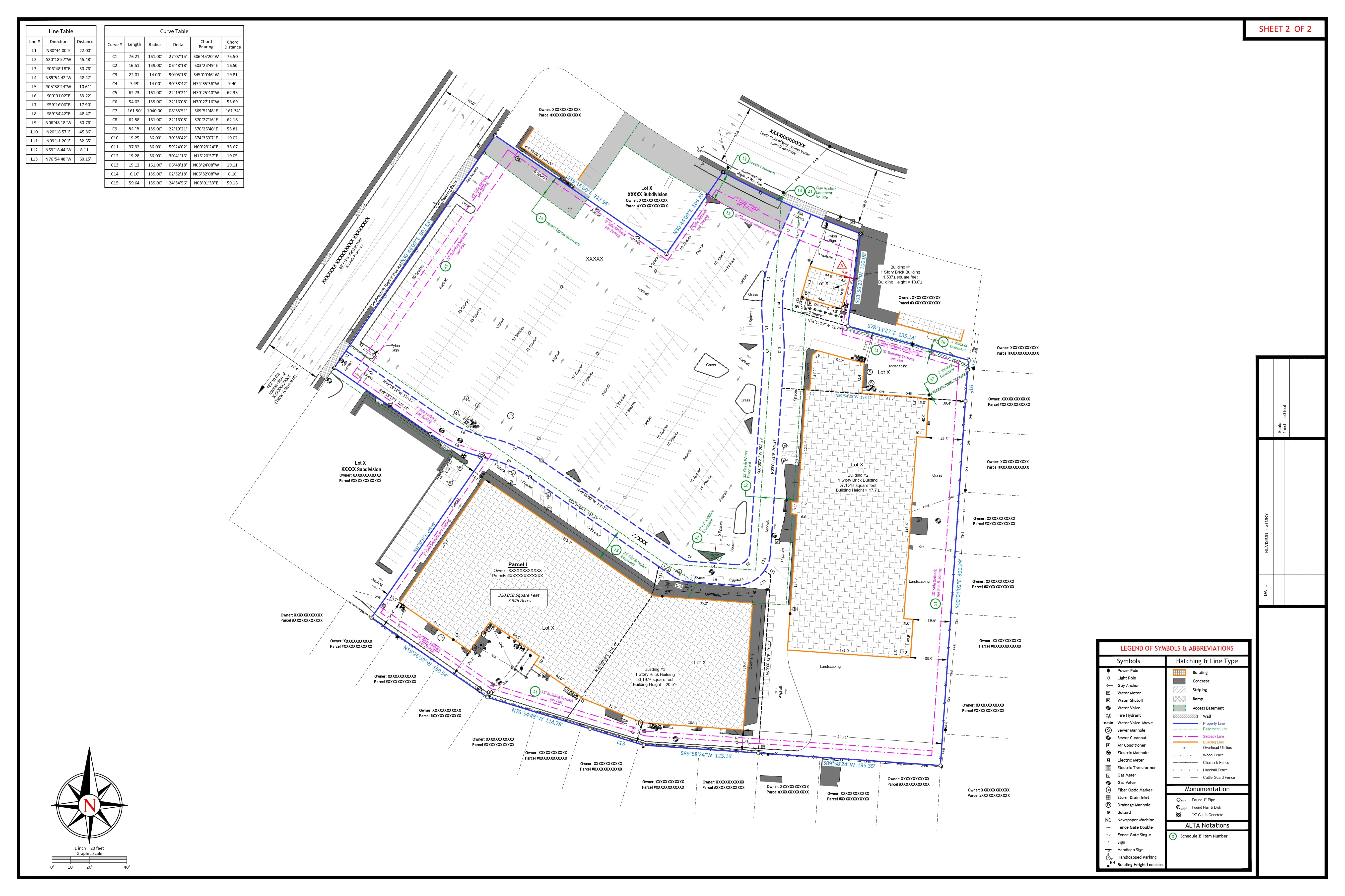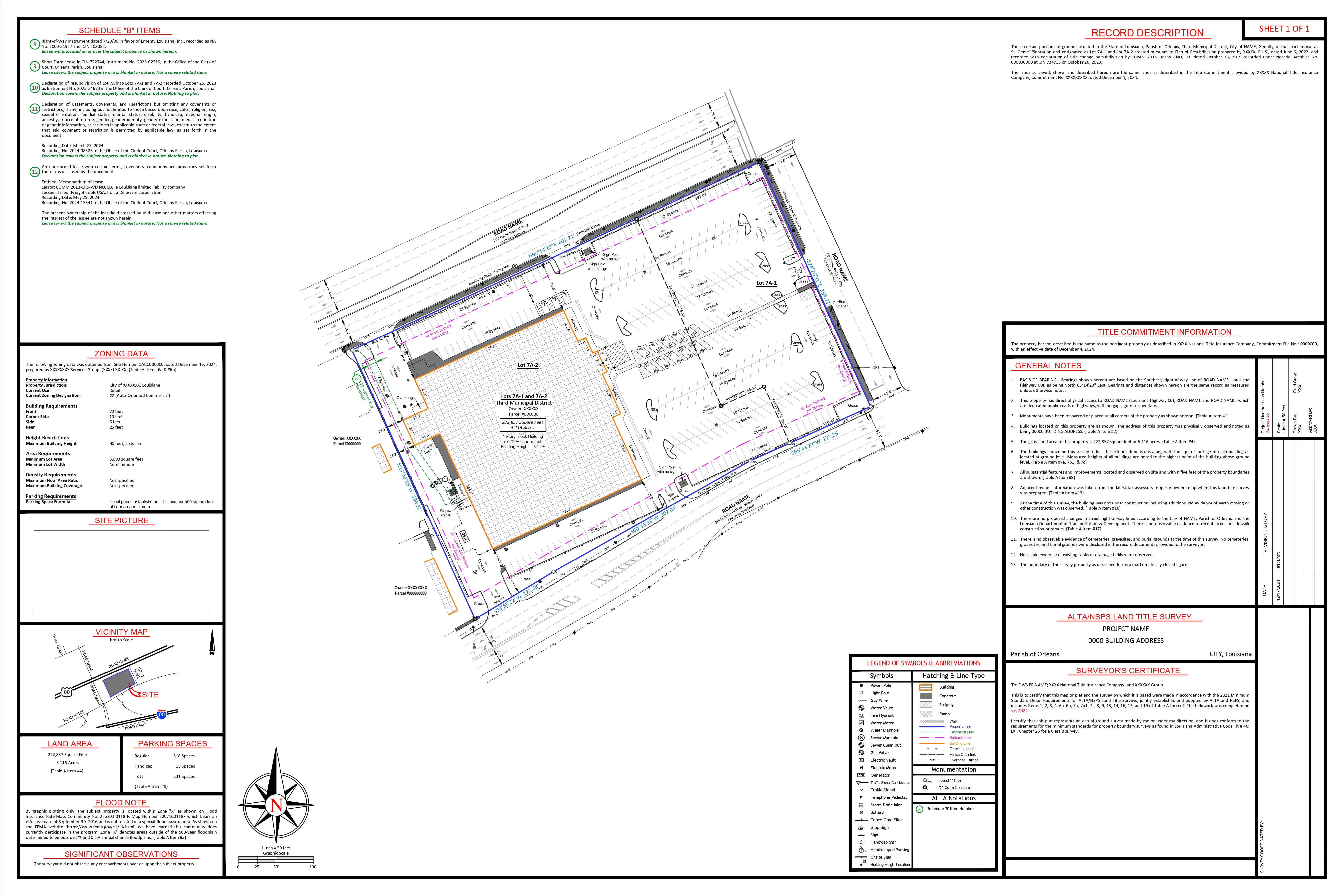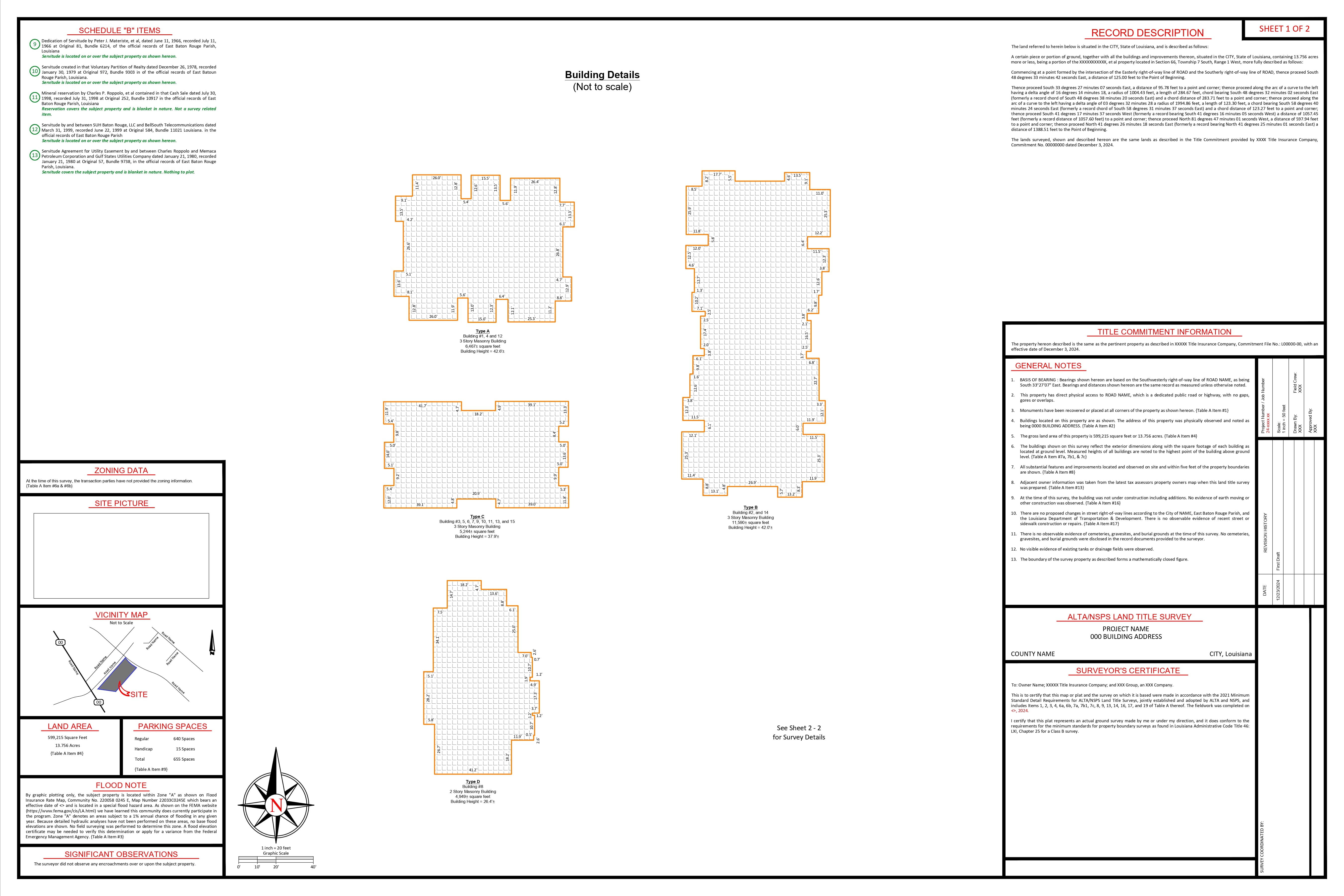


Autodesk Civil 3D

Auto CAD LT

Carlson

Bentley MicroStation

Leica Cyclone 360

Revit

Pix4D

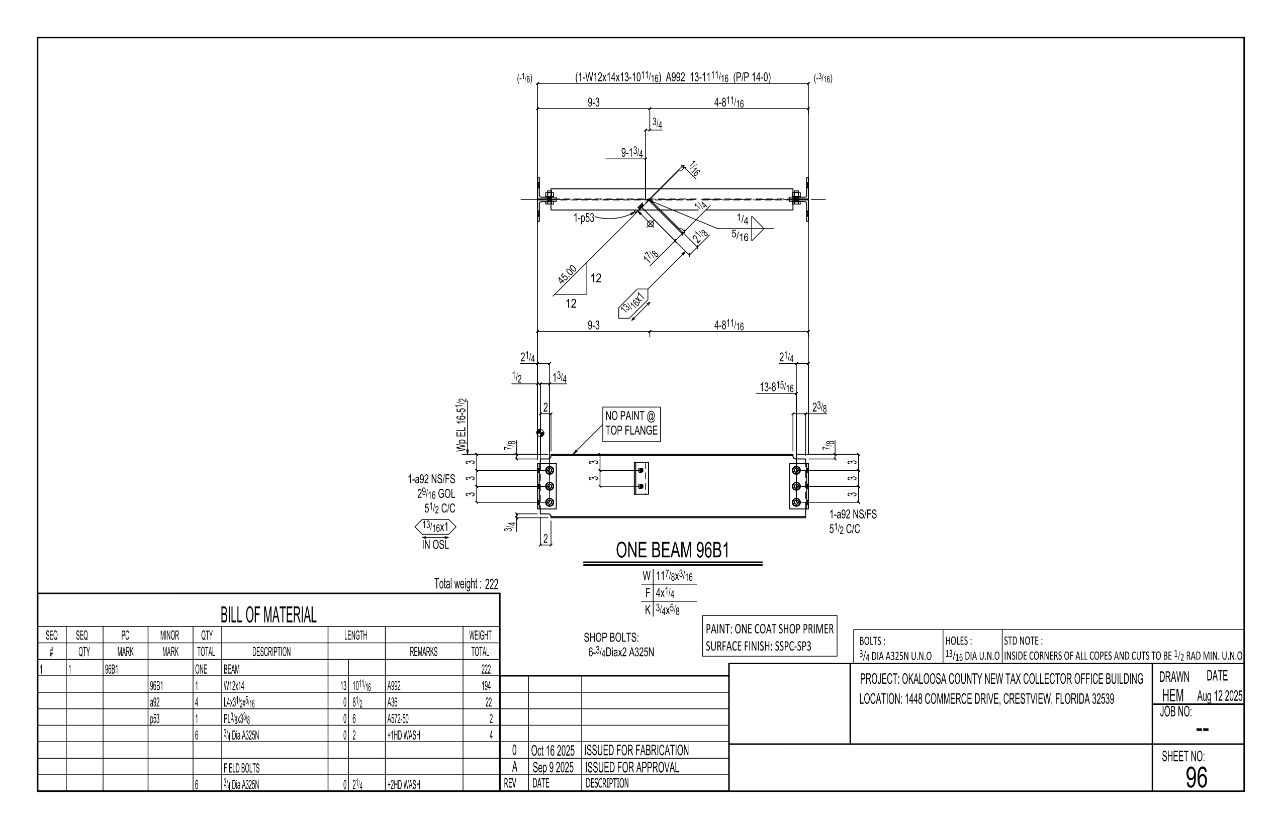
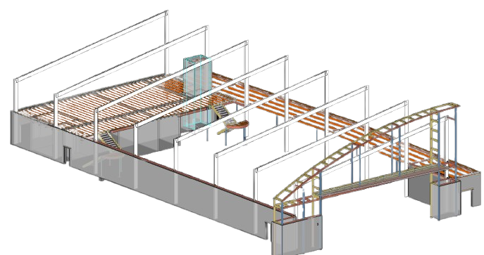
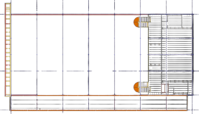
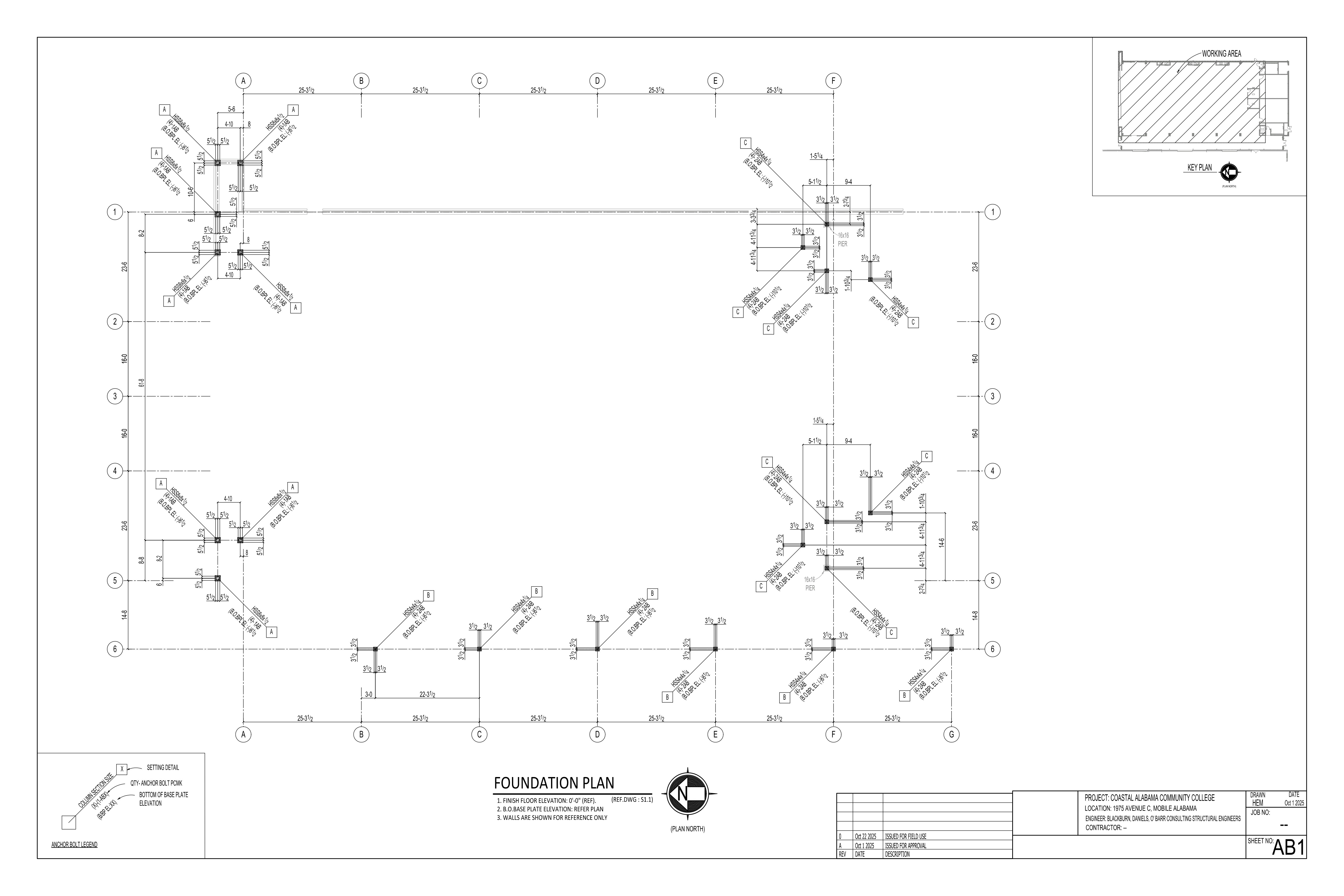
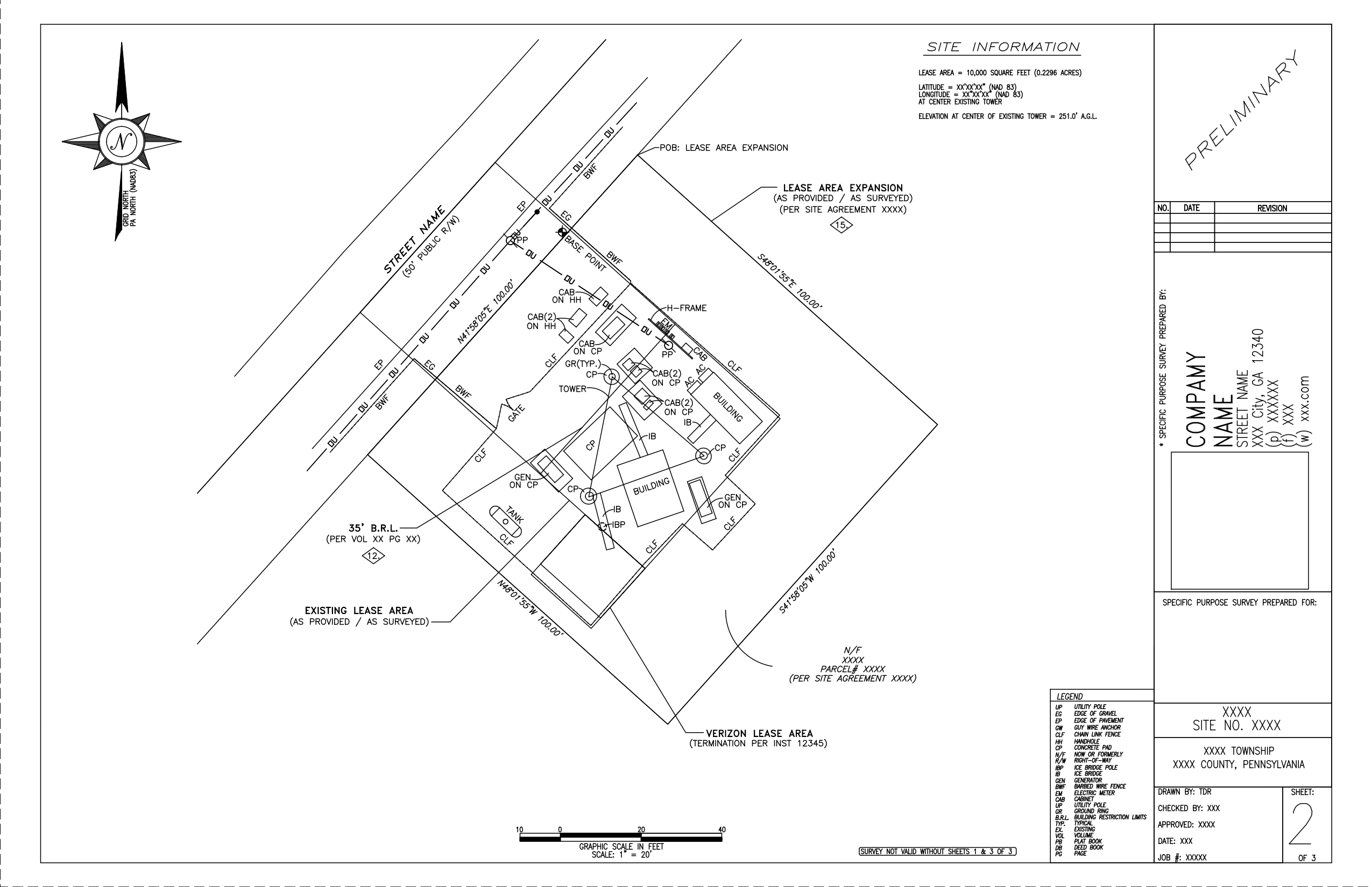
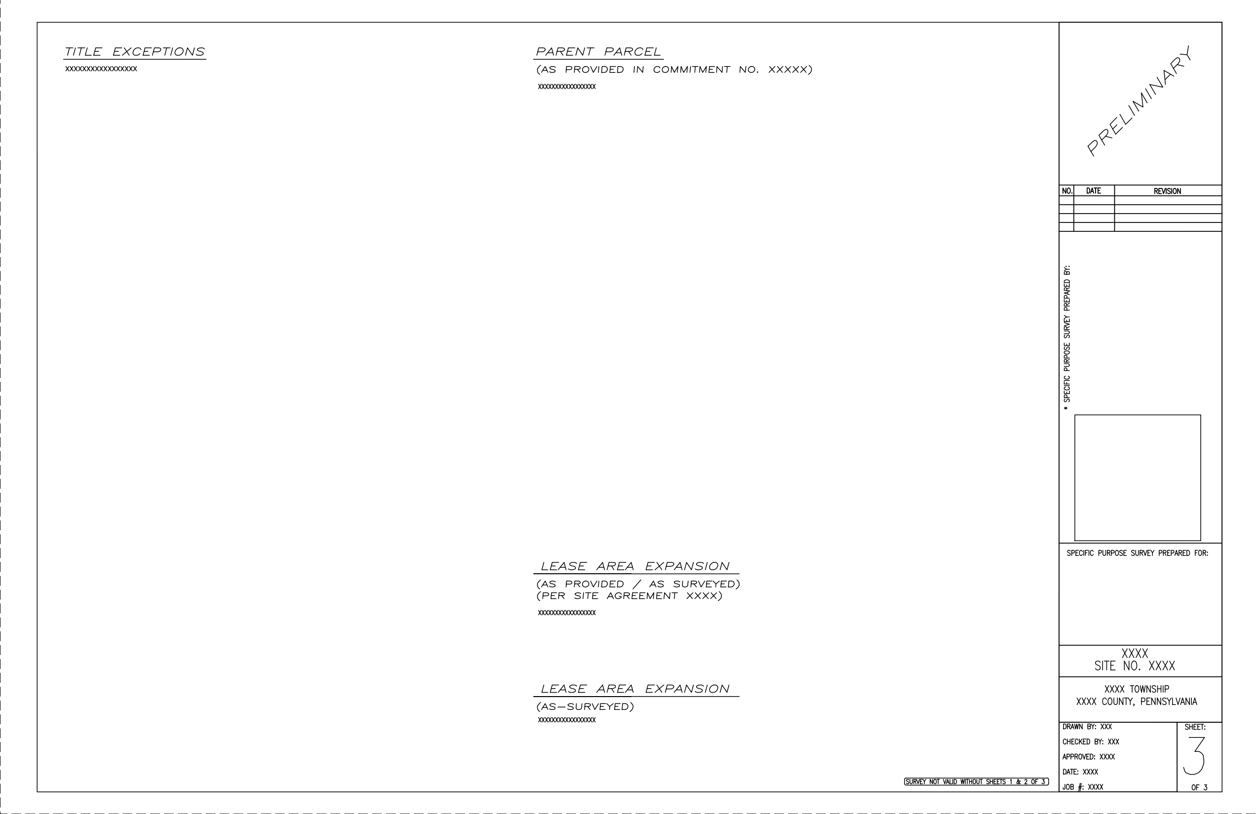
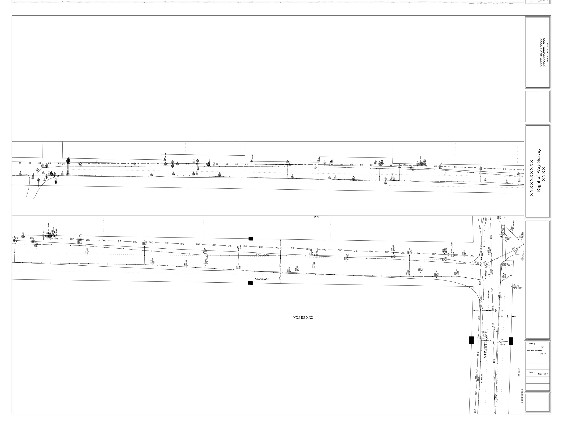
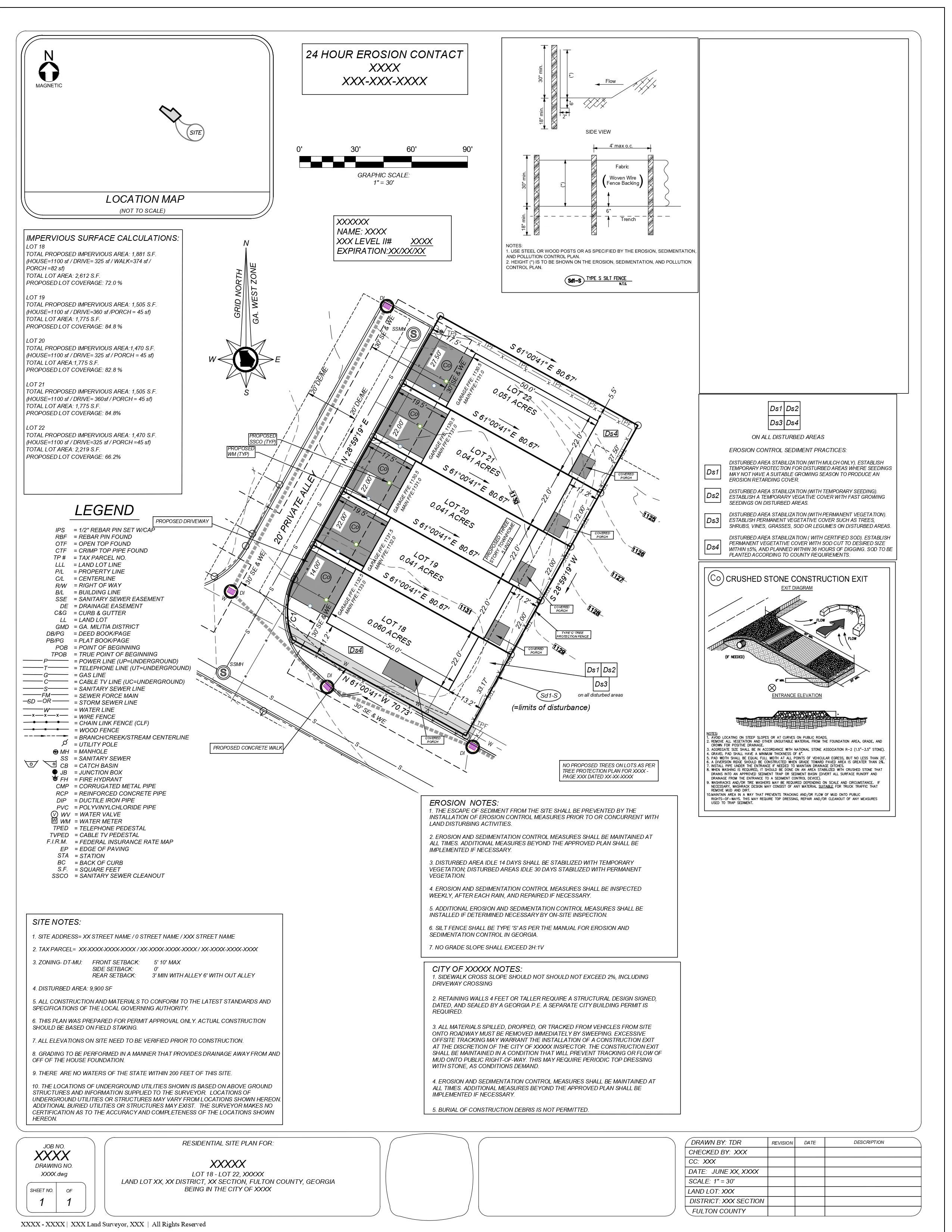
TheDraftRack © 2025
We seek to take the expertise acquired over the years & keep working diligently to adapt ourselves to the growing demands of the ever-so-changing AEC industry. The process is to learn – replicate – learn – replicate.