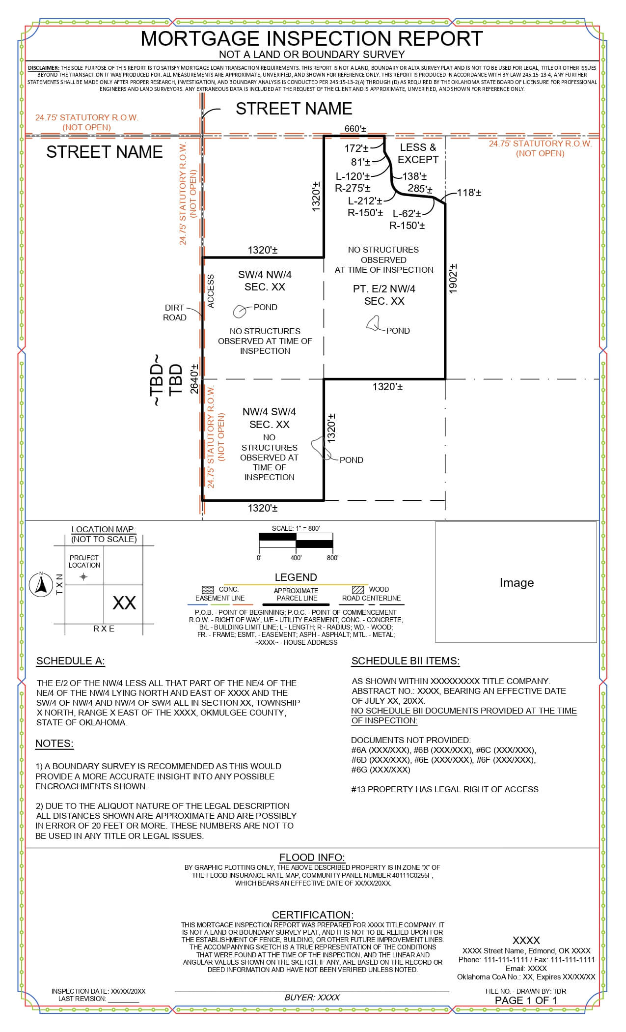
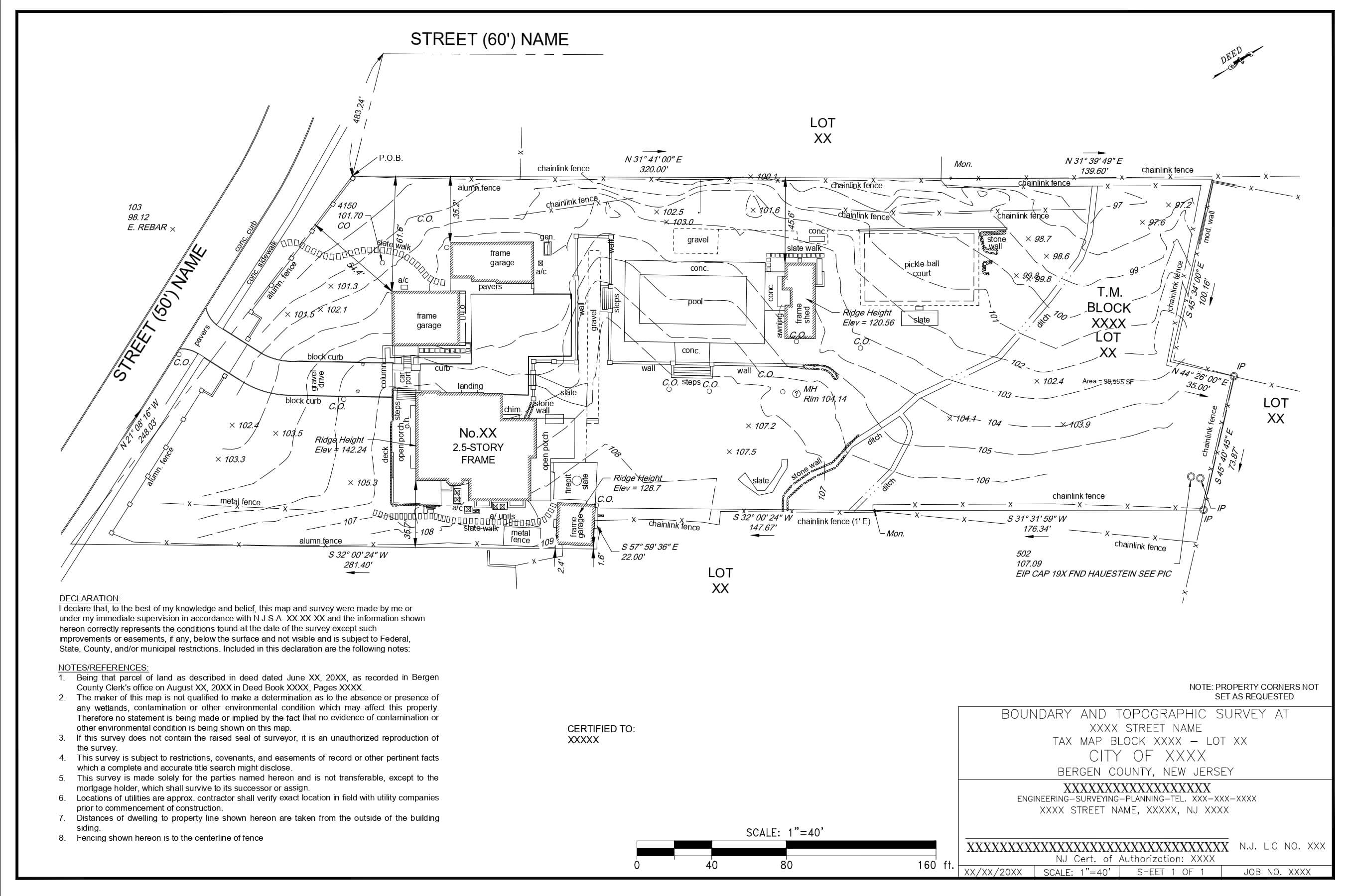
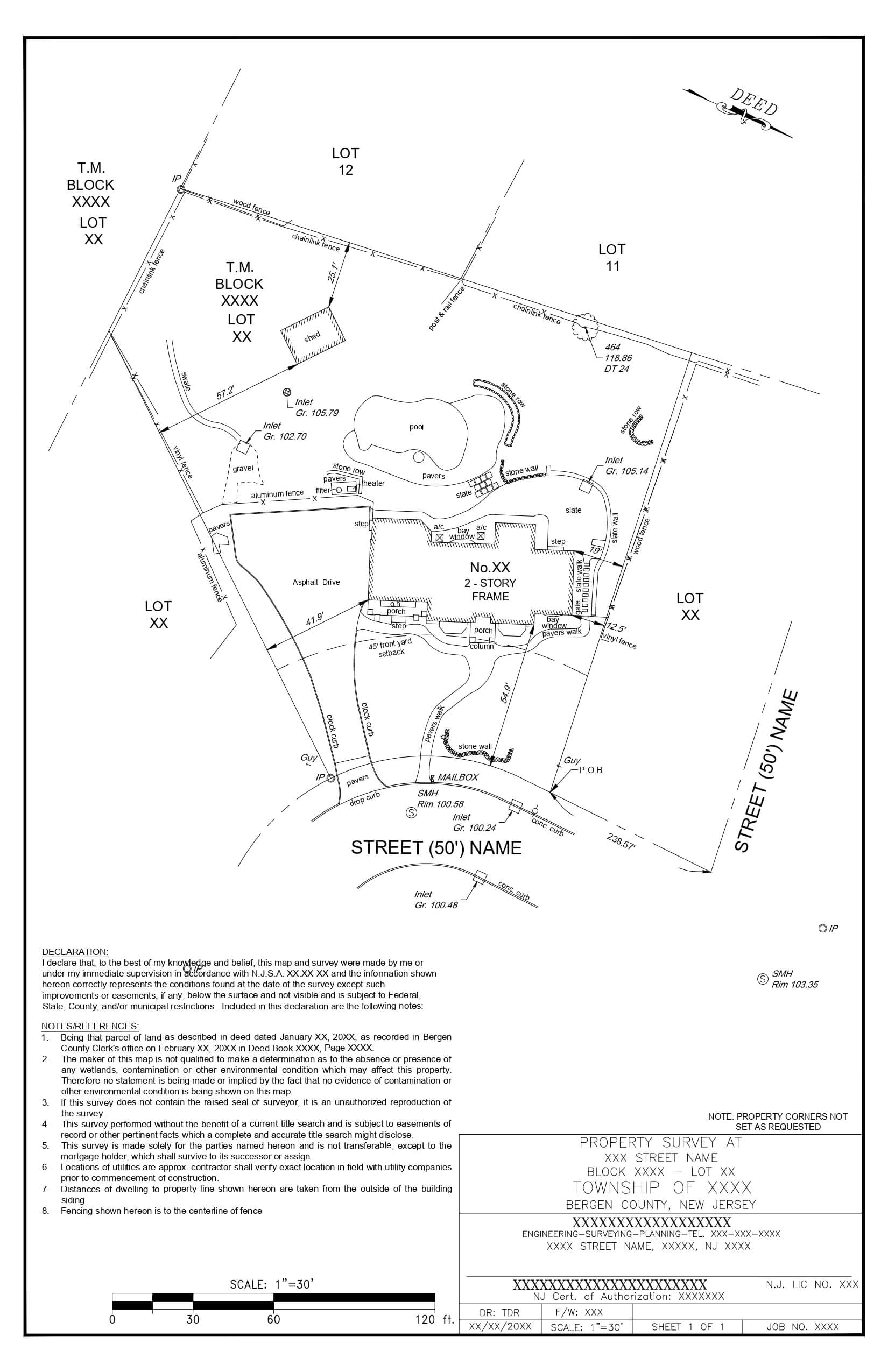
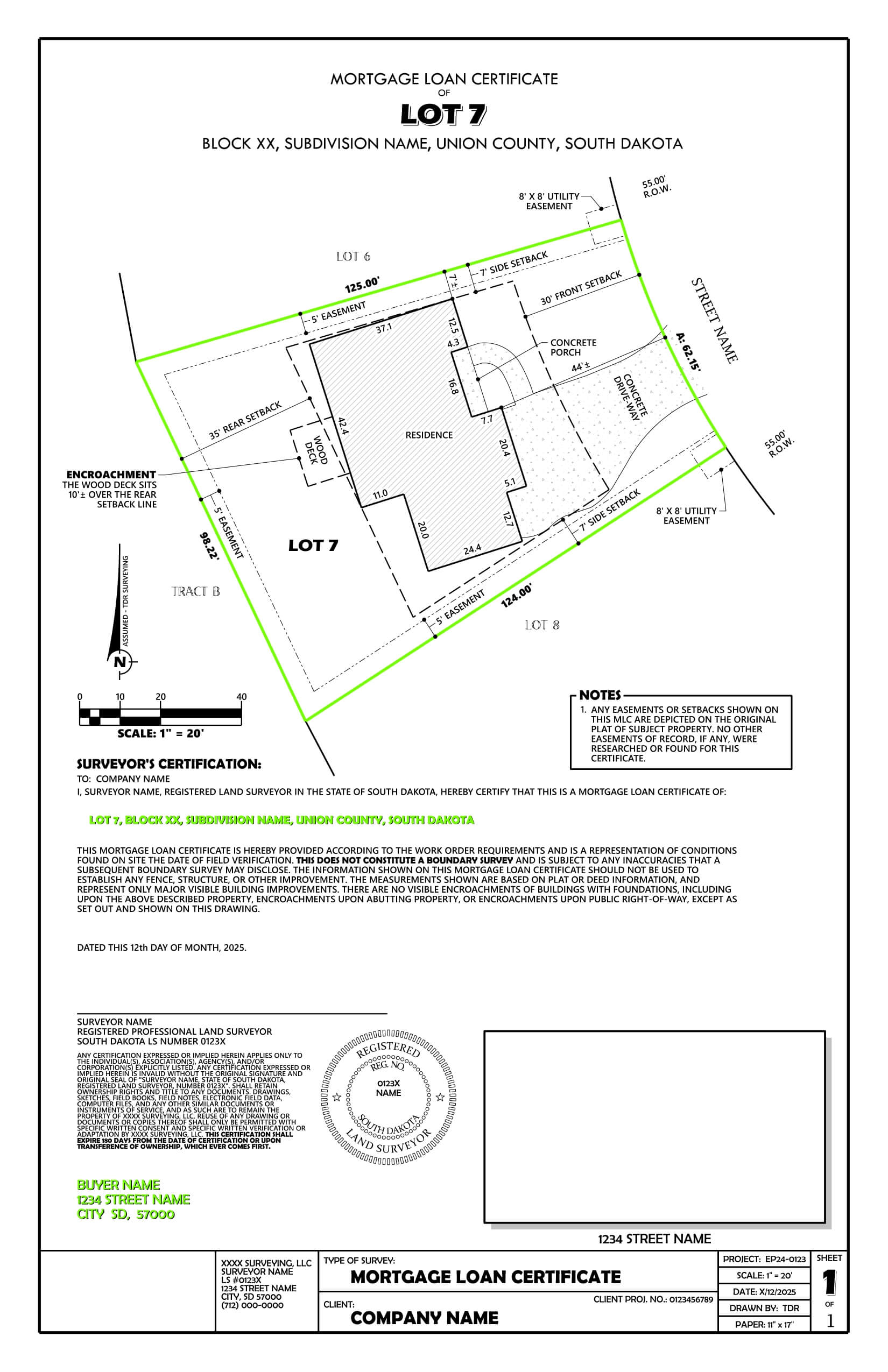
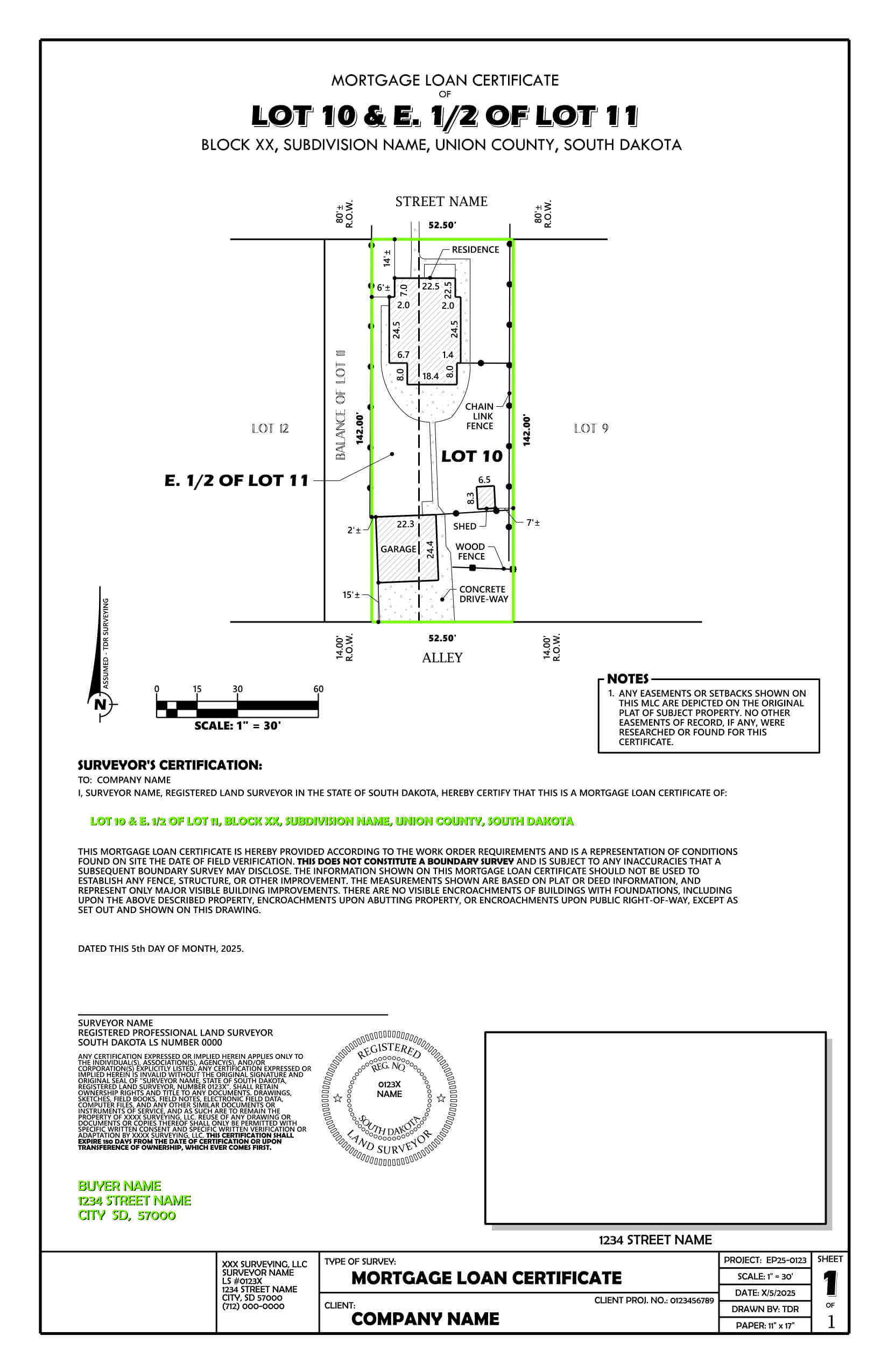
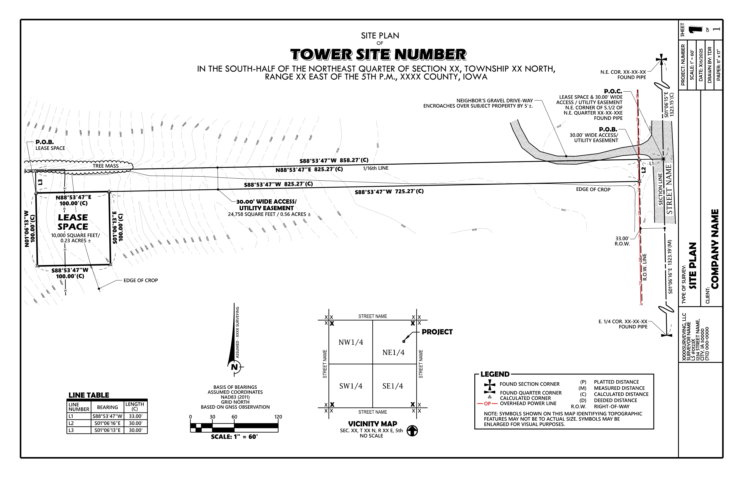
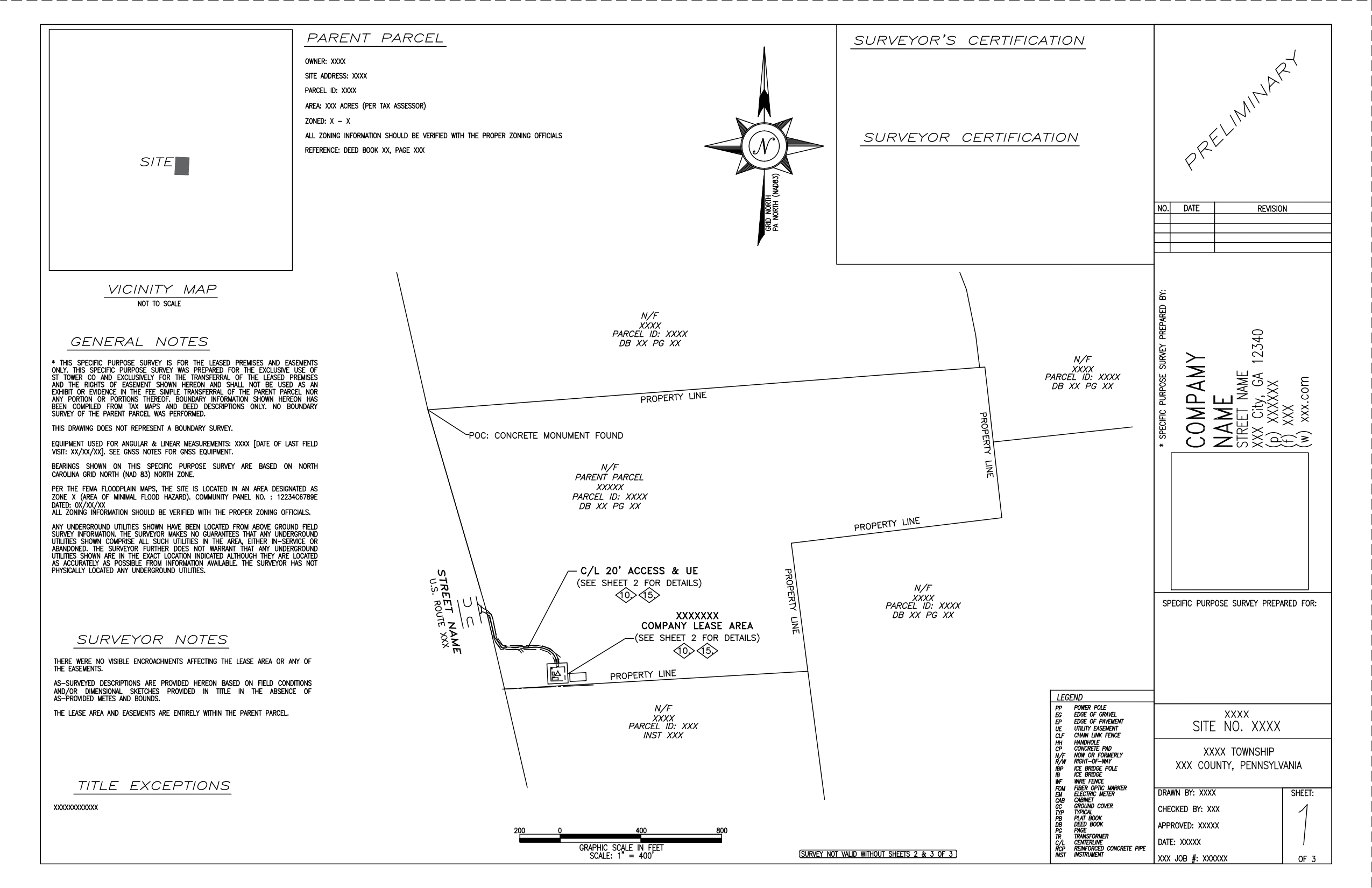
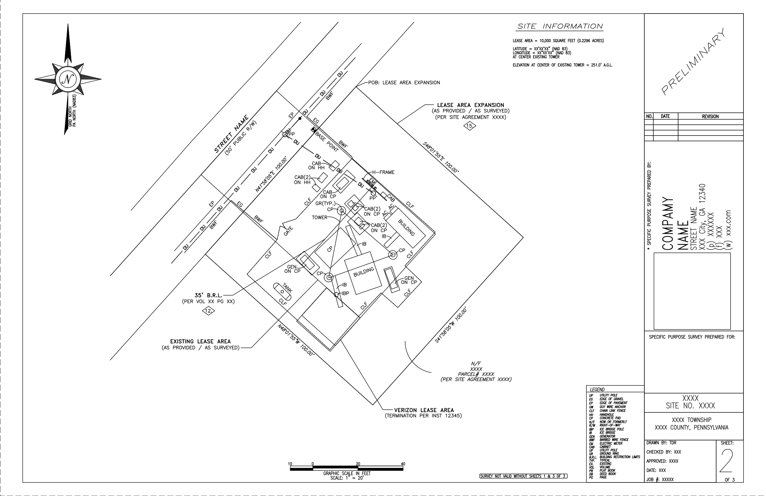
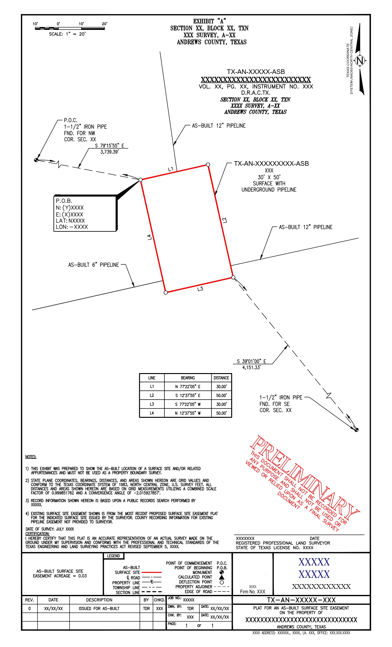
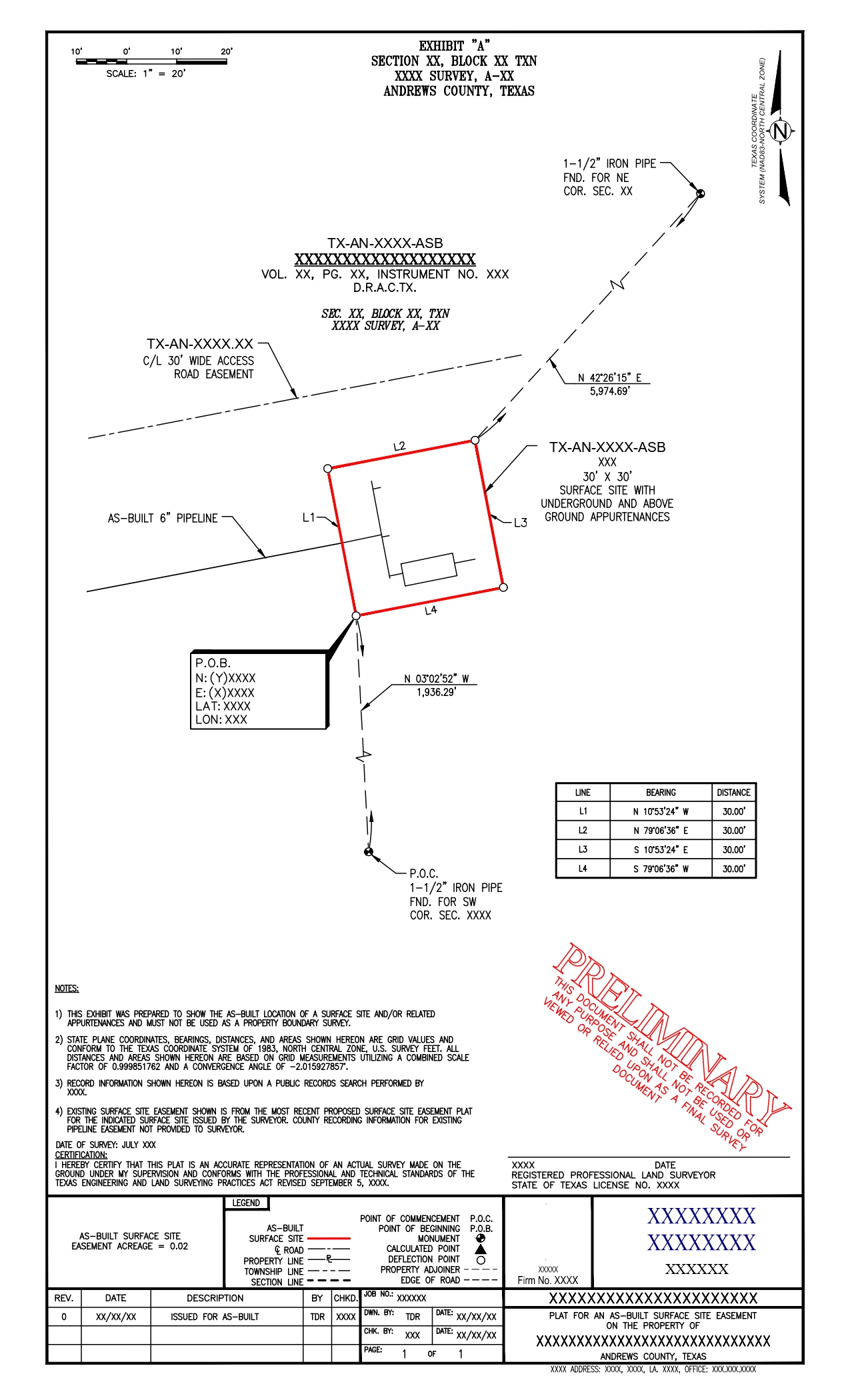
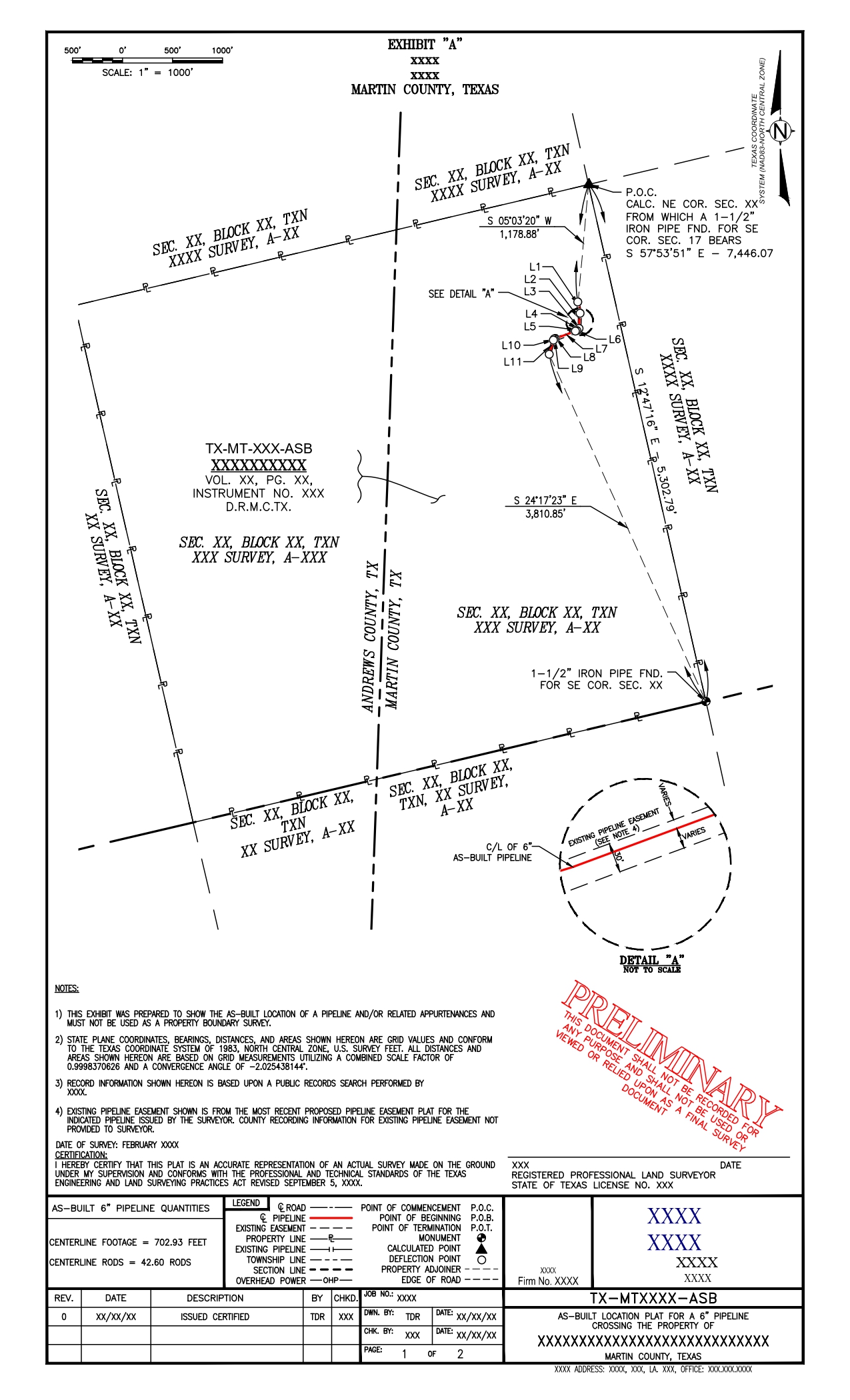
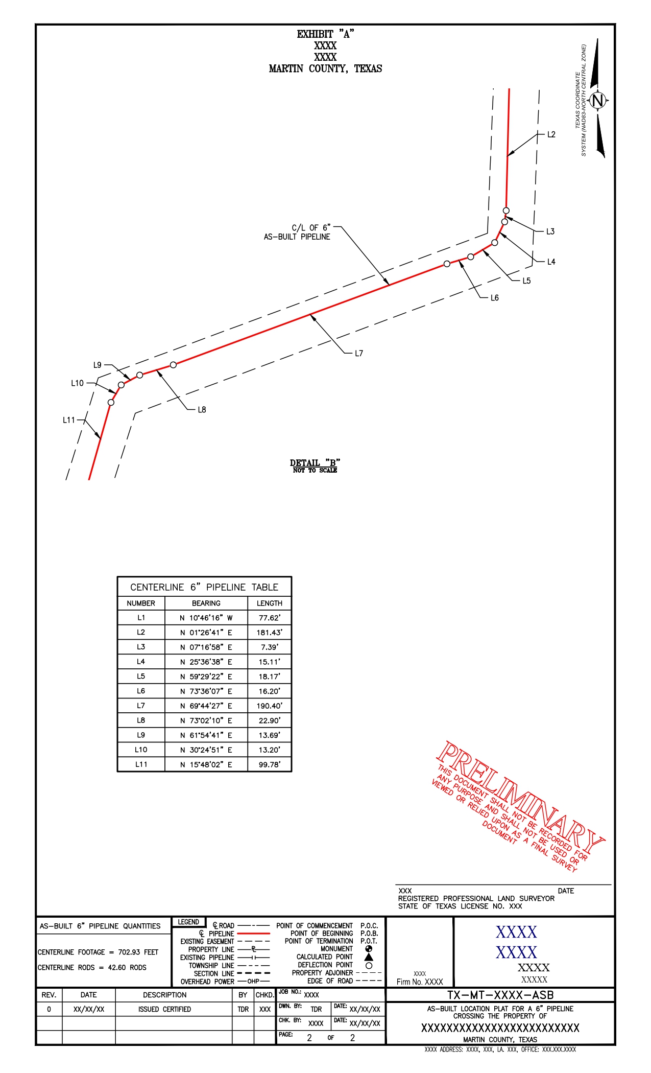
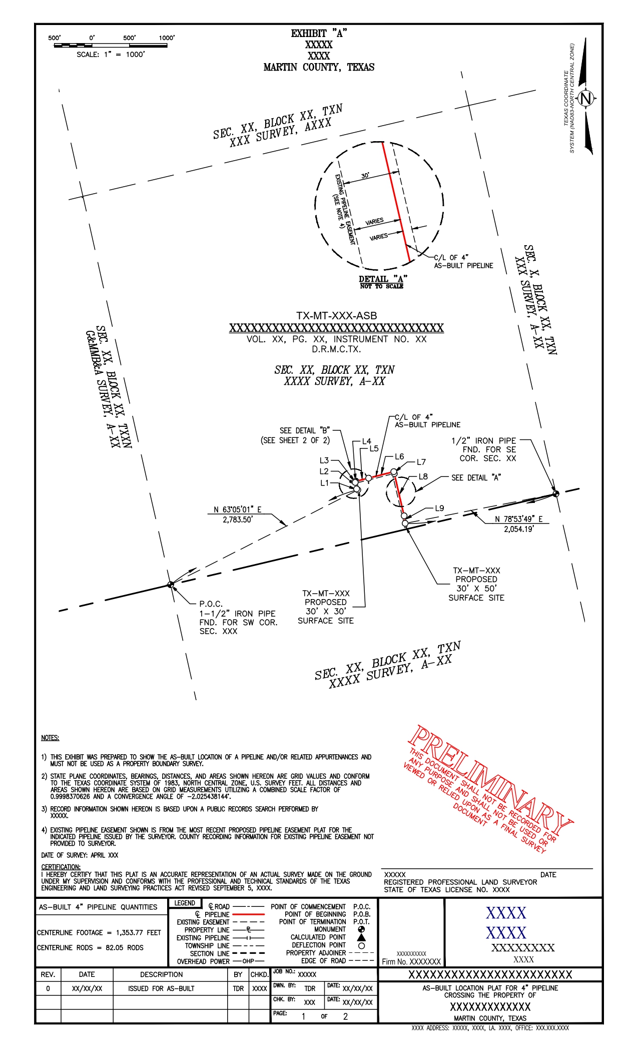
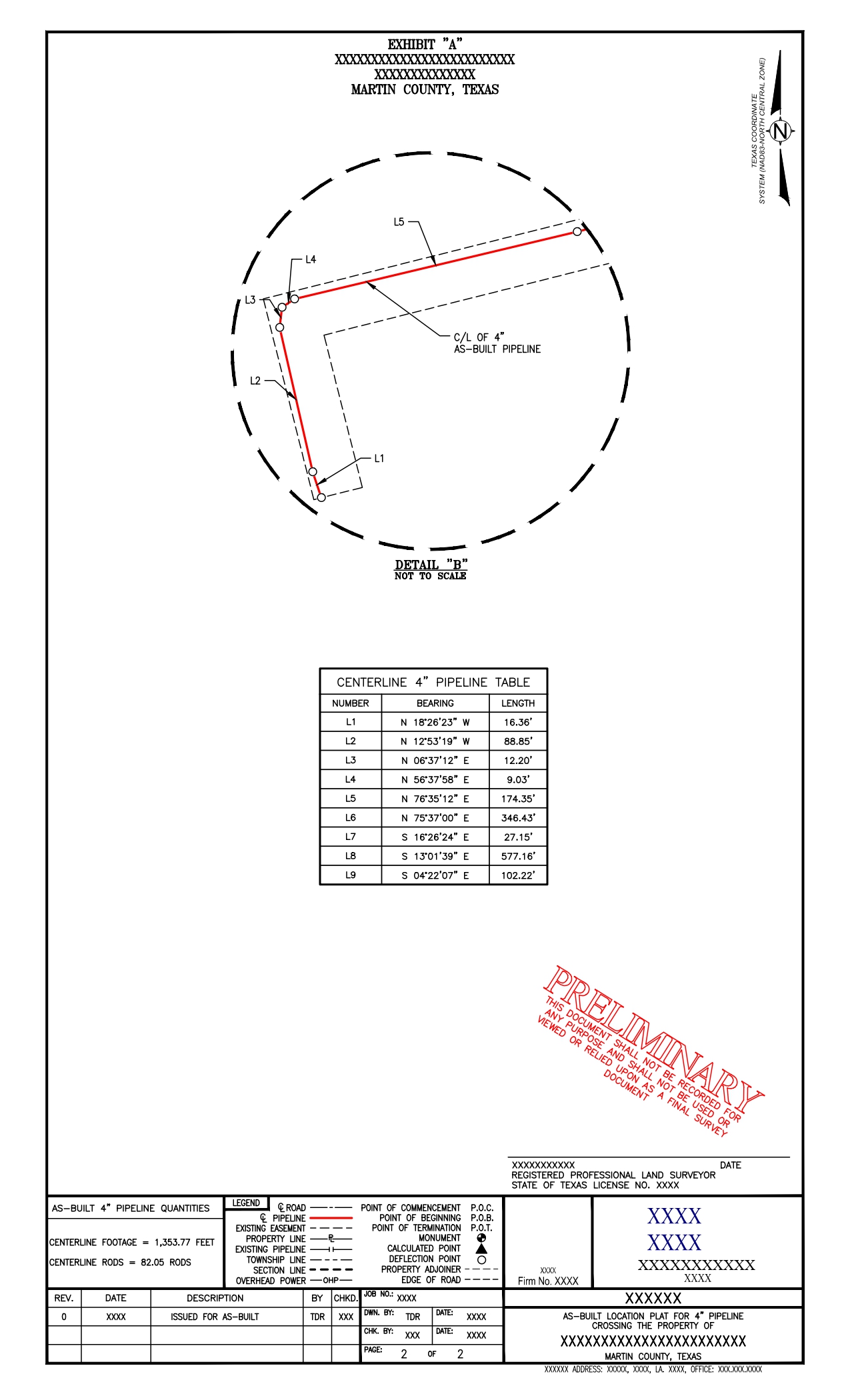
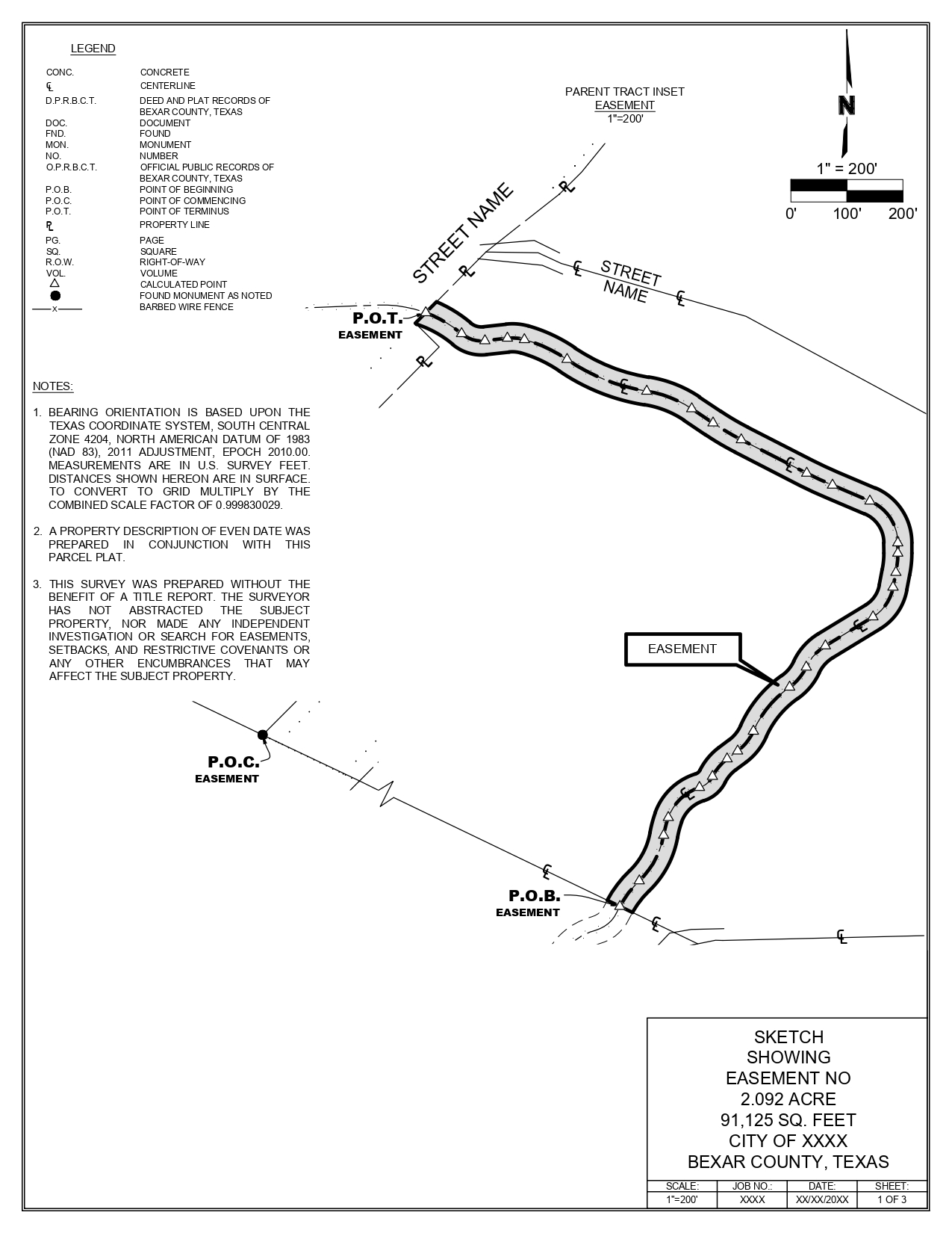
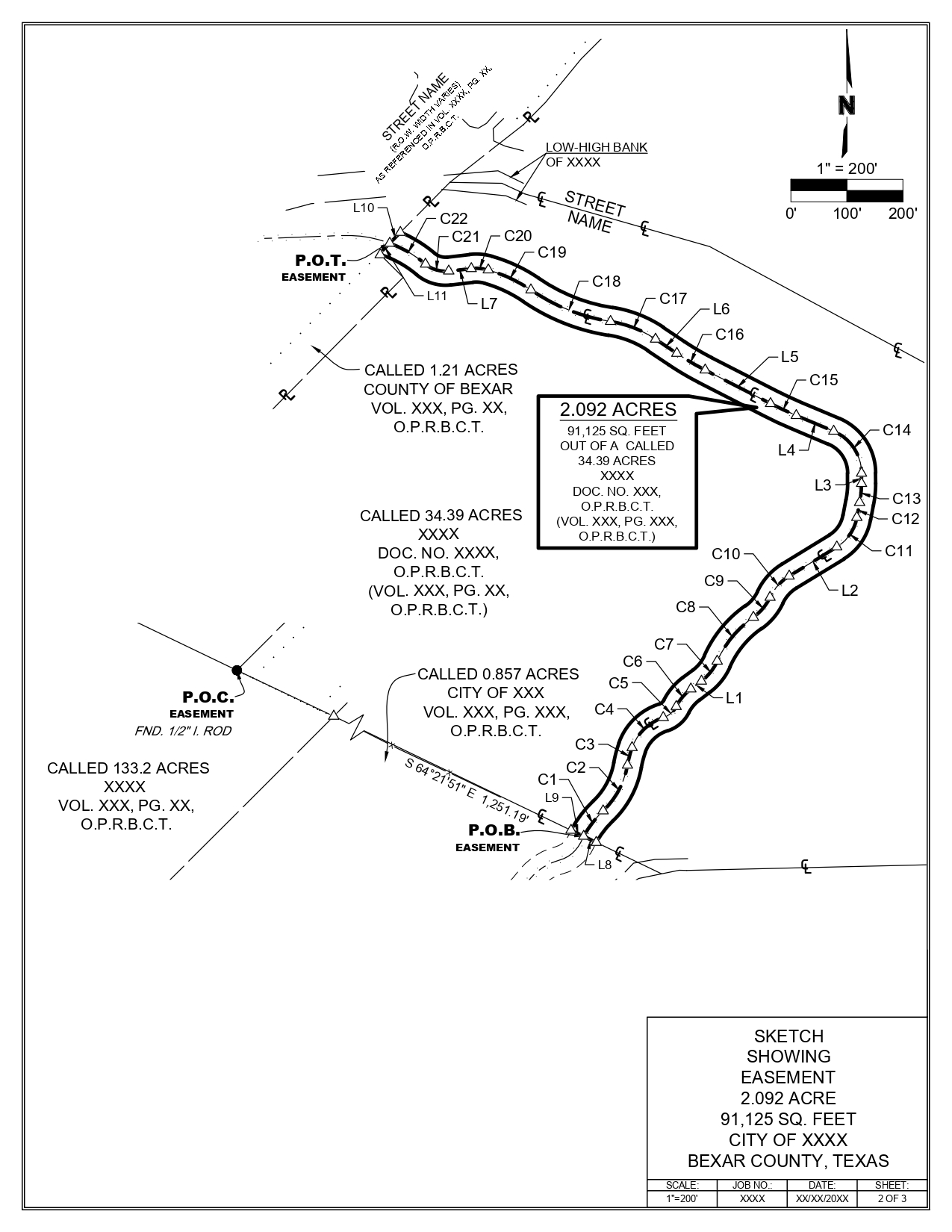
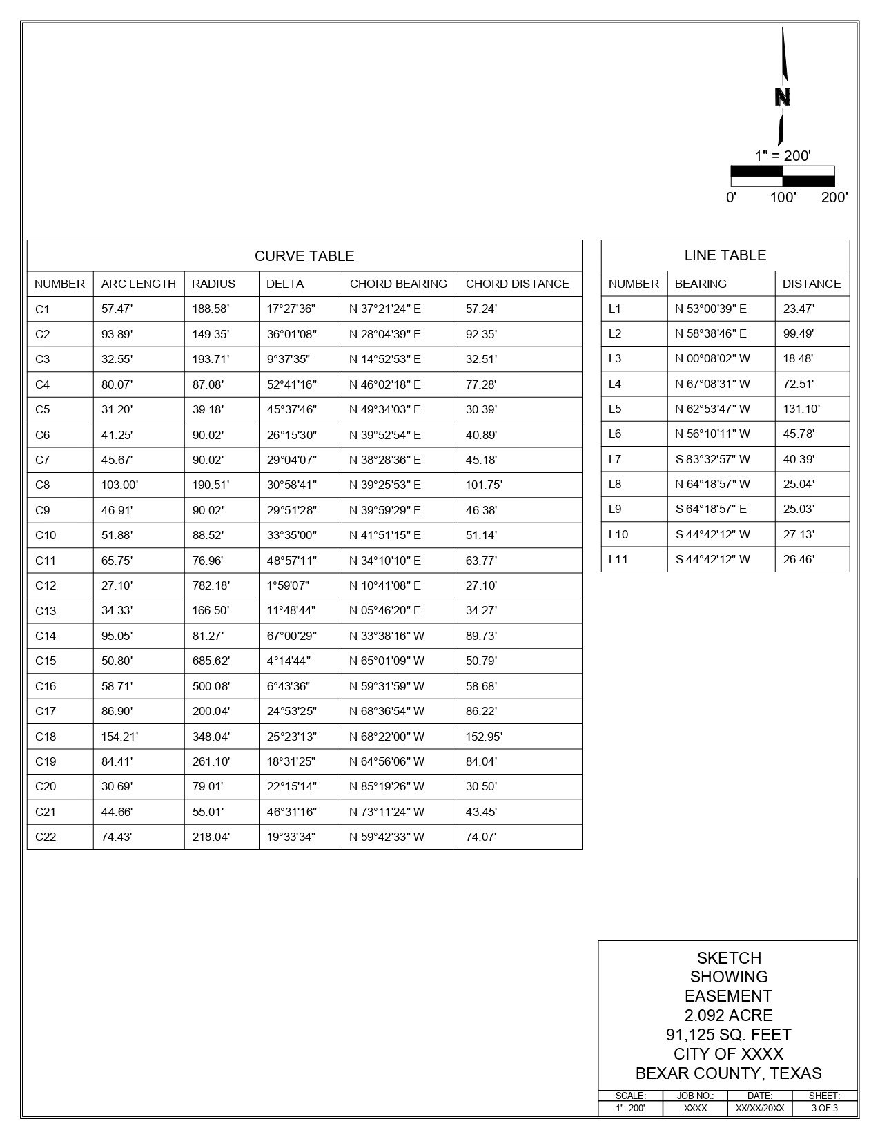
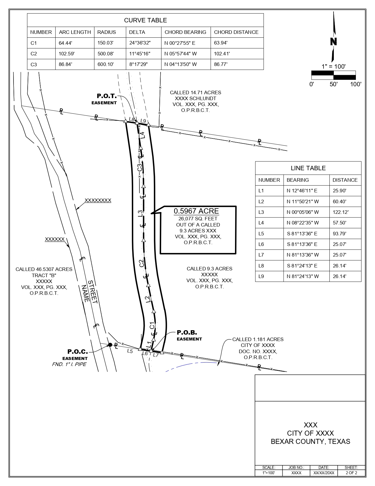
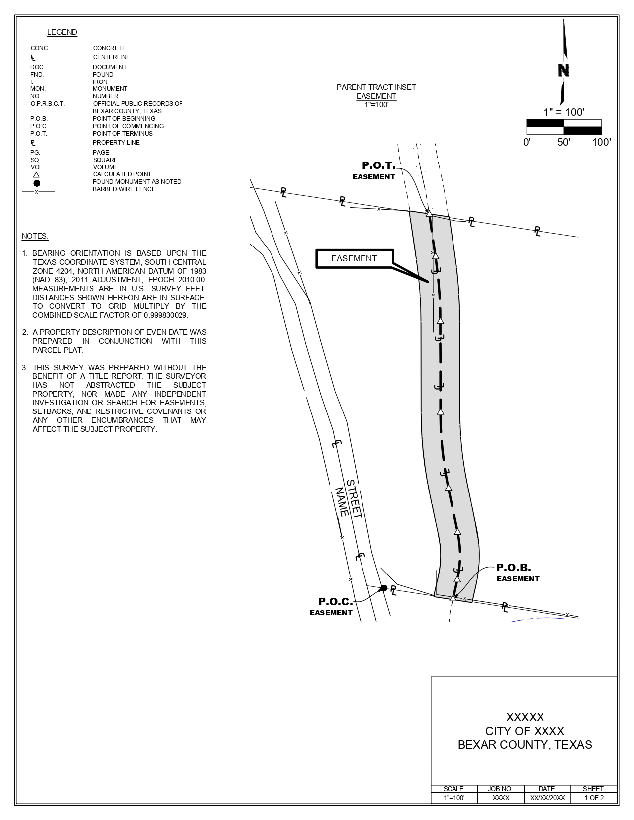
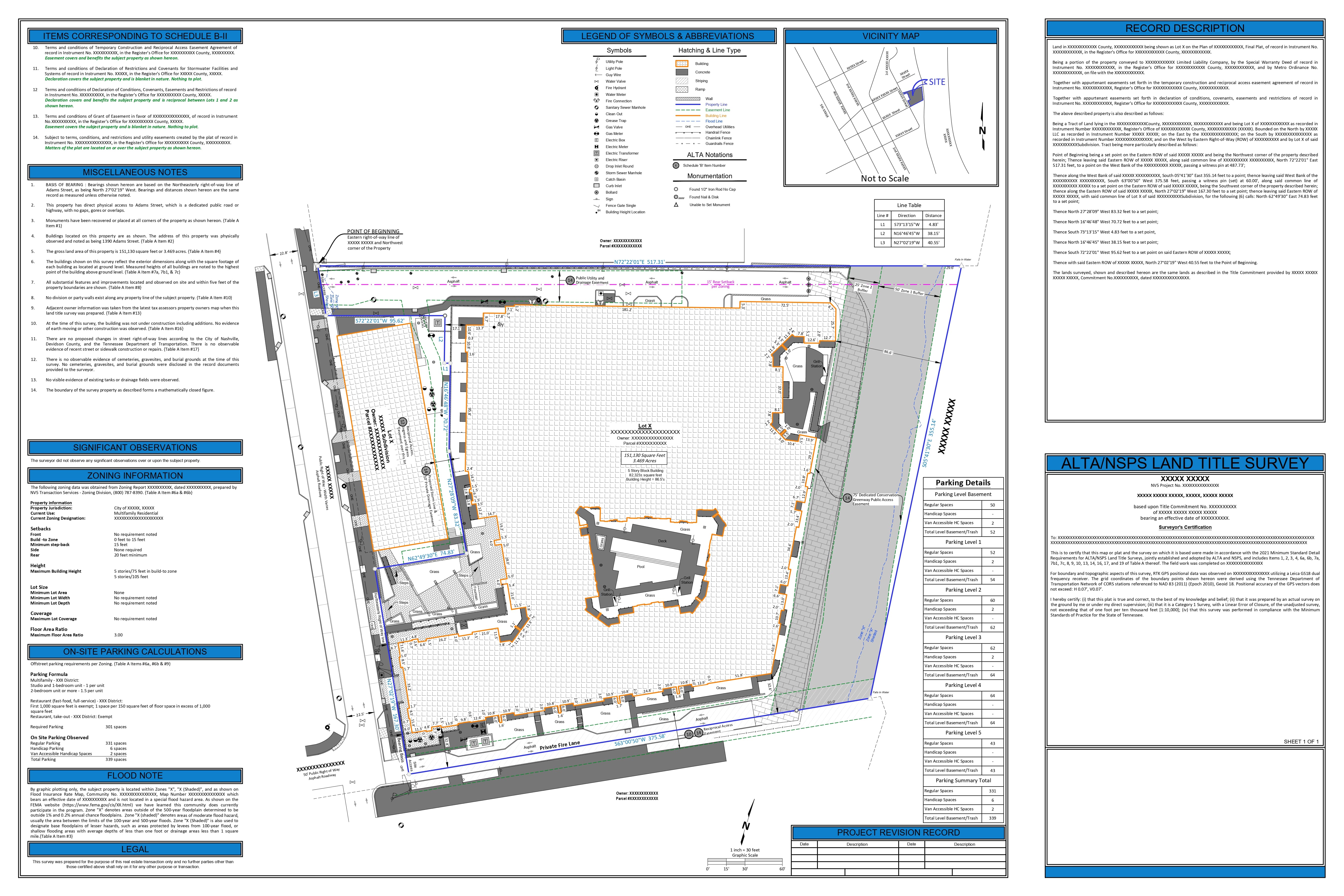
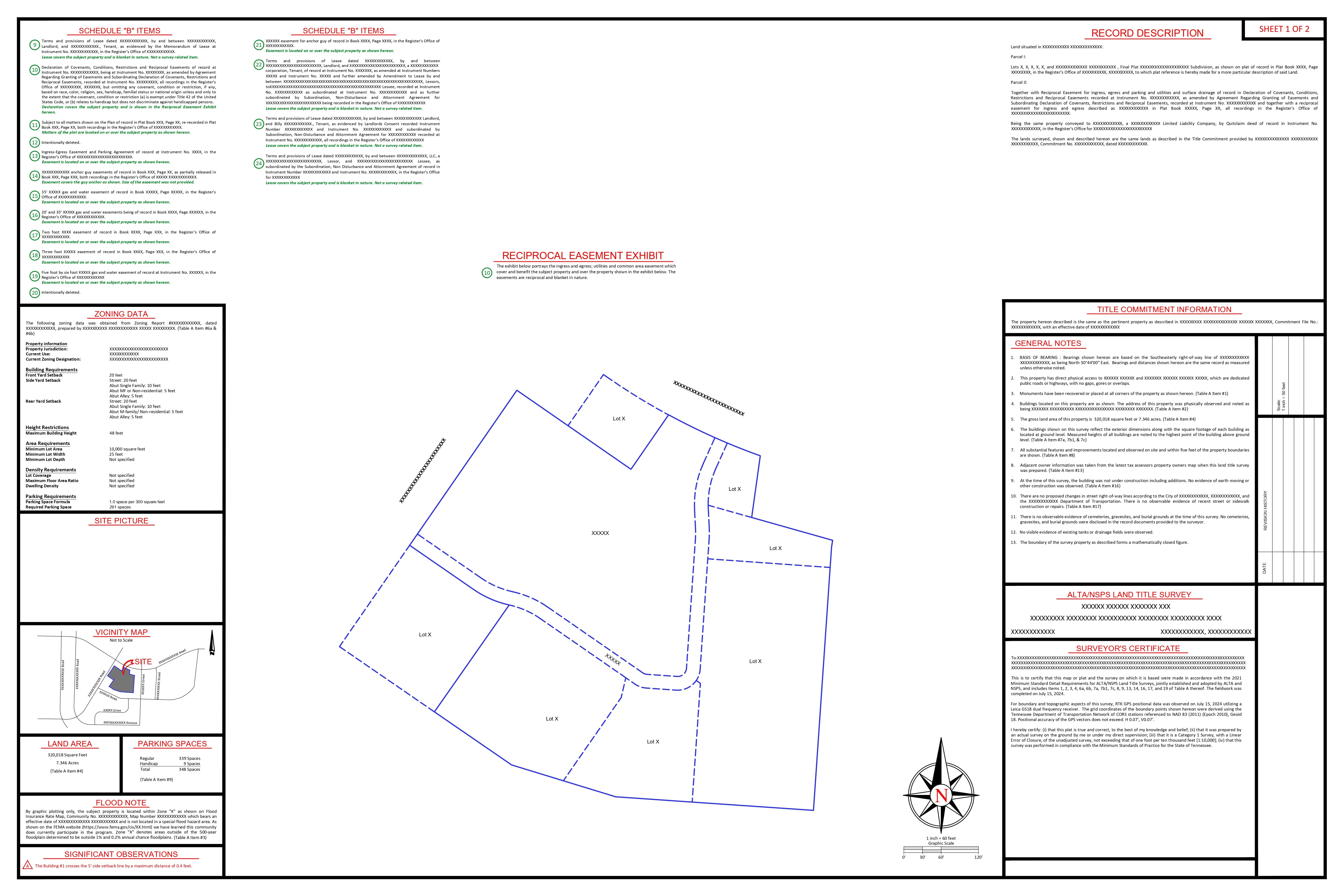
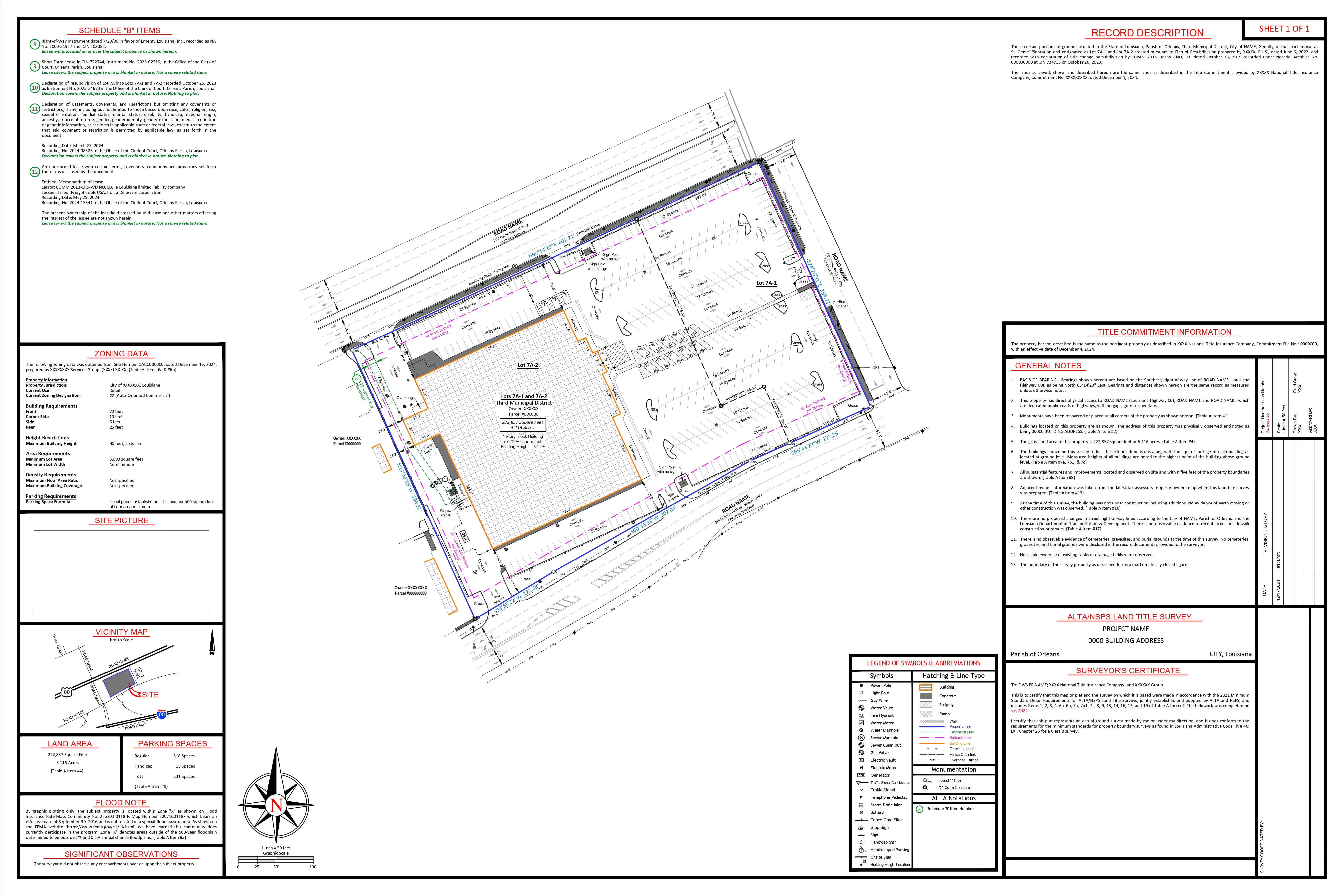
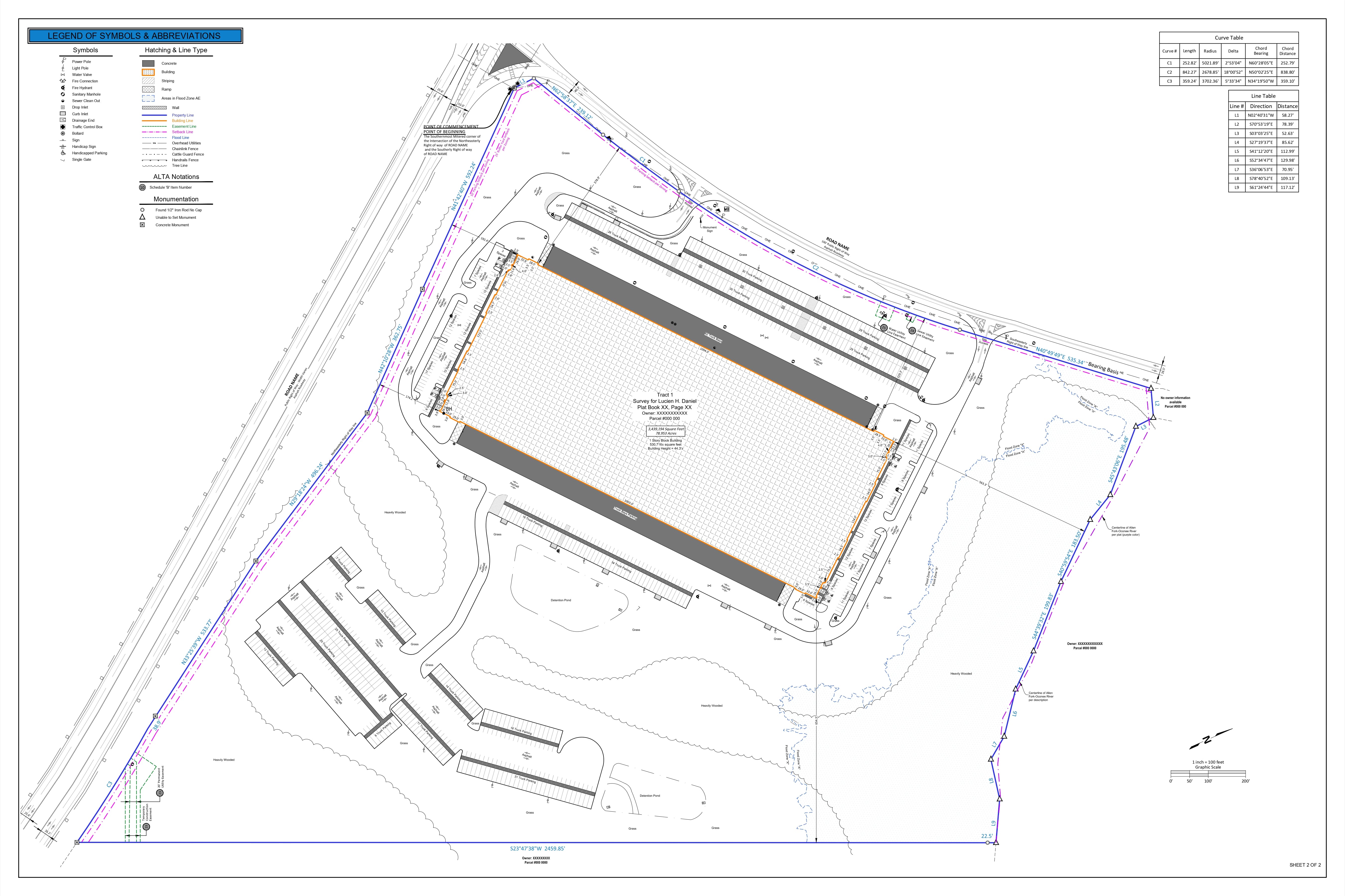
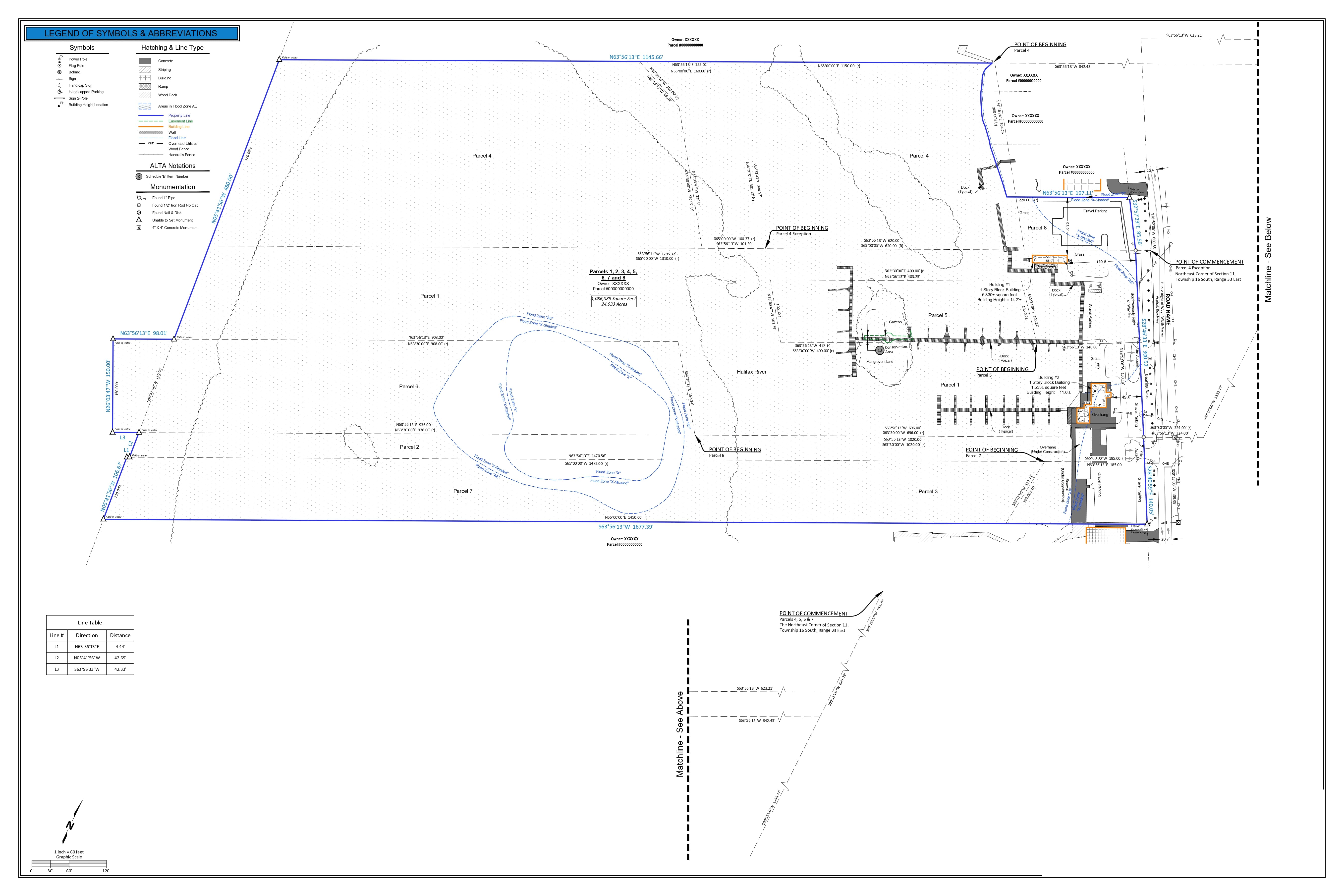
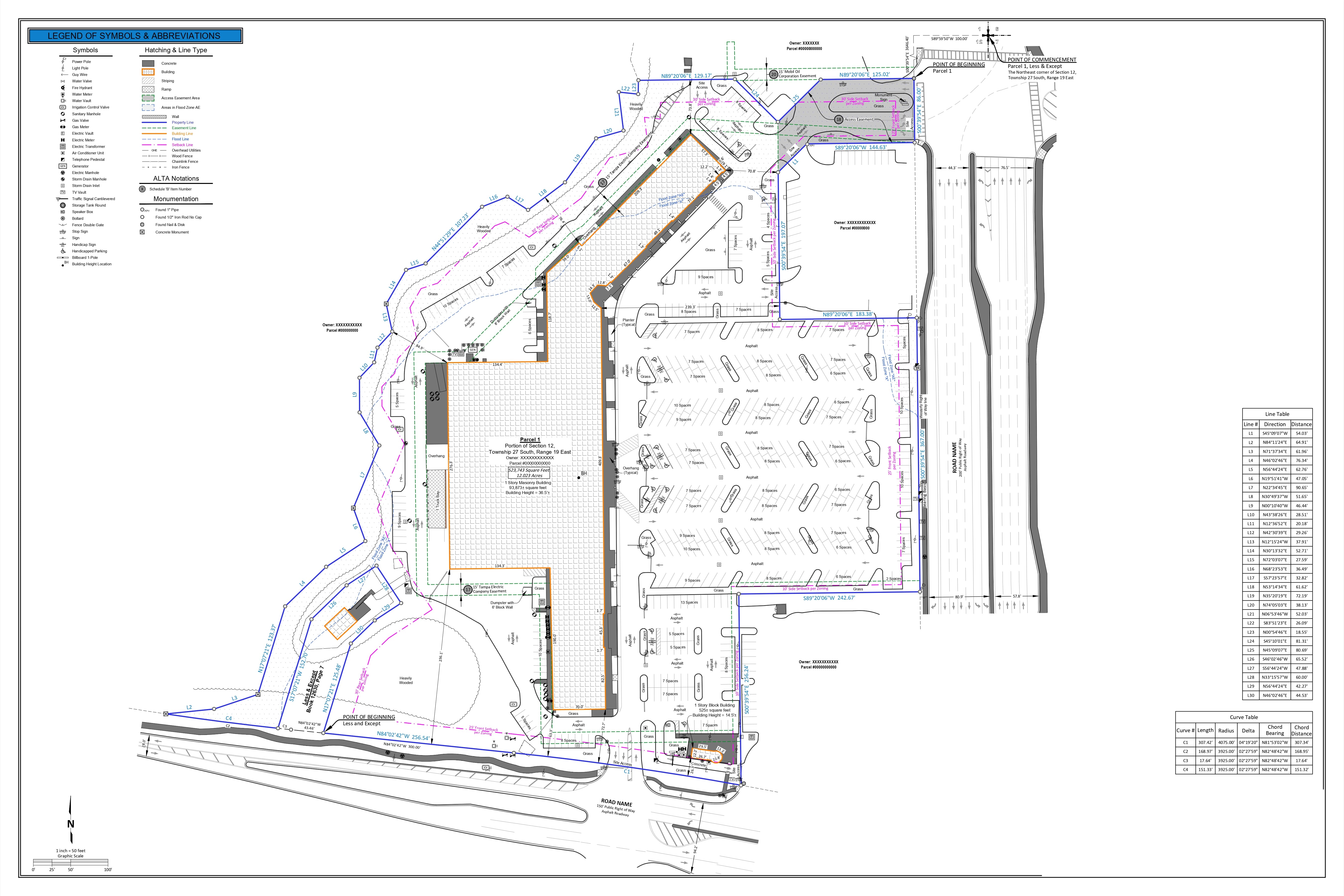
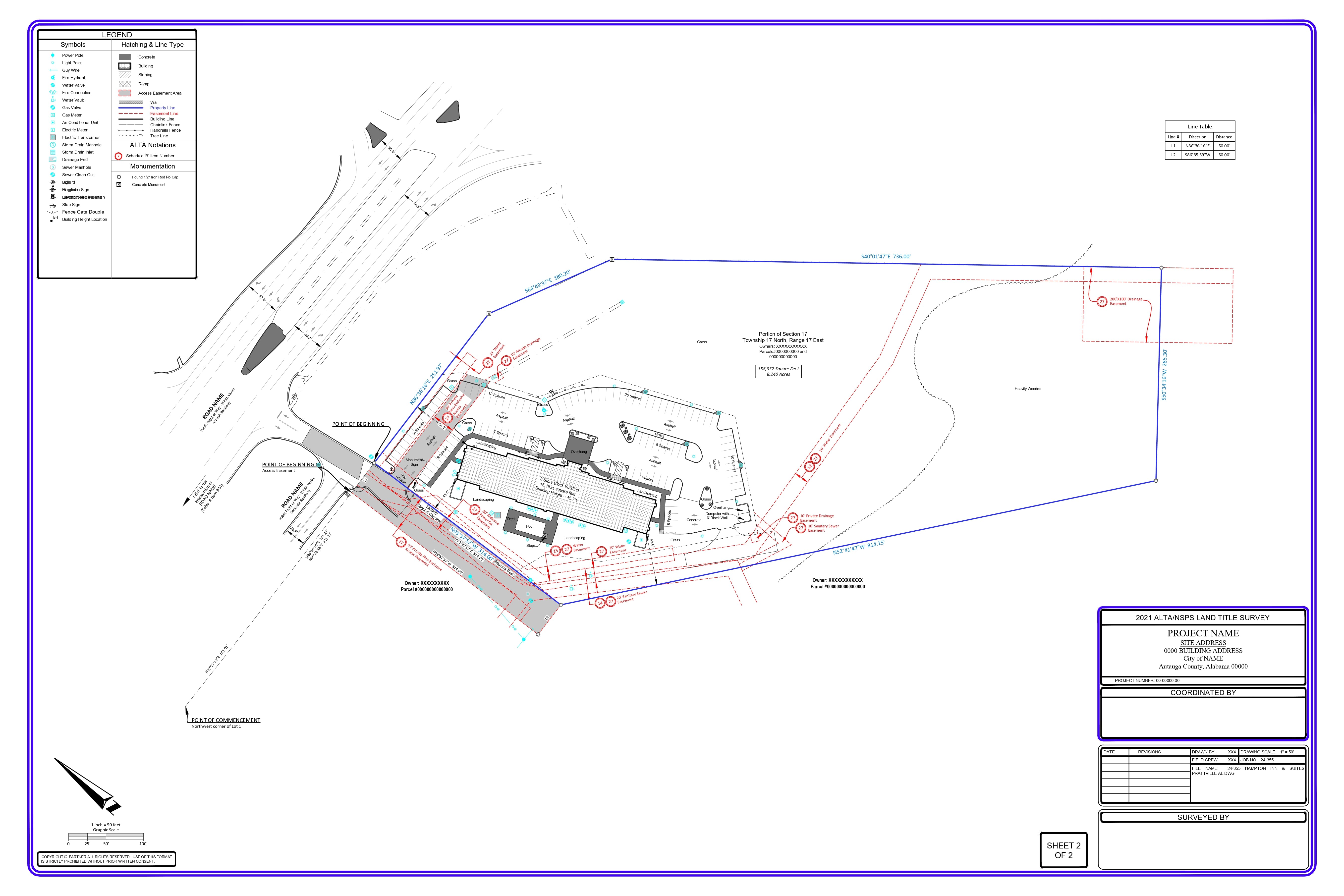
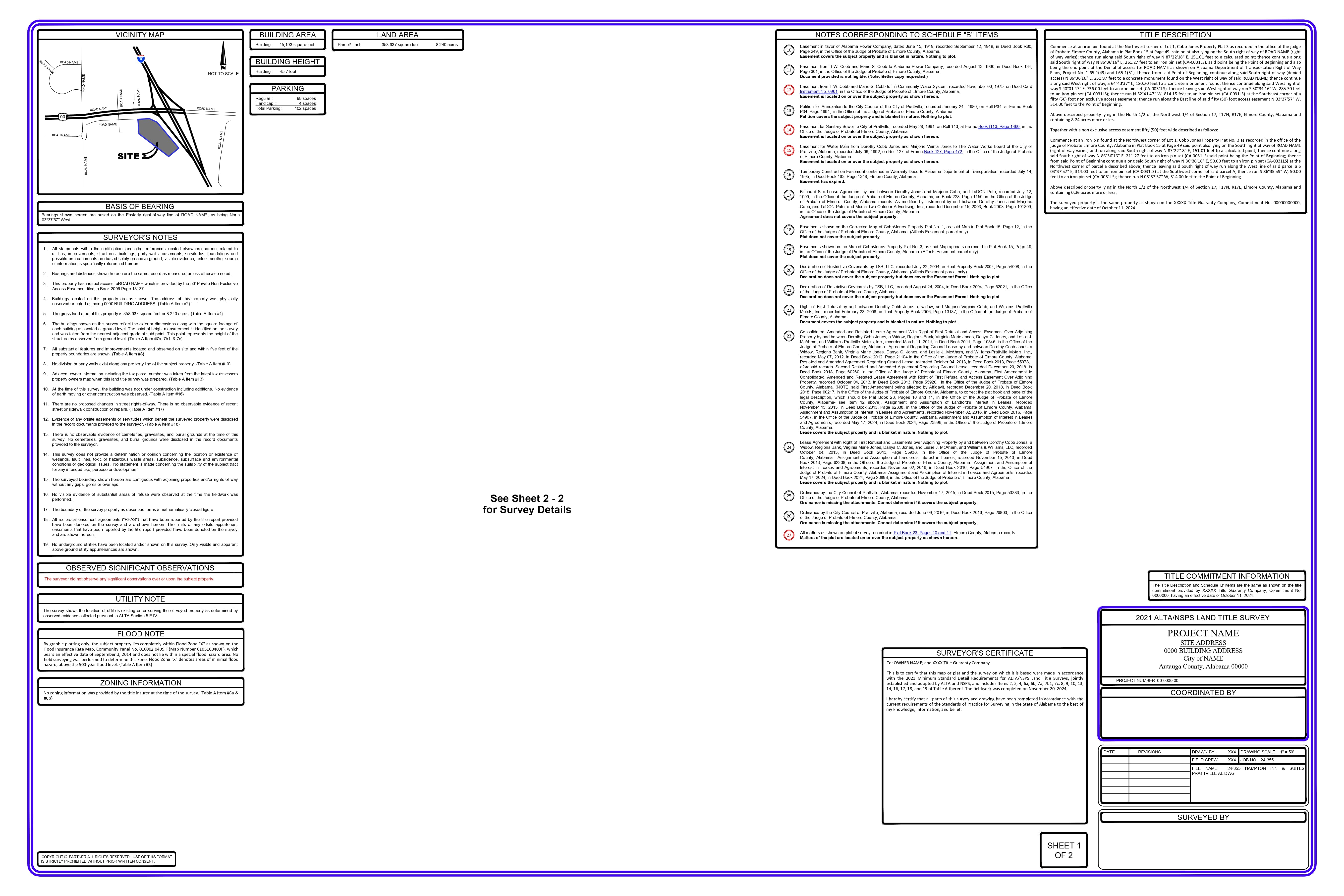
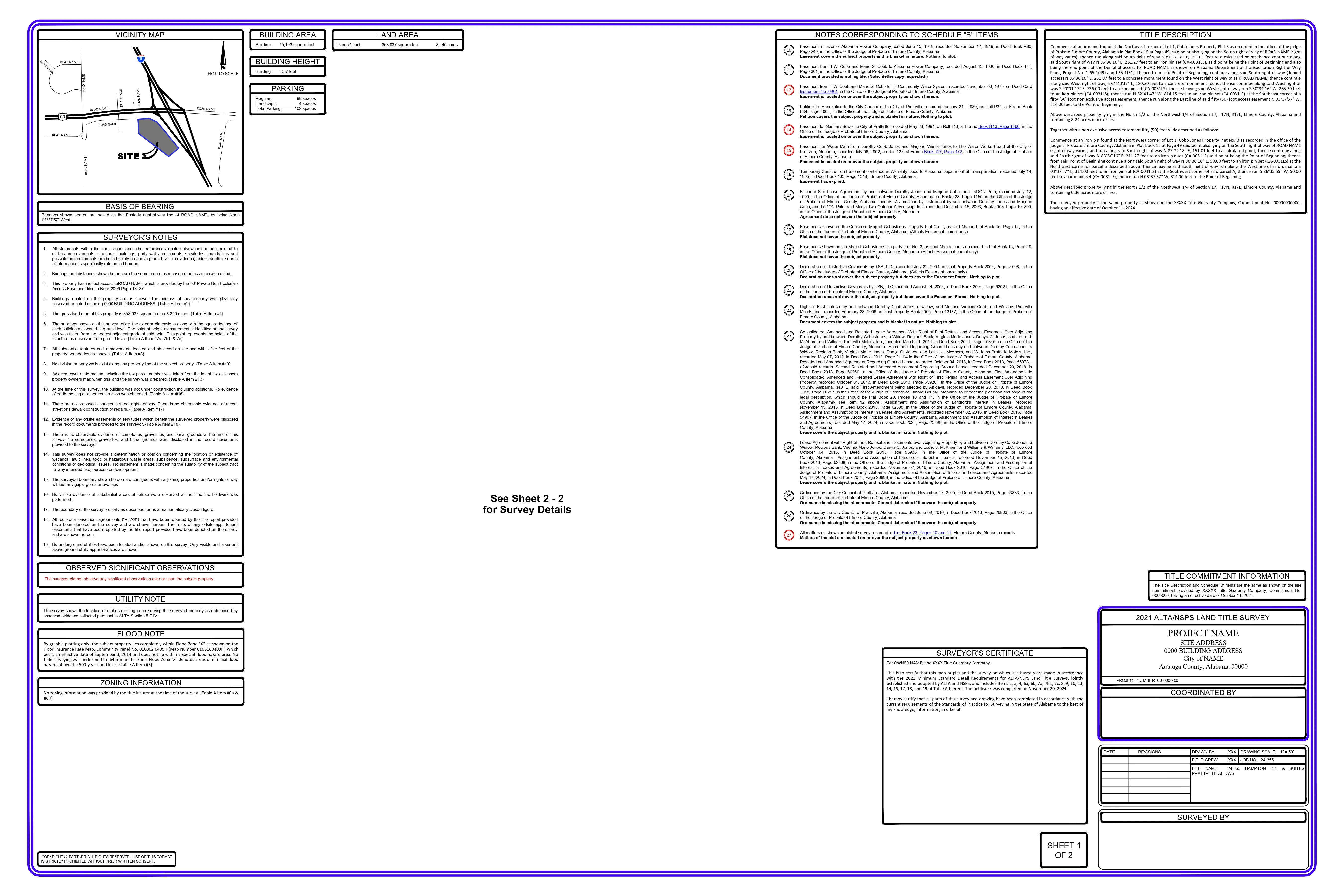
Based on the provided title commitment, multiple section legal descriptions, and “less and except” portions of the property, all metes and bounds are drafted as per the deeds and merged to generate the complete property boundary, including split lines for all deeds.
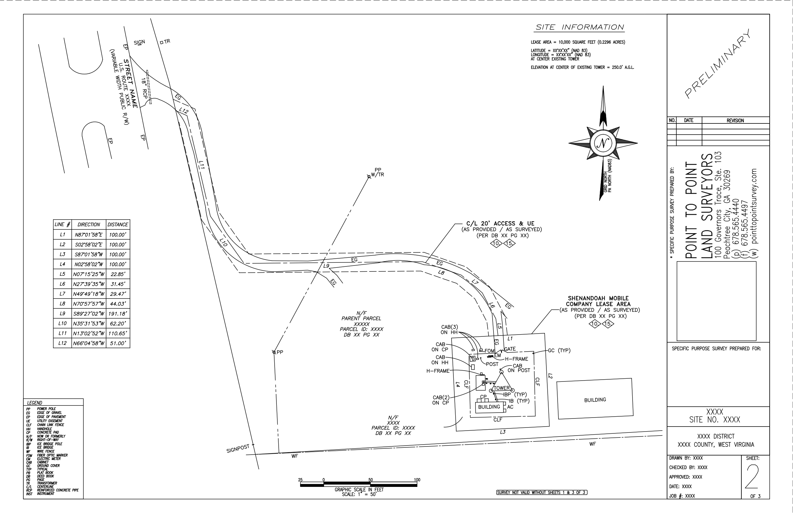
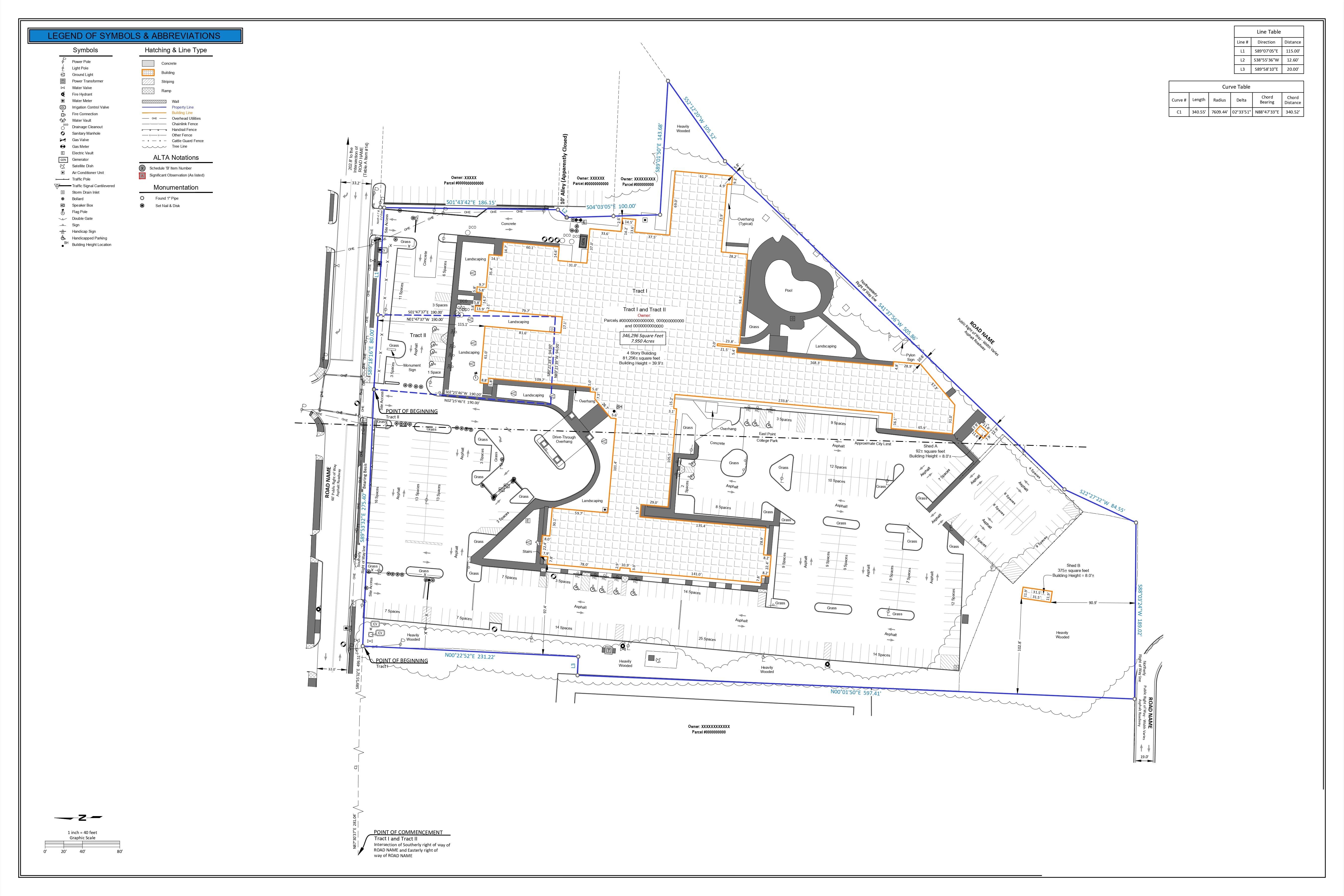
An aerial image of the property is captured from Google Earth and aligned with the property boundary for better representation.
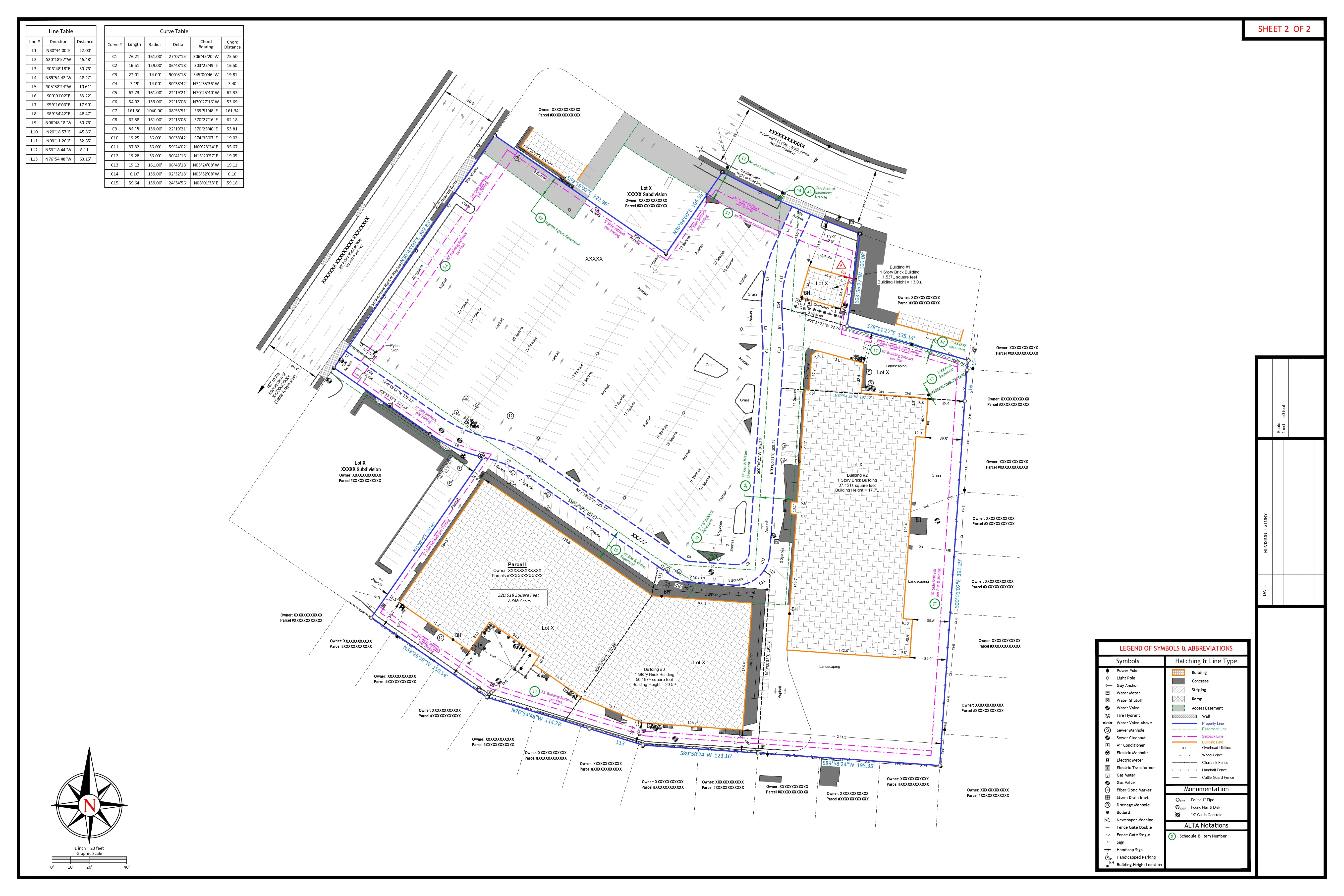
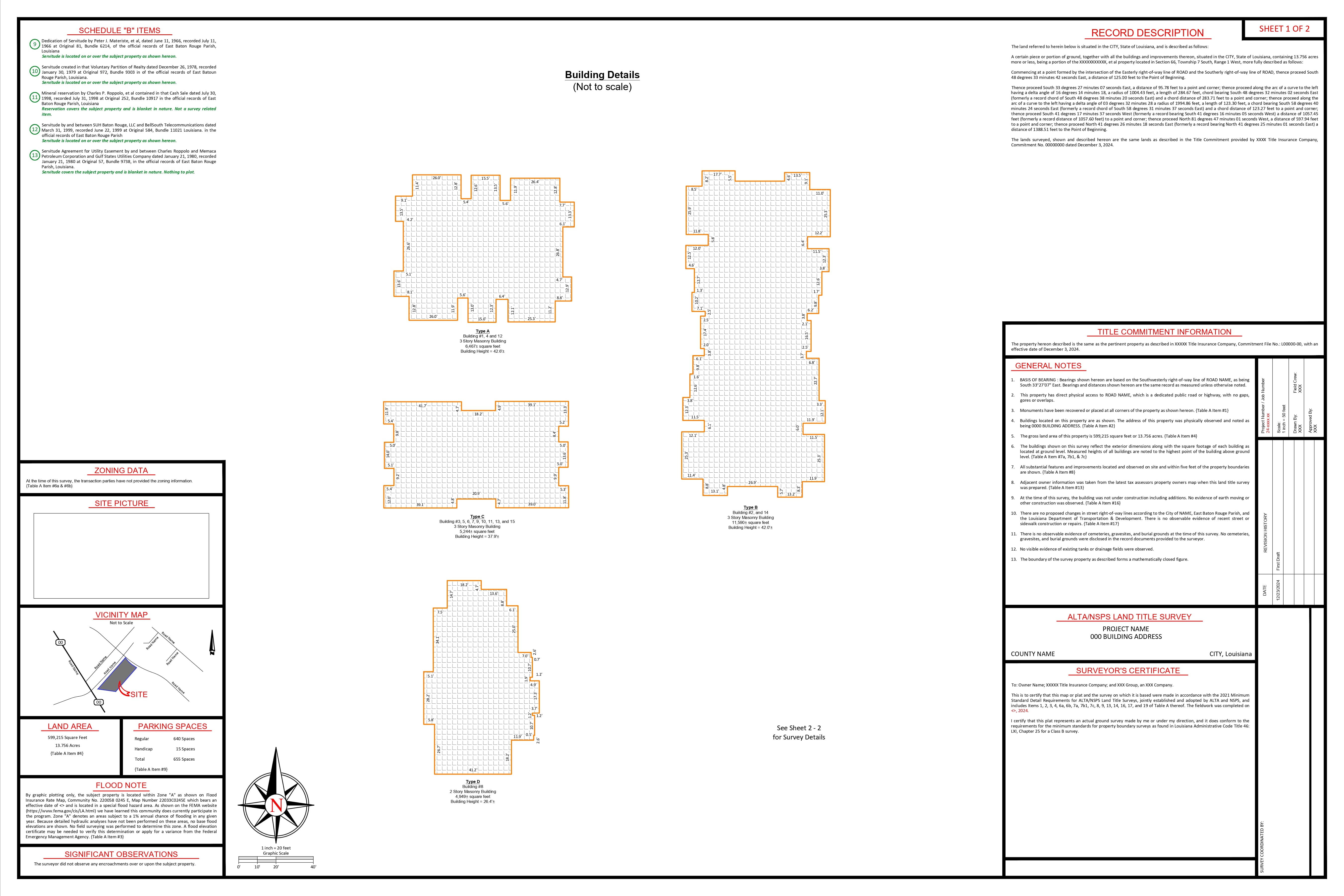
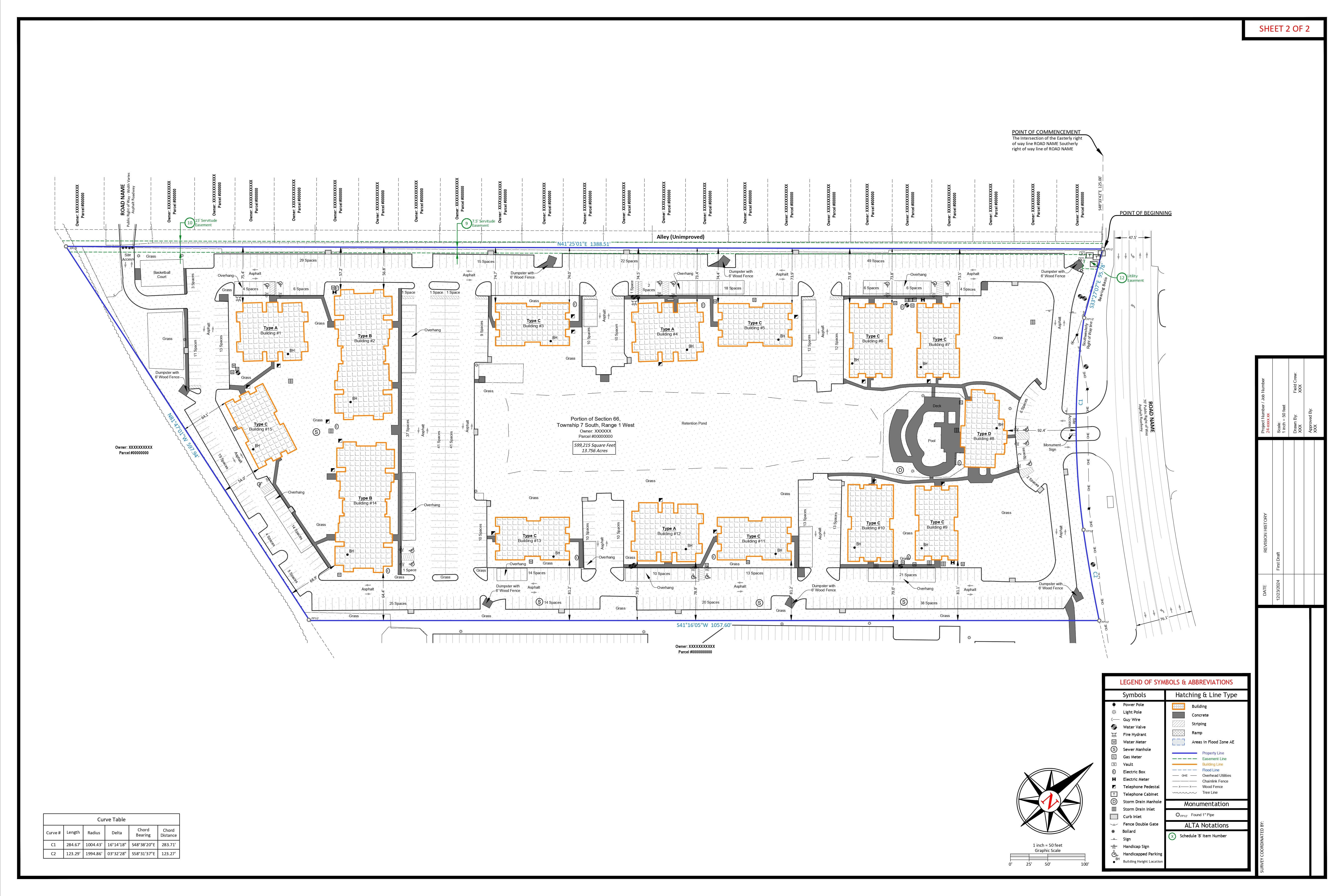
Improvements are drawn entirely based on the field sketch and positioned according to the aerial image.
All property distances, multiple sectional quadrants, and statutory ROW are labeled and shown in accordance with county limits.
All Schedule B-II easement documents from the title are reviewed to determine whether they affect the property, and easements impacting the property are incorporated into the main drawing.
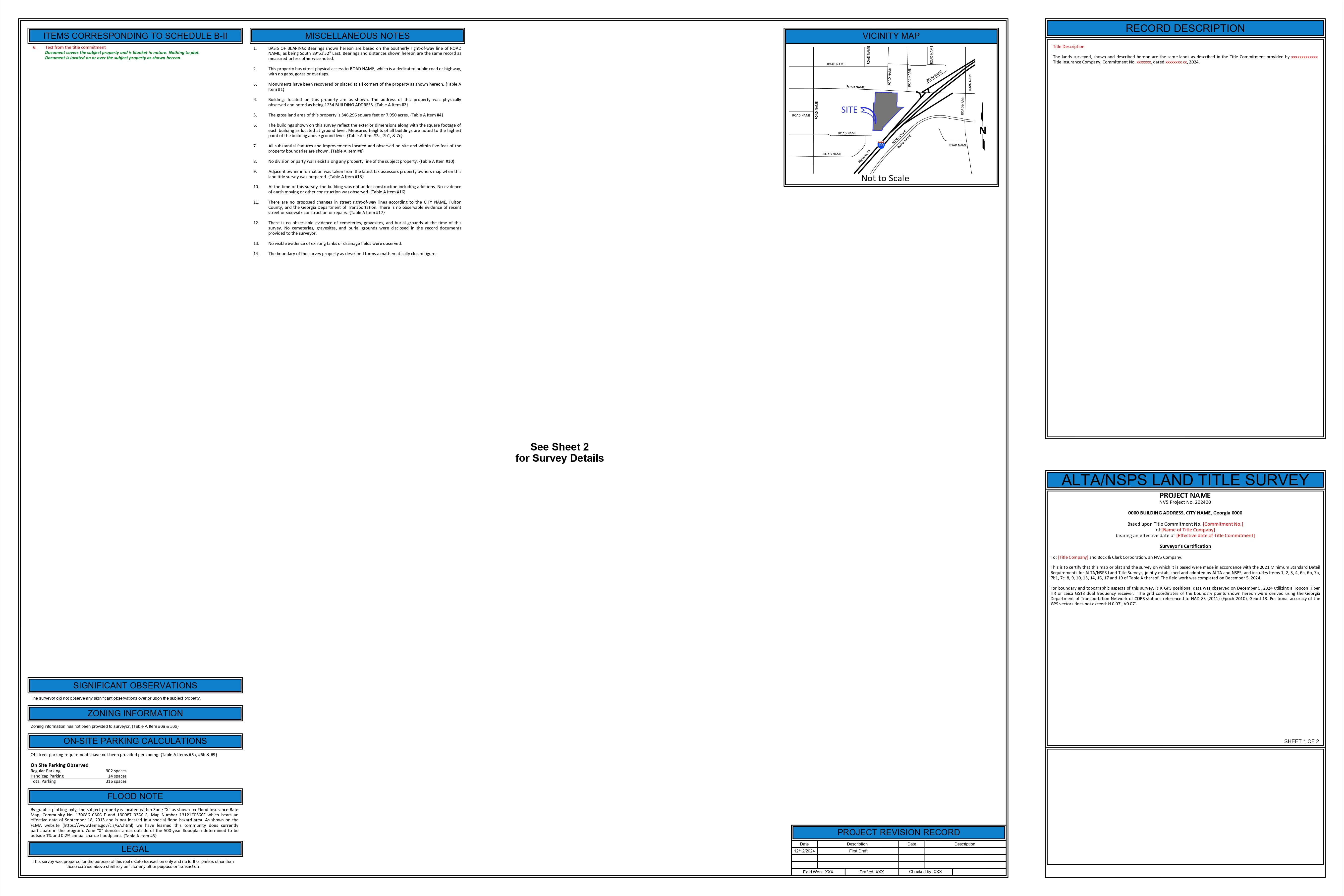
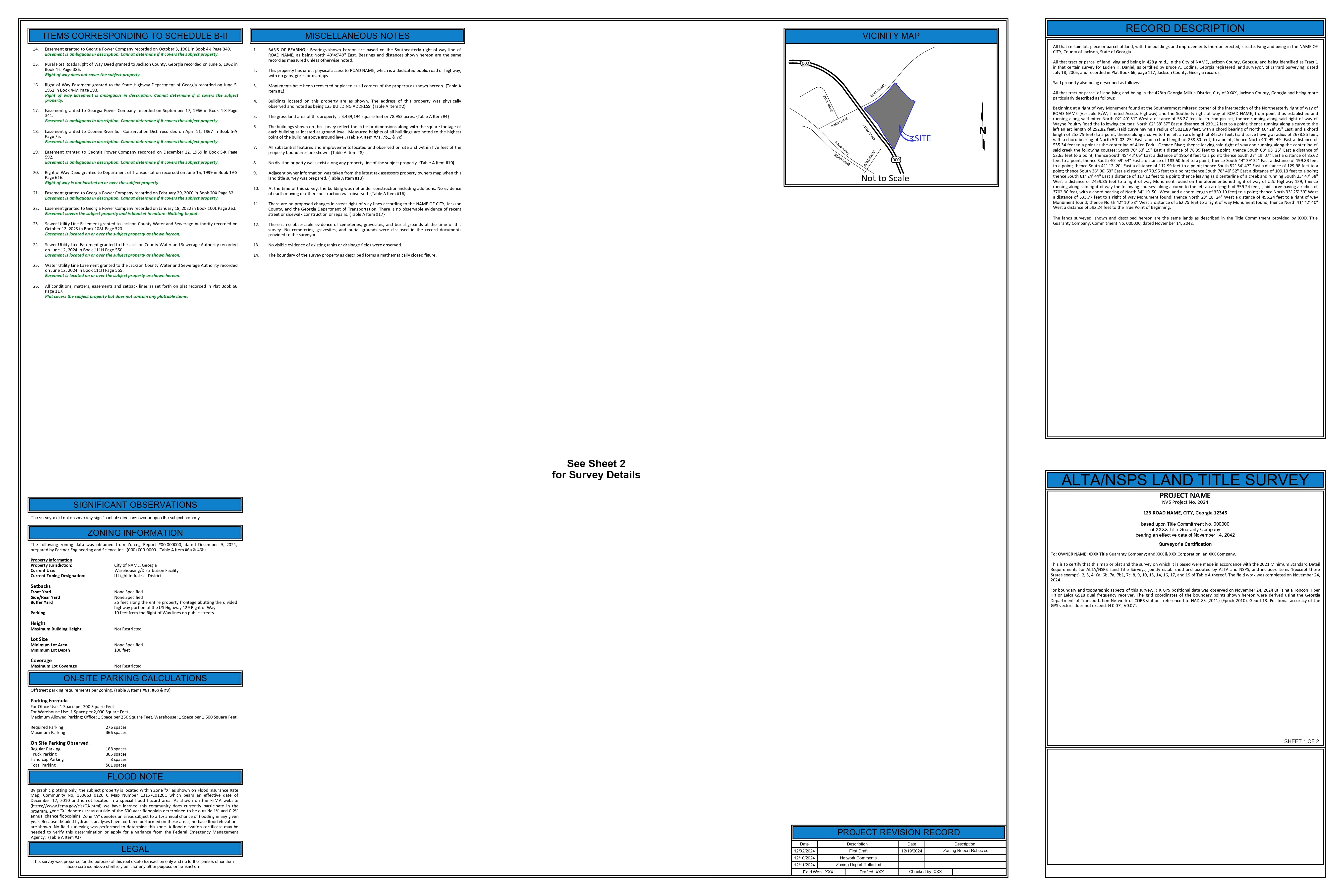
Legal descriptions, site image, notes, title information, FEMA data, and other relevant details are included in the drawing.
Mortgage Inspection Report-Section_Oklahoma
Mortgage Inspection Report-Plat_Oklahoma
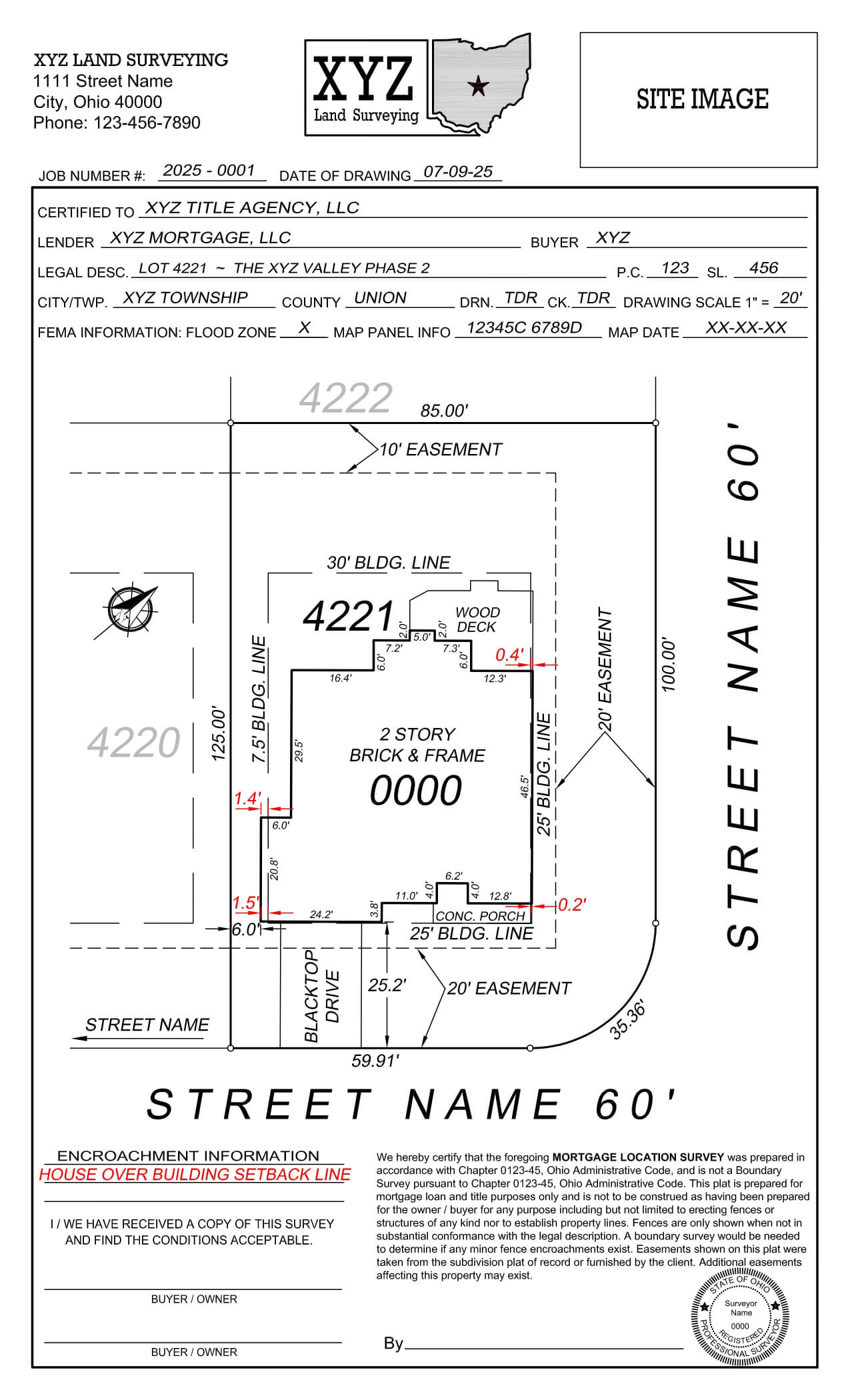
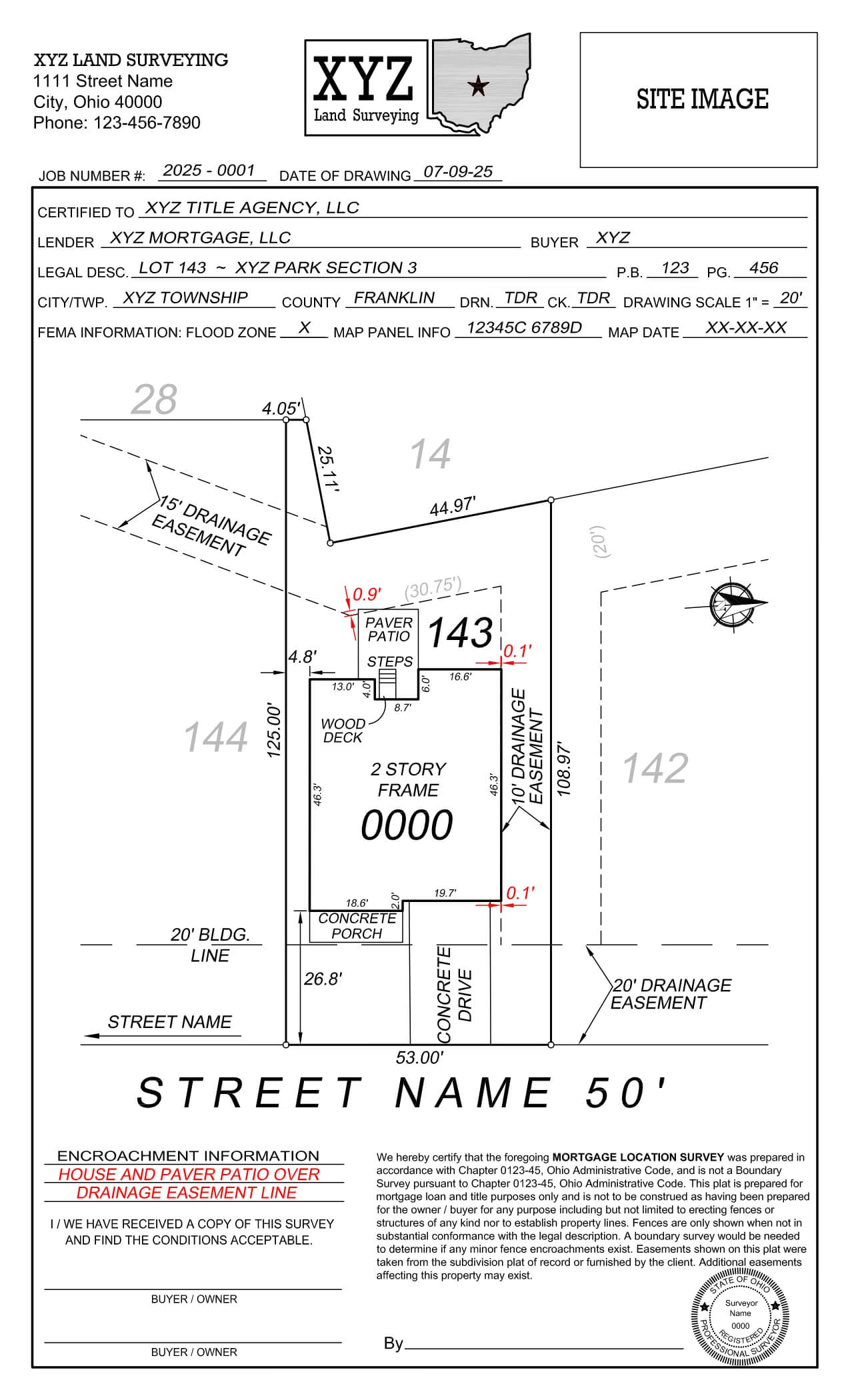
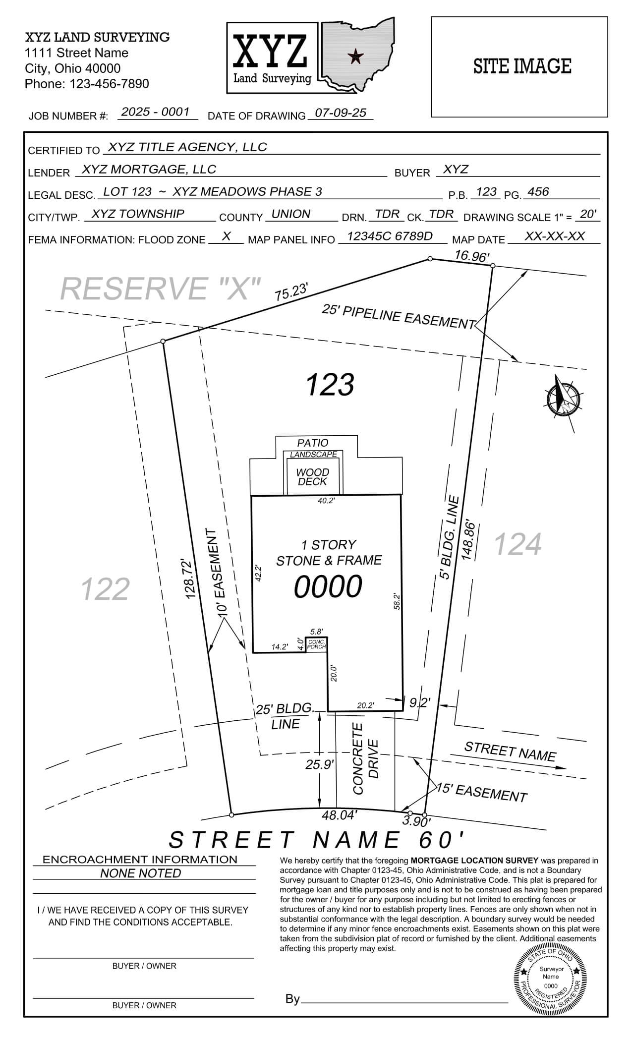
Mortgage Location Survey
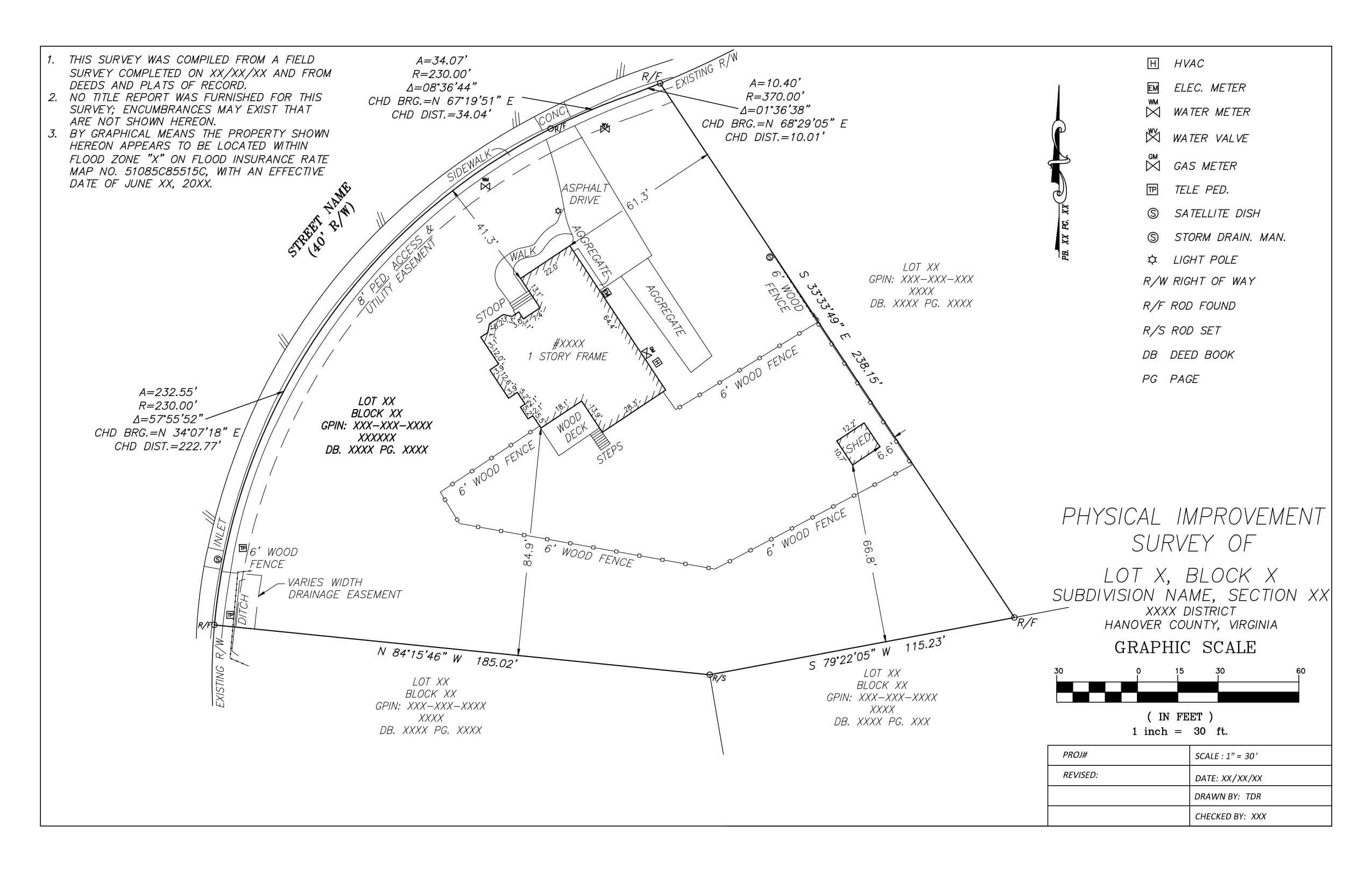
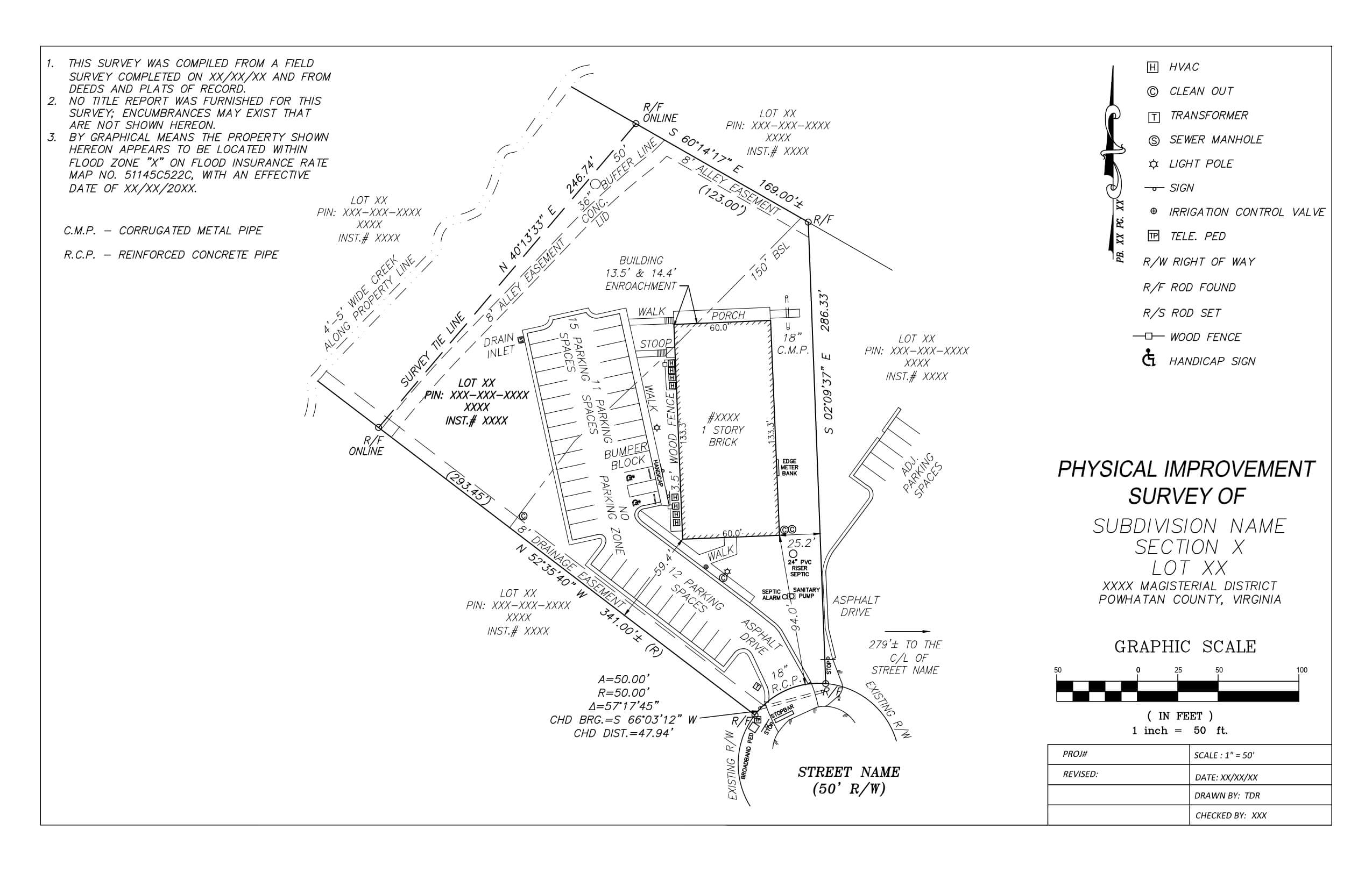
A summary of our process
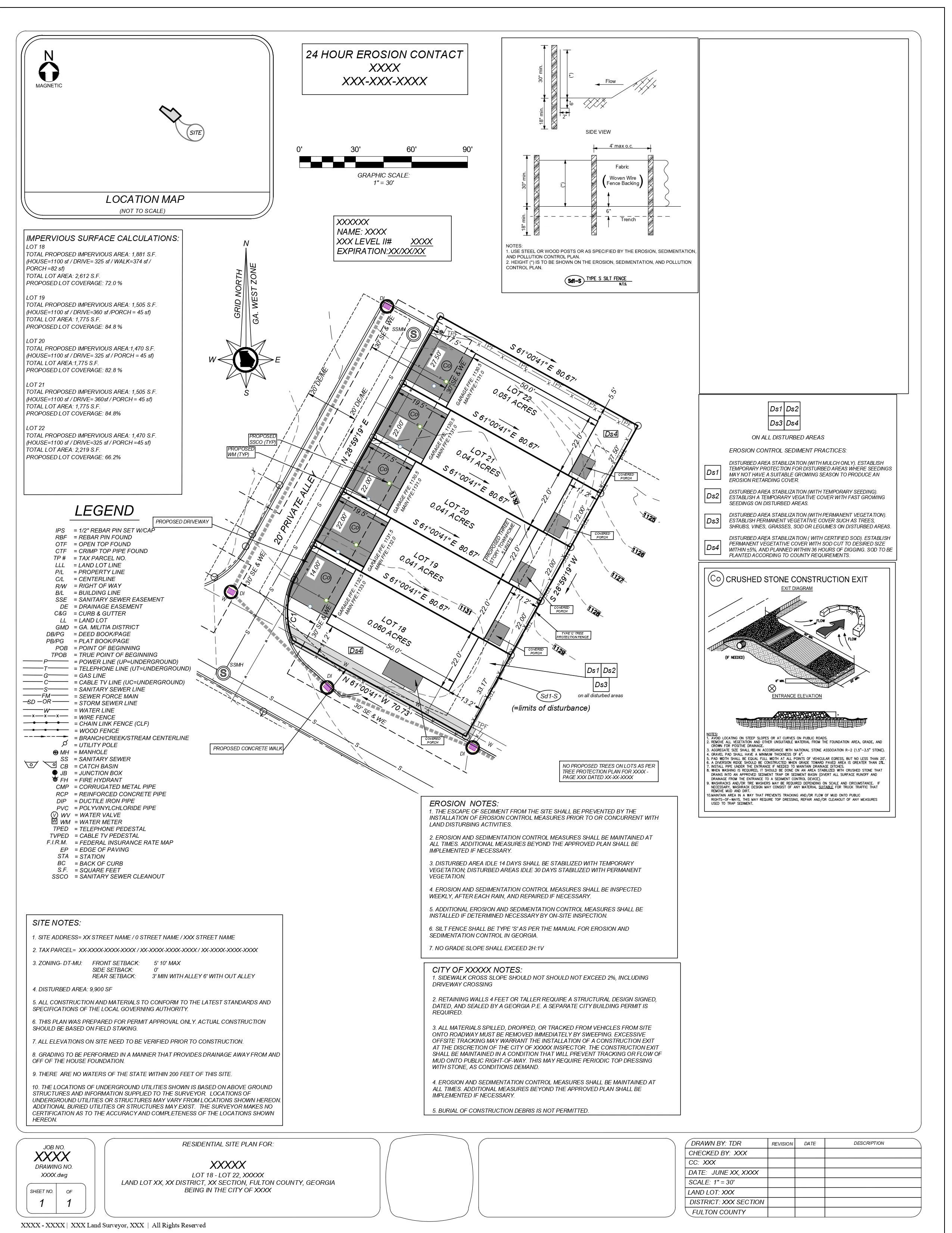
We receive the geo-located COGO points along with all the necessary county documents.
Using these documents, we create the property layout and follow the client’s priority list to establish a step-by-step procedure for property rotation on geo-located COGO points, identifying the best possible rotation and placing the property accordingly.
The drawing UCS is rotated to establish the legal access street at the top or bottom of the paper space, and the North arrow is shown accordingly.
Improvements are drawn entirely by referring to the field sketch and COGO points.
Legal descriptions, notes, title information, FEMA data, and other relevant details are included in the final drawing.