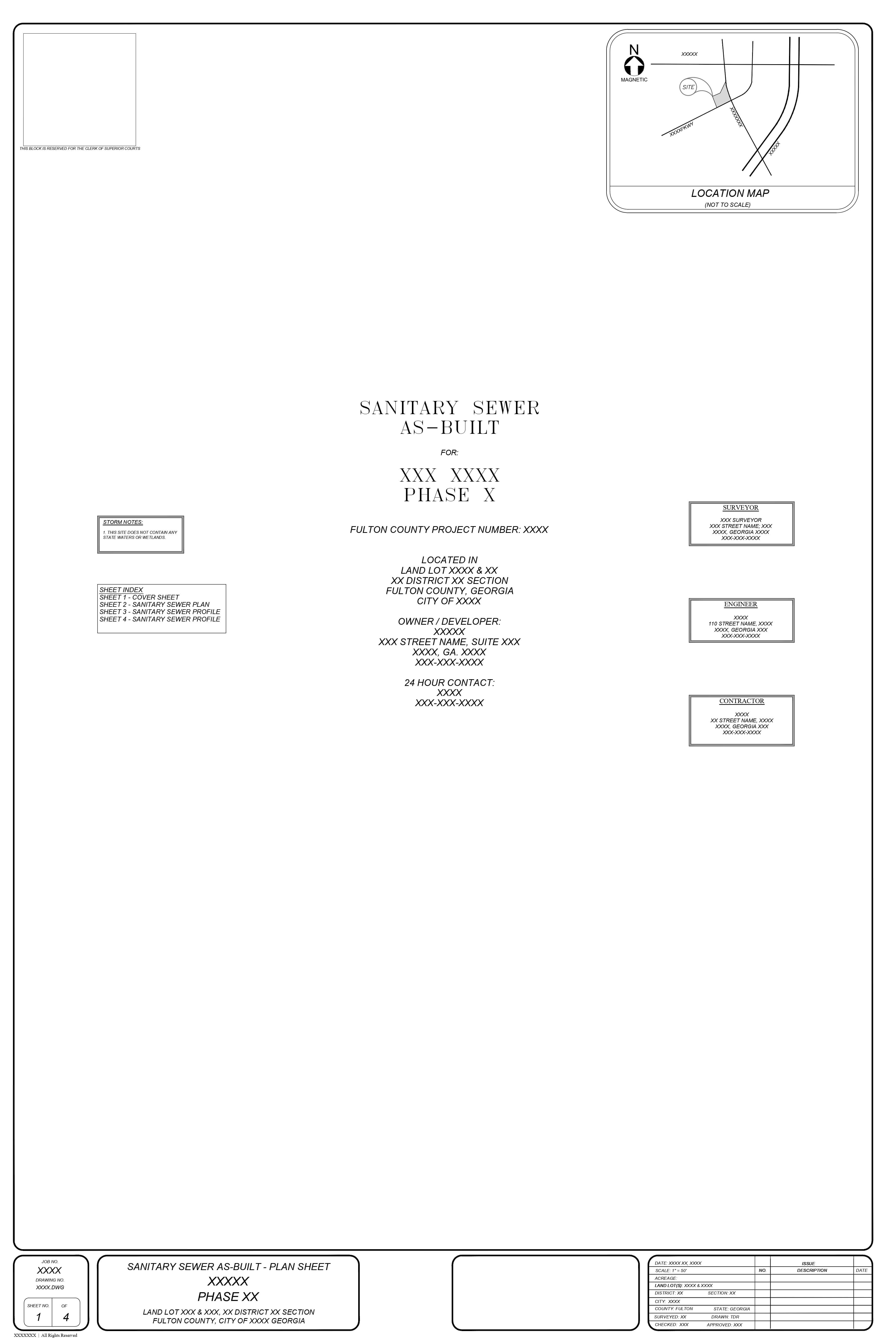
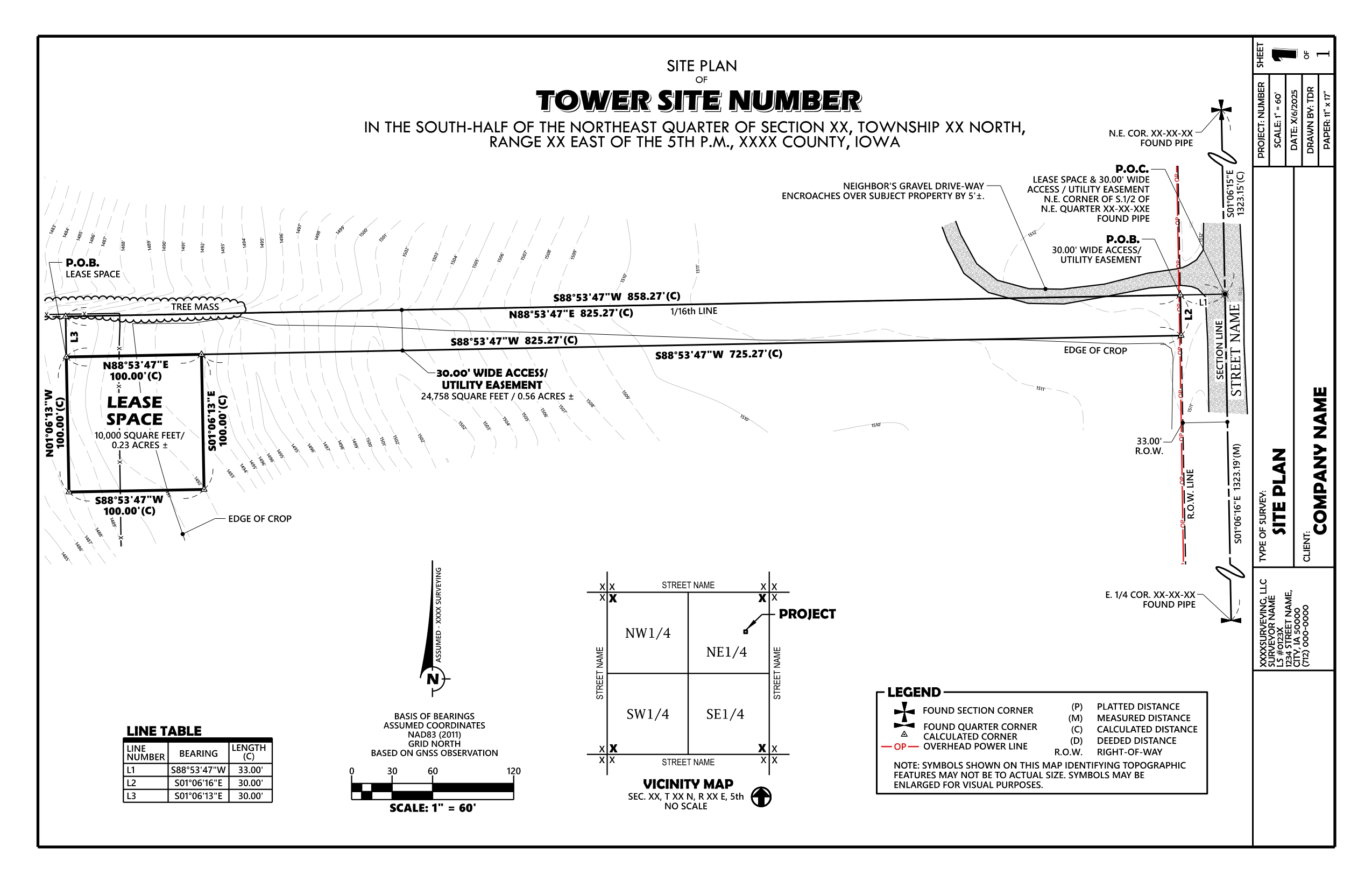
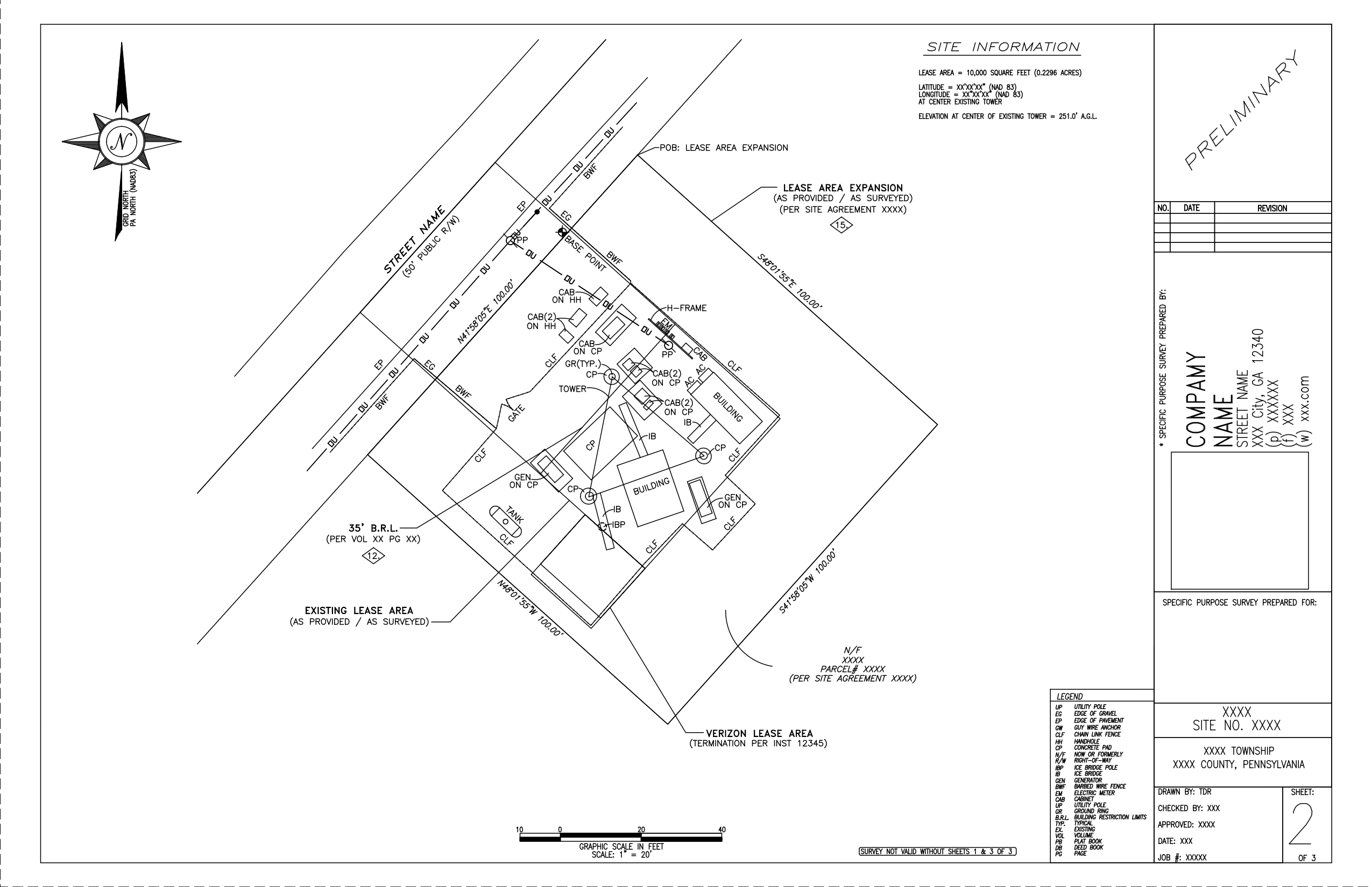
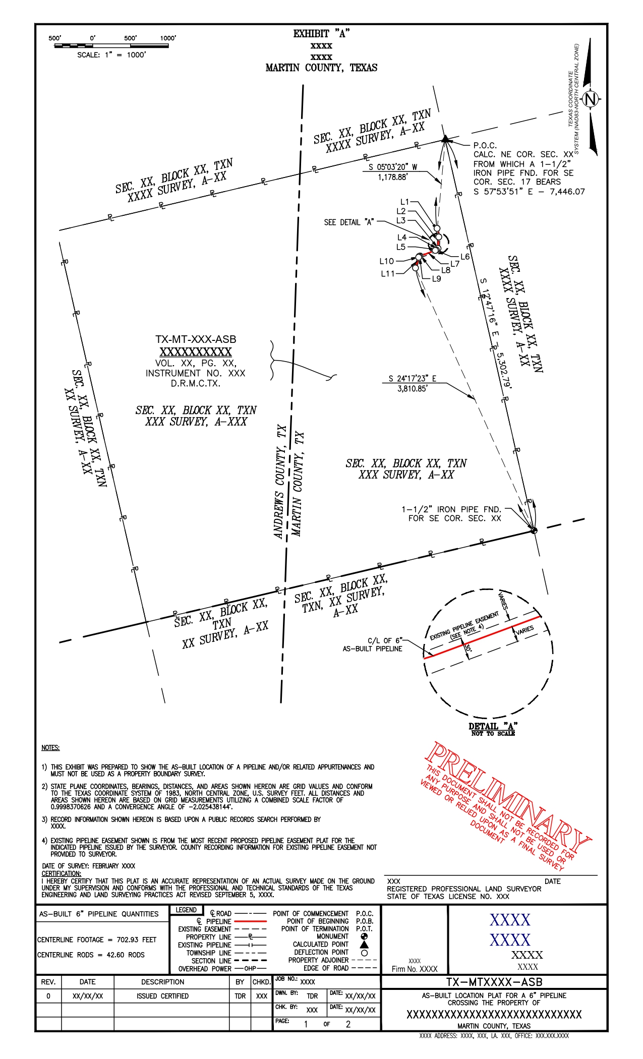
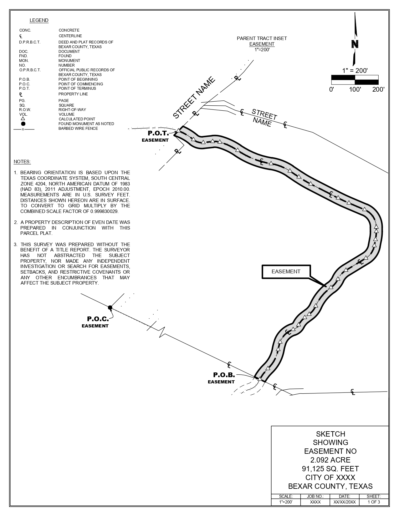
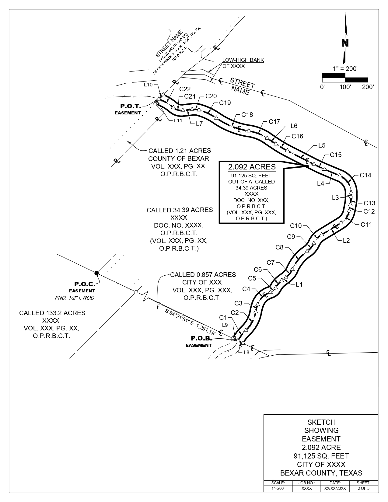
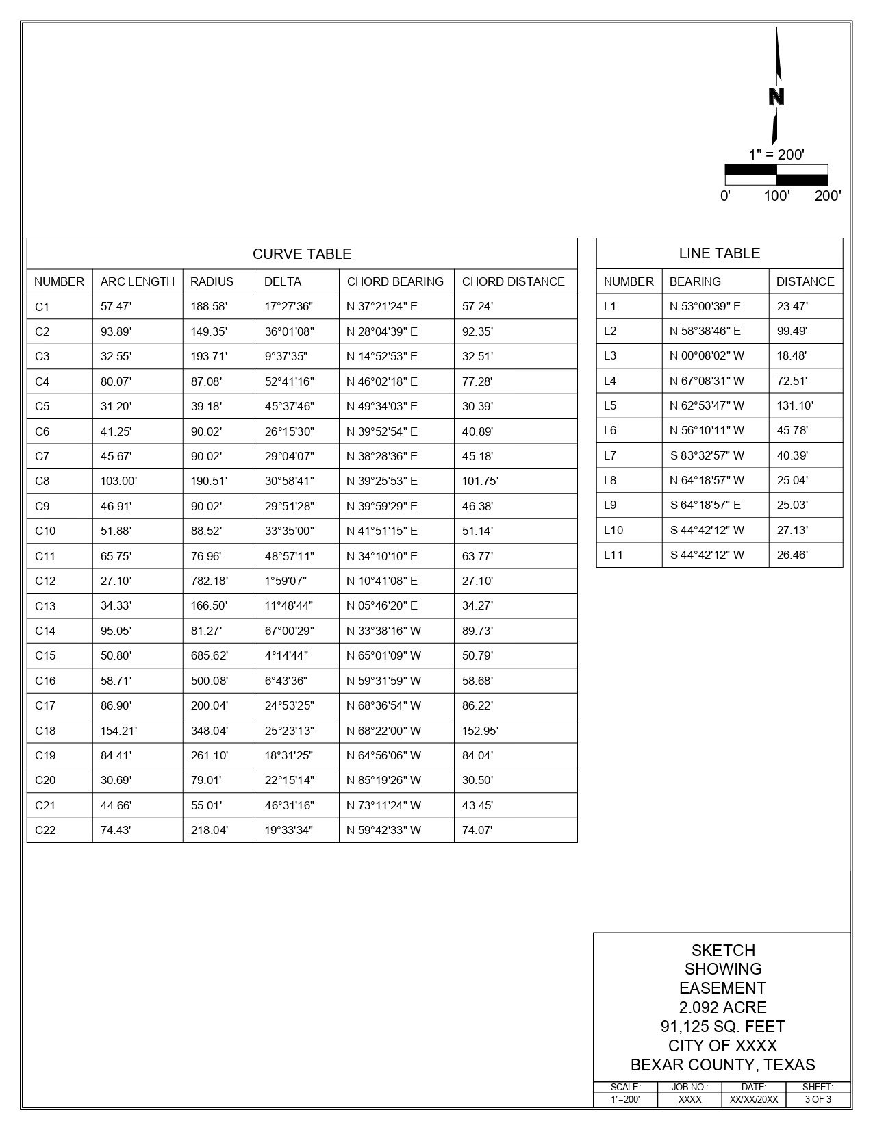
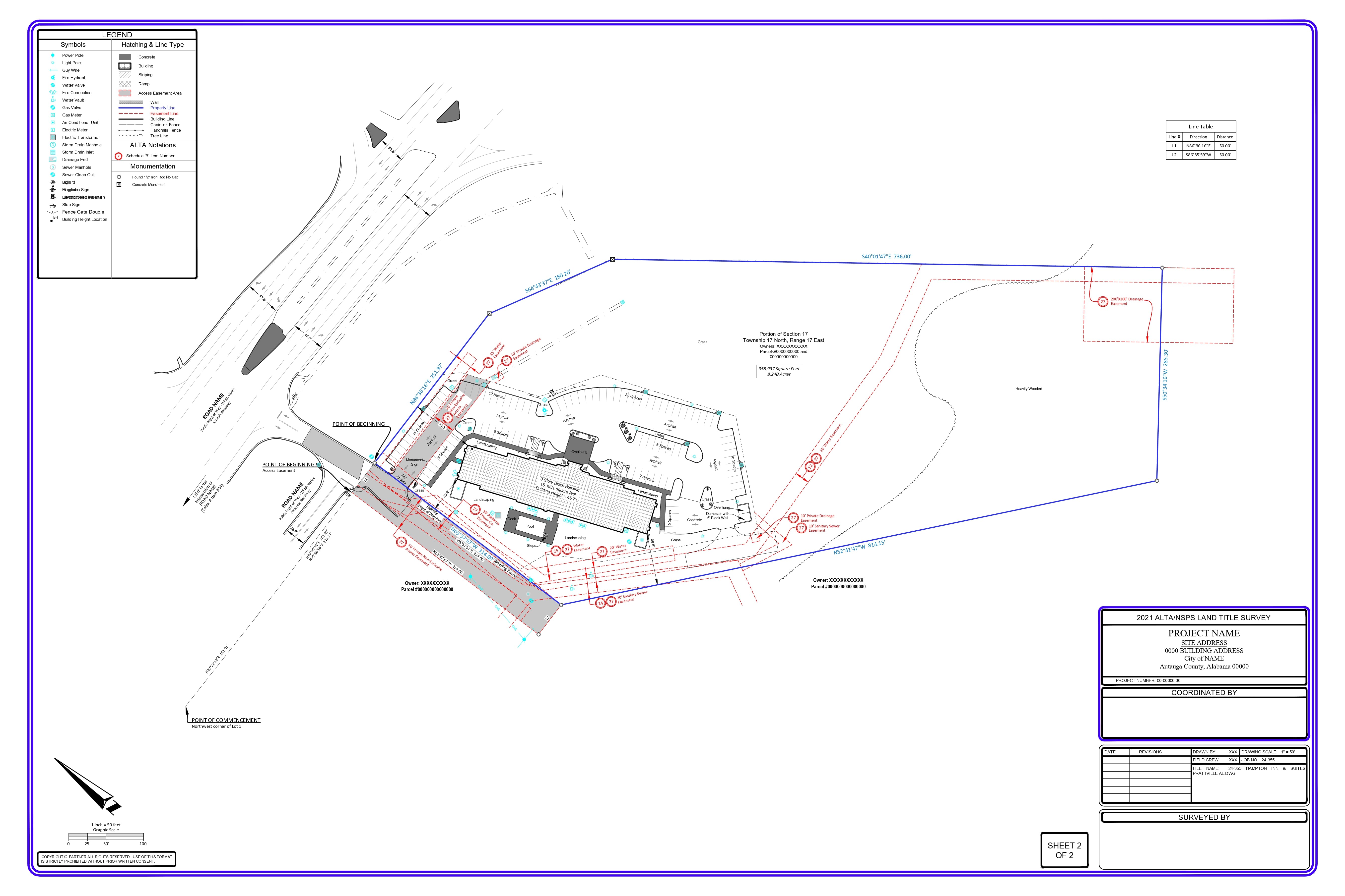
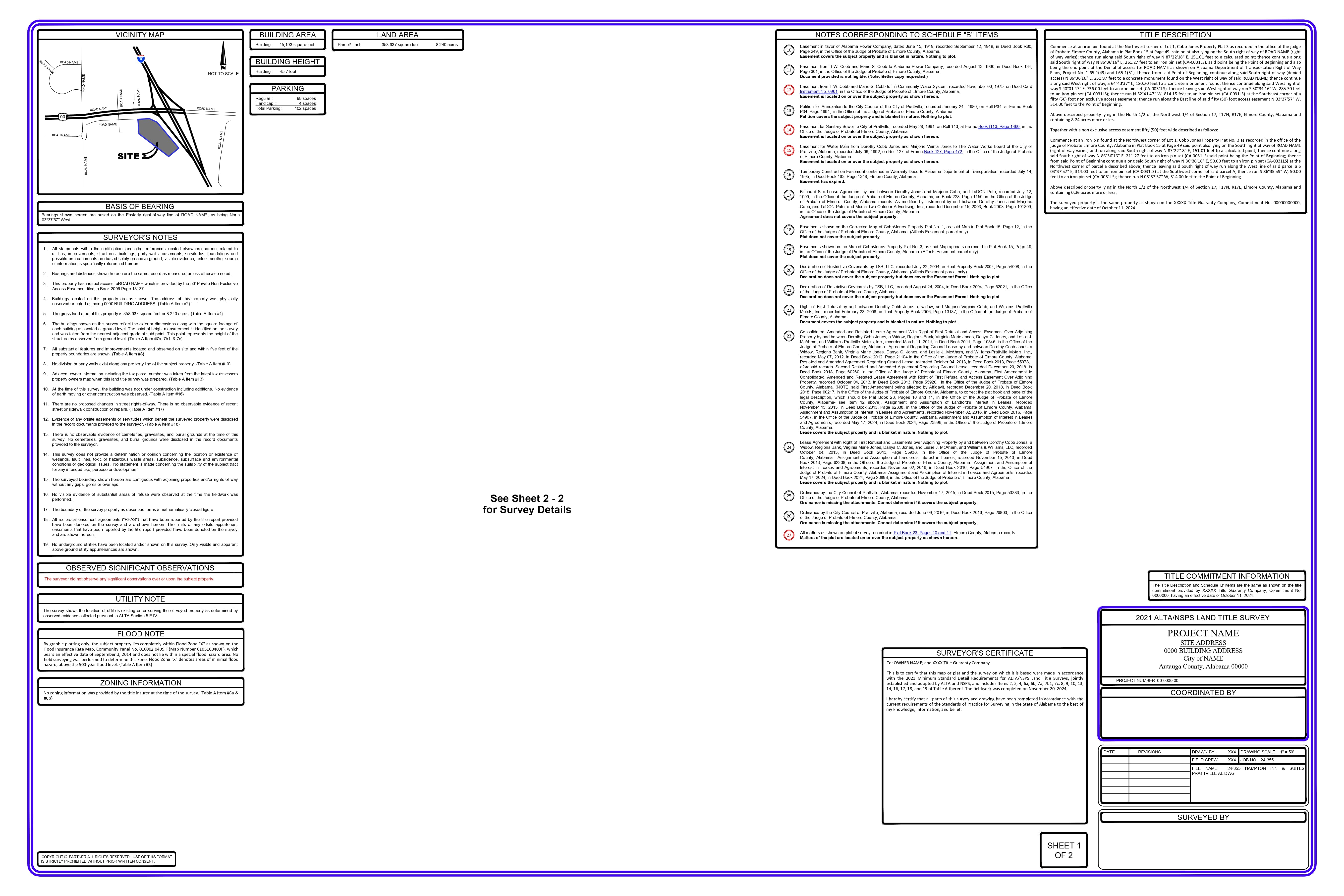
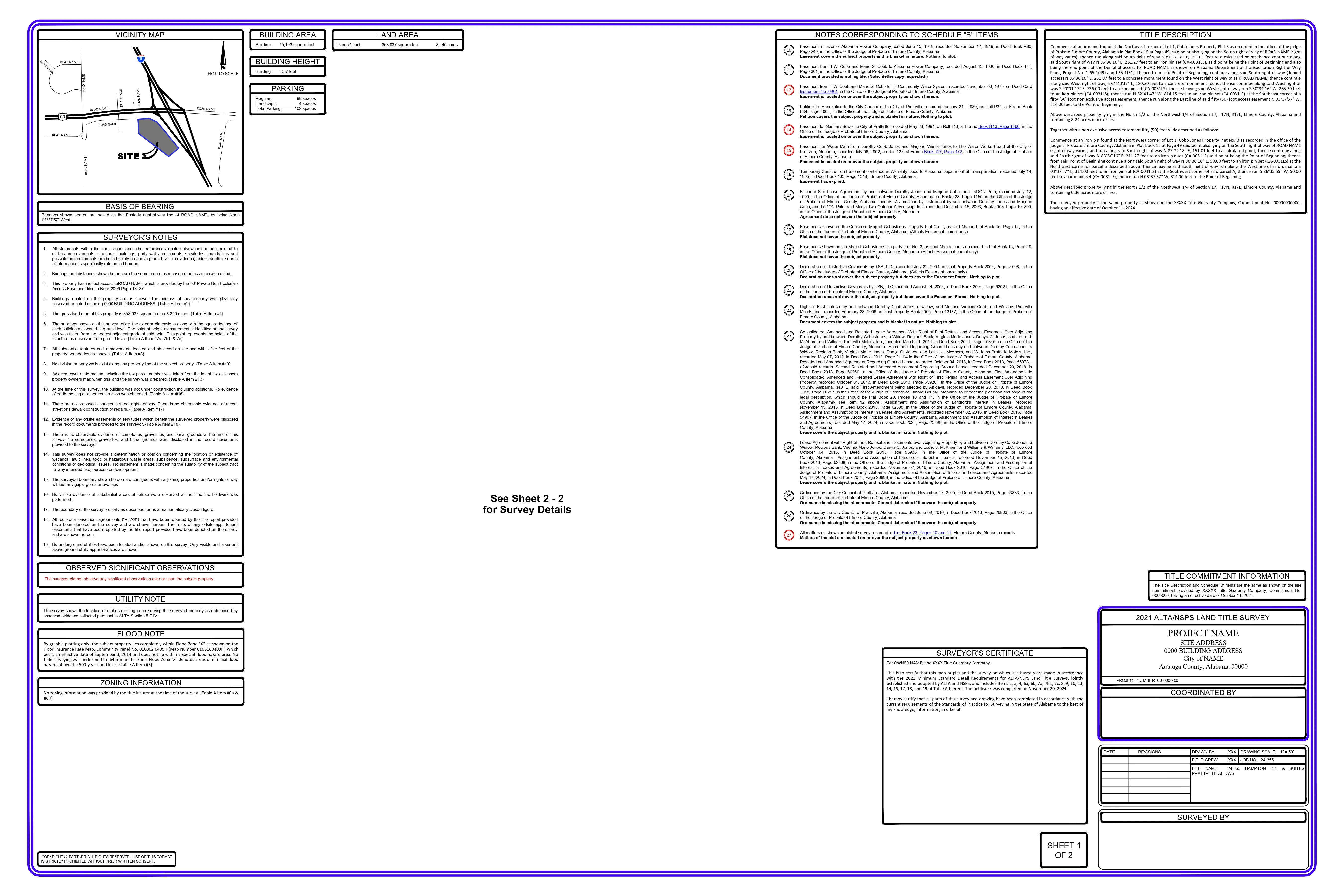
The legal description of the centerline of the easement and the coordinates of the centerline vertex points are provided.
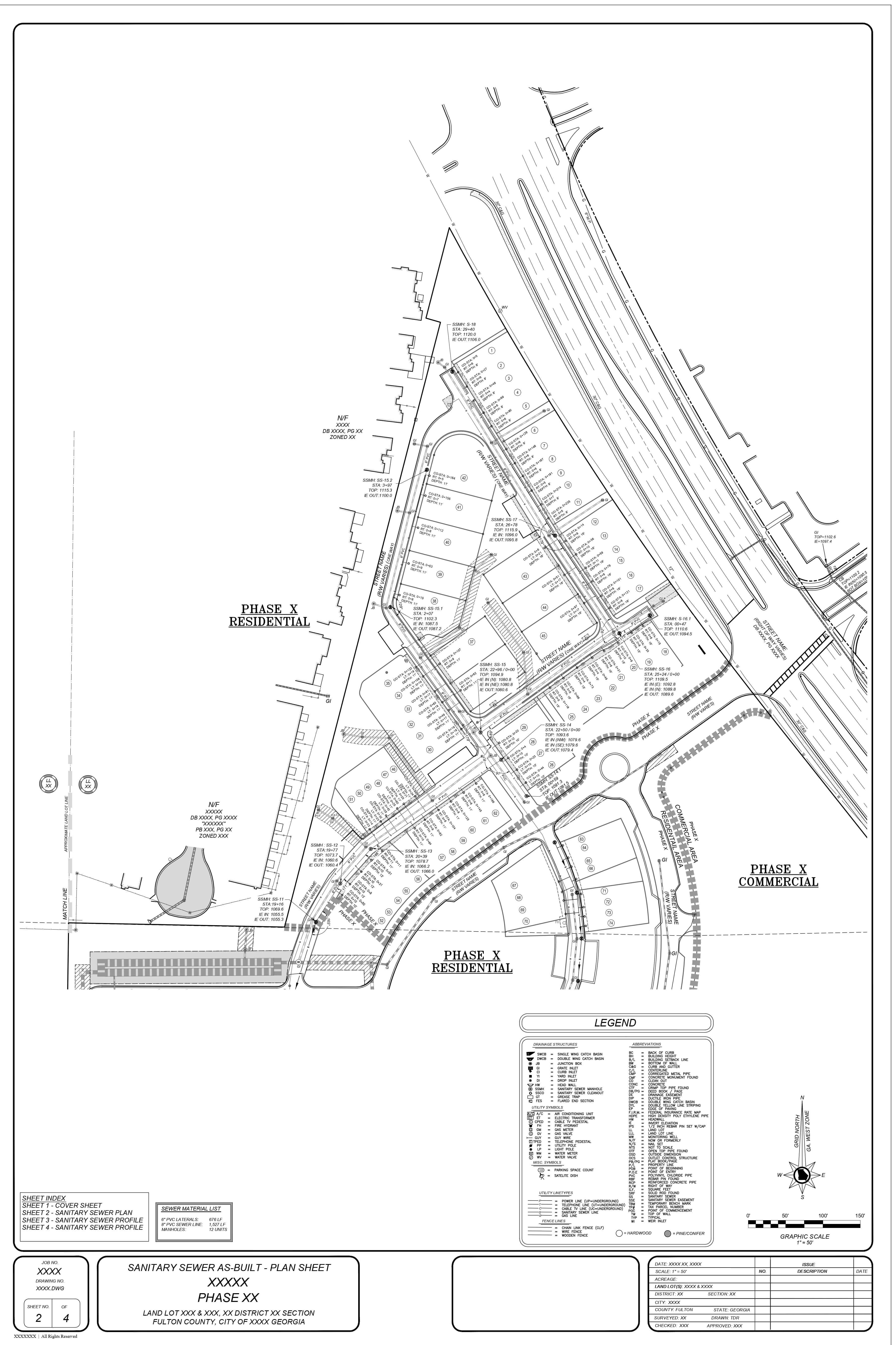
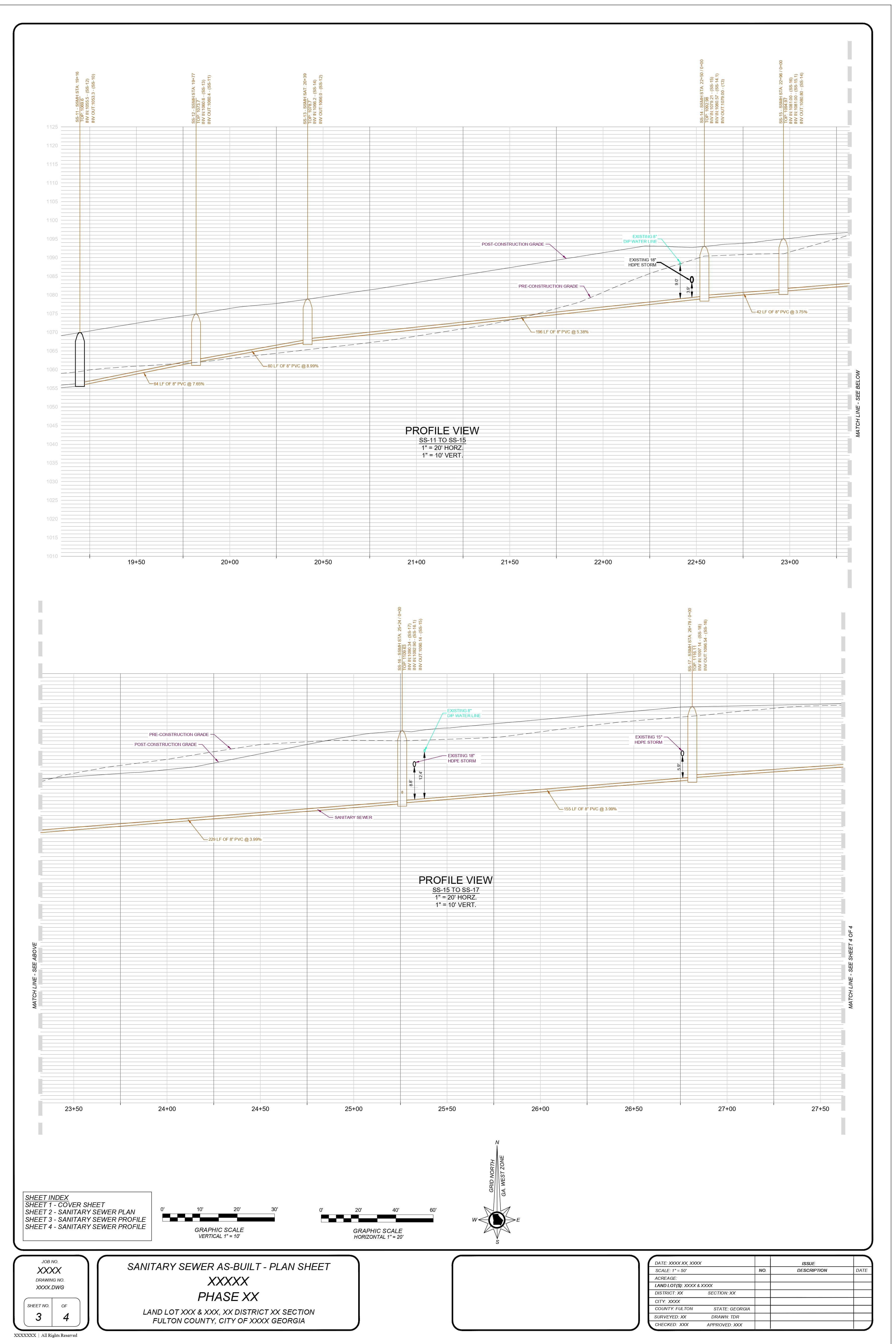
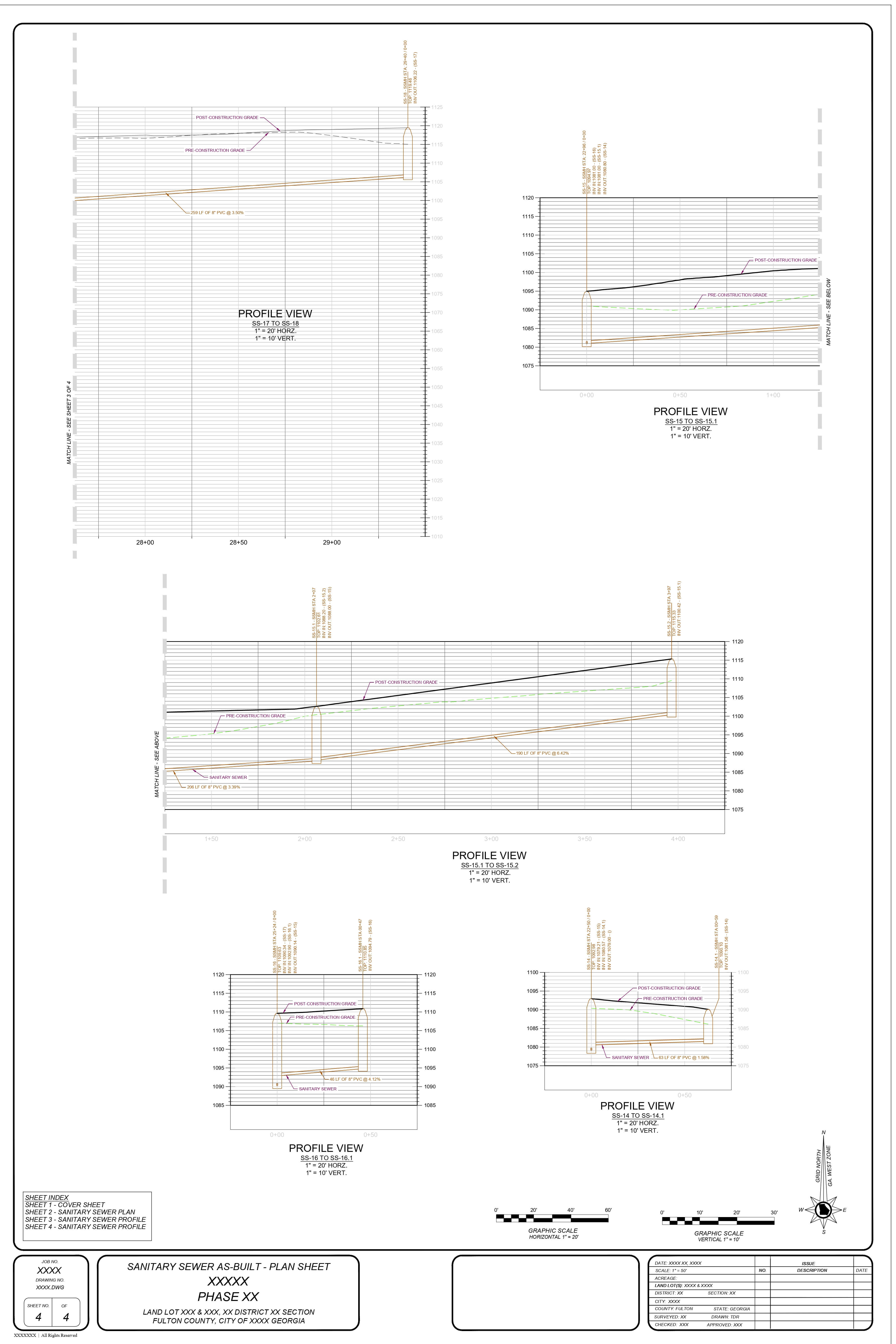
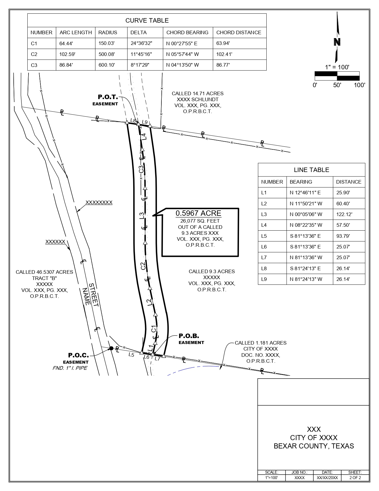
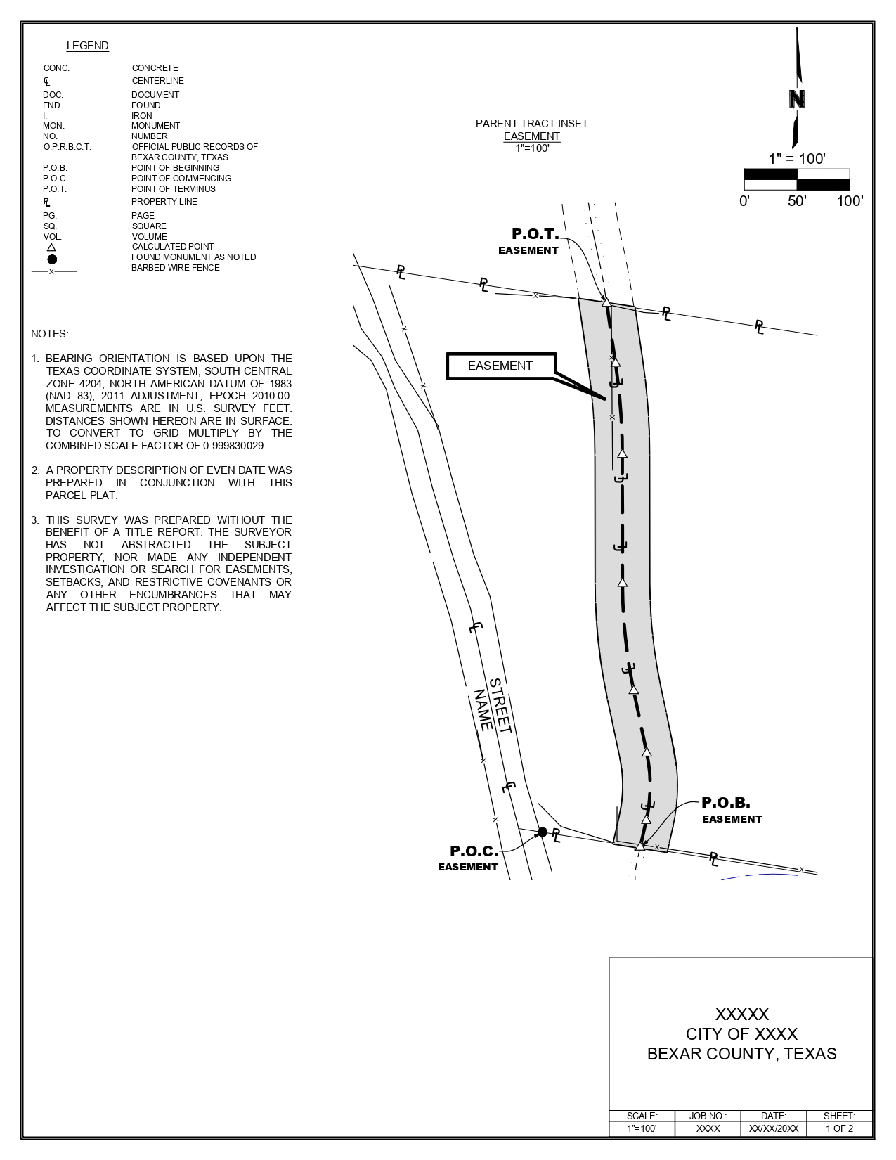
Using this data, we geolocate the centerline and illustrate the easement in relation to its width.
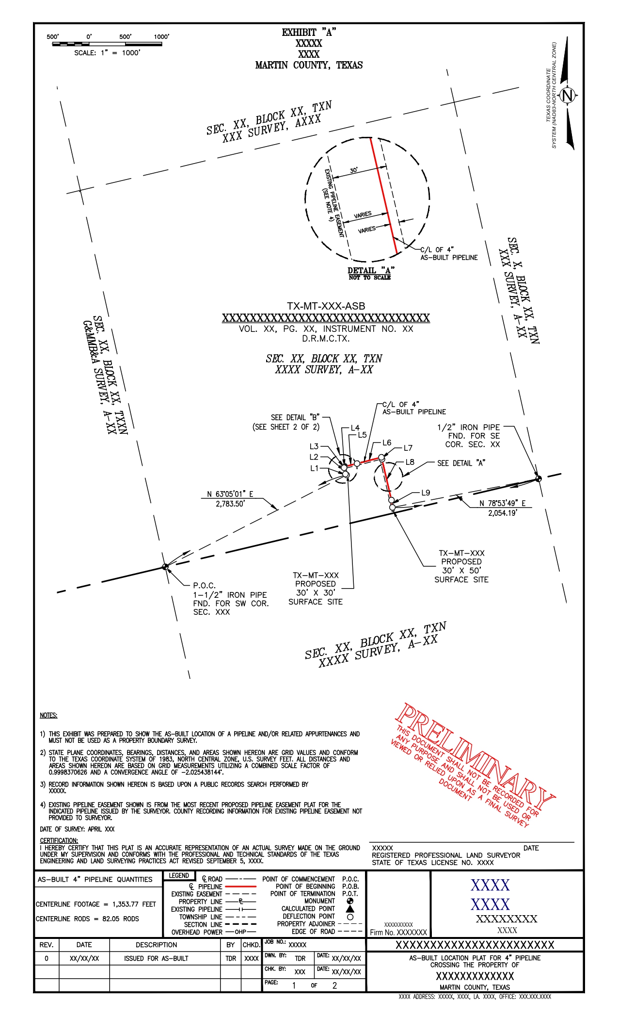
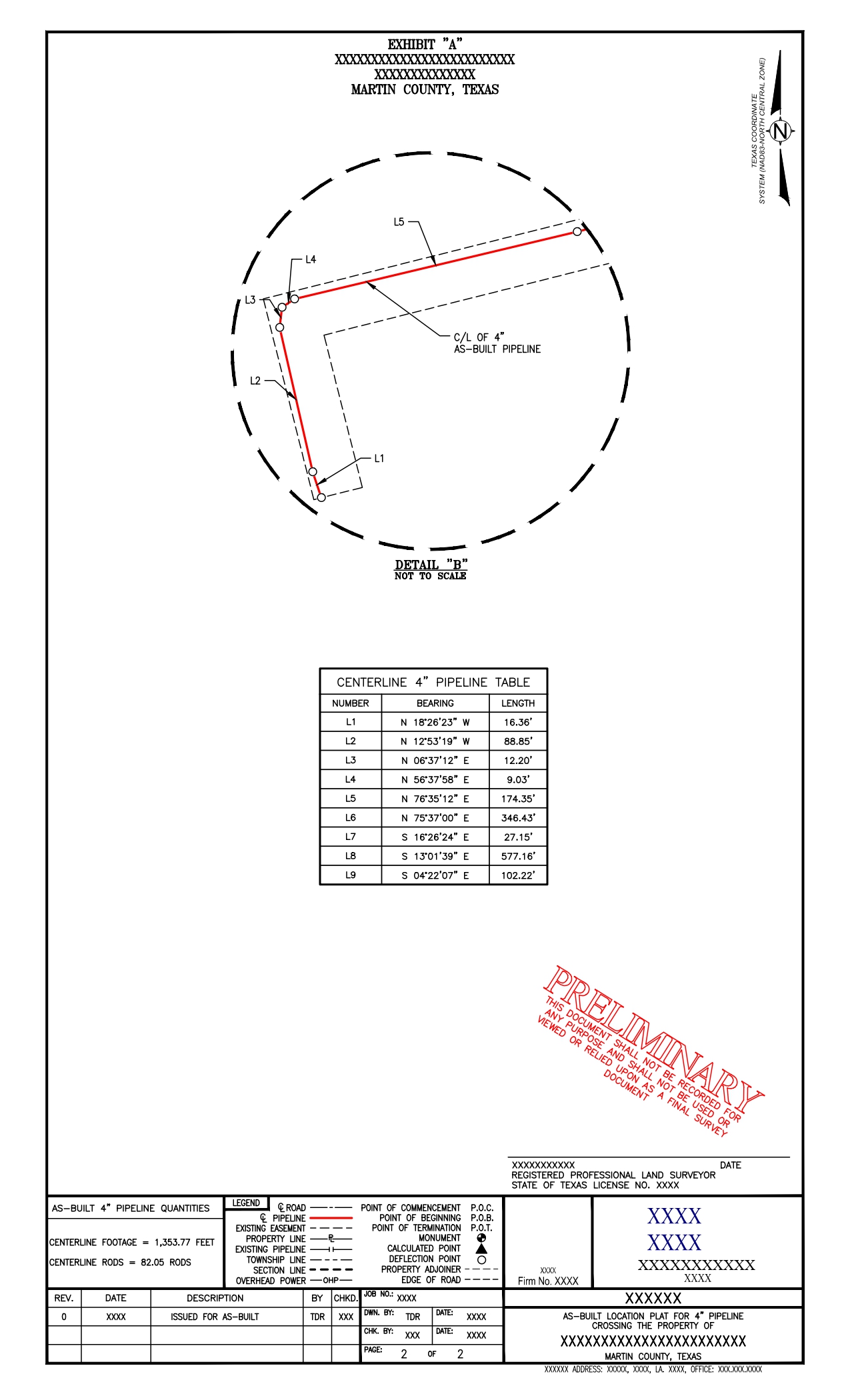
We then determine and depict the area and easement boundary, along with the calculated corners of the easement parcel. We compare the proposed pipeline with the as-built pipeline and adjust as needed, using the COGO points of the as-built pipeline to ensure it fits within the pipeline easement.
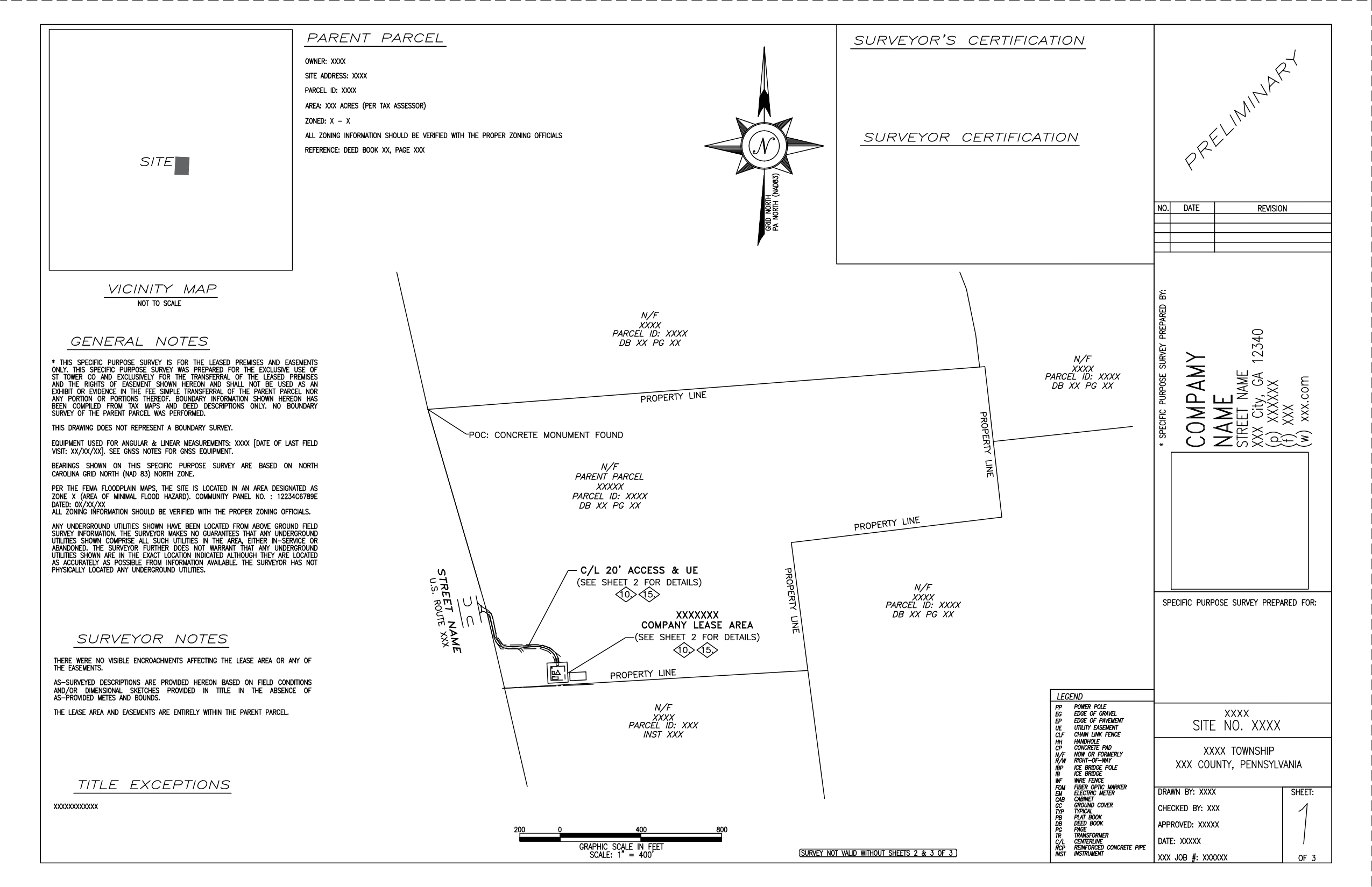
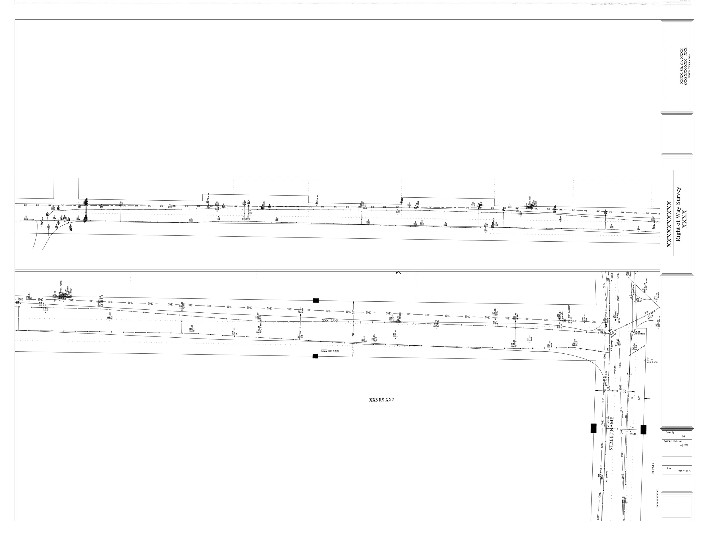
We receive the pipeline map for the entire subdivision. Based on this, we divide the pipeline according to the specific property requirements and identify their POC, POB, and POT.
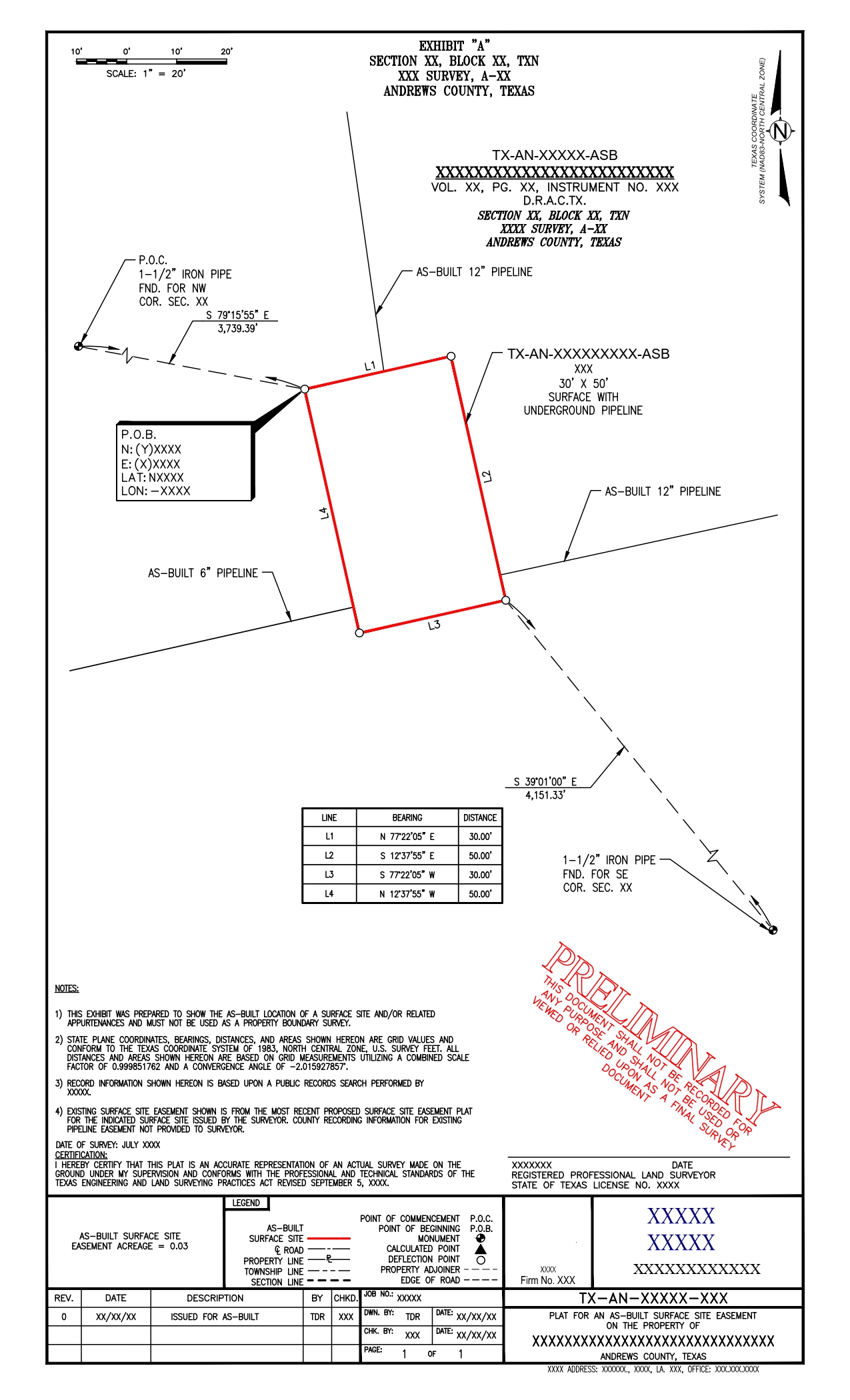
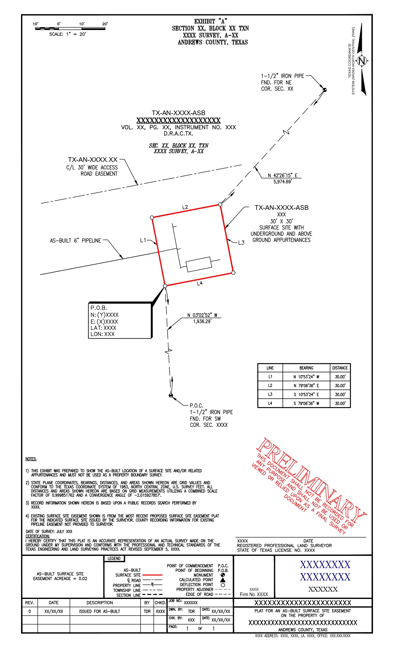
Using the existing as-built pipeline map, we identify intersections of multiple pipelines and create the surface site area to establish the easement. We prepare separate surveys for each.
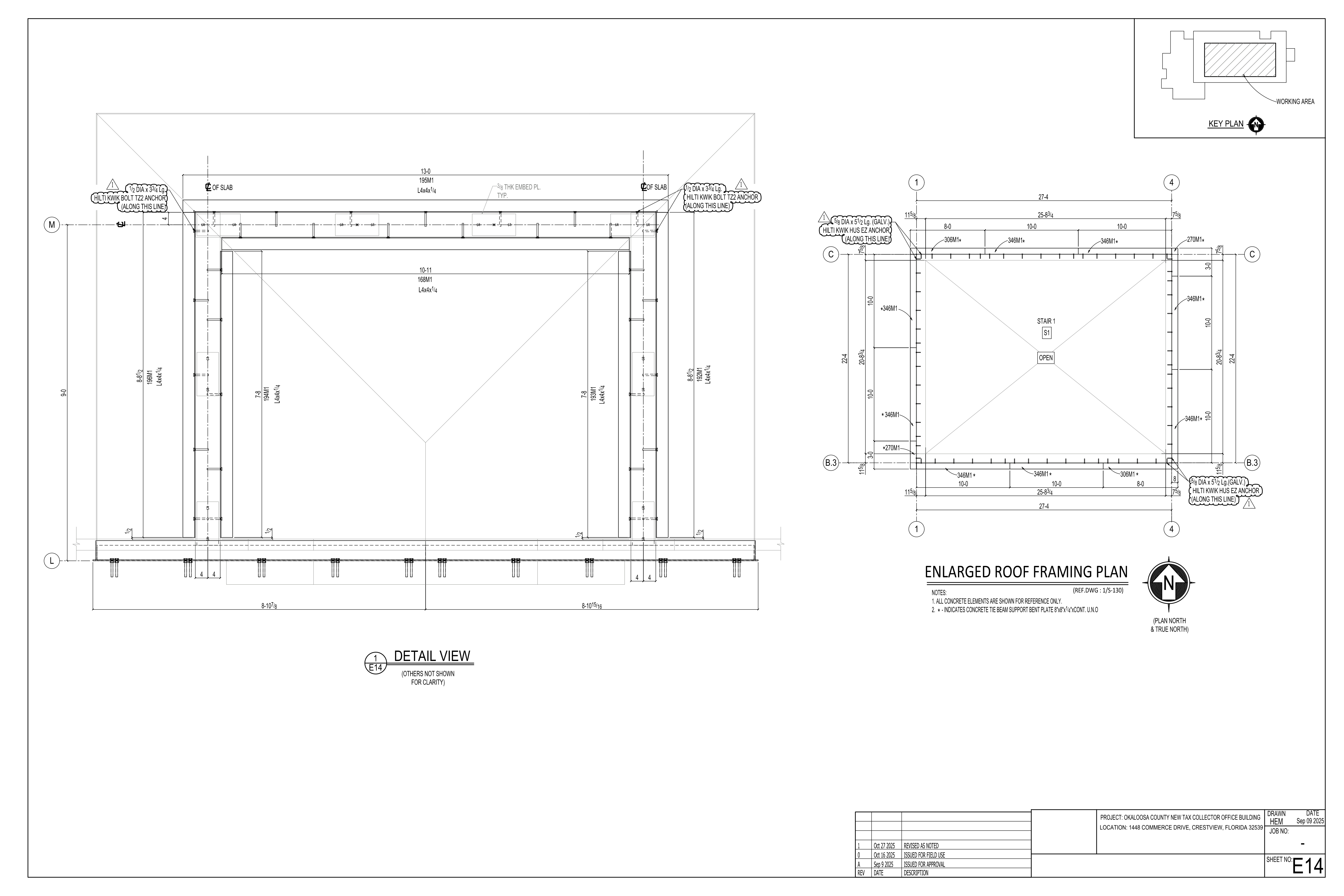
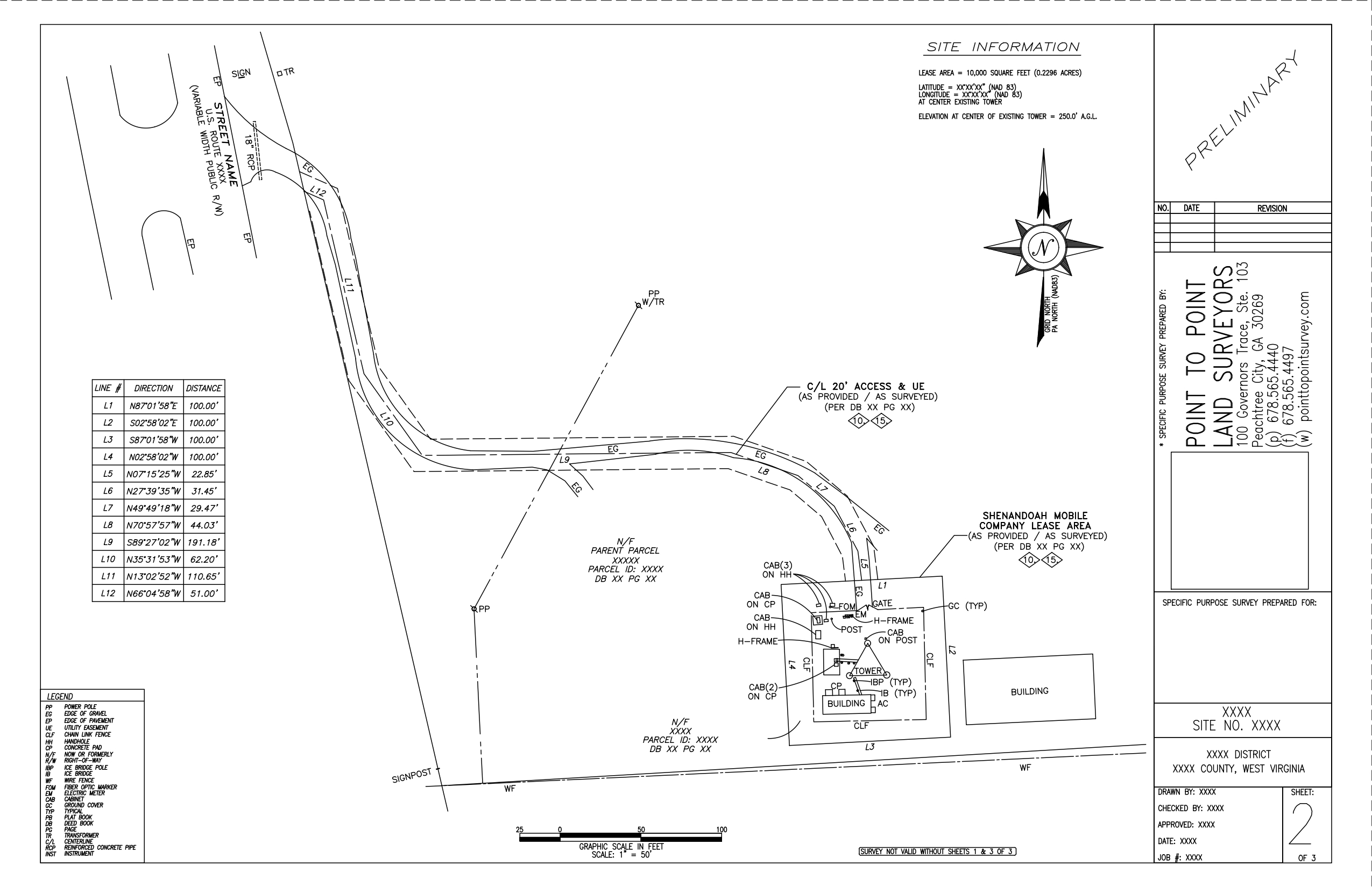
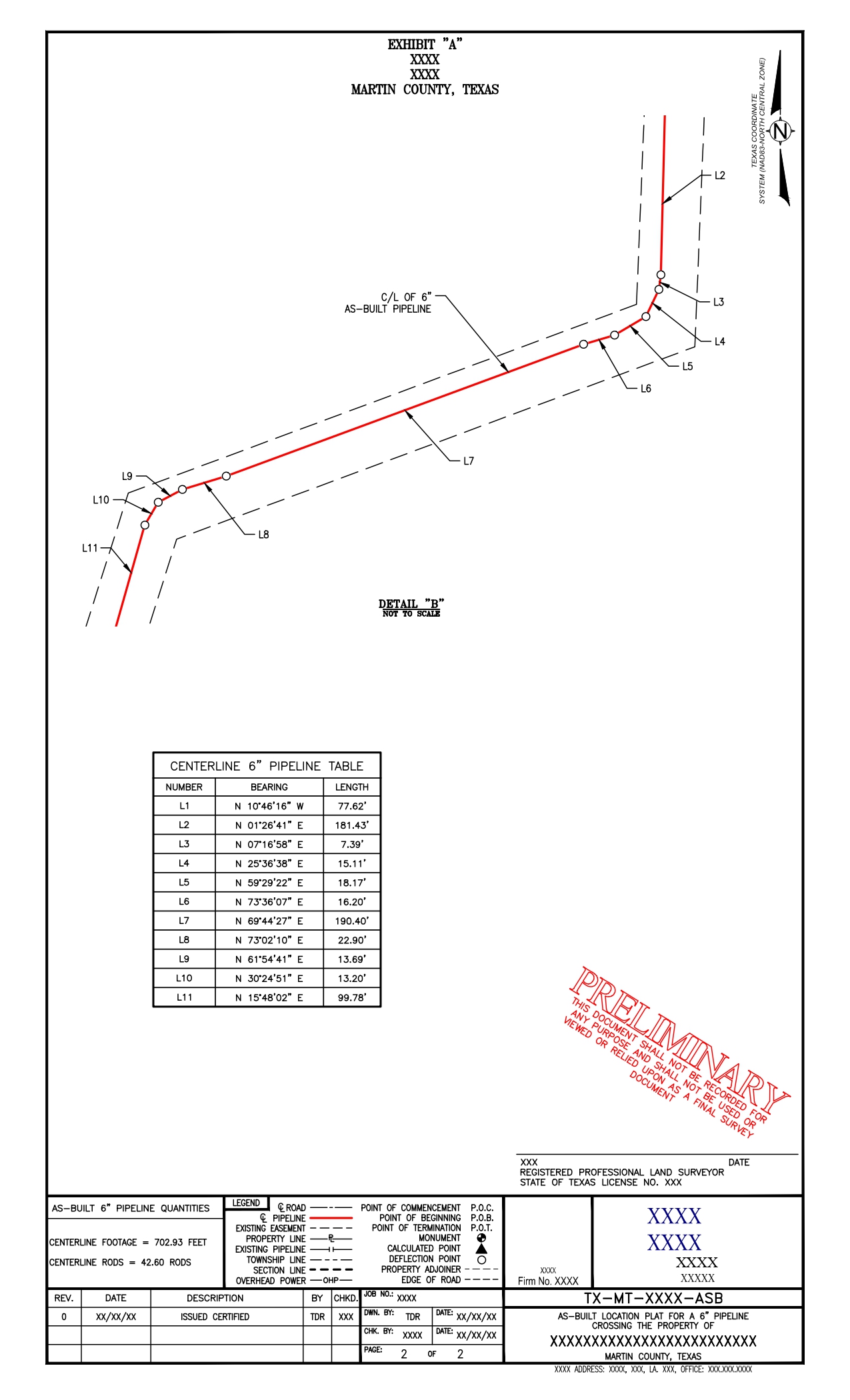
We label all bearings and distances of the pipeline, along with detailed views for sections where the pipelines are more challenging to interpret. These are extended surveys of the as-built pipeline surveys.